Outdoor Links
Hike Arizona
Trip Planning Guide
Trip Report Index
Calendar of Events
Library
|
Kachina Trail Day Hike Flagstaff July 10, 2021 by Tom Simonick |
|
 Group at Kachina Trailhead. [photo by Li] |
| Li, Les, Tom, Annette, Ken, Vicki, Ted, Clara |
|
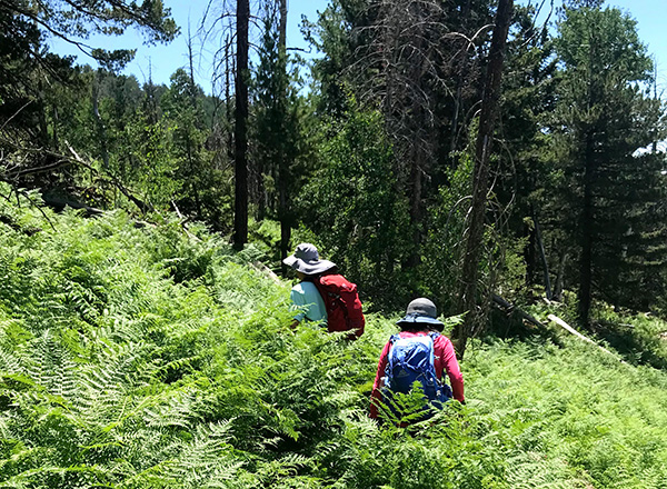
Eight members and guests met at the Kachina Trailhead northwest of Flagstaff for a hike through the forest and meadows of the Kachina Peaks Wilderness. We divided up between short and long hikers and started hiking. Kachina is a popular trail, but this morning there were few hikers. We headed east toward the Weatherford Trail junction, enjoying the combination of pine and aspens. |
 On the Kachina Trail. [photo by Vicki] |
|
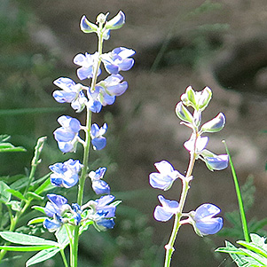
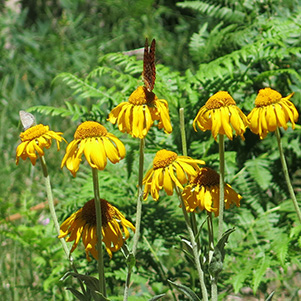
We had not gone far when we saw that the recent rains had brought out ferns, wildflowers and butterflies. |
 Wildflowers. [photo by Vicki] |
 Butterfly. [photo by Li] |
|
The trail starts out flat, but it wasn’t long until it turned rocky, making for a more interesting hike. |
 Soldier on. [photo by Li] |
 A lot of ups and downs. [photo by Vicki] |
|
Two miles from the trailhead we arrived at the cave and took another group picture. |
 The cave makes a great spot for a group picture. [photo by Li] |
| Li, Tom, Annette, Vicki, Les, Ken |
|
It was here that Les and Annette turned around, while Ken, Vicki, Li and I continued east. The trail passes through large meadows, from which you can see the San Francisco Peaks above and Flagstaff below you. We also hiked through tall ferns and shady aspen trees. |
 The San Francisco Peaks. [photo by Li] |
 Quaking Aspens. [photo by Vicki] |
 The trail goes through ferns. [photo by Vicki] |
|
Ken was way ahead of the rest of us and we didn’t see him again until he passed us, having already turned around at the Weatherford Trail junction. We took a break at the junction and started back the way we had come. I thought we might catch Ken, but he was too fast. However, our friend Carolyn caught up with us, returning to the Kachina Trailhead after running up and down the Weatherford Trail. |
 A trail sign not to miss. [photo by Li] |
 Carolyn ran down the Weatherford Trail. [photo by Li] |
|
We stopped to talk with her, and then she continued her run. The temperature was in the mid 80s and we made sure we were hydrated and taking electrolytes. Nonetheless, one of us began to have severe leg cramps. These cramps were not normal, and we slowed down and took frequent breaks hoping they would pass. Unfortunately the cramps became worse and we decided to call for a rescue. Happily, Li was able to call 911 on her phone and then we waited for the search and rescue (SAR) team to show up. Ken also called 911 from the trailhead and confirmed they were coming. Carolyn had completed her run, but grabbed some water and salty nuts and ran back down the trail to our location. We were very happy when the Summit Fire and Medical SAR team showed up and loaded our injured hiker into a “big wheel” basket. The rest of us continued our hike and were passed by a SAR team from the Coconino County Sheriff’s Office. In all, about twenty volunteer team members responded. We are very grateful for their aid! Our injured hiker was taken to the hospital, treated, and released later that night. |
 Search & Rescue. [photo by Li] |
|
Statistics for the long hike: 12.5 miles, 1700 feet AEG. The hike to the cave and back was 4 miles. |
|
Supplemental Report by Ted Tenny |
|
Clara and I drove to the trailhead, signed in, and introduced ourselves. Tom appointed us to sweep, because I’ve gotten so slow and I like to stop and take pictures. Fair enough. Soon the others were out of sight in front of us. There were lots of people on the trail, many with dogs and small children. Clara and I turned around at the cave and hiked back. Just before the trailhead I met Mike Wargel, key player in the Motorola Hiking Club, whom I hadn’t seen in four years. The car thermometer read 100° when we got back. It cooled off to 99° as we drove down the mountain. I left a note on Tom’s car that we had made it back safely. After the hike I filled up the car and we had lunch at Salsa Brava. Driving home was an adventure. Clara took the wheel at Salsa Brava. Things were uneventful until we got past Camp Verde and started seeing signs that said “Crash at mile 205. Highway is closed. Use alt route.” At Cordes Junction there was a patrol car with its emergency lights flashing. Ahead there was a monstrous traffic jam. Cars weren’t moving. So we went to Cordes Junction and planned our route home from there. We wound up driving home by way of Mayer, Prescott, Wilhoit, Yarnell, Congress, and Wickenburg. I’m so glad I filled up the car in Flagstaff! We didn’t arrive home in east Mesa until 9:40 PM. When we got home, my wife asked “Alligator or driver?” Huh? She clarified the question, “Did you serve as Navigator or driver?” That I could answer. “I served as Navigator, sitting in the passenger’s seat in front.” I was so tired that I couldn’t think straight. |
 The other hikers were soon out of sight. |
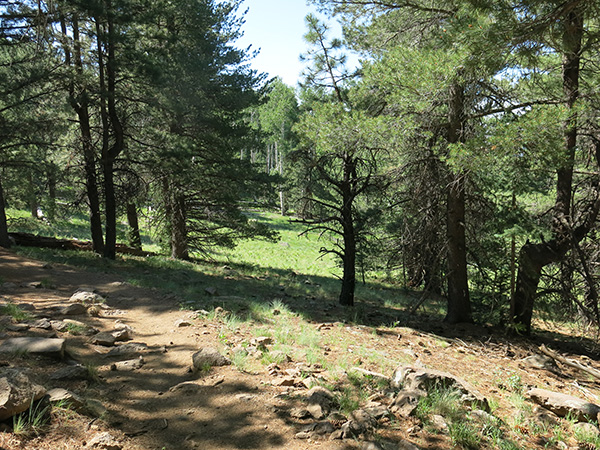 The Kachina Trail hugs the southwest slope of the San Francisco Peaks. |

|

|
| “Grantin’ your wish, I carved our initials on that tree.” | |

|
|
|

|
| Butterflies like the coneflowers. | |
 Is it an arch? |
 Civilization and its discontents. |
 Top of Page
Arizona Trailblazers Hiking Club, Phoenix, Arizona
Comments? Send them to the AZHC .
updated July 14, 2021