| |
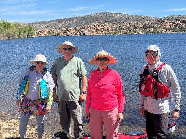
Trailblazers at Watson Lake. [photo by Ash]
|
| Vicky, Chuck, Norma, and Ash. |
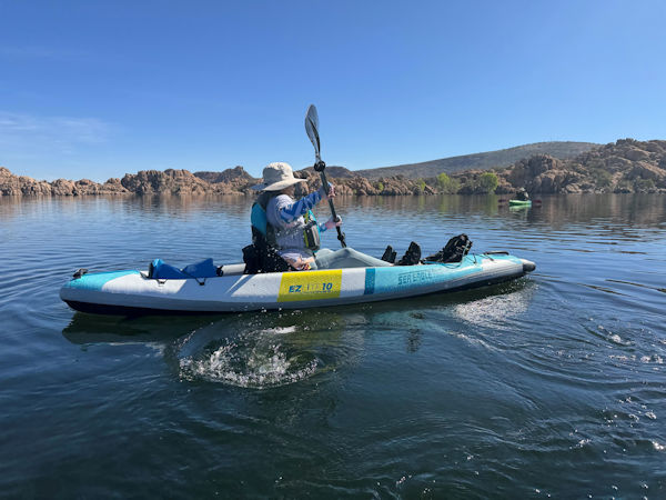
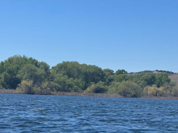
It is late March at Watson Lake in the picturesque Prescott Dells area, as four kayakers from the Arizona Trailblazers gather near the lakes South Ramp
to prepare our kayaks for launch. Today kayaking event was originally scheduled for Lake Pleasant, but unseasonably hot weather over much of the state
and especially the desert, which has already forced the cancellation of at least two hikes, a Joshua Tree National Park car-camping trip, and a Grand Canyon
backpacking trip on the Arizona Trailblazer’s events calendar, convinced us to change this kayaking trip to the cooler high country around Watson Lake.
At 5,100 feet in elevation, kayaking in the 70s sounds much more appealing than kayaking in the 90s in the scorching desert.
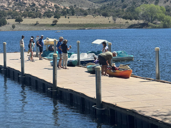
Making preparations to enjoy a day on the lake. [photo by Ash]
|
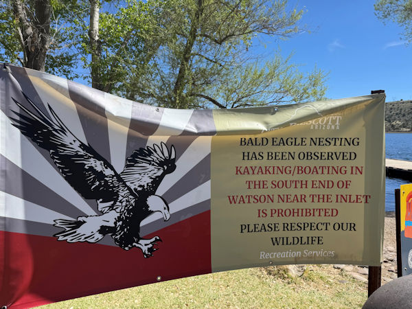
This sign was posted later in the day. [photo by Ash]
|
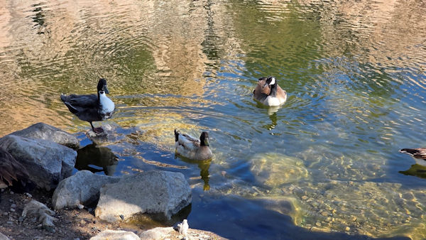
Hybrid Mallard, Common Mallard, and Canadian Goose. [photo by Vicky]
|
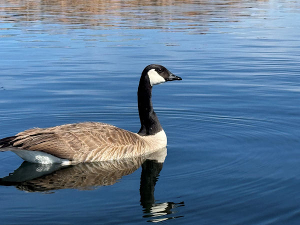
Canadian Goose in its prime. [photo by Ash]
|
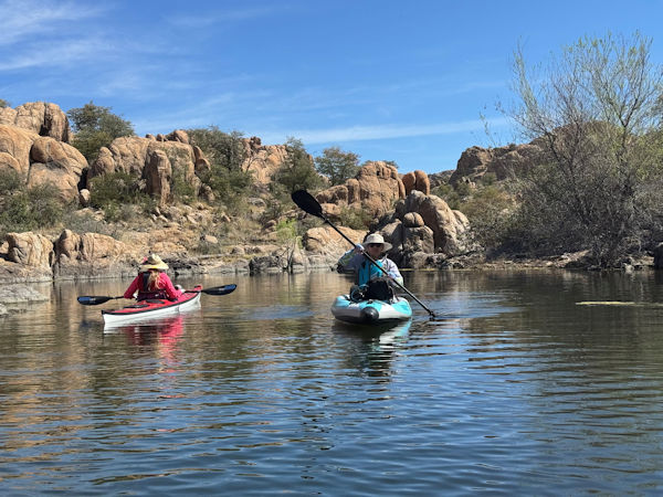
By 9:30 we begin paddling northeast towards the scenic Granite Dells area of the lake at the far north end, where we’ll spend the majority of our time on the
lake today. We continue leisurely paddling up the west side of the lake and reach the Granite Dells area in about 30 minutes. The Granite Dells consists of
huge granite boulders, some the size of large trucks or even as big as a house. After the dam was built and the lake filled with water, many of these large
boulders became partially or even fully submerged. The end result is a vast collection of massive granite boulders, pinnacles, monoliths, and even a few small
islands on the lake. This is truly a kayaker’s paradise, with a labyrinth of passageways to explore, weaving among the many boulders and pinnacles. In addition,
the north end of the Watson Lake Loop Trail threads its way among many of these granite boulders that still sit high and dry above the waterline. By foot or by
kayak, this area is definitely the most scenic and picturesque part of Watson Lake.
Norma and Vicky paddle in opposite directions. [photo by Ash]
|
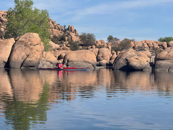
Norma glides along next to giant boulders. [photo by Ash]
|
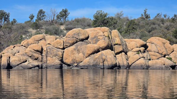
The dark coloration at the base of this line of boulders indicates the high-water mark. [photo by Vicky]
|
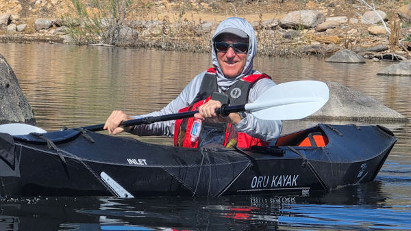
Ash in his new black Oru kayak. [photo by Vicky]
|
Look out! Attack geese! Large and plump Canadian Geese, which normally avoid contact with people and stay far away, start coming right up to the sides our
kayaks, presumably looking for food. One suddenly thrusts its entire head and neck deep inside the cockpit of my kayak, poking all around my legs. Apparently
frustrated at not finding anything, it suddenly nips the small pinky on my left hand and withdraws. Thankfully, my kayaking gloves save me from a painful bite.
Geese have serrated, tooth-like structures within their bills for grasping food and bite down painfully hard. We’ve seen these geese, both in the water and
foraging along the shore, for as long as we’ve been kayaking Watson Lake, but they have never been this fearless and aggressive before. With a number of new
signs posted around the lake warning people not to feed the wildlife, we suspect far too many people have been feeding these geese, causing them to lose their
natural fear of humans and become more aggressive as they associate people with food. A bad scenario for both people and wildlife.
Norma takes a break from paddling to enjoy the scenery. [photo by Ash]
|
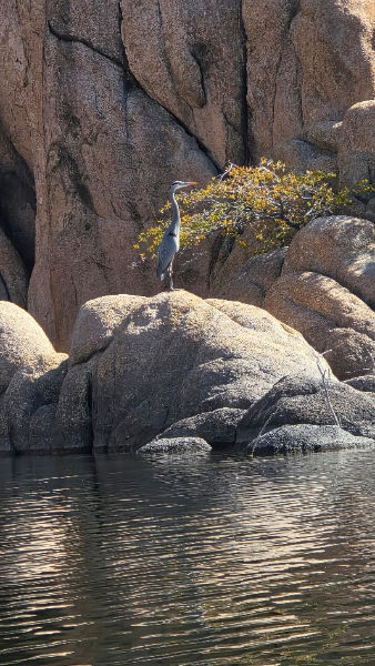
This Great Blue Heron is stationary as a statue. [photo by Vicky]
|
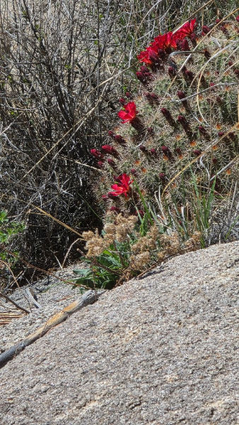
Claret Cup cactus just beginning to bloom. [photo by Vicky]
|
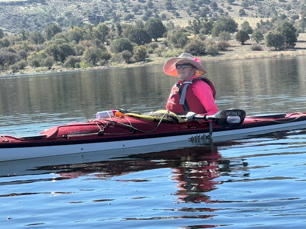
Vicky in her rugged inflatable Sea Eagle. [photo by Ash]
|
After fully exploring this section of the lake, we decide to check out the large grove of partially submerged trees at the far southwest end of the lake.
Depending on the water level of the lake, these trees may or may not be accessible by kayak. When the water level is too low, these trees are left sitting
high and dry, and the entire south end of the lake is inaccessible by kayak. But when the lake is full or almost full like today, one can kayak throughout
these partially submerged trees. Although the lake level has already dropped about two feet from its highest point earlier in the year, there’s still enough
water to allow for paddling among the trees today. On our May 2024 kayaking trip to Watson, the lake was almost at full capacity, and we were able to paddle a
full half-mile or more up one of these channels.
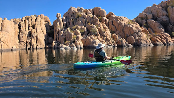
Chuck admires the magnificent scenery of the Granite Dells. [photo by Vicky]
|
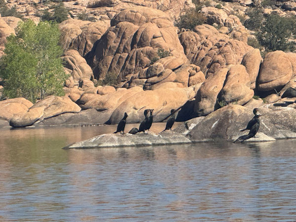
Six Double-Crested Cormorants dry off in the sun. [photo by Ash]
|
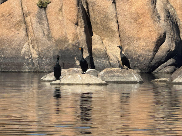
These three Cormorants seek a little more privacy. [photo by Ash]
|
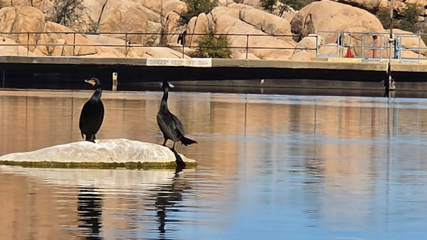
While these two Cormorants stand guard at Granite Creek Dam. [photo by Vicky]
|
But not today. On an earlier kayaking trip to the lake one of our kayakers described this part of the lake as “Arizona’s bayou country”. And it is
somewhat similar to southern Louisiana’s iconic bayou waters, with two narrow channels of water, both lined with a canopy of towering cottonwood and willow
trees providing deep shade and relief from the heat on warmer spring and summer days. Swamp land in Arizona? Not quite, but probably about the closest thing
we have to it. As we approach the dense grove of trees at the lake’s south end, we’re surprised to see a long line of buoys and ropes, stretching from shore
to shore and totally blocking all entry to this end of the lake. What gives here? In all the years we’ve been kayaking Watson Lake, we’ve never encountered
this before and could always paddle as far into and among the trees as the water level would allow. Later, we would learn that this area has been temporarily
closed for the safety and protection of nesting bald eagles. Much like similar closures at the north end of Lake Pleasant during bald eagle nesting season.
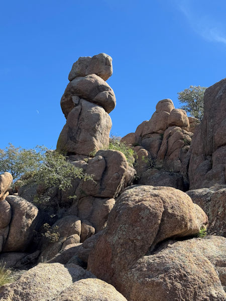
This large structure reminds me of something, but I’m not quite sure what. (Note the crescent moon to the left.). [photo by Ash]
|
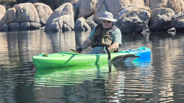
Chuck is visited by a curious goose. [photo by Vicky]
|
With that option now closed to us, by about 12:30 we paddle back to the launch ramp, where we exit our kayaks and stop at a shady picnic table by the water
edge for a quick lunch break. Three of us then decide to drive into the Prescott Valley area for a real lunch, while Norma opts for a few more hours of
additional kayaking, stating that she’s not quite ready to return to the heat of the desert. I suggest Leff-T’s Steakhouse & Grill in Dewey, where we’ve
stopped many times in the past after hikes and kayaks in the Prescott area. Unfortunately, we discover that Leff-T’s is closed on Mondays. OK then. Time now
for Plan B. After a good deal of discussion, we eventually end up at Rosa Pizzeria in Prescott Valley. A great choice, and we’ll definitely return here in
the future.
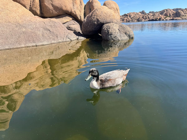
This mallard is in its element. [photo by Ash]
|
Buoys and ropes cordon off the entire south end of the lake to all entry. [photo by Ash]
|
|
 Top of Page