Outdoor Links
Hike Arizona
Trip Planning Guide
Trip Report Index
Calendar of Events
Library
|
Jim Thompson Trail Day Hike Sedona in December December 12, 2015 by Chuck Parsons |
|
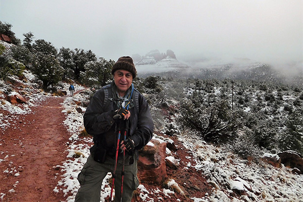
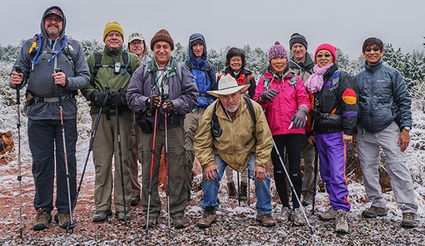 Eleven bundled Trailblazers brave the elements. [photo by Wayne] |
| John S., Chuck, Darrell, John R., Ken, Rudy, Cecilia, Christina, Chris, Lin, Wayne. |
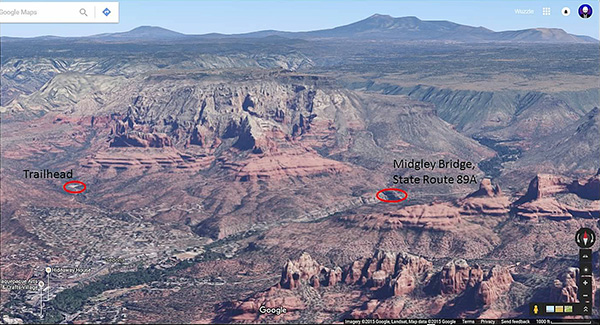 Aerial view of the Jim Thompson Trail, courtesy of John S. |
|
Anyone who has ever heard the beautiful and touching song Moab in November by Ellis can hopefully appreciate why I’m using Sedona in December as the sub-title for this trip report to reflect our unique hiking experience today on the Jim Thompson Trail, especially after seeing the terrific collection of pictures to follow. |
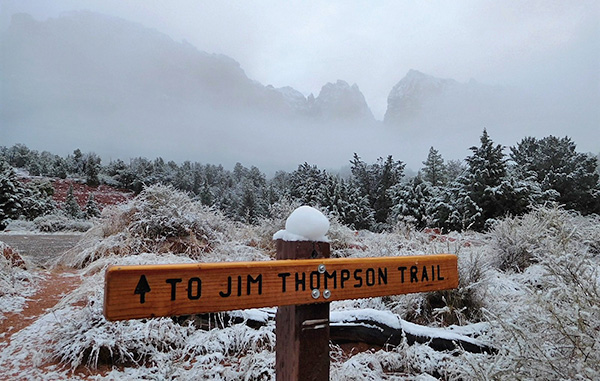
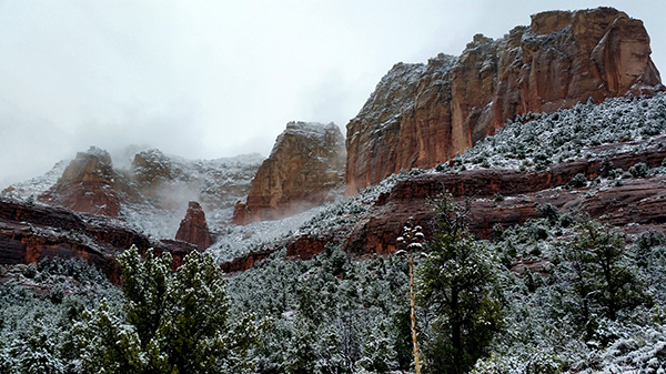
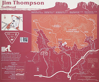 Jim Thompson Trailhead sign. [photo by John S.] Because no matter how many times you’ve seen these breathtaking monoliths that define the very essence of Sedona under normal conditions, to see them as we have today is an extra special experience beyond all expectations. For there is Sedona and then there is Sedona in December when the snow falls softly across this remarkable landscape, draping every rock and branch and leaf and every nook and cranny it can penetrate in a beautiful blanket of gleaming white and transforming this special place into a magical winter wonderland second to none. |
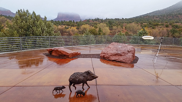 The view from the Sedona Ranger Station patio tells it all. [photo by John S.] |
 Lin gets up close and personal with Mama Javelina. [photo by Lin] |
 This is a scene you certainly don’t see every day in Sedona. [photo by John S.] |
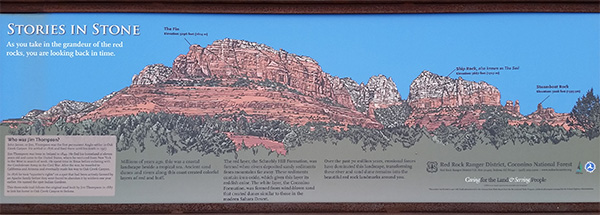 Stories in Stone. [photo by John S.] |
|
When those alarm clocks started sounding off at 5:00 am in the morning, cold and pitch dark outside with the steady drumbeat of rainfall on the roof for many of us, it is so tempting to simply turn off that annoying alarm and roll over and go back to sleep in our warm and comfortable beds. It takes major dedication and the commitment of a hard-core hiker to ignore that temptation and force ourselves from the bed to face a potentially disastrous day of hiking in rain, sleet, hail, and snow in near-freezing conditions while slogging along a slick and muddy trail full of icy water, slush, and thick soft red mud. But we are no ordinary hikers, we Arizona Trailblazers, and one of our unwritten mottos is “Neither rain, nor sleet, nor snow shall stop the Arizona Trailblazers from making their appointed rounds on the many scenic trails across Arizona.” And when it’s all said and done every single one of us is grateful for making the effort and having the opportunity to see what few others ever get to witness in this enchanting place called Sedona in December. |
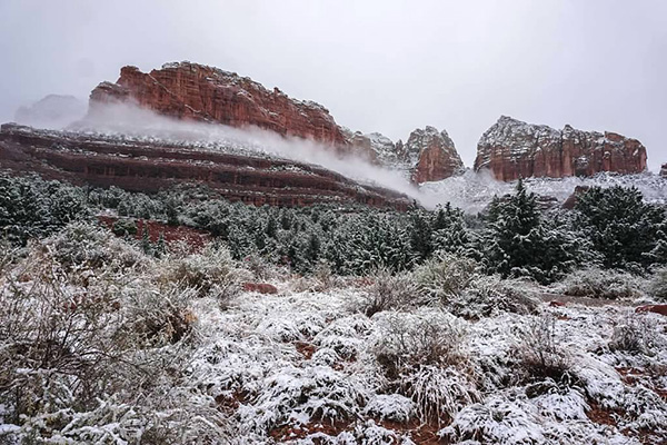
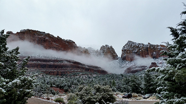
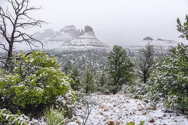
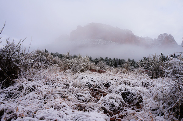 Ground level clouds nearly obscure the red rocks. [photo by Lin] |
 But the clouds and mist also lift periodically. [photo by Christina] |
|
The time is 9:20 when we finally pull into the trailhead parking area at the end of Park Ridge Road. The sky is a solid dull-gray overcast without a hint of blue, everything is either soaking wet or very muddy from recent rains and melting snow, and the temperature is hovering at a teeth-chattering 46 degrees. This scenario could turn away many people, and in fact we are the only ones here so far. But, despite the seemingly unfavorable conditions, the surrounding scenery is enough to take our breaths away and in an instant make all the time and effort of getting here totally worthwhile. |
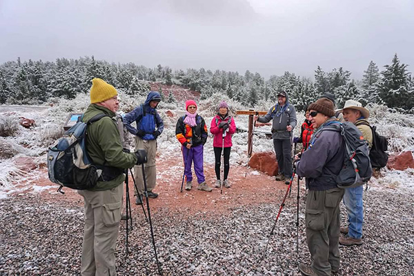 Trailblazers gather for a quick round of introductions. [photo by Wayne] |
 Preparing to hit the trail. [photo by Chris] |
 Everything is covered with a layer of snow. [photo by Wayne] |
 Our three vehicles are the first to arrive. [photo by Wayne] |
|
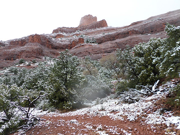
Although it’s a simple, nondescript and nearly empty parking lot except for our three vehicles, we find ourselves standing centerfield in one of Mother Nature’s most enchanting outdoor cathedrals imaginable, completely surrounded by misty, snow-covered red rock buttes, mesas, pinnacles, and peaks soaring high into the low-hanging cloud cover, a view that is beyond measure. There is a complete and peaceful silence all around us in the hushed aftermath of a snowstorm and the only sounds that can be heard are those of our own muted voices. This can only be Sedona in December. |
 Looks like this is the correct way to go. [photo by John R.] |
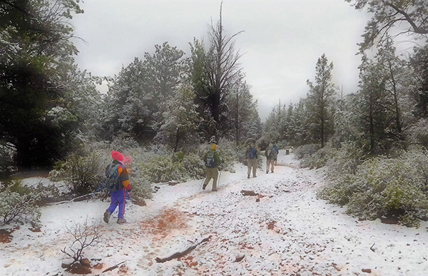
 Trailblazers strike out from the trailhead. [photo by Wayne] |
 Trailblazers trying to capture a magical moment. [photo by Wayne] |
|
No sooner do we hit the trail at precisely 9:40 when leaden skies open up and start spitting a combination of icy-cold light rains and slushy wet sleet down upon us. But we all have several layers for warmth and raingear for protection from the elements and bravely push on into the unknown, determined to make it to the end no matter what the weather throws at us. Nothing can stop us now except for a thunderstorm. We may be brave and determined, but at the same time we’re not foolhardy. Although we certainly don’t expect it today, at the first signs of thunder and lightening we’ll beat a hasty retreat back to the trailhead. The safety and well-being of our hikers takes priority over everything else in this hiking club. |
 Trailblazers carefully negotiate a wet and rocky path. [photo by John R.] |
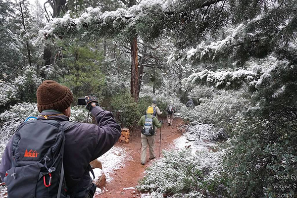 Photographer photographing photographer. [photo by Wayne] |
 A snowy winter wonderland. [photo by Wayne] |
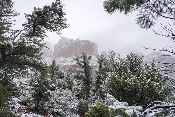
 The Fin and Ship Rock briefly appear as ghostly apparitions out of the mist. [photo by Wayne] |
|
We carefully make our way down a slippery set of steep rocks as we descend into a large rocky wash, lined with snow-covered junipers, pinyon pines, and manzanitas, and hike for roughly twenty minutes before gradually coming full circle and face to face with the three vehicles we just left behind in the parking lot. What the ...? Was I totally asleep at the helm? Has the cold completely numbed my brain? But everyone seems to take it all in good humor, as I remind them that this is, after all, an exploratory hike and you never know what you’re going to run up against on these hikes. Rudy scouts ahead to see if he can determine where we may have gone astray and comes back to report an unmarked trail junction we had passed by earlier. After studying another trail map, it looks like we should have made a left turn there. By continuing straight, we were unknowingly hiking on the Jordan Trail. |
 Guys, are we still on the trail? [photo by Lin] |
 John S. looks for tracks in the snow. [photo by Lin] |
 Good Grief! Did we just come full circle? [photo by Lin] |
 OK people, let’s take one more good look at this map. [photo by Lin] |
|
Unmarked trail junctions are a prime example of issues encountered on exploratory hikes, along with trails that seem to gradually disappear into oblivion. Christina would later tell me: “I didn’t mind it at all ... it kind of reminds me of a cartoon ... it adds to the fun we have on this hike.“ Thanks for that, Christina. We start again from the marked Jim Thompson Trailhead and soon come to the junction in question roughly a hundred yards from the trailhead. No markings or trail signs whatsoever, but we do see one of the large cairns in the distance. We make a left turn here and begin a gradual ascent through Mormon Canyon. Several hundred more yards up the trail and we come to yet another trail junction. This one is actually marked, with the Jordan Trail branching off to the right and finally identifying the trail we’ve been hiking as the Jim Thompson Trail. We’re definitely on the right track this time, so we keep forging ahead. |
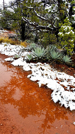
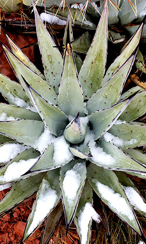 Agave filled with snow. [photo by Lin] |
 Treacherous trekking on the Slip ’N Slide Trail. [photo by Lin] |
|
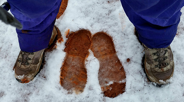
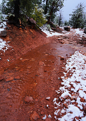
The temperature seems to be dropping as the rain and sleet diminishes, and then it suddenly starts snowing, first gently and then harder. Unbelievable! We must all be asking ourselves the same question. When did any of us last hike in an Arizona snowstorm? Probably never for most of us. I remember hiking a number of years ago during a brief snowstorm on the Courthouse Loop Trail, but we didn’t have nearly as much snow as we do today. It continues snowing intermittently for the next half hour or so as we slog along through an increasingly muddy trail. There’s regular mud and then there’s the thick red mud of Sedona that clings stubbornly to boots and spatters and stains pant legs unmercifully. After a while some of us, at least below the waist, begin to look as if we were on the losing end of a paint ball battle. |
 We’re finally back on trail once again. [photo by John R.] |
 Forging our way through Mormon Canyon. [photo by Lin] |
 The Fin briefly appears through dense cloud cover. [photo by Wayne] |
 Water sheets down the face of this monolith. [photo by John R.] |
 Extreme conditions for this agave cluster. [photo by Wayne] |
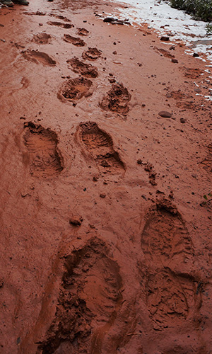
 A herd of hikers recently passed by here. [photo by John R.] |
|
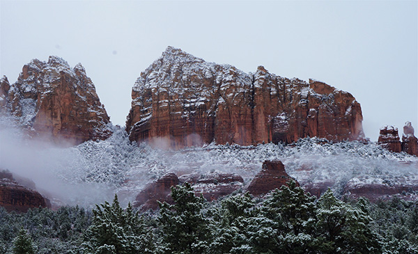
So who was Jim Thompson anyway? Generally, if a trail is named after an individual that person must have been important enough in some way to justify naming a trail after them, and Jim Thompson is certainly no exception.  These boots are made for mud slogging. [photo by Lin] About a mile or so from the trailhead, the Jim Thompson Trail begins to contour from west to east along the southern base of The Fin, Ship Rock, and finally Steamboat Rock before reaching its highest point (4,770 feet) on the east side of Steamboat Rock. At 5,667 feet, Ship Rock is the highest of these three formations that can be seen for many miles throughout the greater Sedona area. |
 ... while these boots are made for snowshoeing. [photo by Lin] |
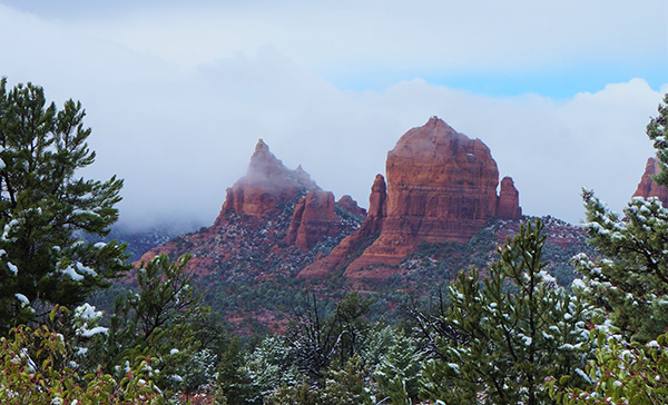
 Panoramic view of the three formations. [photo by Wayne] |
 A second spectacular panoramic view. [photo by John S.] |
|
Thick, low-hanging cloud cover continues to drift in and out among the red rocks, creating some interesting and challenging photography opportunities. On several occasions the sun makes a valiant effort to punch through the cloud cover, only to be totally obscured once again within seconds. But the snow has stopped for now and we have gradually warmed up from all the hiking. |
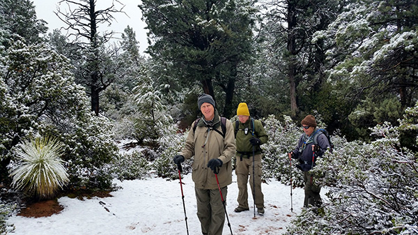
 Hiking through a winter wonderland. [photo by John R.] |
 Slowly working our way higher on the trail. [photo by John R.] |
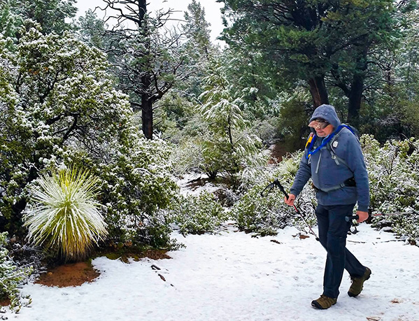
 John R. pauses for a break and photo op. [photo by Lin] |
 This prickly pear cactus is not a happy camper. [photo by Wayne] |
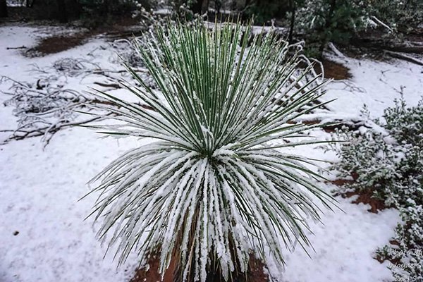 This yucca seems to be thriving in the snow. [photo by Wayne] |
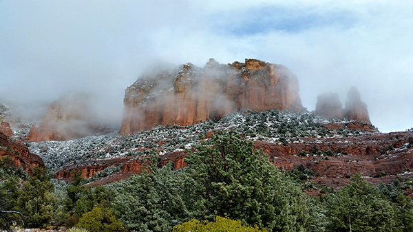
 Ship Rock shrouded in mist and fog. [photo by Wayne] |
 Second view of Ship Rock. [photo by Christina] |
 A snow-covered Ship Rock soars to 5,667 feet. [photo by Lin] |
 Red rock formations covered in snow. [photo by Wayne] |
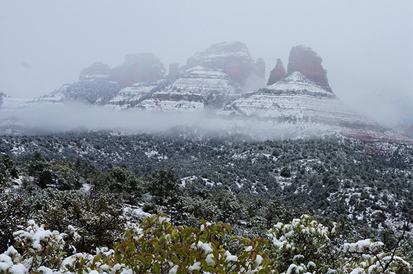 Low-hanging clouds appear as a band of fog. [photo by Lin] |
 The red rocks glisten with rain and snow melt. [photo by Christina] |
 Wispy clouds, snow, and red rock form the perfect combination. [photo by Lin] |
 Steamboat Rock rises to 5,228 feet. [photo by Christina] |
 The hardy juniper is a tough survivor. [photo by Wayne] |
 Manzanita thicket stands guard over lichen-covered boulders. [photo by Wayne] |
 Trailblazers are nearing the end of the line. [photo by Wayne] |
 All of that snowmelt has to go somewhere. [photo by John R.] |
|
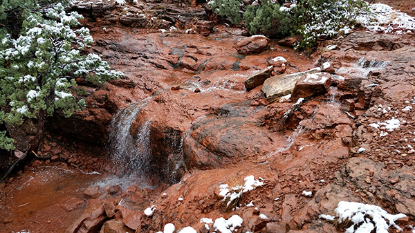
As we approach the upper end of the trail near Steamboat Rock, we start seeing small waterfalls along the side of the trail as well as water running down and across the trail itself. Snow in these red rocks of Sedona has a very short life span, at least in December. When it starts melting, cascades of melt water start pouring down from the highest areas of melt first, joining forces with water from lower elevations, before eventually becoming a torrent of water pouring out of the red rocks. |
 Water flows over the edge of a rock shelf here. [photo by Wayne] |
 In this case it simply flows right down the trail. [photo by Lin] |
|
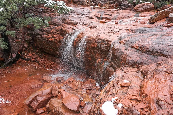
All of those normally bone-dry waterfalls we’re used to seeing on Sedona area hikes are all running today as flowing water unfailingly obeys the dictates of gravity and seeks the lowest level it can find in the shortest amount of time. |
 One of many ephemeral waterfalls along the trail. [photo by Lin] |
 This would be the perfect place in warmer weather. [photo by Wayne] |
 The most picturesque waterfall on today’s hike. [photo by Wayne] |
 Chuck and Lin check out yet another waterfall. [photo by John S.] |
 Balanced rock cairn. [photo by John R.] |
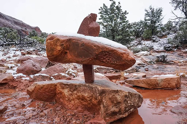 I wonder how long it took to construct this behemoth. [photo by Wayne] |
 Midgley Bridge as seen near the end of the trail. [photo by John R.] |
|
The original goal of this hike was to reach a scenic viewpoint overlooking Wilson Canyon and lower Oak Creek and continue hiking to the bottom of Wilson Canyon where we would then link up with the Wilson Canyon Trail and follow that for a mile or so along the creek bed. The Jim Thompson Trail also continues on to Midgley Bridge, where several trails originate. |
 Just enough sun for a perfect reflection. [Lin] |
But all those plans have been thrown out the window with today’s weather, and we decide to break for lunch just short of the overlook and make the return hike from here. With this low fog-like cloud cover still obscuring many of the views, we wouldn’t be able to see too much from the overlook anyway. So we’ll have to save that for another future hike on the Jim Thompson Trail. Although it’s certainly not necessary in this case, it’s always a good idea to have an incentive for coming back to repeat a hike. The sun finally manages to break through and begin burning the cloud cover off as we hike the last mile of trail back to the trailhead. Blue skies slowly begin to emerge and dominate by the time we reach the Jim Thompson Trailhead in full sunshine. What a contrast from this morning when we started out. And with that sunshine the snow is melting faster than ever, and water is cascading in even greater volume down the face of these iconic red rocks of Sedona. |
|
After we finally arrive at the trailhead by 1:20 in the afternoon and get cleaned up as much as possible, we decide on the Hideaway House in Sedona for a late lunch. The temperature has warmed all the way up to 51 degrees. But that sun sure feels good. |
 We find the driest place we can for a quick lunch. [photo by Rudy] |
 Clouds still shroud the top of Ship Rock. [photo by John R.] |
 But blue skies are finally starting to appear. [photo by Lin] |
 Ship Rock slowly begins to emerge from the clouds. [photo by Lin] |
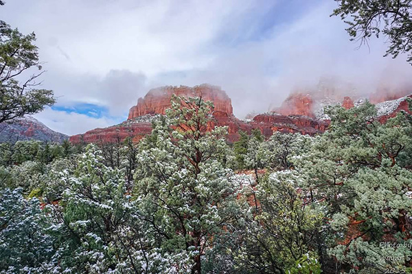 The Fin is nearly cloud-free. [photo by Wayne] |
 The trail comes closer to the base of The Fin. [photo by John R.] |
|
A key element of photography is timing — being in the right place at the right time to capture and preserve that perfect moment in a brief instant of time before it’s lost forever. And I think all of us will agree that we were in exactly the right place at exactly the right time on today’s hike because we had many such perfect moments, captured and preserved forever by some very talented photographers among us. |
 Parting view of the red rocks of Sedona bathed in sunshine. [photo by John S.] |
 The Hideaway House in Sedona. [photo by John R.] |
 Eight hungry Trailblazers enjoying dinner at the Hideaway House. [photo by John S.] Clockwise: Christina, John S., Rudy, Wayne, Lin, John R., Chuck, Cecilia. |
|
If Ellis could have joined us on the Jim Thompson Trail today, I have a strong feeling that she would have been inspired enough by all this breathtaking scenery to write a companion song to Moab in November, perhaps even calling it Sedona in December. What an amazing adventure this has been today, something few, if any of us, have ever seen before and may never see again. We have been truly blessed to have personally experienced, if only for a few brief hours, Sedona in December. |
 Top of Page
Arizona Trailblazers Hiking Club, Phoenix, Arizona
Comments? Send them to the AZHC .
updated September 22, 2016