Outdoor Links
Hike Arizona
Trip Planning Guide
Trip Report Index
Calendar of Events
Library
|
Hackamore to Dome Mountain Goldfields December 29, 2018 by Ted Tenny |
|
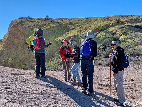
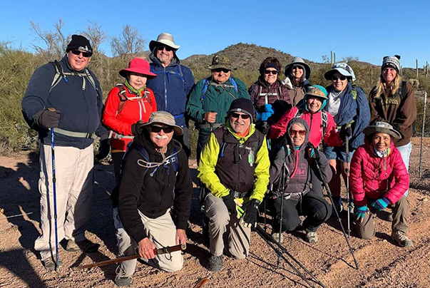 Trailblazers ready to go on a chilly morning. [photo by Quy] |
||||
|
||||
|
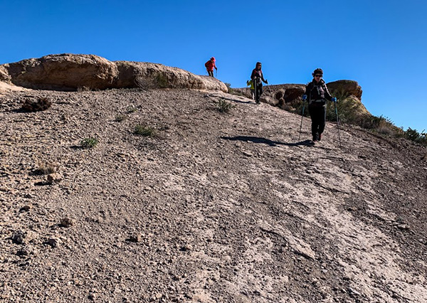
The north end of the Orohai Trail is easy to follow, marked with a sign where it dead ends at Forest Road 1356. But the south end is notoriously hard to follow, worst near Hackamore Trailhead. No signs, no cairns, no nothin’. People get lost there all the time. I’ve spoken with the rangers about it, to no avail. A few years ago the trail was re-routed. Fortunately I know where the trail is. Fourteen fantastic Trailblazers started out from Hackamore Trailhead on a cool, breezy morning. I’d thought of taking the Green Thumb Trail, but with the wind blowing fiercely I decided to take the Orohai Trail instead, because part of it goes through a canyon. |
||||
 The Orohai Trail starts downhill—out of the wind. [photo by Quy] |
||||
 Why do they call that rock on Blue Ridge “Bulldog Peak”? |
||||
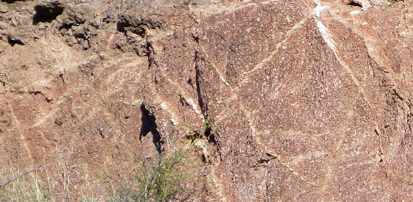 Veins of quartz beside the canyon are cross-hatched. |
||||
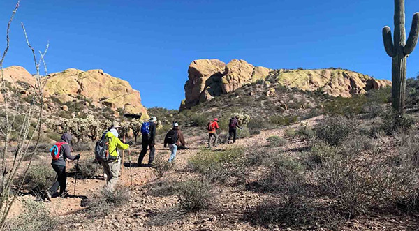
 Leaving the canyon on the Orohai Trail . |
||||
 Brittlebush in bloom. [photo by Quy] |
||||
|
After we got out of the canyon I took off my jacket at the junction with the connector trail, then pointed out Triple Trail Junction to everyone when we got there. |
||||
 Peaks 3195 and 3075 on Bulldog Ridge. |
||||
|
Yes, there is a sign marking the place where the Orohai Trail dead ends at FR 1356. It doesn’t identify the road or the trail, but has an arrow pointing west. That’s where we went. |
||||
 Peak 3134. Ted has climbed it twice. The Elliptical Arch is on the way up. |
||||
|
On the Bulldog Canyon Trail I pointed out where the “long” hikers would climb up on Bulldog Wash Ridge. Then we turned south on the horse trail. I discovered the horse trail in 2003, the first time I climbed hill 2685. It was the great shoot-out. Carrying both my last film camera and my first digital camera on that hike, I needed to be convinced that digital pictures were good enough. So I took the same pictures with both cameras. Afterwards I got my color negatives digitized, then looked at the pictures side by side on the computer screen. I never went back to film. There’s something to see at the north end of the horse trail: the frog. For a long time it was a mystery to me why N.C. McFarland called Peak 3269 and Dome Mountain the “Frog Peaks” on his 1883 map of Arizona Territory. But there’s the frog, in stone. |
||||
 Dome Mountain and the Frog. |
||||
 The horse trail plays hopscotch with the wash. |
||||
 Owww! How did I get stuck? |
||||
 We pass through a district of primitive roads. [photo by Quy] |
||||
|
The north half of the Wolverine Pass Trail is kind of like the south end of the Orohai Trail. Worst near the power line, it has a few cairns here and there. Sometimes you can see the trail for a little way, but admittedly I’ve lost the trail on several occasions. |
||||
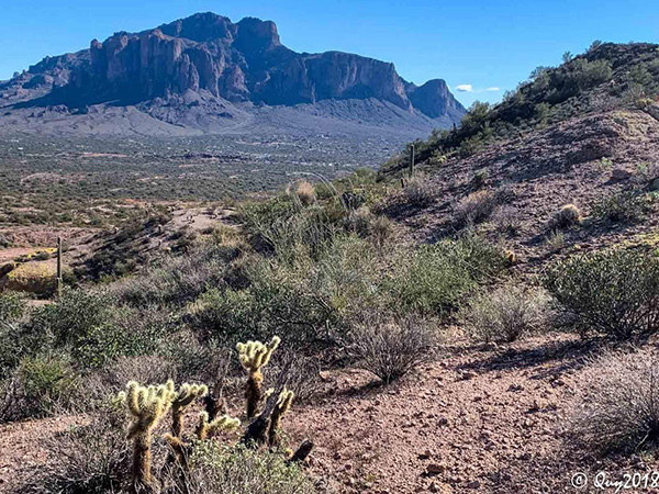
 Purple mountain majesties—the Superstitions. [photo by Quy] |
 Intricate texture of a cholla skeleton. |
 Almost to the power line. |
|
We made it to the power line, then turned left on the easy Powerline Trail back to Dome Mountain Trailhead. The hike was over for us “short” hikers. I pointed out the Blue Ridge Trail to the “long” hikers, then I drove Laurie, Joe, Sally, and Karen back to Hackamore Trailhead. Afterwards, Debbie Rowray led an exploratory hike on the Blue Ridge Trail, for another 2½ miles. Thanks, Debbie! → More pictures, by John. |
|
Supplemental Report by Debbie Rowray |

John was more than helpful, and everyone seemed to love the views. I look forward to adventuring more in the Goldfields soon, and discover more on the ridge at a turn or so we did not make. Thank you to all that joined me on the longer version. Happy New Year to all! See you on future hikes! Debbie |
 Starting on the Blue Ridge Trail. [photo by Quy] |
 I’ll take you up, up, up to the top. [photo by Quy] |
 Steep spot on the way up. [photo by Quy] |
 Superstitions from Blue Ridge. [photo by Quy] |
 The Great Pumpkin. [photo by Quy] |
 You see, it’s like this. [photo by Quy] |
 A’down we go. [photo by Quy] |
 Debbie and Monika on Blue Ridge. [photo by Pete] |
 Peak 3134 from Blue Ridge. [photo by Quy] |
 Top of Page
Arizona Trailblazers Hiking Club, Phoenix, Arizona
Comments? Send them to the AZHC .
updated January 1, 2019