Outdoor Links
Hike Arizona
Trip Planning Guide
Trip Report Index
Calendar of Events
Library
|
Bronco to Tonto Day Hike Northeast of Carefree March 24, 2018 by David French |
|
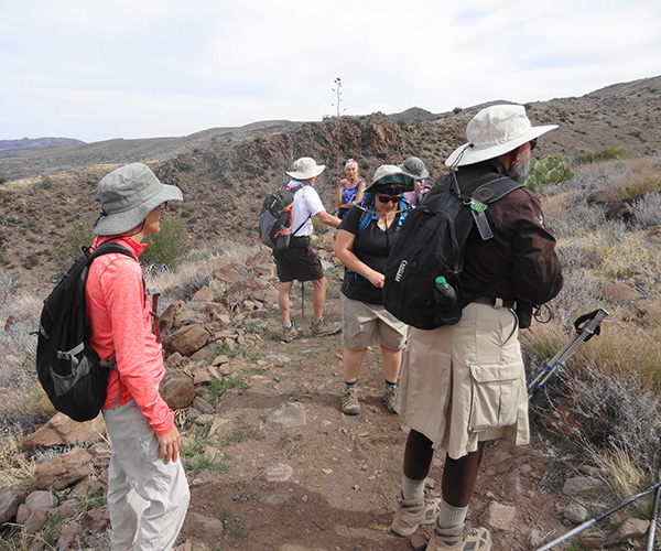
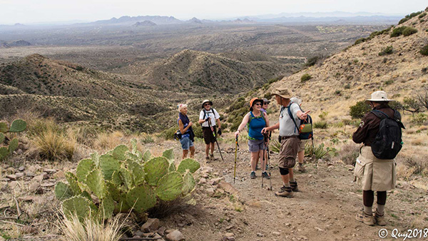
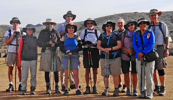 Randy, Gabe, Jim, Dan, Carol, Pete, Tamar, Ramona, Sandy, Quy, Dave |
|
On a cool Saturday morning, eleven Trailblazers showed up near the Cave Creek Office of the Tonto National Forest on Bartlett Dam Road. This modest-sized group reminds me of the Trailblazers when I first joined nine years ago. It is a pleasure to hike with a smaller group that stays together. Thank you, Trailblazers. This hike was to continue my quest to hike much of the Maricopa Trail, which makes a 310 mile loop around the greater metropolitan area. I had previously led a club hike between 7th Street and Spur Cross, and hiked with a friend from Spur Cross to Bronco Trailhead. We consolidated into two vehicles and drove the eight miles to the Bronco Trailhead that is further north on Cave Creek Road (aka FR 24). After the group photo we followed the Maricopa Trail signs, crossed the road, and followed an old access road to the electric transmission lines, then turned south following a road that is still used to maintain the power line. |
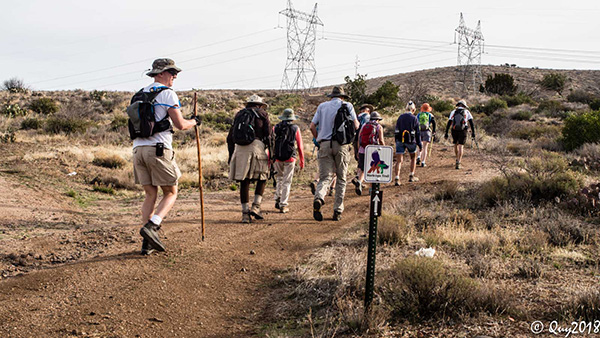 Away we go. [photo by Quy] |
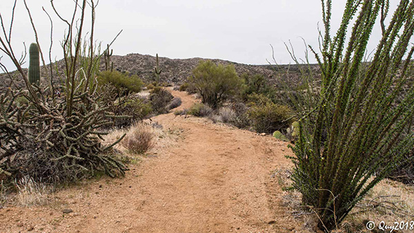
 The trail starts out smooth enough. [photo by Quy] |
 Oops! This must have fallen out of the truck. |
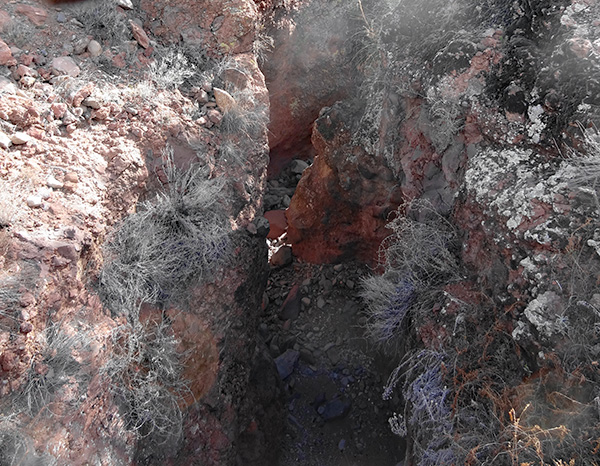
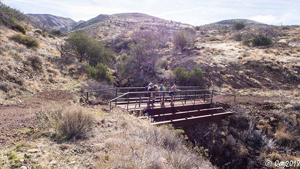 Bridge over Sycamore Canyon. [photo by Quy] |
 Don’t think I’ll try to broad-jump this one. |
|
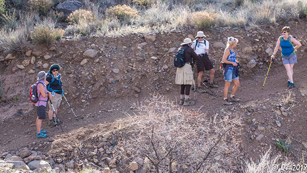
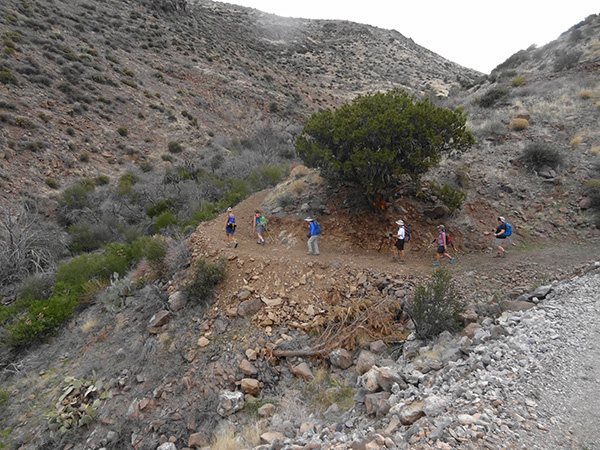
After a mile or so we curved to the east, away from the transmission lines. We crossed a nice steel bridge over Sycamore Canyon. The canyon is an intriguing slot canyon at this point. Then we began the climb up Kentuck Mountain. The climb is about 600 feet from this bridge crossing and fairly easy, because there are some flat spots to give us some relief. Once we left the power line corridor, the trail appears recently constructed using a trail building machine that cuts into the hill and deposits the material on the downhill side. It appears to be well engineered for good hiking and sustainability. |
 She’ll be comin’ ’round the mountain. [photo by Quy] |
 First break. |
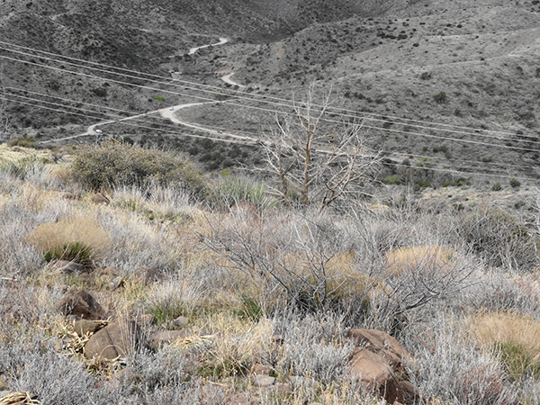 FR 24, aka Cave Creek Road. You’ll get a charge out of this! |
 Kentuck Mountain, here we come. |
|
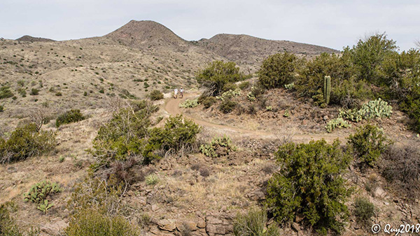
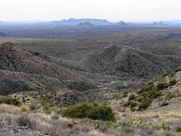
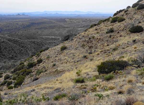
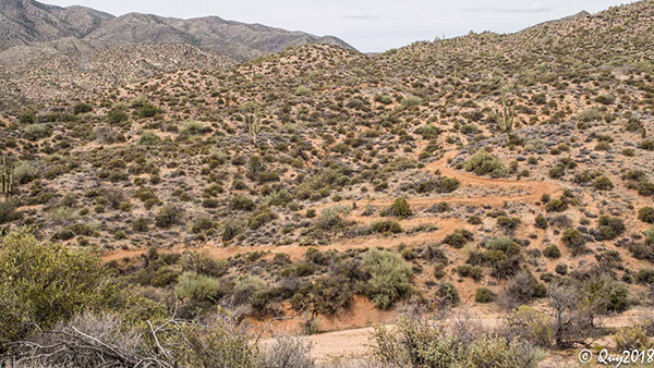
The trail passes through pristine mountainous terrain that offers nice views of rugged hillsides and distant views of many recognizable mountains such as Four Peaks and Weaver’s Needle to the east and the mountains at the north end of the Desert Mountain high-end residential area to the west. Vegetation is a little sparse, but we all agreed the hike was prettier than we expected. We reached the summit of the trail at elevation 4200 just below the Kentuck Mountain Peak. It was a little breezy and cool at this point. Then we headed down. The trail is fairly steep but relatively new so it did not present a footing challenge. |
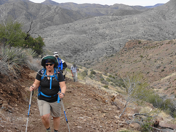 And I’ll huff and I’ll puff and I’ll climb this mountain. |
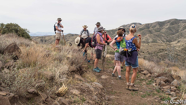 At the summit, 4250 ft, we have great views in all directions. [photo by Quy] |
 Now we head down and down. [photo by Quy] |
|
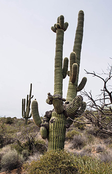
About halfway down, we found a nice rock outcropping and stopped for our lunch break. Afterwards we continued downward, crossed a wash, up again and then down again to another wash crossing. After another climb, we descended down to Blue Wash Creek and our low elevation of 2864'. After a short break, we continued southward. As we climbed up out of the creekbed, we entered very familiar Sonoran Desert terrain with lots of Saguaros, cholla, and other very familiar plants. |
 What a view! |
 Desert Mountain Golf Course in the distance. |
|
|
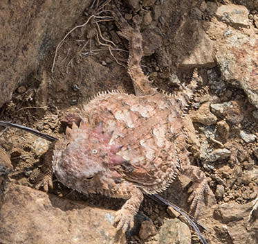
| Flora and fauna of the Maricopa Trail. [photos by Quy] | |
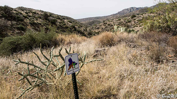 On the right trail. [photo by Quy] |
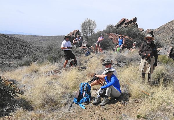 We found the best lunch spot. |
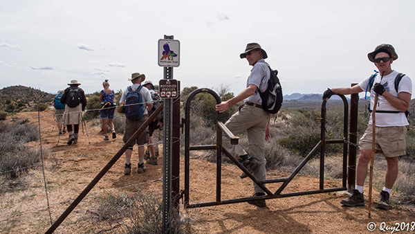 One of several gates. |
|
The trail eventually curved back to the west and we crossed under the transmission lines again. The chaparral under the power line corridor had been recently bulldozed. I assume this destruction was to lessen the heat from a wildfire to protect the transmission lines. The last mile or so of the trail was directly along the transmission corridor and was the least interesting part of the hike. Very near the southern end, the trail dog-legged to the west and intersected Bartlett Dam Road a couple hundred feet east of where we parked the cars. After a brief break and change of shoes, we got one person to drive the two of us back to Bronco Trailhead to retrieve our vehicles. |
 Long winding road. [photo by Quy] |
 We must be getting somewhere. [photo by Quy] |
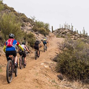 Peddlers on the trail. |
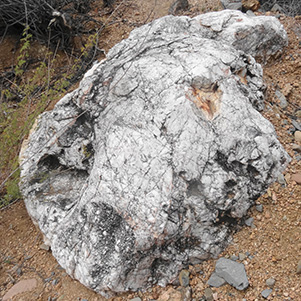 Where there’s quartz, there might be gold. |
 First wildflowers this year. |
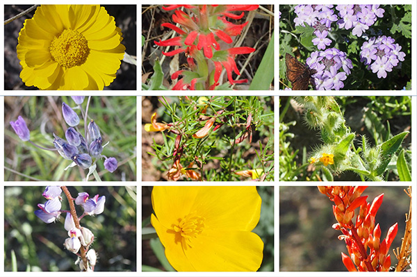 Lots of wildflowers to cheer us. [photos by Quy] |
|
Bronco Trailhead is well signed on Cave Creek road and has a restroom. Tonto Trailhead has no facilities and no formal place to park, but you can park perpendicular to Bartlett Dam Road just east of the Forest Service facility. |
|
Supplemental Report by Jim Buyens |
|||||||||||||||||||||||||||||||||||||||||||||||||||||||
|
It was certainly great seeing you all on today’s hike. I hope you had as great a time as I did, and that you felt the same sense of accomplishment at the end. And special thanks for you, Dave, for making it all possible! Jim |
|||||||||||||||||||||||||||||||||||||||||||||||||||||||
|
|
||||||||||||||||||||||||||||||||||||||||||||||||||||||
 Top of Page
Arizona Trailblazers Hiking Club, Phoenix, Arizona
Comments? Send them to the AZHC .
updated March 26, 2018