Outdoor Links
Hike Arizona
Trip Planning Guide
Trip Report Index
Calendar of Events
Library
|
Leaf Peeper Sierra Vista November 7-8, 2021 by Tamar Gottfried |
|
 Group photo along the river. [photo by Quy] |
||||
|
|
Several cars of Trailblazers left Phoenix early on a Sunday and convened at the San Pedro House, east of Sierra Vista. Folks got time to explore the Nature Conservancy site while two of us shuttled a car to Hereford to await us on the end of the planned hike. The plan was an 8 mile one way hike, but it took 14 miles of driving to reach the southern end of the hike. Nine of us started out from San Pedro House and soon reached the banks of the San Pedro River. We enjoyed the cool shade, riparian vegetation, and the sounds of running water and quickly convened for a group photo along the river. After a nice flat walk for a bit, the trail started to verge away from the river. |
 The trail looks reasonable here. [photo by Quy] |
 So pleasant by the water! [photo by Quy] |
 We’re leaving the river. [photo by Quy] |
|
Now it was quickly getting warm as it was close to midday, and the roadlike path was not as pleasant as the riverbank. Some of us started to rethink going 8 miles along a sun-soaked road. Thinking we had missed a separate path with the option to stay closer to the water and small trees, we consulted some GPS tracks, and indeed, there appeared to be a path parallel to the river. We took a fork off the mail trail and found the tiny path that was supposed to go nearer to the river. This was no obvious trail and the longer we followed it, the higher the dry grass was. We started to encounter catclaw and dense dry vegetation and very little trail, but we trudged on with the tall trees along the riverbank in view. The clever ones among us turned back to the main trail and back to our starting place. |
 Rambling through the woods. [photo by Quy] |
 Tall grass. [photo by Quy] |
|
Determined not to turn around, we encountered scratchy violent vegetation of all varieties and less of an obvious path as well as uneven/unstable ground with branches and other obstacles. Eventually we made it to the riverbank, and found no easy way to walk along the water. There was a high bank, which was very squishy and just as dense with plants. At this point, we decided to go back towards the original trailhead along the river as well as we could, until we could make a turn and rejoin the actual trail. The path we were following may have been a trail or a road at some point, but it definitely was nothing now. Frustrated, bloody, with all sorts of plant life embedded in skin, clothes, socks and shoes, we kept moving until we saw a hill, and from there, the actual trail. We made it back to San Pedro House and agreed that this Suffer Fest of snarls made the point that the path alongside water is not always the best or easiest way to travel. As it was late in the day to complete the original hike, we took time to pull stickers from our clothes and bodies (Bill had so many that he trashed his socks) and then we drove to Hereford Bridge, our original ending point. Once there, we met up with Lin and Carl in their RV and took a little walk on the trail toward the river and followed it north to get a taste of what we had missed by skipping the last 6 miles of the hike. |
 Stickers. [photo by Quy] |
 Maybe this isn’t the way, after all. [photo by Quy] |
 Hot food makes everything right. [photo by waitress] |
|
Sufficiently tired and dirty, we drove to Sierra vista and had a late lunch/ early dinner at La Casita, a charming Mexican restaurant, where the service and food erased our memories of our aborted hike.
|
 Amid fall colors. [photo by Barbara] |
 A walk in the woods. [photo by Wendy] |
 We’ll cross that bridge when we come to it. [photo by Wendy] |
|

|
| Up, up, up, amid fall colors. [photos by Quy] | |
 A pleasant little waterfall. [photo by Tamar] |
 Quy. [photo by Tamar] |
|
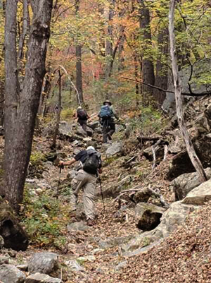
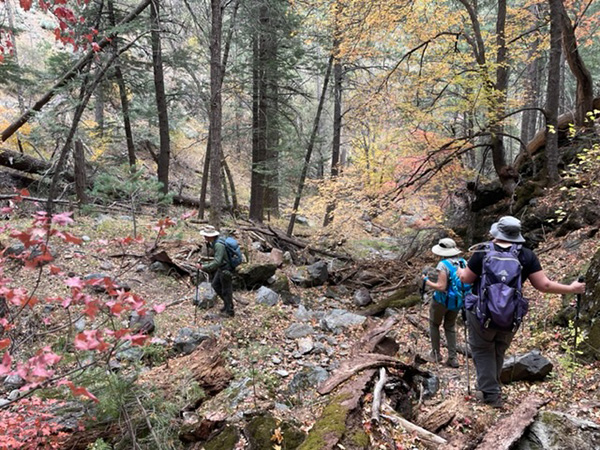
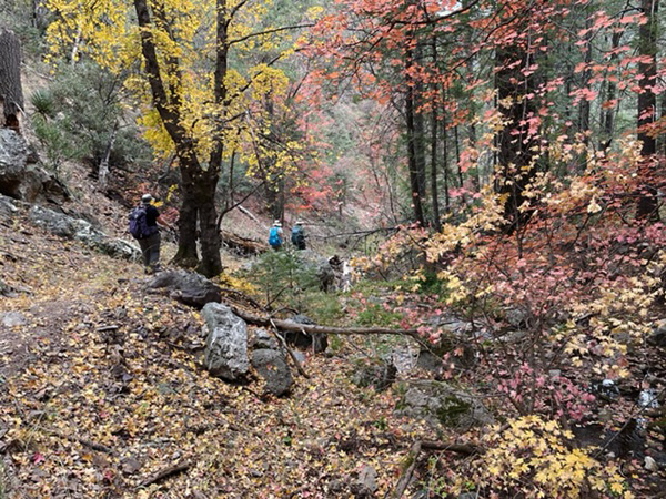
The trail gained over 1000' of elevation in the first 3 miles, even with a portion of descent close to the stream. We were split into groups – five fast people at the front – two of us going a little slower next, but only 5-10 minutes behind. Another hiker right behind and two shorter distance hikers at the back, who turned around at about 2 miles in, and spent the rest of the day relaxing and enjoying the preserve and the other trails down there. We were tasked with completing all hiking before 4 PM when the preserve closed, and the gate would be locked. We passed a few trail junctions along the way, but thoroughly enjoyed the stream area, which had an abundance of water crossings, little waterfalls, and a variety of fall colors. The color bonanza lasted until the last 1000 ft of elevation—at that elevation, the leaves were on the trees or were yellow and on the ground: no variety. We passed the junction of Hamburg and Pat Scott, and took the Pat Scott Trail to the Crest. This trail is less steep, with wide switchbacks to the top. It also has the remains of mining tools and equipment, as well as abandoned cabins. We made it to the Crest just at the time 3.5 hours in, where we needed to turn around to make it down in time. While the turnaround at the Crest Trail was supposed to be 9 miles total, it ended up being more like 10.5 miles. Three brave souls continued left on the Crest and back down the Hamburg Trail to complete the loop at 11.5 miles. |
 Autumn color, everywhere! [photo by Quy] |
 Traipsing through the woods. [photo by Quy] |
 Autumn color, everywhere! [photo by Quy] |
 Let’s take a break. [photo by Quy] |
|
The hike down was just as beautiful, but much faster than the way up (a distance and elevation gain similar to going up Bright Angel from Indian Garden in the Grand Canyon). Those folks who did the loop found the upper part of Hamburg to be much steeper than the Pat Scott Trail, and with less historical remnants. We made it to the bottom with time to spare, and had time to enjoy cold drinks and snacks before embarking on the 3 hour drive back to the Valley. We agreed that it had been a lovely day, with perfect weather, relaxing water, and an abundance of fall colors along with a challenging and satisfying hike. The 2 days of Southern Arizona hiking left us eager to come back down and explore more of this part of our state. |
 Top of Page
Arizona Trailblazers Hiking Club, Phoenix, Arizona
Comments? Send them to the AZHC .
updated November 13, 2021