Outdoor Links
Hike Arizona
Trip Planning Guide
Trip Report Index
Calendar of Events
Library
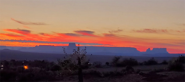
Arizona, Utah
October 2-7, 2021
by Mimi Tran
|
Trip Leader: Mimi Tran 17 Trailblazers signed up for this trip which is exploratory in the sense that none of the participants has done any of the kayaking part on the schedule. It is the first time that the Trailblazers have camped at Wahweap Campground. The goal is to have an adventure at Lake Powell / Glen Canyon National Recreation Area. Lake Powell, which some consider the most beautiful place on earth, is actually not a lake. The Bureau of Reclamation, in the early 1960s, erected a 710 feet tall concrete arch Dam on the Colorado River, near where it crosses from Utah to AZ. The dam is named after the Glen Canyon that was inundated. Behind the dam, water backed up for almost 190 miles, creating a huge reservoir, aka Lake Powell. It took many years for the reservoir to be filled. At full capacity, Lake Powell stores 24 million acre-feet of water, enough to flood the entire state of Massachusetts hip-deep. Newspaper
The Southwest has been plagued with a drought for over 20 years. The lake’s
surface has dropped by 140 feet since 2000. Just in the past year, it has dropped more
than 50 feet. Currently it is at ~ 30% pool. This “unprecedented” low water
level will be a challenge for kayakers when launching. It also gives the lake a distinctive
“bathtub ring”.
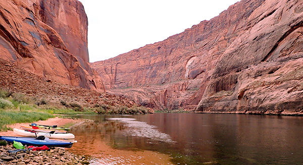
Day 1, Saturday, October 2 Lin and Nicole drove to Page from Monument Valley. Vicki and Richard drove from CA via Kingman AZ. Ann and John B. took their RV for the first time on this trip. Sonny drove solo to his individual campsite. Mark and Michelle came up with their trailer to Lone Rock Beach the day before. Deirdre drove up to Page on Monday. A caravan of 3 vehicles departed from Bell and I-17 at 7:30AM. Eileen and Wayne drove their SUVs. Wendy and Mimi carpooled. John S, Chuck and Mohammed were in John’s Jeep pulling a white trailer. The caravan group decided to stop at Antelope Point to check out “The challenging launching conditions” seen online. There is a moderately steep and rocky path to the water. After seeing this path with our own eyes, it was decided that “it’s doable”. |
 Marching down the long boat ramp. [photo by Wayne] |
 Rocky slope to the water. [photo by Eileen] |
 What we had to haul our kayaks down and up. [photo by John] |
|
Wahweap Campground has low bushes and hardly any trees except for the group site G1. Shade is a scarcity. Two canopies were set up to shield the picnic tables. Fire restrictions were enforced therefore no fire pit and charcoal were allowed. The buildings are of an esthetic Territorial Style. The bathrooms and showers are quite clean. From the campsite, the view of the lake is expansive. A pleasant surprise, there is an electric outlet close to the picnic tables and it became a charging station for mobile devices. |
 The lucky campers with shade. [photo by Lin] |
 Sunrise from group site G1. [photo by Mimi] |
 Sunset from group site G1. [photo by Wendy] |
|
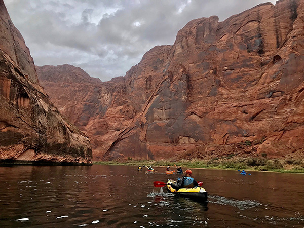
Day 2, Sunday, October 3 Antelope Canyon Paddle by Mimi Tran |
|
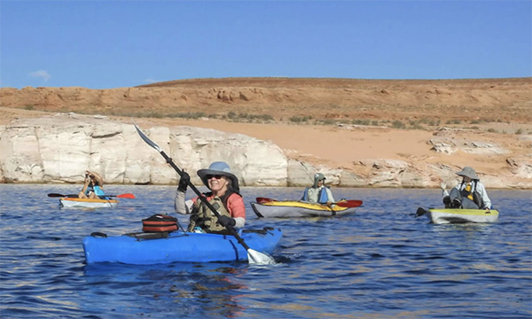
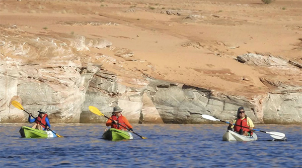
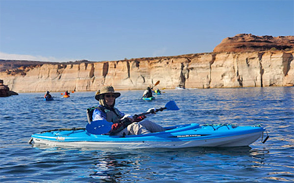
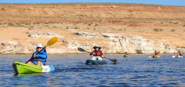
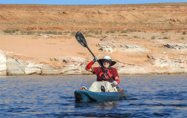
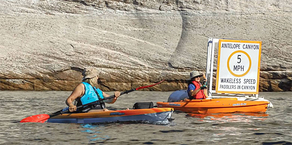
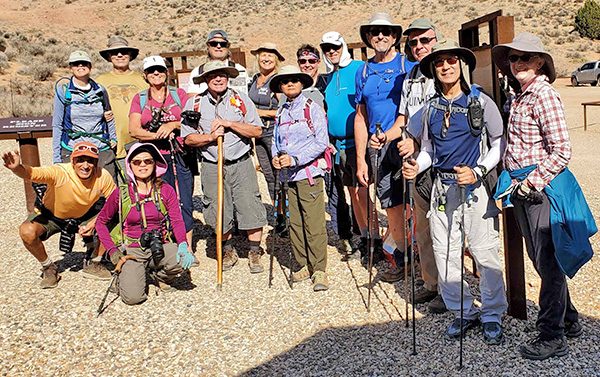
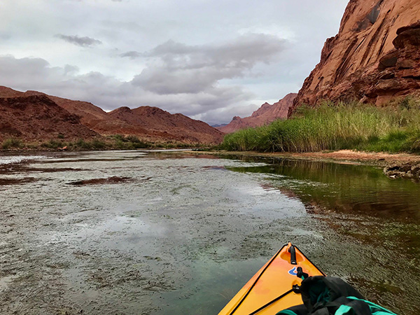
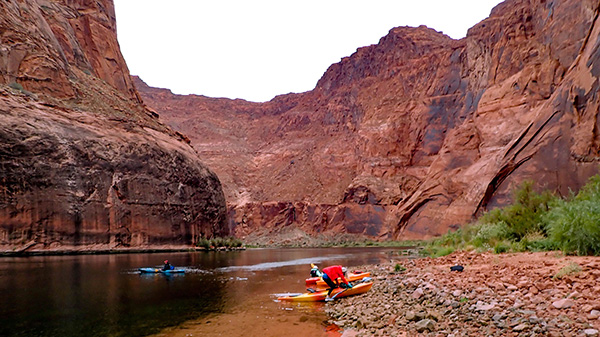
Today, the Trailblazers will approach Lower Antelope Canyon from the water. Sixteen departed from the campground at 7 AM to drive to Antelope Point. Deirdre skipped this outing. Some vehicles were loaded with kayaks on their roofs. Five people rented their watercrafts. Wendy rented a Hobie with pedals. It took more than an hour to carry all the kayaks down a steep and winding rocky path to the water. The paddle was 80 minutes going 5.5 miles RT. After 30 minutes in the open lake, we reached a sign indicating the entrance to Antelope Canyon. The 50 minutes in the canyon was in calm water. The feel was very peaceful. |
 Finally launching. [photo by Wayne] |
 Ready to paddle to Antelope Canyon. [photo by Wayne] |
| Wendy, Eileen, Chuck, Mimi, Mohammed, Michelle, John B. |
 Eileen, Vicki, Mohammed, Wendy. [photo by Wayne] |
 Ann, John B., Richard. [photo by Wayne] |
 Sonny, Mimi, Eileen, Wendy, Vicki, Ann. [photo by Wayne] |
 Wayne, the photographer, being photographed. [photo by Wendy] |
 Richard, Ann, Mimi, John B., Mohammed, Eileen. [photo by Wayne] |
 Happy paddlers and friends, Vicki and Ann. [photo by Wayne] |
 Nicole, John S., Ann, John B., Richard. [photo by Wayne] |
 Nicole is forging ahead. [photo by Wayne] |
 Custom made skirt draped over John’s knees. [photo by Wayne] |
 Quagga-mussel shells. [photo by Wayne] |
|
Black dots of quagga-mussel shells. Natives of the Black Sea, they hitched a ride on a visitor’s boat and arrived in Powell about a decade ago and then proceeded to multiply. |
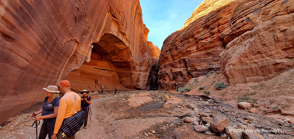
 Approaching the Antelope Canyon entrance. [photo by Wendy] |
 Happy to reach the entrance. [photo by Wayne] |
 Vicki and Mimi made it. [photo by Wayne] |
 Entering the Canyon: Mohammed, Chuck, Wayne, John S., Michelle, and Mark. [photo by Eileen] |
 Caves in the canyon wall. [photo by Wendy] |
 Chuck and Sonny exploring a cave. [photo by Wendy] |
 The calm water of the canyon curve. [photo by Wendy] |
 Approaching the beach. [photo by Wendy] |
 All made it to the beach. [photo by Wayne] |
 Put down at the beach in a lot of muck. [photo by Eileen] |
 Keeping our kayaks together. [photo by Wendy] |
 Kayaks all lined up. [photo by Wayne] |
 Antelope Canyon beach group picture. [photo by Wayne] |
| John S., Ann, John B., Eileen, Mark, Michelle, Richard, Mohammed, Sonny, Wendy, Mimi, Nicole, Chuck, Vicki |
|
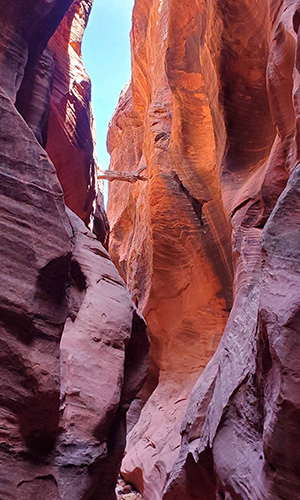
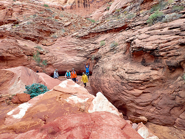
15 Trailblazers hiked into the Lower Antelope Canyon. RT 3.5 miles. 3 people hiked 5.5 miles. The entrance is wide open, then the canyon gets narrower and narrower with sinuous curves. |
 Gorgeous canyon walls. [photo by Wendy] |
 Wide entrance to Antelope Canyon. [Wendy] |
 Bottleneck here. [photo by Wendy] |
 Big step here. [photo by Eileen] |
 Happy hikers. Are they inseparable? [photo by Wayne] |
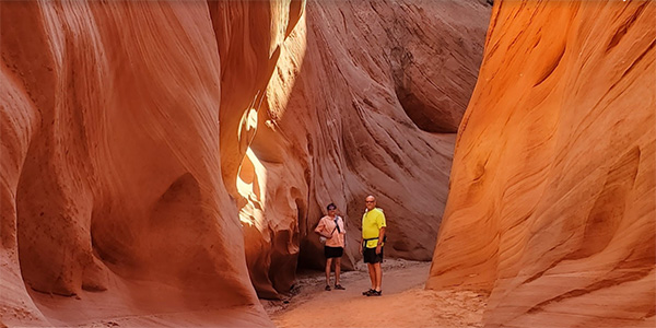 Vibrant colors surround Mark and Michelle. [photo by Wendy] |
 Wavy canyon walls. [photo by Eileen] |
 Narrower passage. [photo by Wayne] |
 Sinuous curves. [photo by Wendy] |
 In the Canyon. [photo by Eileen] |
||||
|
 Wayne resting at the Canyon entrance. [photo by Eileen] |
|
The paddle back was uneventful. Thankfully, no one capsized. We encountered some choppy water on the open lake, as the wind usually picks up in the afternoon. Back to the campground, 16 Trailblazers had a copious potluck dinner. |
 Potluck dinner. [photo by John B.] |
|
Day 3, Monday, October 4 Wire Pass to Buckskin Gulch by Wendy Rennert |
 Slot Canyons, here we come! [photo by Wendy] |
||||
|
|
Since the last 8.5 miles to the trailhead are on a dirt road that becomes impassable when it rains, and since flash floods can reach very high up the slot canyon walls within minutes, it is essential that you double check the weather forecast and also with the nearest ranger station before you embark on this trail. After checking the weather forecast and recent trip reports one more time the night before, reports indicated that the road that was impassable on September 29 was now passable, and the water in the slots was at most knee deep now instead of waist to chest deep. So, with that knowledge, 15 Trailblazers traveled along a bumpy dirt road and gathered at Wire Pass Trailhead. The Paria Canyon-Vermilion Cliffs Wilderness Area requires a permit displayed in your car. In hindsight I should have gone with my first instinct and bought all the permits the night before online at the campground. The only carrier that seems to work at the trailhead is Verizon, and even though a few of us have Verizon, the recreation.gov site was giving us trouble, so the process to get passes at the trailhead cost us an hour of time. Lesson learned! The Wire Pass Trail starts in a desert wash, with beautiful rock formations here and there along the way. |
 Wire Pass Trail starts in a wide wash. [photo by John S] |
 Sonny has done this trail before, but is excited to experience it again, this time with some water in the slots! Each time is a new and different experience. [photo by Wendy] |
|
As we enter the Wire Pass slot canyon area, the canyon walls soon narrow and require some maneuvering. We help each other down one level and the next, and also down a sturdy 10-foot ladder. Hope you don ’t mind tight places! |
 Michelle helps Lin down one of the medium sized drops. Each person helps the person behind them. [photo by Wendy] |
 Some spots are barely wide enough even to go single file! [photo by John B] |
 One by one, down the ladder we go! [photo by Wendy] |
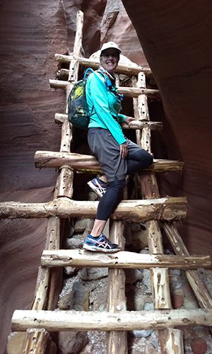 Here comes Ann down the ladder! [photo by John B] |
|
Slot canyons are much deeper than they are wide. These narrow canyons are about 100-200 feet tall. We really enjoyed the close confines and beautiful curvy walls of the slot canyons – so peaceful, so gorgeous! |
 A welcome ray of sunshine in the dry part of the slots. [photo by Wendy] |
|
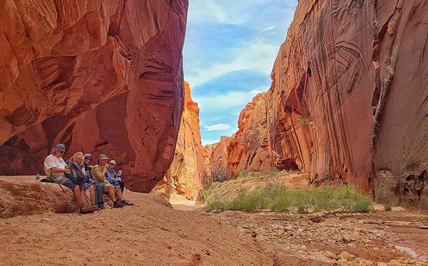
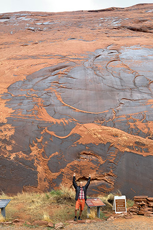
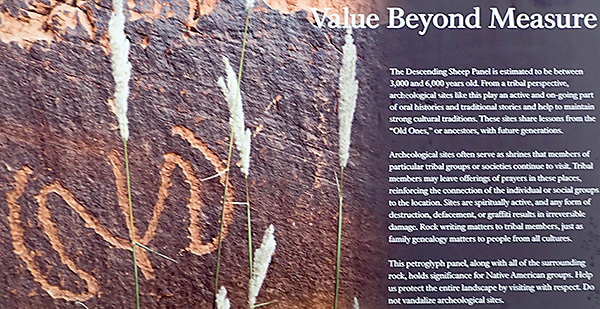
At about the 1.8-mile mark, we reach the junction of Wire Pass and Buckskin Gulch. At this junction, we admire the fine collection of petroglyphs before we continue on to the right (south) into Buckskin Gulch. |
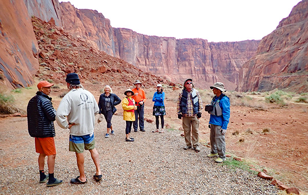
 Victoria, Mohammed and Mimi check out the petroglyphs. [photo by Wendy] |
 An example of one of the petroglyph panels. [photo by Wendy] |
|
Buckskin Gulch is one of the largest slot canyons in the world, and it is the longest one in the U.S. (about 15 miles). Slot canyons are formed over millions of years when water full of gravel, sand and debris slowly works its way through narrow cracks in solid rock (in this case, it is Navajo Sandstone), and over time carves deeper and deeper through and smooths the canyon walls. When we reach the first spot where you are forced to walk through the water pools, five people decide to head back to the junction and hike a little way into the north part of Buckskin Gulch, two people head back to the trailhead, and the remaining eight of us watch a random hiker (not with our group) plow on through the puddle. Ok, that was easy, yes, we can do this!! So one by one, we try our hand sloshing through our first puddle. |
 Here comes Victoria through the chilly water – and she does it barefoot!! Now that ’s brave! [photo by Wendy] |
|
Ok, we did it! Now that our boots are wet and squishy, we have no problem plowing through the rest of the pools. Glad I wore an old pair of boots! You cannot see the bottom of the pools, so this is where your hiking poles come in handy to gauge how deep the water is. Pools varied from ankle deep to just above the knees, and from sandy to muddy to rocky. |
 Ann takes the lead through the pools, and without a hiking pole! Her method is to hug the canyon walls instead. [photo by Wendy] |
 Such gorgeous canyon walls. Look how tiny we are! [photo by Lin] |
|
We look at the canyon walls in amazement at how relatively smooth the walls are, and how powerful the water must be when it is rushing through. We see a log wedged between the canyon walls very, very high up near the top of the canyon – a sign of how high the water can get in the slots. We look up at the sky again to reassure ourselves that we indeed have clear skies all day today, and the only water we need to hike through is left over from the rain 4 days ago. We love but also respect the canyon ’s beauty and how it was powerfully formed. |
 The log wedged in near the top of the canyon is a reminder that these slots are a dangerous place to be in rainy weather! [photo by Wendy] |
 The changing light changes the colors of the canyon walls. The mud path guides us through and around the pools. [photo by Wendy] |
 John B. enjoying the quiet solitude. [photo by Ann] |
|
As time goes on, Sonny and Mohammed get farther ahead of us, and Lin and Victoria get farther behind us, so for a while, we are a party of four. Since I was carpooling with Lin, I was about to turn around and go back so that she didn’t have to wait for me, but just then Lin and Victoria showed up, so the six of us continued on. |
 A passerby takes a photo of us – Wendy, Richard, Ann and John B. [photo by Wendy] |
 My favorite part of the trail – Richard, John B. and Ann forging through the knee-deep water and beautiful, narrow canyon. [photo by Wendy] |
|
When we met up with Lin and Victoria, we find out that they had both gone barefoot through the pools all the way up to this point, but now they were ready to put their boots on again for the remainder of the hike. |
 Lin declares that going barefoot is like a spa treatment! If you are brave enough! [Victoria] |
 Curvy, picturesque canyon walls – what a treat! [photo by Wendy] |
|
Not too long after Lin and Victoria catch up to us, we run into Mohammed and Sonny who are heading back to the trailhead. We asked them how much farther they went, and we went to that same spot before turning back. |
 The canyon opens up again briefly. Great spot for a snack break before heading back! [photo by Wendy] |
 Lin continues to take photos while we rest and fuel up for the return trip. [photo by Lin] |
|
On our way back, we get to an opening in the canyon, and we note that this is where we saw a man asking a woman to marry him earlier today (they were not part of our club). So Victoria recreates this moment and spontaneously says to Richard – “Will you marry me again?” Awww! |
 Victoria and Richard say yes, again! [photo by John B] |
|
As we work our way back through Buckskin Gulch and Wire Pass back to the trailhead, we had so much fun. But we note that it is also getting cloudier, so we are thankful to get out of the canyons and off of the dirt road without a drop of rain. The next evening, we ended up getting a whopper of a storm, so we really did thread the needle of opportunity, thankful that we were able to do that hike 4 days after 1 storm, and 1 day before another storm. On October 16, I checked back on subsequent All Trails reports, and there are reports that in the storm that occurred after our hike, the 10-foot ladder has washed away (again)! It is now lodged about 30 feet above the trail in Buckskin Gulch, and the BLM ranger says the ladder will NOT be replaced again. Instead, the BLM has established a new route requiring a little scrambling to provide access to the trail below where the ladder once was. We are so grateful that the ladder was there on the day we did our hike! Thanks to the drivers who maneuvered the very bumpy road to the trailhead…Thanks to Victoria, Richard, John B., Ann and the random couple who provided snacks to me, since I inadvertently forgot my lunch that day…Thanks to all participants, and thanks to Mother Nature for providing great weather and fantastic scenery! Statistics: 8 hikers did 6 miles round trip, 5 hikers did 4 miles round trip, and 2 hikers did about 3.6 miles round trip. |
|
Day 4, Tuesday, October 5 Kayaking Horseshoe Bend on the Colorado River by Chuck Parsons |
|
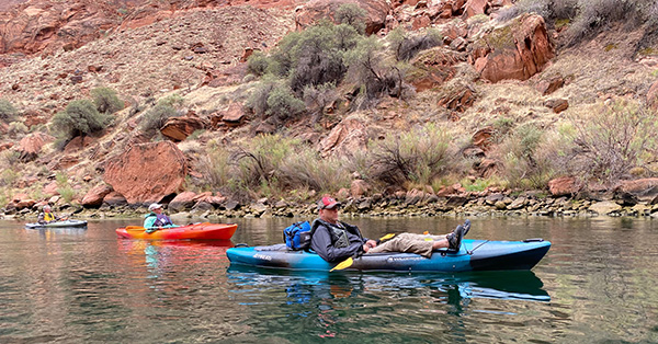
5:00 AM on Tuesday morning, as most of us rise and make a valiant attempt to shine. Pitch dark and 56 degrees. Still, a much welcome break from the relentless heat of the Phoenix metro area. We need to get ourselves ready to face the day, eat a good breakfast, organize our kayaking gear, and leave the campground by 6:30 AM sharp. We have an 8:00 AM rendezvous time with the backhaul outfitters, Kayak The Colorado, at Lees Ferry, and it’s going to take us roughly 90 minutes to make the drive. So, let’s get moving, Trailblazers. Today, we have a date with destiny, doing what most of us kayakers have wanted to do for a long time—kayaking a full ten miles on the Colorado River, all the way through Horseshoe Bend and back downstream to Lees Ferry. One more item to check off the old bucket list. 6:30 AM and a caravan of six vehicles, carrying thirteen passengers and their kayaks, rolls out of Wahweap Campground and heads for Lees Ferry. Not much traffic on the road this early on a weekday morning, so we make good time, arriving at Lees Ferry by 7:45 AM. We unload our kayaks and carry them over to the waiting outfitters’ loading dock, where they load them and all our gear onto three large shallow-draft river boats tied up at the dock. The Colorado River/Horseshoe Bend adventure is about to begin! John Lee, a Mormon and a polygamist in his time, settled here in 1871 and started a ferry service in 1873. The ferry service changed hands several times over the years and continued operating until 1929, when the original Navajo Bridge opened to traffic. One of Lee’s wives, Emma, is quoted as saying “I came here near freezing to death, and now I am almost cooked alive.” We have to wonder how long Emma toughed it out. Lees Ferry is Mile 0 on the Colorado River and marks the starting point of the river’s 277-mile-long passage through the Grand Canyon, and therefore becomes the primary reference point from which all other points on the river are measured. We go over standard safety rules on the Colorado River, learn where to cross the river and what side to stay on, sign trip waivers, and finally get underway at about 8:40 AM. Today, we’ll head upriver to Mile 10, where we’ll be dropped off at Petroglyph Point to begin our journey down the river and back to Lees Ferry. |
 Trailblazers at Lees Ferry loading dock. [photo by Wayne] |
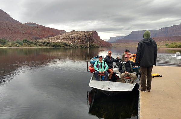 All aboard, Trailblazers! [photo by Ann] |
 This boat is loaded and ready to roll. [photo by Wayne] |
 The Colorado River is calm and serene this morning. [photo by Deirdre] |
 A horse taking his morning stroll along the river. [photo by Mohammed] |
 This colorful mallard takes flight in response to the boats. [photo by Mohammed] |
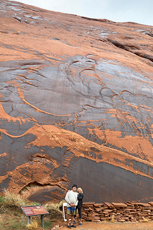 Rich and Vicki against the petroglyph panel. [photo by Mohammed] |
 Mohammed against the petroglyph panel. [photo by Mohammed] |
|
Ann, John B., and I are in the lead boat as we slowly pull away from the dock and head upriver. Soon, the boat operator accelerates, and we lurch forward, leaving a large wake behind as the other two boats follow. The cool and clean early morning air coming off the river is both bracing and refreshing, as we leave Lees Ferry farther and farther behind. From time to time we see large Great Blue Herons take flight, as we disturb them in their daily search for fish swimming by their rocky perches.at river’s edge. All three boats at full cruising speed, we skim steadily along as we move upriver, passing Mile 1 and then Mile 2. At Mile 3 we see the small side canyon known as Waterholes Canyon. Time permitting, we plan on stopping here on the way back to Lees Ferry to do the short three-mile round-trip hike in the canyon, or at least as much of it as we can. After sitting in kayaks for miles, it’s an opportunity to get out and move. Occasionally we pass people fishing from power boats near the shore, as they cast their lines far out into the river in hopes of catching the big one that got away. We also see small groups of horses standing in shallow water close to the riverbank, as they graze on river grasses growing in the river. Very much like the Lower Salt River horses. We cruise past Mile 4, Mile 5, and then Mile 6 where we plan on beaching our kayaks and getting out for a lunch and rest break as we kayak back downriver to Lees Ferry. Here, there’s a campground with nearby restrooms. Continuing our upriver journey, we soon pass Mile 7, Mile 8, then Mile 9. Only one more mile to go before reaching our drop-off point. At about 9:30 AM the boats slow down and ease into Petroglyph Point. We all disembark here, as the boat operators slide our kayaks and gear into the river. We have arrived at last! Petroglyph Point, or what our boat operators refer to as Petroglyph Beach, is a wide, sandy beach on this stretch of the Colorado, located just upstream of Horseshoe Bend. Ideal for wading and certainly inviting on a hot summer day, the water is both too cold and too dangerous for swimming. At a constant temperature of about 50 degrees year-round, the Colorado River below Glen Canyon Dam can be very deadly, with hypothermia setting in within minutes. Invasive tamarisks are the predominant tree species along this stretch of the river. After retrieving our kayaks and gear from the boats and pulling them up well away from the river’s edge, we start up a series of steps to higher ground and several pit toilets overlooking the beach. Then we hike a short quarter-mile gravel and dirt trail out to the petroglyph panels, carved into the typical dark desert varnish of a high sandstone cliff face. |
 We never knew Mimi was so strong. [photo by John] |
 Trailblazers are preparing to launch. [photo by Mohammed] |
 The cultural significance of Native American rock art. [photo by John] |
 Petroglyph 1. [photo by John] |
 Petroglyph 2. [photo by Deirdre] |
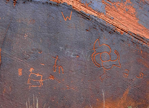 Petroglyph 3. [photo by Wayne] |
 Petroglyph 4. [photo by Wayne] |
 Discussing petroglyphs and the big river trip ahead. [photo by John] |
 Trailblazers are preparing to launch. [photo by Mohammed] |
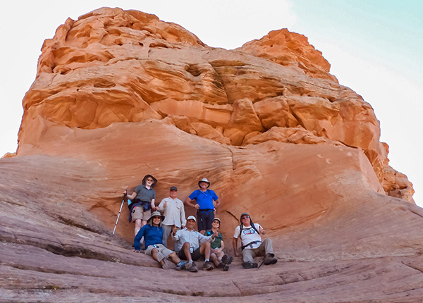
 Lining up for the important group picture. [photo by Wayne] |
 13 Arizona Trailblazers, with the Colorado River as the backdrop. [photo by Mohammed] |
| John S., John B., Ann, Mark, Michelle, Sonny, Mimi, Wayne, Mohammed, Richard, Victoria, Chuck, Deirdre |
 Launching kayaks into the Colorado River. [photo by Wayne] |
|
Ancestral Puebloans lived in this area around the Colorado River from about 1,000 years ago to 3,000 years ago and created these rock art panels. Commonly called petroglyphs, these drawings and images were carved, incised, or scratched into the rock face using crude sharp stone instruments. Pictographs, by comparison, are painted onto the rock surface with a variety of natural pigments. Periodic large releases of water from the dam deposit or excavate large amounts of sand, and these panels were only revealed less than twenty years ago when the surging river removed a large amount of sand from this particular area. We hike back to our kayaks, load up our gear, and start the ten-mile journey all the way through Horseshoe Bend and back down the river to Lees Ferry, where we started from a couple of hours earlier. The river flows on average 2-3 MPH along this stretch above Lees Ferry. If we simply float along and let the river carry us back, the trip could take as long as 5 hours. If we paddle, it won’t take quite as long, so we paddle with the current. Long before any man-made dams blocked its passage to the sea, the wild and untamed muddy Colorado River was said to be too thin to plow and too thick to drink. Not any longer. Since the completion of Glen Canyon Dam in 1966, the full average daily load of 500,000 tons of sand, silt, and gravel the river has carried for millions of years on its 1,450-mile journey to the Gulf of California is now deposited in Lake Powell for many miles behind the dam in the form of a vast and growing alluvial fan. In some places this material is over 100 feet deep and continually building up. |
 Trailblazers kayaking on the Colorado River. [photo by Wayne] |
 The sky is looking pretty ominous in this scene. [photo by Deirdre] |
 Richard and John B. are in the lead here. [photo by Wayne] |
 Michelle and Deirdre admire the scenery. [photo by John] |
 This big guy is grazing on river grasses. [photo by Wayne] |
 Grass grows thick and abundant in the river shallows. [photo by John] |
 Deirdre paddles through a river of grass. [photo by Deirdre] |
 This Great Blue Heron waits patiently for a fish. [photo by Wayne] |
 Now this is the way to kayak! [photo by Mohammed] |
 Vicki and Rich are having fun on the river. [photo by Mohammed] |
 Sonny is moving right along. [photo by Mohammed] |
 Wayne is lining up the perfect Kodak moment. [photo by Mohammed] |
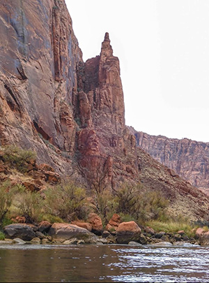 Finger Rock, high over the river. [photo by Wayne] The primary bird life along the river continues to be Great Blue Herons, as they patiently sit on their rocky perches at river’s edge, waiting for breakfast to swim by. Or lunch. Or dinner, depending on the time of day. Completely enthralled and engrossed by the river and our surroundings, we lose all track of time as the worries and concerns of everyday life melt away. Before we know it, we drift past Mile 9, then Mile 8 and Mile 7 and finally pull into the campground (with restrooms) at Mile 6 for a well-deserved lunch/rest break. We beach our kayaks and pull them up well away from the river. With plenty of large rocks and boulders available, we each select our favorite one and sit down to enjoy lunch and snacks, as we watch the river flow by. But we’ve been sitting on our duffs all morning long in our kayaks, so we need to get on our feet and walk around a bit to get the blood flowing and the leg muscles firing and working in harmony once again. Then it’s back on the river. For those of you familiar with the Willie Nelson classic On the Road Again, in our case it’s On the River Again. Perhaps we could turn that into a new travel classic. John S., where is your guitar? Help us out here. We’re almost halfway through the trip already, with just six more miles to go before reaching Lees Ferry. |
 Horseshoe Bend from the overlook. [photo by John B.] |
 Horseshoe Bend Overlook from the river. [photo by Wayne] |
 Ann is in her element on the Colorado River. [photo by Mohammed] |
 John B. is having a great time on the river. [photo by Mohammed] |
 Scenic view from the river. [photo by Wayne] |
 6 Mile Campsite on the Colorado River. [photo by Wayne] |
 We beach our kayaks for lunch. [photo by John] |
|
So now it’s Victoria to the rescue, as she expertly leads a small quartet of kayakers
in her rousing version of Row, row, row your boat. Row, row, row your boat gently down the stream. Merrily, merrily, merrily, merrily, life is but a dream.
Row, row, row your boat gently down the stream. As my mind drifts with the river, another classic river song comes to mind, as we continue rolling down the Colorado River for mile after mile. Proud Mary, (commercials first) written by John Fogerty, became a huge hit for Creedence Clearwater Revival in 1969. I never saw the good side of a city until I hitched a ride on a river boat queen. Big wheel keep on turnin.’ Proud Mary keep on burnin.’ Rollin’, rollin’, rollin’ on the river. That sure brings back some great memories. Proud Mary is a classic river song for the ages. A year later, Ike and Tina Turner would turn this song into a #1 hit for themselves. John S.—how about adding Proud Mary to your repertoire of songs for the next camping trip? |
 Three more kayakers arrive for lunch. [photo by John] |
 And then beach their kayaks. [photo by Deirdre] |
 Wayne is enjoying his lunch break. [photo by John] |
 Mark, Michelle, and Deirdre head back out on the river. [photo by John] |
 Another spectacular view looking down the Colorado. [photo by Wayne] |
 Walls of colorful sandstone loom high over the river. [photo by John] Similar to Antelope Canyon, just 8 miles away, the upper part of Waterholes Canyon lies on the Navajo Reservation above the rim of Glen Canyon. The lower sections empty out into the main canyon and eventually into the Colorado River. In 4 miles Waterholes Canyon drops 1500 vertical feet through the Page Sandstone in Glen Canyon and into the Colorado. This explains much of the technical aspects of the canyon. |
 Kayakers continue paddling down the Colorado. [photo by John] |
 Hungry horses munching on river grasses. [photo by Deirdre] |
 First wave of Trailblazers on the beach at Waterholes Canyon. [photo by John] |
 Hiking up the slickrock of Waterholes Canyon. [photo by John] |
 John B. is in a good mood today. [photo by Ann] |
 Some boulder scrambling required here. [John] |
 Trailblazers hike deeper into the canyon. [photo by John] |
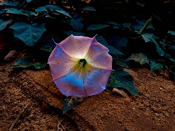 Datura, from the toxic nightshade family. [photo by John] |
|
We start hiking in a wide and open drainage area, surrounded by canyon walls soaring hundreds of feet above us. As we hike in deeper, the walls gradually begin to close in and the canyon narrows down. Although certainly no joking matter, I remark at one point that we should be looking for quick escape routes to higher ground if we see muddy water start to flow through the canyon or hear loud, rumbling noises. Any signs of a thunderstorm would require us to turn back and make a quick retreat to the river. But the sun is shining for now, and there are no signs of rain at the moment. Although it could be raining 50 miles away and we wouldn’t even know it. As we continue up the canyon, we began to encounter more obstacles that require us to climb up and over large boulders in our path, which will become large drop-offs on the hike back out. After about a mile of hiking, the going gets increasingly tougher and we decide to turn back. The hike back out is much quicker, and we’re back out on the beach once again. We push our kayaks out into the river one last time for the remaining 3 miles to Lees Ferry and Mile 0. After 7 miles of kayaking and 2 miles of hiking over somewhat challenging terrain, most of us are beginning to tire a little. But we get a good rhythm going with our paddling and concentrate on making that final push to the end. Row, row, row your boat, gently down the stream. Nuts! Now I can’t get that darned tune out of my head! Let’s keep on paddling. |
 Trailblazers squeeze past a challenging overhang. [photo by Ann] |
 We continue hiking up the canyon. [photo by John] |
 Water flow and depth measuring devices? [photo by John] |
 Taking a closer look. [photo by John] |
 Ann shows us how it’s done. [photo by John] |
 Vicki, Mimi, John S., Ann, John B., Chuck. [photo by John] |
 Rich, Vicki, Mimi, John S., John B., Chuck. [photo by Ann] |
 John S. demonstrates a controlled butt slide maneuver. [photo by John] |
 Vicki and Mimi squeeze through Fat Man’s Pass. [photo by Ann] |
 Waterholes Canyon hikers are heading back to the river. [photo by John] |
|
We see a few more horses grazing on the thick, lush river grasses in the shallows and catch an occasional glimpse of a trout darting about in the crystal-clear waters near our kayaks. The icy waters of the Colorado River below Glen Canyon Dam are the perfect environment for rainbow trout. But not so good for the native species like river chubs and squawfish, who have long adapted to the warmer waters of the river before dams were ever built. Rounding one last bend in the river, we finally see Lees Ferry ahead in the distance. Woo-hoo! We begin to paddle even faster now and keep putting more and more of the river behind us, as we close in on the final goal of the day. The last 7 kayakers, from our original group of 13, pull into Lees Ferry and beach our kayaks at 3:00 PM. Although we started our journey 10 miles upriver from Lees Ferry and the official Mile 0 beginning of the Grand Canyon, I believe this insightful quote from Major John Wesley Powell is just as relevant today on our passage through Horseshoe Bend as it was when he wrote it over 150 years ago on his perilous journey down the Colorado. One might imagine that this (the Grand Canyon) was intended for the library of the gods; and so it was. The shelves are not for books, but form the stoney leaves of one great book. He who would read the language of the universe may dig out letters here and there, and with them spell words, and read, in a slow and imperfect way, but still so as to understand a little, the story of creation. For those who may not be familiar with John Wesley Powell and his exploration of the Colorado River, you might be interested in his fascinating account (above). In 1869 Powell and a crew of nine men, with four heavy wooden dories, embarked on one of the greatest adventures in human history on a 99-day journey down one of the most dangerous rivers in the world, marking the first navigation of the wild and fearsome Colorado River through the Grand Canyon. |
 Chuck paddles down the river. [photo by Mohammed] |
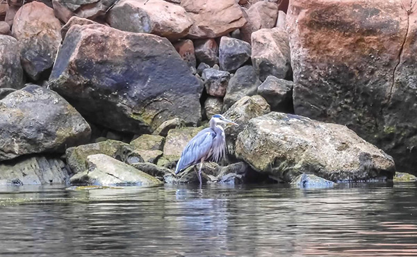 Great Blue Heron stalking the shallows for fish. [photo by Wayne] |
 A colorful pair of Mallards in their prime. [photo by Wayne] |
 Trailblazers wait for dinner at the Marble Canyon Restaurant. [photo by Ann] |
|
John S., Mohammed, Victoria, Richard, Chuck, Sonny, Mimi, John B., Michelle, Mark
|
|
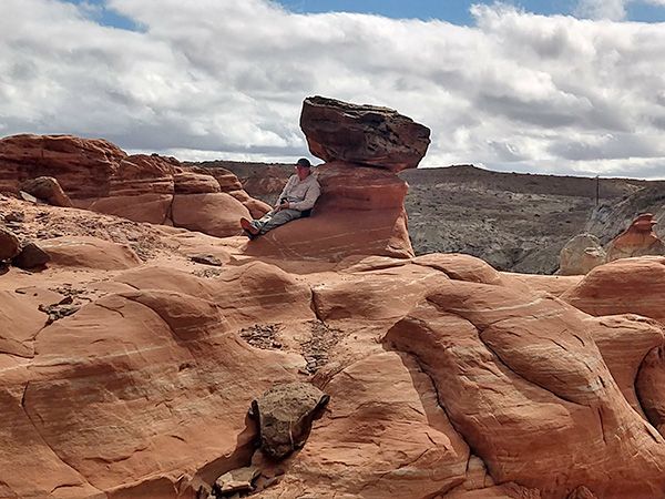
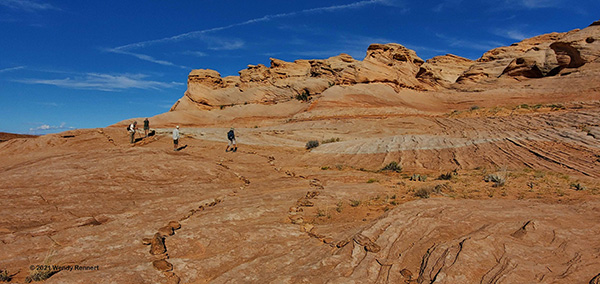
Day 5, Wednesday, October 6 Hike #1 – Toadstool Hoodoos Day Hike by Wendy Rennert |
|
The evening before, a storm passed through, so we pondered over the original hike options for today – Cathedral Wash or Paria Canyon from Lees Ferry? No, there will still be lots of water in the canyons, making them too tough. Spencer Trail? No, it is a steep uphill climb, and will be slippery after the rain. River trail? No, there didn’t seem to be much point to go all the way to Lees Ferry just for a 2.5-mile hike along the Colorado River, so we opted instead for some of the trails back in the Kanab and Big Water UT area. I was glad I had so many hike options in my ‘back pocket’ that we could choose from! We started off with the Toadstool Hoodoos hike. The Toadstool Hoodoos are balanced rock formations that look like toadstools or mushrooms, and are located in the Grand Staircase-Escalante National Monument area. The hoodoos/toadstools form because Dakota Sandstone boulders perch atop pedestals of softer Entrada Sandstone. As the Entrada erodes away, the harder Dakota forms a cap, and leaves a rock column sheltered from water and wind. |
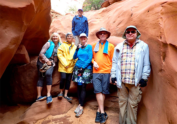
 Can you find the 10 Trailblazers peeking out from behind the various toadstool hoodoos? [photo by Wendy] |
| Chuck, John S., Mohammed, Sonny, Ann, John B., Nicole, Wayne, Lin, Mimi |
|
We first pass through a badlands area (the striped mountains shown in the photo below), and follow the trail in and out of washes, and up towards the Entrada Sandstone hills. At the top of a knoll, it opens into an odd and vast wondrous landscape of hoodoos and toadstools. |
 Mimi, John B. and Sonny, starting out on the Toadstools trail. [photo by Wendy] |
 Wayne poses by the largest of the toadstools. [photo by Ann] |
 The Trailblazers investigate the vast slickrock area behind the most popular toadstool. [photo by Wayne] |
 A collection of toadstools, short and tall. [photo by Wendy] |
 Spend some time here to photograph these geological wonders in different lighting and from different angles. [photo by Wayne] |
 These two toadstools seem to be talking with one another. [photo by Wendy] |
 Big landscapes, big sky…brilliant colors everywhere! [photo by John S] |
 White badlands and possible toadstools in the making in the fantastic backdrop behind Mohammed and this toadstool. [photo by Wendy] |
|
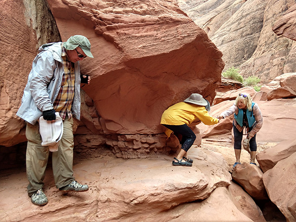
Lin takes us to an area to the left and a little farther back from the main toadstool area, to see another collection of toadstool hoodoos. It includes the group of toadstools shown in the first photo of this trip report. We wander around here for a short while, and take a closer look at some of the hoodoos in this grouping and other intriguing sights. |
 This toadstool has three cavities – might be eroding away a bit faster than its neighboring toadstools. [photo by Wendy] |
 Meanwhile, Chuck carefully tests the wet sandy area to see if it is quicksand or not. Luckily, it is not! [photo by Wendy] |
 Lin takes her time at the puddles, capturing reflections and interesting photo angles. [Ann] |
 A neat little alcove with what almost looks like dripping stalactites. [photo by Wayne] |
|
We each took a hike break at the turnaround point in our own way. Some continued to take photos, others soaked in the fantastic views, others chatted with each other, and others found great rest spots. |
 Lin does her best yoga tree pose at the edge of this beautiful viewpoint overlooking the badlands. [Wayne] |
 Sonny finds the perfect nap spot. [photo by Ann] |
|
Though this was a short hike at only 2 miles, it sure packs a whole lot of beauty and geological interest into this one area. We could stay longer and just soak it all in, but we also want to see what else this region has to offer! On to part 2 of today’s adventure! |
 One last look at the granddaddy of toadstools – almost looks like the white rocks below are still swirling and moving about! [photo by Wendy] |
|
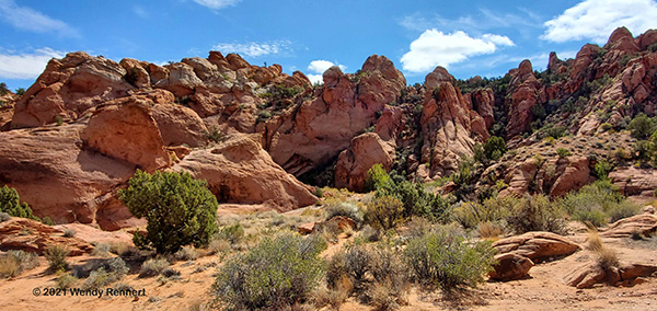
Day 5, Wednesday, October 6 Hike #2 – Rock Lane Day Hike by Wendy Rennert |
|
After the Toadstools hike, since we were in the neighborhood, we stopped by the Catstair Canyon west end entrance to see if that area had dried up enough yet to hike it. As kind of expected, it did still look pretty muddy, so we bailed on that hike idea. But it was still good to stop there, because now we know where both the west and east entrances are for future reference. |
 Catstair Canyon west end – trying to find the beginning of the trail. Nope, too muddy, save this for another day! [photo by Wendy] |
 We do need to return here some day, as Catstair Canyon sure does have pretty scenery! [photo by Wendy] |
|
Before we moved on to the 2nd hike of the day, a couple of people requested to return to our campsite, some wanted to eat lunch and one wanted to check out the progress of their belongings, which they were trying to dry out from the previous evening’s rain. Now we’re ready for the 2nd hike of the day, Rock Lane Trail! For this last hike of the trip, we have seven eager hikers. |
 A great shady respite that we carefully climbed up to! [photo by Wayne] |
||||
|
|
This is another short hike, only 2 miles long, but it is very close to our campground (and right across the street from a dispersed campsite called Beehive Campground), and we are not up for a long hike at this late stage of the trip. It was a pleasant surprise for all of us! In places, it is sort of like a mini version of the famous Wave hike (AZ) and Checkerboard Mesa (Zion NP), but without the hassle and disappointment of trying and not being able to get a permit like so many people do for the Wave. In fact, there is even a pin mark on Google maps dubbing this “the New Wave,” which is what intrigued me in the first place. This Navajo Sandstone area was sculpted by wind and water over time, exposing cross-bedded sandstone and many, many thin layers of undulating sedimentary rock. I don’t want to overhype this trail, as to some it probably pales in comparison to the actual Wave hike, but we really enjoyed this easy little hike for what it does have to offer, and how uncrowded it was. |
 Sonny pokes his head out of a neat rock formation. [photo by Wendy] |
 Mohammed likes climbing around these rock formations as much as Sonny does, perhaps they are part mountain goat! [photo by Wendy] |
 Check out the multitudes of thin, wavy rock layers along this hike. [photo by Wendy] |
 Sonny enjoys climbing in and around the various rock formations. See the checkerboard pattern here! [photo by Wendy] |
|
The Rock Lane Trail is aptly named, because the entire 2 miles of the trail are outlined on both sides by rocks that some unknown group meticulously placed there, presumably to help keep the surrounding area as pristine and untouched as possible. |
 You can see the rock lined trail that leads our group around this beautiful mountain! [photo by Wendy] |
|
We have a good time taking in the expansive views of the surrounding area, and playing on the rocks. In one spot you can see Lake Powell too. |

|

|
| Mohammed and Sonny take turns at striking a fun, precarious pose! [photos by Wendy] | |
|
We even took a fairly long break to talk to one of the locals on the trail (Clem, and his dog Sven). He works for Glen Canyon National Recreation Area and was full of information on the trails in the area. It was a good thing we did run into him, because we asked him about the cool cave we saw in the distance and the road leading to it, and he strongly recommended against it – that road is super deep with sand and is the only back road in this area that he has gotten stuck in – REALLY stuck in! So we are content to just admire it from afar, and continue back to the trailhead. John S. and Mohammed also hike a very short side trail to an even better viewpoint than we had from the main trail. I wish Sonny and I had seen that turnoff, not sure how we missed it, ah well! |
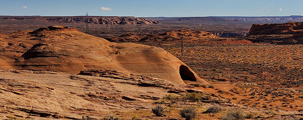 Robin, to the Bat cave! LOL. [photo by Wendy] |
 A tiny arch – sort of. [photo by John S] |
 The knowledgeable local Clem and his sweet dog Sven. [photo by John S] |
 We all do hang loose / aka ‘wave’ hand gesture, as a nod to the similarity this trail has to the famous Wave hike! [photo by Wayne] |
 Swirls in the sandstone, great formations. [photo by John S] |
 The side spur to the viewpoint provides even better views. [photo by John S] |
|
Thanks to Mimi for organizing this Lake Powell area hiking / paddling trip, and thanks to all who participated! |
|
Final Note: This trip barely scratched the surface of what Glen Canyon National Recreation Area has to offer. Rainbow Bridge can be enjoyed with an easy boat ride. Now that the water is extremely low, the hidden wonders of Glen Canyon are slowly beginning to emerge from the depths. Pre-dam era, the place has acquired an almost mythical status with a fairy tale maze of side canyons with their own side canyons, each offering a different marvel. Other sites like Cathedral in the Desert are also gradually emerging. Some consider it “a crime” that Glen Canyon, once inhabited by many generations of Native Americans, was “drowned” with countless habitats. Edward Abbey wrote “imagine the Taj Mahal or Chartres Cathedral buried in mud until only the spires remain visible.” You decide.
Further reading: → More pictures, by Wayne. → More pictures, by John B.. → More pictures, by Ann. → More pictures, by Wendy. |
 Top of Page
Arizona Trailblazers Hiking Club, Phoenix, Arizona
Comments? Send them to the AZHC .
updated October 31, 2021