Outdoor Links
Hike Arizona
Trip Planning Guide
Trip Report Index
Calendar of Events
Library
|
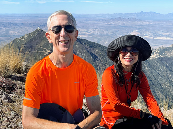
Mount Wrightson Day Hike Santa Rita Mountains/Madera Canyon November 13, 2021 by Li Li |
|
|
I had been thinking about climbing Mount Wrightson after being there two years earlier. Since no one posted the hike this year, I decided to lead it myself. Mount Wrightson is located in the Santa Rita Mountains in southern Arizona in the Coronado National Forest. It is about 9,456 feet of elevation, and is the highest peak in the Tucson area. It was named after a mining engineer and entrepreneur William Wrightson, who was killed by Apaches in 1865 in the battle of Fort Buchanan. After a few hikers dropped out, we ended with 5 Trailblazers on the hike. It was a bright sunny day although the weather was a little chilly in the early morning of November. The temperature was about 47°F, so it was not bad. Our plan was to do a figure eight hike up the Old Baldy Trail, finishing the steep climb first, then take the long gentle route with a gradual descent on the Super Trail to save our knees. |
 Terry, Ken, and Michael |
 Tom |
 We’re on the trail. |
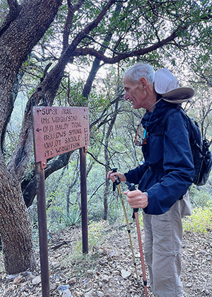 Checking the trail sign. |
|
Although 7:30 AM was an early start, the trailhead was quite busy. A large group of 15 people started earlier than us. As we started after them, we had the trail to ourselves. One mile up to the hill, I spotted fresh bear scat in the middle of the trail, which was confirmed by Tom. The weather must be warm enough at Madera Canyon that they had not gone into hibernation yet. Everyone hiked so fast that within no time we reached Josephine Saddle, although it was 2 miles of steep climbing of more than 1000 feet. There was a memorial on the saddle dedicated to the three boy scouts who lost their lives in November 15, 1958. There was a sudden storm which came out unpredictably that dropped three to four feet of snow on the mountain. Three boys were lost in the storm and perished in the harsh weather. |
 A snack break at Josephine Saddle. |
 Ahhh, the autumn leaves! |

|
|
|

|
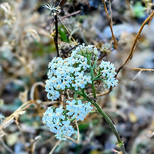
| Late Bloomers | |
 Bellow Spring. |
|
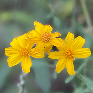
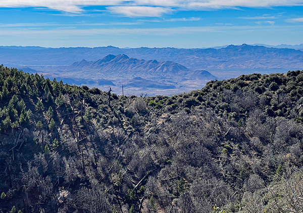
Today was November 13, almost exactly 63 years to that day, and the weather was nice. I thought about how unpredictable Mother Nature is, and that we always have to plan every hike carefully. We took a picture and first break then continued on to the next saddle. There was not much fall color left on the trail although here and there small colorful sumac shrubs still showed off the yellow and red colors, a majority of the trees leaves were gone. Ponderosa pine were still freshly green in the forest and stood cheerfully next to the trail and made us feel welcomed. After passing endless switchbacks, we saw Bellows Spring on the way up, which had a stream of water flowing down to the hill, providing a joyful sound along the path. This part of the forest looked different, it had changed scenery from ponderosa dominant to aspen and blue elderberry trees and then to limber pines. Soon we got to the Baldy Saddle. The views were incredible. In the south we could overlook the massive Madera Canyon, with endless mountains and hills and green forest covered the entire regions. Over the north we could see Fred Lawrence Whipple Observatory with its white dome on the top of Mount Hopkins. In the far west you could see Baboquivari Peak and Kitt PeakObservatory. On the northeast you could see the Florida Canyon and Florida Saddle, Mt. Ian, and Mt Josephine. Pusch Ridge, Mt. Lemmon, and the Rincon Mountains were also visible. |
 This way to Mt. Wrightson. |
 We’re almost there. |
 Terry at the top. |
 Tom and Li. |
 Trees in a row. |
|
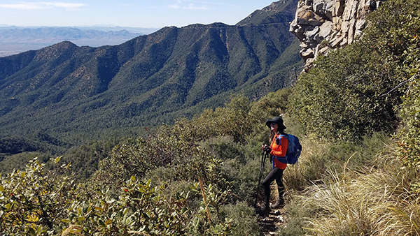
We saw a few hikers at this saddle including the group that started ahead of us. The trail otherwise was pretty quiet over this great weather weekend. We took a second snack break and continued on. To my surprise, I did not feel the hike as hard as the first time, although climbing was quite steep. Four of us reached the 9,453 feet Mt. Wrightson summit over three hours. The summit was nice and small compare to the memory I had two years ago. I knew it was my illusion but Tom felt the same way I did. |
 Mountains, everywhere. |
 More mountains. |
 Li is unfazed. |
 We’re finally on the downgrade. |
|
Instead of cold and windy on this sky island, we had a warm and cool breeze this time. Plenty of sunshine in the cool mid-November weather. Our faces beamed with bright sunshine and joyful smiles since we just conquered the highest peak in the Tucson area. A hiker who was sitting on the brick wall greeted us. He even called out our names! We were so surprised. It turned out he had been following the Trailblazer’s website and knew that we would be there so he was there early to wait for us patiently. His name was Paul. He kindly took a group picture for us and we chatted a little bit. He seemed very knowledgeable of the mountains around Tucson areas. He pointed out a lot of names of surrounding mountains. |
 Lizard who didn’t run away in time. |
 Lest we forget. |
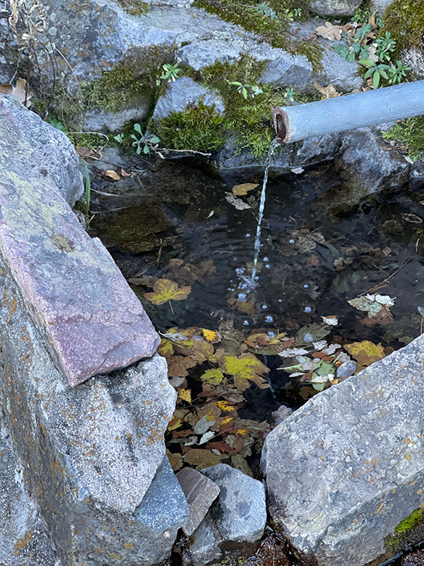
 I wouldn’t drink it. |
|
I was always curious about what the brick wall was. So I did some research, and it turned out it was the remains of the concrete foundation of Mt. Wrightson fire lookout, which was built by the Civilian Conservation Corp in 1900 and was used from 1900 until 1950. We took an hour lunch break at the top then continued our journey to finish the hike. Ken left early, since he planned to drive home after the hike. Micheal decided to stop at Old Baldy Saddle instead of summit. So Terry, Tom and I formed a small group and continued steering to the Super Trail down to the canyon. We passed the Baldy Spring, which was totally dry, then Josephine Peak junction. This part of the trail had become overgrown with a lot of gray-thorn spiky bushes, which made going down a bit harder, although we could still follow the trail without any difficulty. The weather also started getting warmer as we approached the south side of mountain. Terry injured his ankle due to a loose rock, but he wanted to continue. Tom and I wanted to cut the hike shorter to go down from Old Baldy Trail, but Terry insisted that we should keep our original plan, going down from the Super Trail after a small break on Josephine Saddle. I admire a lot of our hikers. The majority of them never complain about anything, even with some injury or fall, which reminded me of the American spirit of toughness, braveness and endurance. It was a long hike, but we all did it with a smile. When we got to the trailhead, Michael and Ken were there waiting. The hike was great, and we finished 14 miles with over 4000 feet elevation gain in 6 hours. There are still many trails, such as Josephine Peak, that I have never been at Madera Canyon. Maybe we will explore some other trails next year. |
||||
After 14 miles of a strenuous hike on Mount Wrightson, I decided we needed a recovery hike with mild elevation and an easy trail on Sunday, so the nature trail came to my mind. It turned out to be a great success. We had a relaxing day in nature. The Mount Wrightson nature trail started at Proctor Trailhead and ended at Old Baldy Trailhead. It was a popular place for wildlife watchers and nature lovers, since it hosted more than 250 species of birds such as gray-breasted jay, acorn woodpeckers, hummingbirds, and other wildlife including black bear, raccoon, mountain lion, bighorn sheep, bobcat and ring-tailed cat, white tailed deer, and Arizona gray squirrels. The trail was first constructed by Roosevelt’s “tree army”, Civilian Conservation Corp (CCC) in 1933 to 1938. They set up the camp sites working on erosion control and conservation projects, and they built an infirmary, garage, kitchen, mess hall, service buildings, and later bridges, picnic tables and fireplaces in this area. Today we could still see the remnants of the concrete on parts of the trail. We started the hike at 8:30 AM so the weather was comfortable. After we walked on paved road for about 5 minutes, the sun was out and it made the hike so pleasant in the cold morning. Along the narrow concrete path there were many mature fresh green mesquite trees providing plenty of shade, yet allowing some sunbeams to shine through, creating a relaxing and tranquil environment. Not far from the path a large Arizona white oak caught my attention. The tree was huge, had a distinct appearance and in great shape which I had never seen in any other forests. On the left side of the path we saw four differently shaped bat houses standing on the high metal poles. |
 Terry, Michael, Tom |
 Li |
 Bat Houses |
 A pleasant stream. |
|
Arizona has 28 out of 45 species of bats, among them the Mexican long-tongued bat is an important pollinator for columnar cacti, agaves and other desert plants in Sonoran desert region. One mile from the trailhead we could hear the water trickling, it was the Madera Canyon Creek which originated from a few springs flowing between Mt. Wrightson and Mt. Hopkins into the Santa Cruz River near Green Valley. The large smooth boulders, huge variety of oak trees, Arizona sycamores, colorful bushes, and lower desert grasses decorated along the creek, formed a desert oasis, which I did not expect to see in this region. It was beautiful beyond description. |
 Michael, Terry, Li, Tom |

|

|
| A pleasant stream. | |
 Terry |
 Michael |
|
We passed a large wooden bridge and continued walking along the creek. We saw many majestic Emory, Mexican blue and Arizona white oaks standing tall and elegantly in the evergreen forest forming an inviting environment and providing shelter for people and animals alike. |
 A big black bird screamed “Roto Rooter”. |
 A helpful sign. |
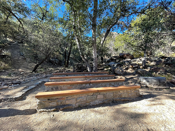 Amphitheater |
 Mountains, all around us. |
|
After passing two more wooden bridges, we reached a large open field which had many gigantic sycamore trees, picnic tables and an amphitheater. Michael decided to turn around before the steep ascent to the desert landscape. The weather started getting warm around 10:00 o’clock, while we started climbing up the hill and making the switchbacks. The view at this point became wide open, instead of walking in the forest we were exposed on the hill. On the right we could see McCleary Peak, Mt. Ian, Josephine Saddle, Mt. Wrightson and Baldy Saddle. After another 25 minute walk we approached the end of the trail at the Old Baldy Trailhead for our lunch break. On the way back we saw three white-tailed deer eating their lunch under the trees. They seemed unbothered by people as we passed by. We were happy to return to shaded forest again, since the weather was getting hot in the afternoon. We took many pictures along the creek and visited White House ruin before returning to the Proctor Trailhead. |
 White-tailed deer. |
 A pleasant stream. |
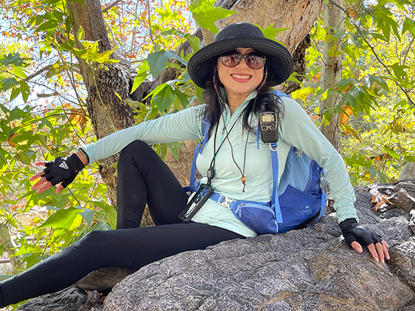 Li |
 Terry and Tom |
 The wall. |
|
We finished the hike at 1:00 PM for a 7.4 mile hike with 1093 feet elevation gain in 4 hours. It was a good hike and we were all happy we did it. I am planning to return here to do a Spring hike to see wildflowers, birds and waterfalls next year. → More pictures, by Li (long hike).→ More pictures, by Li (short hike). History of CCC at Madera Canyon. History of Madera Canyon, history, birding, and hiking. |
 Top of Page
Arizona Trailblazers Hiking Club, Phoenix, Arizona
Comments? Send them to the AZHC .
updated December 3, 2021