Outdoor Links
Hike Arizona
Trip Planning Guide
Trip Report Index
Calendar of Events
Library
|
South Fork of Deer Creek Day Hike Mazatzal Mountains March 18, 2023 by Victoria Johnson |
|
 Trailblazers are ready to brave the Mazatzals. |
| Michael, Bruce, Greg, Anna, Diane, Jon, Terry, Scott |
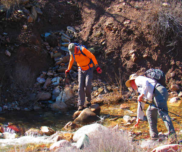
Nine hikers showed up at the trail that began at the Deer Creek Trailhead. What was originally described as a B hike turned into an A hike due to recent rains where creek crossings were filled to capacity requiring the balancing skills of a ballerina. Remnants of deer scat could be found as the hikers began a steep uphill climb that also required several boulder hoping crossings across South Fork Creek for which the trail is named.
 First of many creek crossings. |
A special bridge was erected for hiker Jon Ratke where two hikers threw large rocks into a creek crossing that Jon was able to walk on without getting his feet wet subsequently named Jon’s Bridge. At the two mile marker the trail became narrow, was not well maintained, and required maneuvers through fallen southern Sycamore trees as a result of damaged roots caused by the 2004 Willow Fire and loose rocks strewn about due to recent rains. Approximately half of the group turned back. The remaining hikers continued to the 3.4-mile marker where the group sat by a deep pool fed by a cascading water fall and where snowcapped peaks of Mount Peeley (7,030 ft) and Mazatzal Peak (7,903 ft.) could be seen. Large fields of yellow poppies could be viewed on cliffs engulfing the canyon as the group headed back towards the cars. Dinner was eaten at the Saddle Bronc restaurant in Fountain Hills.
 New bridge |
 The desert is very green. |
 With all the water the desert is blooming. |
 More water crossing. |
 The hill side are blooming with color |
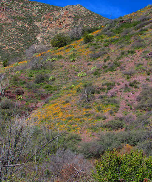 More hill sides are blooming with color. |
 The stream is running full bore down the hill. |
 Still snow on the ground. |
 Lunch by the stream. |
→ More pictures, by Vicky.
 Top of Page
Arizona Trailblazers Hiking Club, Phoenix, Arizona updated April 27, 2023
Comments? Send them to the AZHC .