Outdoor Links
Hike Arizona
Trip Planning Guide
Trip Report Index
Calendar of Events
Library
|
Continental-Anasazi-Mesa figure-8 Flagstaff June 30, 2018 by Ted Tenny |
|
 Sixteen sagacious Trailblazers: |
| June, Michael, Tran, Jim, Dwight, Ramona, John, Monika, Heather, Ken, Joe, Ted, Tom, Jeanne, Mark, Li |
|
Sixteen sagacious Trailblazers sought to beat the heat – and almost did – by hiking in Flagstaff in the summer. High in the low 80s. Plenty of sun. But we enjoyed a little shade in the sparse forest of Campbell Mesa, and an occasional breeze. We all hiked the Continental Loop counterclockwise, then split up into two groups. Michael Humphrey led eleven hikers on the Campbell Mesa Loop, while I led five hikers on the Anasazi Loop. Both groups hiked their second loop clockwise. |
 Let’s get organized. [photo by Tom] |
 Trailblazers pass Mt. Elden on the Continental Loop. |
 Ted gives directions for the Campbell Mesa Loop. [photo by Tom] |
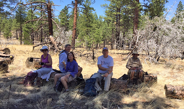
 “Short” hikers: Joe, Ted, Tran, Jeanne, June. |
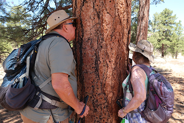 Mmmm! Trailblazers savor that sweet caramel aroma of a Ponderosa Pine. |
 Dead tree is nature’s sun-catcher. |
 Methinks I won’t sit on this stump. |
 Agassiz Peak, Doyle Peak, and Sheep Hill. |
 Sawyers have cleared a tree that fell over the Anasazi Trail. |
Because our winter was so dry there were very few flowers. |
 Rafinesquia neomexicana - New Mexico Plumeseed |
 Convolvulus sepium - Hedge Bindweed |
|
The “short” group finished their hike around noon, then three of us stopped at Salsa Brava for lunch before returning to the Valley of the Sun. |
| → More pictures, by Tom. |
|
Supplemental Report by Jim Buyens |
|
|||
|
Once again it was great seeing everyone on the trail and enjoying the relatively cool weather in Flagstaff. And Ted, all thanks to you for organizing this great event. I hiked the 10-mile route which actually turned out 8.3, but the weather was getting warmer and anyway, there must have been a 10-mile hike one day that came in at 11.7 or so. Jim |
|||||||||||||||||||||||||||||||||||||||||||||||||
|

|
||||||||||||||||||||||||||||||||||||||||||||||||
 “Long” hikers: Monika, Jim Heather, John, Michael, Ramona, Ken, Mark, Li, Dwight, Tom. |
 Merrily, merrily, down the trail we go. [photo by Tom] |
 Yes, there is shade on Campbell Mesa. [photo by Li] |
 Let’s stop for a break here. [photo by Li] |
 Mark, Li, Ramona, and Ken. [photo by Tom] |
 Monica, Heather and Jim. [photo by Tom] |
 We stopped for lunch before returning. [photo by Tom] |
 Top of Page
Arizona Trailblazers Hiking Club, Phoenix, Arizona
Comments? Send them to the AZHC .
updated July 4, 2018