Outdoor Links
Hike Arizona
Trip Planning Guide
Trip Report Index
Calendar of Events
Library
|
Calderwood Butte Peoria February 15, 2022 by Wendy Rennert |
|
|
There were 4 Trailblazers on today’s hike, and we started hiking at about 8 AM from Calderwood Butte Trailhead in Peoria, AZ. It was a beautiful, slightly breezy morning. Peoria now has about 20 miles of hiking trails, split between 5 mountain preserves and a community park – West Wing, East Wing, Calderwood Butte, Sunrise, and Sonoran Mountain Ranch preserves, and Paloma Community Park. Today we explored all of the trails at Calderwood Butte, I’d say the least known of all of these parks. |
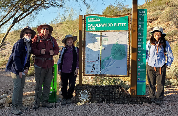 Wendy, Chuck, Robbi, and Angel at Calderwood Butte Trailhead. [photo by Wendy] |
|
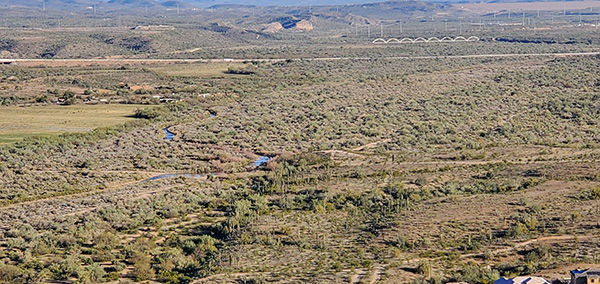
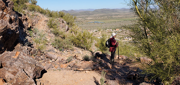
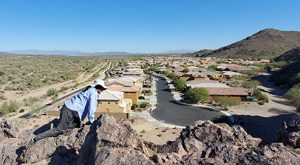
If you just do the main loop that most people do, the mileage is only 1.5 miles. But by adding on both the north and south spur trails, we managed to hike about 5 miles today. Throughout the trails, there are plenty of switchbacks, multiple stretches of uphill and downhill, and mostly rocky terrain. Total ascent of all the uphill sections was about 1,000 ft. gain, whereas if you just did the 1.5 mile loop, you’d only have a 357 ft. gain. So we felt we had a great workout by the end of the hike. We basically had the trail to ourselves today – only came across 1 person on the way out, and a few couples on the way back. And no bikers to deal with! The uphill segments are mostly gradual. We pass by the southern spur trail, because we will do that part last, on the way back. Before we know it, we are up at the saddle of the main trail, where the loop portion begins. We pause for a moment to take in the views. Though the mountain is mostly surrounded by housing developments, there is open space to the north and west which looks perhaps like a flood plains area for the Agua Fria River. You can also see mountains in the distance. |
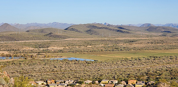 Peoria “lakes”, grassland with a possible ranch, the 303 highway, and distant mountains. [photo by Wendy] |
 I do believe there is even some water in the Agua Fria river today! [photo by Wendy] |
|
At this point we take a left to continue on to the top, where we have some nice 360° views. |
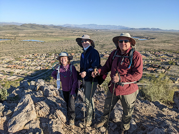 1st accomplishment - top of the butte! [photo by Angel] |
|
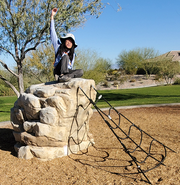
From here, we work our way down this mountain until we get to the northern spur trail. We continue down on the spur trail, through a small wash, and up and then down a small hill, that eventually ends at a road (we liked the names of 2 of the streets here - Yellow Bird Lane, and Skipping Rock Rd!). There is a small park with a playground across the street, so just for fun we head over to the park for a bit of play time at the playground! |
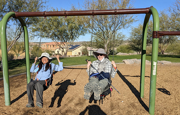 Who says you can’t go back? Feeling like a kid again! [photo by Bobbi] |
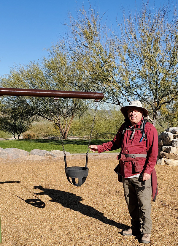 Chuck displays the baby swing for us. [photo by Wendy] |
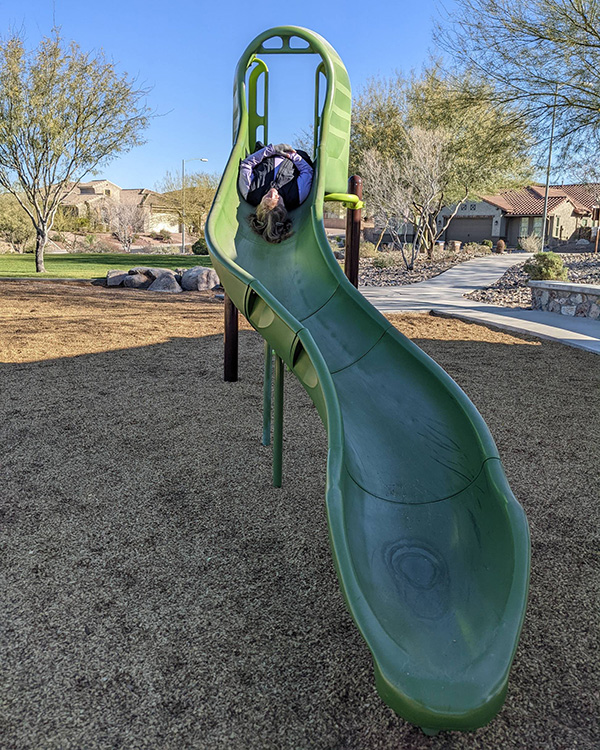 Robbi gets in a few minutes of inversion therapy (spine relief) on the slide. [photo by Angel] |
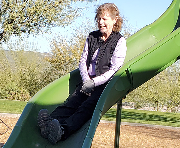 While you’re up there, might as well slide down. [photo by Wendy] |
 Queen of the jungle (gym, that is)! [photo by Wendy] |
|
Ok, ok, that was fun, but we have some more hiking to do! We head back up the north spur trail (which is only 0.6 mi), and at the junction of the main loop trail, this time we take a left to hike the other side of the loop. When we get almost back up to the saddle, we take a short break at the nice pair of benches perched high above Peoria. |
 Chuck pauses to take in the views again. [photo by Wendy] |
|
Just a short distance downhill from the saddle is the start of the aforementioned southern spur trail. I point to the 2nd butte in the distance – “That’s where we are headed,” I said. You can see the trail as it winds its way down, threading the needle between the houses near the top of the butte, and the multitude of houses at the bottom. The south spur trail is 1 mile long. |
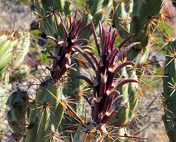 New primary leaves coming in on this buckhorn cholla. [photo by Wendy] |
|
About half way down this trail, I point out a particular buckhorn cholla that seems to be in a very good location, because it is one of the few with lots of new primary leaf growth. They are the reddish parts in the above photo. A bud will form on each primary leaf, which will produce spines, then a flower or a new joint may be produced. The primary leaves will eventually dry up and fall off. |
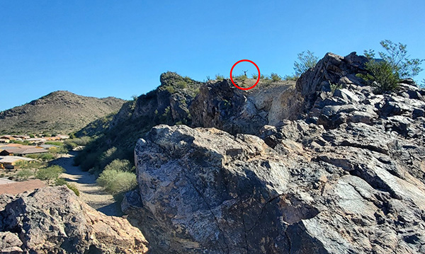 Hello over there! (Bobbi is circled in red) [photo by Wendy] |
|
I take the group almost all of the way to the end of the spur trail, just to the point where we can veer off-trail a tiny bit and follow the top edge of the butte to it’s end right above the homes. It is a cool perspective from this angle. We imagine what it must be like during a good rainstorm - there are a couple of spots that likely spout waterfalls over the butte - it would be cool to see them from one of the nearby homes - their own private waterfalls! |
 Angel enjoys the view, but don’t go any farther! [photo by Wendy] |
|
We start heading back towards the main trail, and I spot something sticking out from one of the rocks under a tree - it is a geocache! There was a rubber stamp and a sign-in log, so we checked out some of the entries, and made our own entry in the booklet. The geocache was placed there in 2014. It must have been in some sort of waterproof box until recently, because it was in pristine condition when we found it. But no box today, so one of our hikers pulled out a spare plastic bag to keep the geocache in until the owners come back again with another box. |
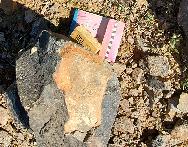 I spy a geocache! [photo by Wendy] |
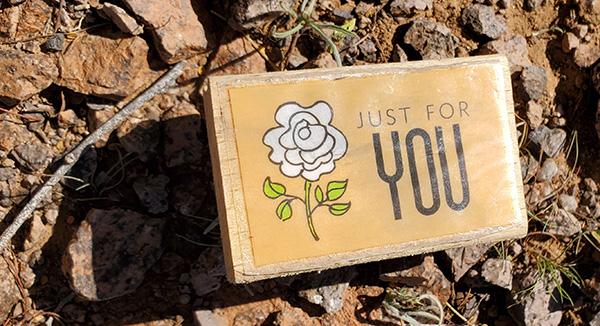 If only there was some ink with this rubber stamp [photo by Wendy] |
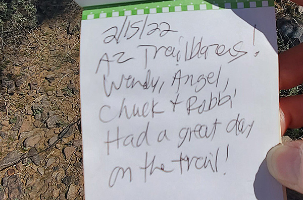 Letting them know the AZ Trailblazers were here. [photo by Wendy] |
|
Ok, time for one last uphill segment before we head downhill for good to the trailhead! After the hike, we sat at the nice picnic table at the trailhead for a quick lunch on this beautiful February day! |
 Top of Page
Arizona Trailblazers Hiking Club, Phoenix, Arizona
Comments? Send them to the AZHC .
updated February 18, 2022