
Outdoor Links
Hike Arizona
Trip Planning Guide
Trip Report Index
Calendar of Events
Library
|
Apache Wash Loop Day Hike Phoenix Sonoran Preserve January 9, 2016 by Chuck Parsons |
|
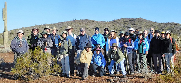 25 Arizona Trailblazers gather near the Apache Wash Trailhead. [photo by John R.] |
||||
|
Weather for the Seattle or Portland area, right? Wrong! This was the southern Arizona weather pattern for the entire week leading up to the Apache Wash Loop hike in the Cave Creek area of the north valley on Saturday morning. Out-of-town visitors searching for winter warmth and sunshine in the normally sunny and dry Valley of the Sun were in for a rude awakening this week when a major El Niño weather system dominated and shifted the mighty weather engine known as the jet stream far to the south on a collision course with Arizona, sweeping a series of large storm cells from far out in the Pacific across the entire state and dumping record amounts of snow in the mountains and completely saturating the desert with steady rainfall for five consecutive days. But for an area under siege from years of prolonged drought, we have no room whatsoever to complain. We need the rain and we need the snow, and we desperately need lots of both to break this vicious drought cycle once and for all. |
||||||||||||||
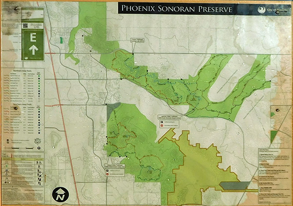 Map of the Phoenix Sonoran Preserve. [photo by John R.] |
||||||||||||||
 Trailblazers make the first crossing over Apache Wash. [photo by John R.] |
||||||||||||||
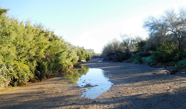 Looking upstream in the normally dry wash bed. [photo by John R.] |
||||||||||||||
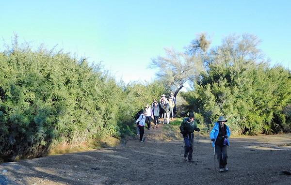 A large group takes a while to cross the wash. [photo by John R.] |
||||||||||||||
|
Early Saturday morning at the Apache Wash Loop Trailhead in the heart of the Phoenix Sonoran Preserve. Clear and sunny skies with a bracing temperature of 40 degrees and a light breeze blowing out of the northwest that makes it feel even colder. We could have all stayed home in warm and cozy beds and slept the morning away. And I’m sure a few of our hikers may be entertaining that very thought right now as we all stand around and shiver in the chilly breeze. “What the heck was I thinking anyway? I could be back home under the covers right now, dreaming the morning away.” But the trail beckons us today, we’re burning valuable daylight, and we are after all a hiking club of dedicated hikers not prone to wasting such a beautiful day. This looks to be a perfect day for hiking, and 25 Arizona Trailblazers are ready and anxious to hit the trail running on this spectacular morning in the Sonoran Desert of southern Arizona. The air has been washed clean and pure from a full week of rain and wind, and it’s almost intoxicating as we breathe the damp, creosote-scented desert air deeply into our lungs. What more could a dedicated hiker ask for? |
||||||||||||||
 A hot air balloon slowly rises above the desert. [photo by Lin] |
||||||||||||||
 Trailblazers make their way along the Apache Wash Trail. [photo by John] |
||||||||||||||
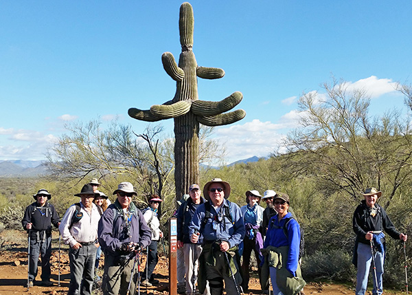 Time out for a short rest break. [photo by Lin] |
||||||||||||||
 Waiting for the rest of the group to catch up. [photo by John] |
||||||||||||||
|
After our usual round of introductions, at 9:00 am sharp we strike out on the Apache Wash Trail which will take us on an elongated loop stretching far out into the desert, almost touching the Carefree Highway before making a wide U-turn and beginning the return leg of the loop. As expected, parts of the trail are very muddy and slippery from all the rainfall this week. But everyone manages to safely navigate through them without incident. After about a quarter-mile of hiking we come to the first of six crossings through Apache Wash. The embankment leading down into the wash is also muddy and slippery, but 25 hikers make it down OK. Apache Wash is a large natural drainage running a serpentine pathway through this part of the Phoenix Sonoran Preserve. This first crossing is very wide and parts of it are choked with boulders and large cobblestones from bank to bank. Despite all the rain, the wash is completely dry, at least from casual observation. Below the surface, however, it’s a different story since most of that water has completely soaked into the ground at this point. These large desert washes, despite the massive amounts of flood water they’re capable of carrying during heavy rains and runoff, empty out relatively quickly. The challenge is not finding yourself in such a wash while it’s still running. More than a few unwary and careless hikers have been swept to their deaths trying to cross a running wash. Never a good idea for anyone to even think about. |
||||||||||||||
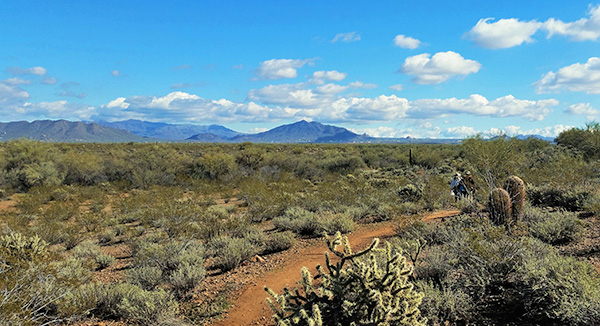 Sweeping view of the vast Phoenix Sonoran Preserve. [photo by Lin] |
||||||||||||||
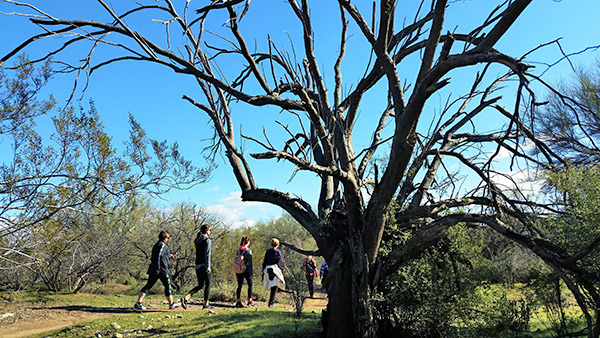 Although dead, this sprawling ironwood tree is still an imposing sight. [photo by Lin] |
||||||||||||||
 Trailblazers take time out for a rest break. [photo by John] |
||||||||||||||
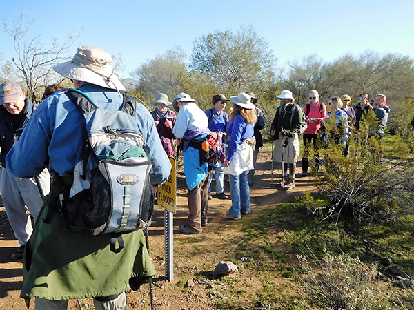 We make a quick refueling stop here. [photo by John] |
||||||||||||||
|
But as treacherous as they can be under certain conditions, these washes also play a vital role in all desert environments. In addition to serving as natural drainages for the desert, washes help to manage and conserve life-sustaining water for many plants and animals throughout the desert. Not all of that flood water raging through a desert wash flows away and simply disappears. Instead, millions of gallons sink into the ground beneath the wash or becomes trapped in low-lying areas of the wash to slowly percolate down into the soil. Washes help recharge critical underground aquifers, serving as natural retention basins for that most precious of all aspects of desert life: water. Without it, nothing can survive in this harsh environment. However, we’re not really thinking too much about all of that right now as we continue making our way along the Apache Wash Trail at a pretty good clip. At the same time though, desert hikers can’t help but note the completely different riparian type of environment created by these washes. Like all large desert washes throughout the vast Sonoran Desert, Apache Wash features a narrow green corridor of sprawling mesquite, paloverde, ironwood, and catclaw, all sending down deep roots to tap into the steady supply of water, while the surrounding desert is comparatively barren and even seems bleak and totally uninviting by comparison. It’s really quite a contrast to observe, especially as we make additional crossings through the wash. |
||||||||||||||
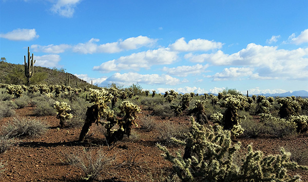 A sprawling sea of Teddy Bear chollas. [photo by Lin] |
||||||||||||||
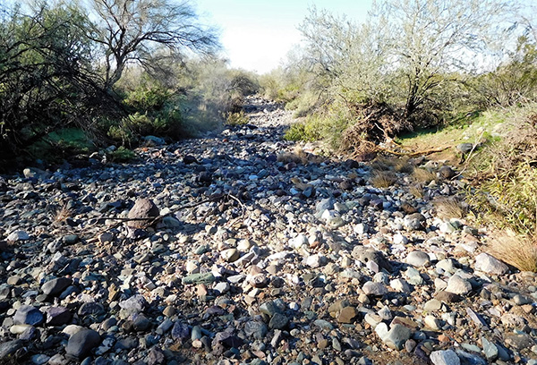 This section of Apache Wash is filled with rocks and boulders. [photo by John R.] |
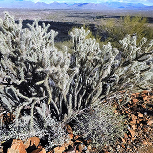 This large staghorn cholla screams “better give me a wide berth.” [photo by John R.] |
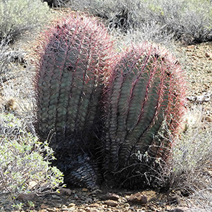 A double-barrel delight in the desert. [photo by John R.] |
|
After 3.5 miles of hiking, the trail begins to make a large bend as it approaches Carefree Highway with its noisy stream of traffic. This marks the far northeast end of the loop. Although not the ideal place for a snack break, we stop here and wait for the rest of the group to catch up as we take a short water and snack break to refuel ourselves for the return portion of the loop back to the trailhead. |
 Becky and Paige, our two newest members. [photo by Lin] |
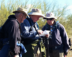 Let’s see now, where is that last trail junction on this map? [photo by Lin] |
 Three generations of hikers: Deedee, Korrie, Jaci, and Kayla. [photo by Lin] |
 First crossing of a water-filled section of wash. [photo by Wendy] |
|
After a couple more miles of hiking, we come to a rather ambiguous trail sign that points in one direction for the Apache Wash Trail and in the opposite direction for the Apache Wash Connector Trail. Although I hiked this trail a month earlier as an exploratory hike, I don’t remember seeing this particular trail junction then. Going to the right seems counterintuitive since we would no longer be following the general direction we’ve been hiking for the last two miles. So I choose to take the connector trail to the left which would more seamlessly continue the main loop, or so I thought anyway. But after less than a half mile I no longer recognize the trail at all and realize we are definitely on the wrong track. We study a trail map that Scott breaks out and see that we should have taken the other trail after all. So we backtrack to the junction in question and take the other path, only to find ourselves facing a water-filled section of the wash. On the exploratory hike a month ago there wasn’t a drop of water anywhere on the entire trail or in any of the wash crossings. But that was also before a week of daily rainfall hit the area. |
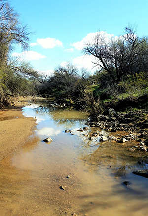 This stretch of Apache Wash is filled with water. [photo by Lin] |
We all manage to cross without incident and continue hiking until we finally reach the junction with the Sidewinder Trail. I tell everyone they have two options here. If anyone wants to call it a day and head back to the trailhead now, all they have to do is continue straight ahead for another half mile or so to reach the parking lot. For those interested in completing the original hike and going up to Apache Vista for the views, we will make a left turn onto the Sidewinder Trail and follow that up to the Apache Vista Trail and continue hiking that to the vista point at the top. Eleven hikers decide to head back to the parking lot and trailhead, with Scott leading, while the rest of us head up the Sidewinder Trail. After roughly ¾ of a mile we reach the junction with the Apache Vista Trail and hang a right. |
|
A few hundred more yards of climbing and we find ourselves standing on top of Apache Vista, looking down on the parking lot far below. We can see several of our hikers on the trail below us and make contact with them over the TalkAbout radios. The opposite view looks down onto a network of several washes meandering across the desert, including Apache Wash and Cave Creek Wash, the larger wash that Apache empties into. |
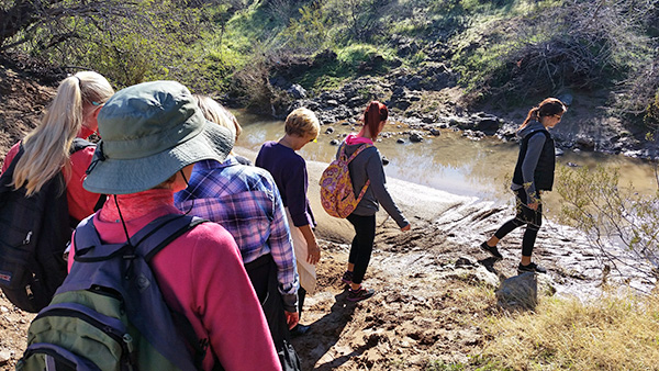 Preparing for a wet crossing. [photo by Lin] |
 25 Trailblazers cross a wet and muddy section of wash. [photo by Wendy] |
 On the final approach to Apache Vista. [photo by John] |
|
We take a final group picture on Apache Vista and start heading back down. We continue hiking the Sidewinder Trail around the back side of Apache Vista and keep looping around the base of the viewpoint until we finally reach the parking lot and trailhead, coming in from the opposite direction of the first group. The time is 12:45 PM, and it’s warmed all the way up to a balmy 52 degrees. With full sun, its T-shirt weather in the desert. Back at the trailhead Rudy takes time to pose for a picture with his new rock buddy, Big Nose Kate, who he met on the trail earlier in the day. For those not familiar with Big Nose Kate, she was a real-life character in the Wild West and gained both fame and a certain degree of notoriety as the long-time girlfriend of Doc Holliday. |
 Monika and Gabe at Apache Vista. [photo by Wendy] |
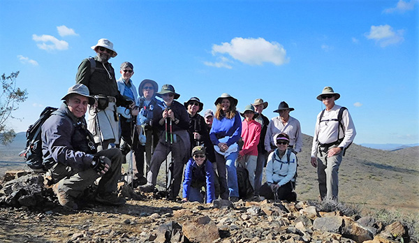 Group picture atop Apache Vista. [photo by John R.] John, Jim, Wendy, Chuck, Pete, Barry, Kim Z., Ed, Kim B., Gabe, Dave, Rudy A., Monika, Rudy G. |
 Trailhead and parking lot from Apache Vista. [photo by John R.] |
 Rudy and his friend Big Nose Kate. [photo by Wendy] |
 Pete, Ed, John, Suzanna, Barry, Wendy, Rudy, Chuck, and Jim at Logan’s Roadhouse. [photo by Wendy] |
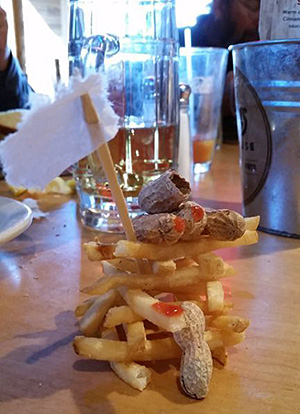 The bloody Battle of Fort French Fry. [photo by Wendy] We’re not quite sure just how the fight got started or which side actually won the battle, but when the Battle of Fort French Fry was finally over a white surrender flag was seen flying over the bloody battle scene and what was left of the besieged fort. Then again, perhaps there was really no battle at all, and the entire scenario was the figment of a bored diner’s wild imagination. But who could that have been? Carefully study the faces of the nine diners at the table and see if you can determine who the culprit was. Good eating and happy hiking! |
| Hike Statistics, by Jim Buyens |
|
|
 Top of Page
Arizona Trailblazers Hiking Club, Phoenix, Arizona
Comments? Send them to the AZHC .
updated December 25, 2019