Outdoor Links
Hike Arizona
Trip Planning Guide
Trip Report Index
Calendar of Events
Library
|
North Rim Car Camping Trip Grand Canyon National Park June 9-14, 2016 by Chuck Parsons |
|
|
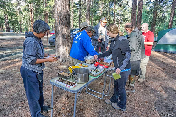
 The Cameron Trading Post, just in time for lunch. [photo by John R.] |
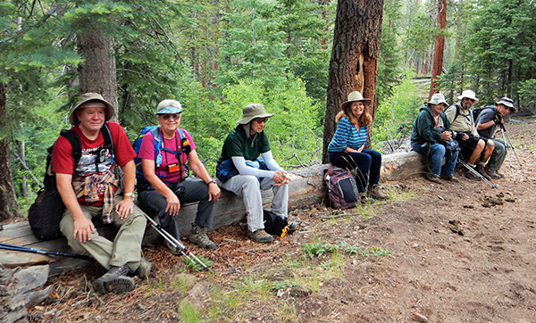
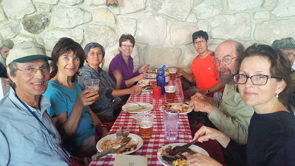
 15 famished Arizona Trailblazers enjoy lunch at the Cameron Trading Post. [photo by Wayne] |
|
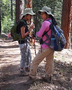
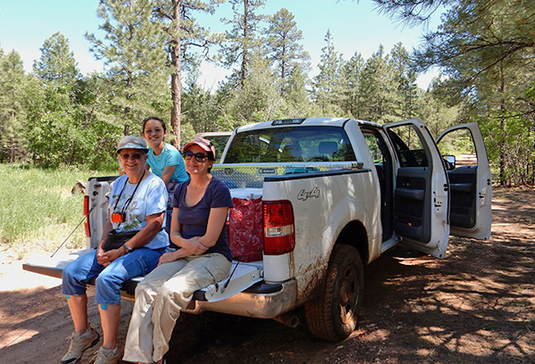
Clockwise on L side: Tamar, Ken, Chuck, Sandy, K.G., Wayne, Gabe, John S. Clockwise on R side: Karen, Monika, Mimi, Mary, Megan, Barry, Rebecca. |
|
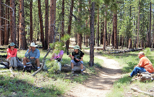
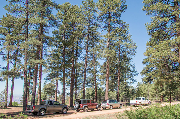
Early on the morning of Thursday, June 9, thirteen Arizona Trailblazers in six vehicles meet at our usual north-bound meeting location at I-17 & Bell Road to start our long caravan to the North Rim of the Grand Canyon. Meanwhile, seven more vehicles with seventeen additional Trailblazers are heading out on their own schedule with different arrival times at the North Rim. We’re also meeting one additional person driving her own vehicle at the MacDonald’s/Safeway location on Highway 89 in Flagstaff. Altogether, we have a total of 31 people in 14 vehicles heading for the North Rim, the largest car camping trip I’ve ever organized in the 18 years I’ve been putting these trips together, first for our predecessor, the Motorola Hiking Club, and then for the Arizona Trailblazers Hiking Club. The plan is to drive north on I-17 to the I-40 East exit just south of Flagstaff, then exit I-40 at Country Club Road which eventually becomes Highway 89. We’ll continue driving on Highway 89 for another hour to Cameron on the Little Colorado River, where we’ll take a lunch break at the historic Cameron Trading Post. Then we continue driving north to the Bitter Springs Junction, where we connect with Highway 89A, cross the Colorado River on the Navajo Bridge at Marble Canyon, and continue driving west along the southern boundary of Vermilion Cliffs National Monument. Continue on 89A to Jacob Lake, where we start heading due south on State Route 67 to the North Rim Entrance Station and finally the North Rim Campground, our home away from home for six days and five nights. Total driving distance will be about 300 miles each way. But a last-minute ADOT notice outlining construction work on I-17 just south of McGuireville, which would narrow traffic down to a single lane for two miles south of town, almost changes our route plan. Michael suggests an alternate route on State Route 87 through Payson to the town of Clints Well and continuing to Flagstaff on Lake Mary Road. However, Kim Z. informs me about a newspaper article she just read, talking about tree removal along 29 miles of Highway 87 north of Payson and yet more lane restrictions through that area. Then, as if to add insult to injury, smoke from three active forest fires—the Jack Fire east of Happy Jack, the Mormon Fire west of Mormon Mountain, and the Pivot Rock Fire—could all potentially contribute to reduce visibility along Lake Mary Road. |
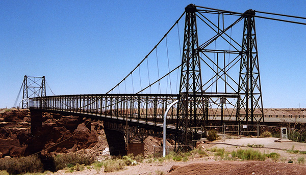 Original bridge, built in 1911, across the Little Colorado River at Cameron. [photo by Chuck] |
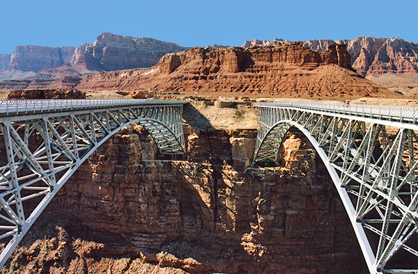 Old and new Navajo bridges span the Colorado River at Marble Canyon. [photo by Chuck] |
 Looking up Marble Canyon from the old Navajo Bridge. [photo by Wayne] |
|
After some discussion, the general consensus is to stick with our original plans for taking I-17 north to Flagstaff. Karen, riding her new Harley Davidson Softail Classic to the North Rim, is the first person to head out on Thursday morning and will keep me updated on traffic and road conditions through the McGuireville area. Less than an hour from our departure from Bell Road, Karen calls to inform me there is no construction work at all and traffic is moving along normally. So here we are worried for nothing. Either ADOT crews never started the project or they finished earlier than expected. Either way, it’s certainly good news for us. Around 11:30 we finally arrive for lunch at the historic Cameron Trading Post, which celebrated its centennial anniversary during our 2011 trip to the North Rim as one of the oldest surviving trading posts in Arizona. The small community of Cameron sits on the south side of the picturesque Little Colorado River Gorge on the Navajo Reservation and marks the location of the first bridge to span the river back in 1911. The trading post was built in the same year on the west side of the bridge and the community of Cameron, founded in 1916, gradually built up around the post. Next stop: Marble Canyon and the Colorado River. |
 The North Kaibab buffalo herd grazes in the meadows. [photo by Chuck] |
 This is the largest buffalo herd we've ever seen on the North Rim. [photo by John S.] |
 A bison calf grazes close to mom. [photo by Wayne] |
|
In the large open meadows adjacent to Highway 67 we come across this large herd of bison, including 20 or more small calves, peacefully grazing near the road. The current herd of hybrid bison within the park, or beefalo as they’re commonly referred to, is the result of experimental crossbreeding of buffalo and cattle on the Kaibab Plateau back in 1906 by one Charles “Buffalo” Jones. Although the original experiments were a failure, they were successful in later years and resulted in a hybrid breed of bison that has been thriving for decades in House Rock Valley to the northeast of the park’s northern boundary. |
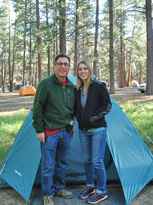 Barry & Megan: the first tent up in the campground. Father-daughter teamwork goes a long way here. [photo by Barry] Most of us finally arrive and check in at the North Rim Campground before 5:00 PM, with plenty of time left to set up our tents and fix a quick dinner before dark. We find our respective campsites in the group of nine that several of us reserved last December. We managed to successfully reserve the entire block of individual sites at the north end of the campground, just below the group sites that we used on our last two North Rim trips. This new arrangement actually seems to work out pretty well, since we’re essentially located on one very large group site now, with more room to spread out and more parking space as well. |
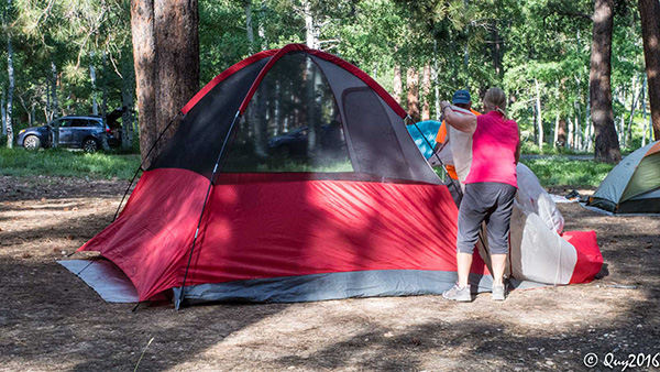 John and Dottie in the process of setting up Big Red. [photo by Quy] |
 Didn’t we just do this as a practice run a few days ago, Sandy? [photo by Quy] |
 Wayne is almost finished assembling Big Blue. [photo by Quy] |
 Let’s see now. Is this Pole A or Pole B, Wayne? [photo by Quy] |
 Trailblazers Camp is set up and ready for five blissful nights on the North Rim. [photo by Quy] |
 Now this camper certainly knows how to relax. [photo by Quy] |
 Karen and her new Harley Davidson Softail Classic. [photo by John S.] |
|
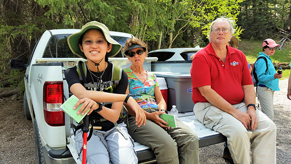
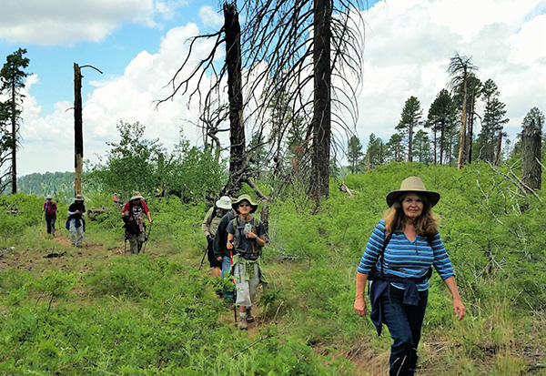
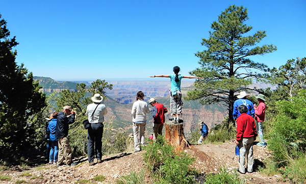
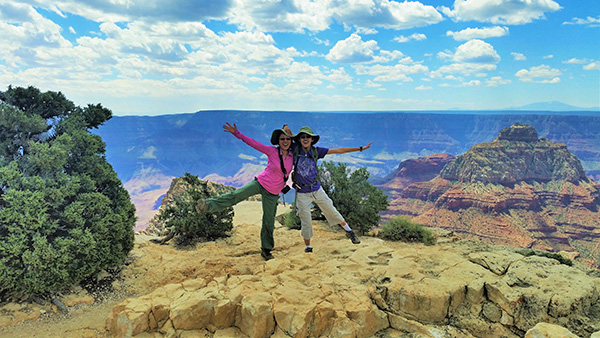
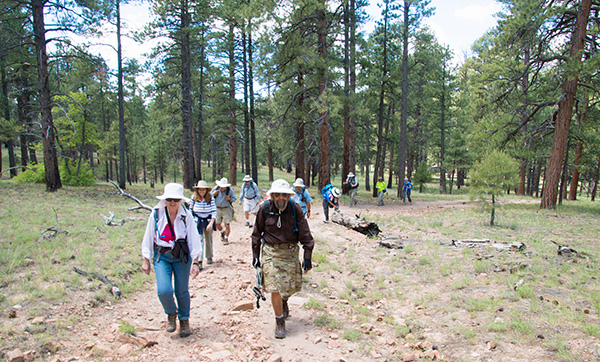
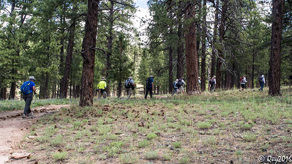
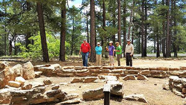
To reach the Widforss Trailhead, we first head north on Highway 67 and drive for about a half mile beyond the turnoff for the North Kaibab Trailhead to Point Sublime Road. Make a left turn onto this well-graded gravel road that runs for 18 miles out to Point Sublime, which we last visited on our 2011 North Rim trip. Drive for about a mile through the lush Harvey Meadow area before reaching the Widforss Trailhead and parking area on the left side of the road. Widforss Trail is named after Swedish-born artist Gunnar Widforss, famous for his paintings of numerous national parks including Yosemite, Yellowstone, Bryce, and Zion, in addition to the Grand Canyon which was his home base from the early 1920s until his death in 1934. Twenty-three Arizona Trailblazers, anxious to hit the trail, gather around the trailhead sign for our first group picture of the trip. It’s almost 9:00 AM on a beautiful Friday morning on the North Rim of the Grand Canyon, as we begin our first hike of the trip, under clear blue skies and a temperature of 65 degrees. |
 The Circle of Introductions. [photo by Wayne] |
 23 Arizona Trailblazers gather at the Widforss Trailhead for the first hike of the trip. [photo by Quy] |
|
1st Row: Quy, Lin, Kim B., Wayne, Gary, Mary, Barry, Megan. 2nd Row: Roy, Chuck, Jade, Deirdre, Rebecca, Michael, Tamar, Ken, Monika, Kim Z., Sandy S., Jim, Gabe, Sandy D., Rudy. |
 Trailblazers start moving out on the Widforss Tail. [photo by Wayne] |
 Trailblazers charge up the first of many inclines on the Widforss Trail. [photo by Quy] |
 We begin a long series of switchbacks on the Widforss Trail. [photo by Quy] |
|
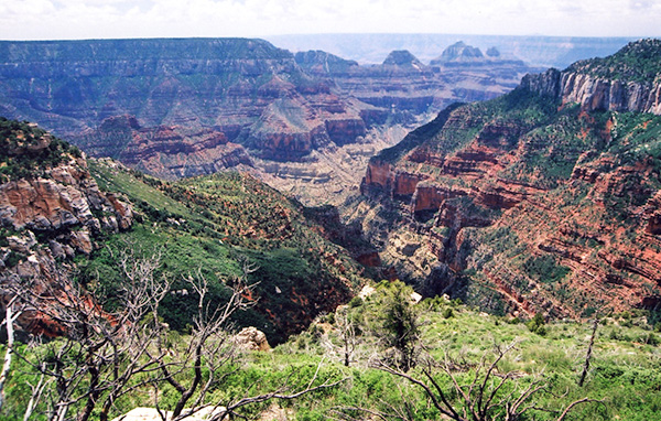
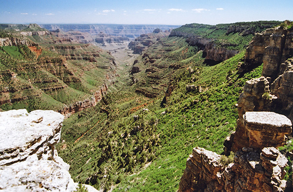
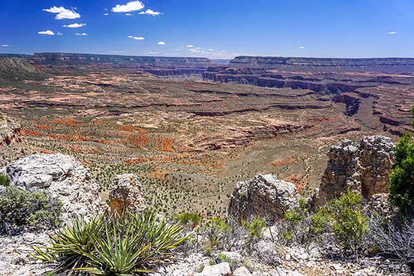
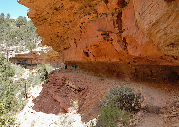
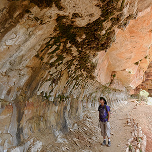
The trail begins climbing in earnest shortly beyond the trailhead and continues gaining elevation for the first 3/4 of a mile, before gradually leveling off and beginning a long series of gentle ascents and descents. It continues to wind its way through a mixed forest of ponderosa pine, aspen, Douglas fir, Colorado blue spruce, and Engelmann spruce in a short series of switchbacks, all the time skirting the head of Transept Canyon, sometimes simply referred to as The Transept, and offering intermittent and enticing glimpses deep into the canyon along the way. Some unknowing hikers no doubt mistakenly believe they’re looking directly into the Grand Canyon at this point, but Transept Canyon is only one of many, many side canyons that all form a complex network that drains into the main canyon. In fact, there are well over 200 individual tributary canyons carved and chiseled through the primary canyon’s great cliffs and terraces along most of its 277 mile length, all emptying their runoff into the Colorado River. |
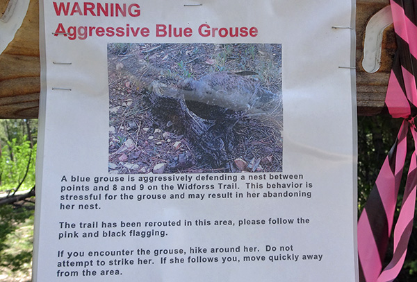 Stand down or I’ll peck your eyes out! [photo by Wayne] |
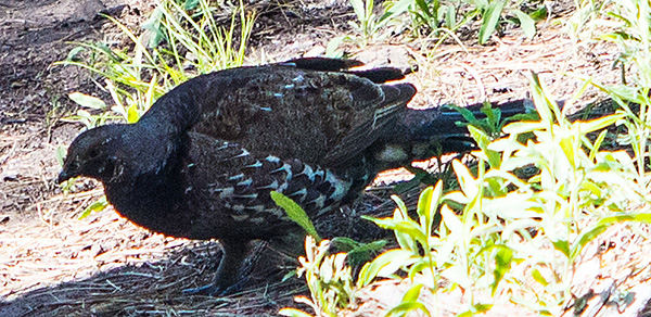 The beautiful Blue Grouse of northern Arizona (she didn’t pick the safest nesting site). [Quy] |
 The first breathtaking view of Transept Canyon along the trail. [photo by Quy] |
 Alpine hiking on the North Rim. [photo by Lin] |
|
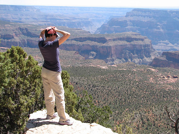
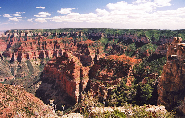
Transept Canyon is a major tributary gorge for Bright Angel Canyon, which runs from Roaring Springs Canyon and Roaring Springs all the way down to the Colorado River at the very bottom of the Grand Canyon, almost 6,000 feet below the North Rim. The Widforss Trail runs for five miles out to Widforss Point, which overlooks yet another side canyon known as Haunted Canyon. On our last two North Rim trips we only hiked about 2.5 miles to the head of Transept Canyon, before turning back. Today’s goal, however, is to hike the full five miles out to Widforss Point, break for lunch, and return along the same route. On a clear day one can actually see the San Francisco Peaks from the Widforss Trail, 70 miles to the south, but a combination of smoke and haze throughout the canyon makes it almost impossible to see today, as well as creating a major challenge for photographers. A polarizing filter helps somewhat, but nothing can completely cut through or eliminate the thick haze in the canyon today. We think most of it is probably due to large fires still burning in southern California, as well as a few active fires here in Arizona, including the Mormon Fire near Flagstaff. Let’s all pray for lots of wind to blow all this dirty air out of the canyon. |
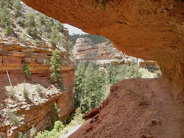
 Sweeping view from the head of Transept Canyon. [photo by Chuck] |
 Second view from the head of Transept Canyon. [photo by Wayne] |
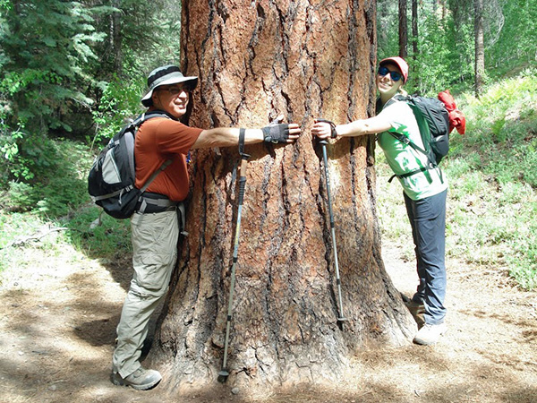 I never knew Barry and Megan were such tree-huggers. [photo by Chuck] |
 We estimate it would take 20 Megans to reach the top of this giant. [photo by Barry] |
 Parting view from the rim of Transept Canyon. [photo by Chuck] |
 This ponderosa pine seems to have a major problem. [photo by Barry] |
|
After finally hitting that 2.5 mile mark near the center point of the head of Transept Canyon and the best vantage point, we stop to admire the view, take lots of pictures and then a short rest break before continuing on. The trail continues running along the canyon rim for almost another mile, before beginning to veer completely away from the canyon and heading due south through heavy forest as it heads directly for Widforss Point. But from time to time we’re still able to walk out to several additional viewing points for different views into the canyon. After about 3.5 miles though, the trail veers far away from the rim. After another mile and a half of hiking under heavy forest cover, the trail finally breaks out into a clearing up ahead, where most of our hikers are enjoying the view and a lunch break. We can see Widforss Point from here, but the trail doesn’t actually go there since it’s another 0.5 miles to the southeast as the crow flies. Even though we can’t get to the point itself, the views from here are absolutely spectacular, looking down into Haunted Canyon and Phantom Creek off in the distance and taking in sweeping canyon views of Osiris Temple, Isis Temple, Cheops Pyramid, and Buddha Temple. This is truly an Arizona Highways moment. After lunch, we all pack up and start the long five-mile trek back to the trailhead. |
 Trailblazers admire the view along the trail. [photo by Lin] |
 Time for a little R&R on the Widforss Trail. [photo by Lin] |
 The Widforss Trail officially ends here at the point. [photo by Quy] |
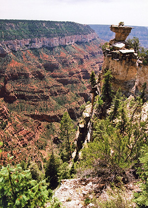
 The tall formation to the right is Buddha Temple. [photo by Chuck] |
|
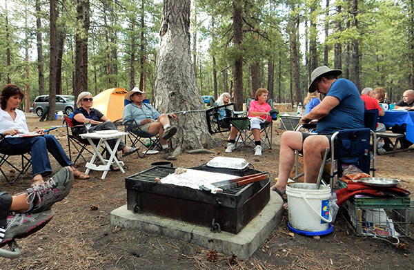
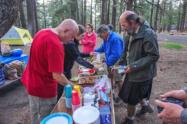
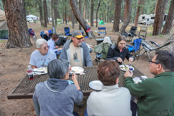
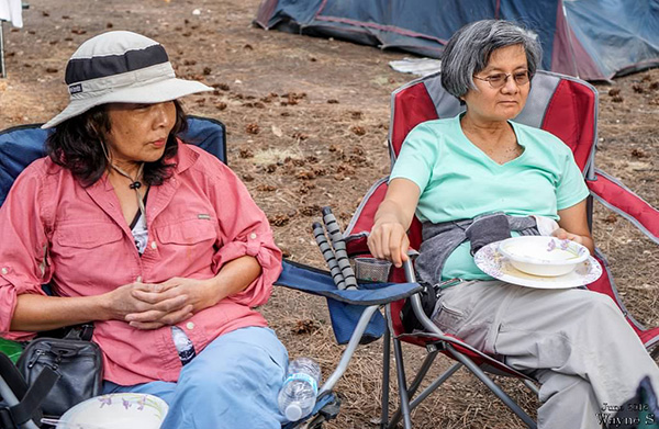
After we all arrive back at the campground from the Widforss Trail hike and get cleaned up, we waste no time in making preparations for the Great Friday Night North Rim Potluck Extravaganza. This evening’s rather expansive menu includes quite an eclectic assortment of appetizing dishes, ranging from chicken enchilada casserole and marinated grilled chicken breasts, to grilled beefsteak and mashed potatoes with mushroom gravy, two-alarm chili, four-bean salad, chicken pasta salad, curry rice, fried rice, cold spaghetti salad, cucumber salad, veggie pasta salad, mac ’n cheese with little smokies, and lots of chips and dips. There was also supposed to be a very special entree of boiled rattlesnake from Rudy, but the snake apparently wasn’t interested in being on the menu and slithered away during the night, bound for parts unknown. Yikes! Was that what I heard late last night moving around in my tent? And all this time I thought it was a large mouse. Dessert items include several varieties of home-made cookies, brownies, and lots of fresh fruit including watermelon, cantaloupe, pineapples, and strawberries. All this washed down by water, iced tea, soda, beer, wine, and even Rudy’s famous apple pie moonshine (this is not true moonshine as we normally think of it, like bathtub gin or hooch made in someone’s backyard still, but instead a brand name of off-the-shelf bourbon that comes in various other flavors, including peach and pear. It’s got a bit of a kick to it, but it does go down rather smoothly). Oops, that’s actually for sipping later while sitting around the campfire or, if absolutely necessary, to help start the campfire. In fact, it’s even been pressed into action on at least one occasion as a gasoline additive like STP to help start a balky vehicle engine. It also works quite well as paint remover. This stuff is amazingly versatile, quite literally the duct tape of beverages. |
 Meanwhile, back at the trailhead ... [photo by Lin] |
 Is anyone going to drink that beer, or is it just for show? [photo by Lin] |
 The Great Friday Night North Rim Potluck Extravaganza. [photo by Quy] |
 Time to unwind after a hard day of hiking. [photo by Lin] |
 Let the feasting begin! [photo by Wayne] |
 Gabe keeps a watchful eye on the proceedings. [photo by Wayne] |
 Sandy D., John S., Megan, Barry, Monika, Mimi. [photo by Wayne] |
 Rudy, Tamar, Kim B., Gabe, Chuck, Jim, Sandy S. [photo by Wayne] |
 Quy, Mimi, Mary, Michael. [photo by Wayne] |
 Grillmaster John S. is still on the job. [photo by Wayne] |
 John R., Dottie, Kim B. [photo by Wayne] |
 Yanis and Vanessa. [photo by Wayne] |
 Sandy D. and Karen. [photo by Wayne] |
 Megan and Barry. [photo by Wayne] |
 Mother and daughter. [photo by Wayne] |
 Quy and Mimi. [photo by Wayne] |
 Deirdre and Rudy. [photo by Wayne] |
 John and Dottie share a special moment. [photo by Quy] |
 Gabe and Monika. [photo by Wayne] |
 Kim B. and John S. [photo by Wayne] |
11:00 PM on a cool Friday night on the North Rim of the Grand Canyon and most of us are safely tucked away in our tents, listening to the steady drumbeat of rain against the tent fabric. That earlier forecast for a 30% chance of rain on the North Rim is finally catching up with us. I begin softly humming the words to the hit song Raindrops Keep Fallin’ On My Head by B.J. Thomas in an attempt to get to sleep. But I change the words to Raindrops Keep Fallin’ On My Tent. Light showers continue on and off throughout the night and long into the wee hours of the morning, finally tapering off around 4:00 AM. Nuts! |
|
I never could get to sleep singing or humming to myself anyway. I start to worry about how the rain might affect our Roaring Springs and Uncle Jim hikes scheduled for Saturday morning. Will we be hiking in lots of mud? Will the trails be slippery? What about possible thunderstorms during the day, especially for the Roaring Springs hikers down in the canyon? Normally we turn back at the first signs of thunder or lightning, but that’s not too practical 3,000 feet deep into the Grand Canyon. A recent article in The Arizona Republic, discussing the Grand Canyon’s North Rim, stated that “Far from civilization, the smaller and less accessible northern half of Grand Canyon National Park could be considered the South Rim’s spurned stepchild. Yet those who make the journey to the North Rim – one person for every ten who visit the southern side – will find nature’s Cinderella, an underrated beauty whose depth and texture mesmerizes.” Scott Craven, The Arizona Republic, May 13, 2016. A mere ten miles across as the crow flies, the great chasm that separates the North Rim from the South Rim may as well be a thousand miles across in terms of park visitation. Five million people visit the Grand Canyon every year, but only 10% of them take the time and trouble to go the extra distance to visit the spectacular North Rim. And that is precisely what makes the North Rim even more special and appealing than it already is. As beautiful and breathtaking as the South Rim is, the stifling and oppressive crush of humanity can become almost unbearable at times and ruin the overall experience and enjoyment for many. The Grand Canyon’s South Rim is a classic example of loving our National Parks to death, a serious and ongoing problem facing all of the more popular National Parks across the country. The lack of crowds and all the associated problems they bring to the South Rim is one of the primary attractions, perhaps ranking just under the natural beauty of the place, that keep the dedicated few, the serious 10%, coming back to the North Rim year after year to embrace Mother Nature’s Cinderella in all her glory and solitude. If the day ever comes when science and technology finally determines a way to bridge the great gap between the two canyon rims, opening an easy pathway for ever-increasing hordes of new visitors, more than a few hearts will be broken and tears shed as the special solitude and magic of the Grand Canyon’s North Rim is lost forever. Let us hope and pray that day never arrives and Mother Nature’s Cinderella will forever remain an underrated beauty, eternally mesmerizing, and unmarred and unspoiled by the misguided hand of man. |
 Ten Arizona Trailblazers at the Ken Patrick Trailhead, with Wayne behind the lens. [photo by Wayne] |
| Jim, Kim Z., Jade, Barry, Gary, Kim B., Megan, Chuck, Sandy, Lin |
 Listen up, people. Here’s the plan for today’s hike. [photo by Lin] |
 Lin and Jade take a quick shade break on the trail. [photo by Lin] |
 The switchbacks on the upper North Kaibab Trail can be seen on the right. [photo by Chuck] |
 Kim B. leads the charge on the Uncle Jim Trail. [photo by Lin] |
 View looking into Roaring Springs Canyon. [photo by Chuck] |
|
Saturday morning on the North Rim, and we’ve divided up into three separate groups. One group of 11 hikers, led my Michael, will be doing an "A" hike down the North Kaibab Trail to Roaring Springs and back. This venture will take most of the day and will involve nearly 10 miles of hiking and descending 3,050 feet into the Grand Canyon to Roaring Springs, turning around, and then regaining that same 3,050 back to the trailhead. A very tough and demanding hike by any standards, but also a terrific opportunity to see the Grand Canyon below the Rim for those who have never done so before. A second group of 11 hikers, led by me, will be doing the much easier Uncle Jim Trail, a moderate 5-mile cherry stem loop trail through the forest with terrific views of both Bright Angel Canyon and Roaring Springs Canyon where our other hikers will be. And if we’re lucky, we may even see them descending the tight series of switchbacks as they carefully make their way down the upper section of the North Kaibab Trail. Their goal is Roaring Springs, five miles down the trail, but the trail descends for a total of 14.2 miles all the way down to the Colorado River flowing at the bottom of the canyon. Meanwhile, our other 9 hikers are remaining behind to create their own itinerary for the day. Some may just hang around the campground or go for a short hike on the Transept Trail or Bridle Path Trail to the Lodge or take the scenic trail out to the end of Bright Angel Point just south of the Lodge. Some may choose to take the scenic drive out to Point Imperial or Cape Royal. The North Kaibab Trailhead and the Ken Patrick Trailhead both share a common parking area. Today we’ll hike the Ken Patrick Trail for almost a mile before finally linking up with the Uncle Jim Loop Trail. The Ken Patrick Trail continues for another 9 miles all the way out to Point Imperial, but we’ll have to consider that one for another day and another trip. The Uncle Jim Trail was named in honor of James T. “Uncle Jim” Owens who served for 12 years, beginning in 1906, as head game warden on the Kaibab Plateau’s Grand Canyon Game Reserve. During that period game management practices called for the complete elimination of predatory species such as wolves and mountain lions, primarily to increase the herd sizes of both deer and elk for the hunters. In this context, “game management” is a bit of an oxymoron, since “management” for wolves, mountain lions, and other predators is simply a euphemism for extermination. Unfortunately, despite everything we’ve learned about these apex predators over the decades and the critical roles they play in maintaining a healthy and diverse ecosystem, that perverse way of thinking still prevails today among a surprising number of people. |
 Even poor Spock is dead tired. [photo by Lin] |
 Jade, Spock, and Lin at Uncle Jim Point. [Lin] |
|
Uncle Jim claimed to have personally killed over 500 mountain lions during his tenure as head game warden and was widely applauded by most for his actions. But without predators to hold their numbers in check, the deer population exploded to unprecedented numbers during those years. The plan ultimately backfired since the deer eventually outstripped their food resources, and the limited range of the Kaibab Plateau could no longer sustain such large numbers, estimated at more than 100,000 at its peak. The result was severely malnourished and underweight deer whose population completely crashed during an exceptionally harsh winter in the mid-1920s when tens of thousands of deer and elk simply starved to death. The mountain lion population has gradually recovered over the years, and the result is a smaller and much healthier deer population, giving credence once again to the old adage that you can’t fool around with Mother Nature. During our previous hikes on the Uncle Jim Trail, we only had to share the trail with a handful of other hikers. But things have changed since our last trip in 2013, and now we have to share the trail with numerous mule trains making round trips out to Uncle Jim Point. Apparently in an effort to boost revenues, the Park Service has started trail rides out to Uncle Jim Point and also down to the Supai Tunnel on the North Kaibab Trail. Looks like both of our groups of hikers will be sharing the trail today. The first half mile or more of the Ken Patrick Trail is now filled with large piles of mule poop and malodorous pools of mule pee. Hikers really have to step carefully along this stretch of trail to avoid a disastrous slip ’n slide. It seems that shortly after the mule trains start out from the trailhead, all or most of the mules decide to heed the call of nature about the same time, a mass toity if you will, and they are quite thorough about taking care of business. |
 Seven tired rumps on a log. [photo by Lin] |
 So where is the real Uncle Jim Point, Uncle Jim? [photo by Lin] |
 11 smiling Trailblazers on Uncle Jim Point at last. [photo by Wayne] |
|
1st Row: Lin, Kim Z., Megan, Jim, Sandy D.. 2nd Row: Jade, Chuck, Wayne, Kim B., Barry, Gary. |
|
The Ken Patrick Trail winds its way up and down through a thick forest of ponderosa pine, Douglas fir, blue spruce, and aspen for a quarter mile or more before we finally catch our first views of Roaring Springs Canyon, a major tributary canyon of the much larger Bright Angel Canyon that descends all the way to the Colorado River. After we reach the Uncle Jim Loop junction and begin heading south, the views of both canyons become ever more expansive and spectacular. This view of the head of Roaring Springs Canyon clearly shows the steeply descending multiple switchbacks of the upper North Kaibab Trail, which drops almost 6,000 vertical feet in 14.2 miles from the trailhead to the Colorado River, firmly establishing its reputation as one of the premier hiking trails in all of Arizona. The Uncle Jim Trail skirts the rim of the canyon over much of its course all the way out to its apex at the southernmost point, with Roaring Springs Canyon to the west and Bright Angel Canyon to the east. |
 Our gracious bus driver, Lyndon. [photo by Wayne] |
 Our saving grace at the end of the Uncle Jim hike. [photo by Wayne] |
 On the long ride back to Barry’s vehicle. [photo by Wayne] |
|
The views are even more spectacular as we continue making our way south, eventually culminating in this magnificent scene at Uncle Jim Point. From our 8,300 foot vantage point on the edge of the North Rim we are treated to unparalleled views of the confluence of Roaring Springs Canyon and Bright Angel Canyon, Brahma and Zoroaster temples, the South Rim, and even beyond to the snowcapped San Francisco Peaks, Kendrick Peak, and Bill Williams Mountain just visible on the far horizon. John used Adobe Lightroom to create this interesting picture. He used a Dehaze filter at maximum and then tweaked the exposure and colors to compensate: |
 The snow-capped San Francisco Peaks, 63 miles south from Uncle Jim Point. [photo by John S.] |
 John S., John R., Dottie, and K.G. at Uncle Jim Point. [photo by John S.] |
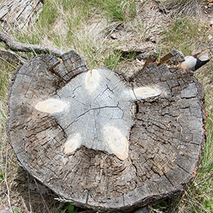 Holy Smokes, John! Do you think this could be a fossilized turtle? [photo by John S.] |
 Maggie, the prettiest Mule Skinner on the North Rim, high atop her trusty steed. [photo by John S.] Although this has always been one of the most crowded parking areas on the North Rim, outside of the North Rim Lodge main parking lot, it has been exceptionally busy today. After Barry drops most of us off near the trailhead, he and Megan take off to find a parking space for the vehicle. We pile our gear off to the side, some take a quick restroom break, and then we wait. Lin and Jade walk over to check out the mules in their corral, since this is the common staging area for both the Uncle Jim Point and Supai Tunnel trail rides. Then we wait and we wait and we wait some more. H’mmm, what do you think this weather is going to do today, Wayne? Those large cumulus clouds are starting to look pretty dark now. Then we wait and we wait and we wait some more. How’s everyone doing so far? Everyone having a good time on this camping trip? Think it might rain today? Then we wait and we wait and we wait some more. Finally, someone shouts out that Barry and Megan are hustling down the road. Hooray! Turns out they had to park almost a mile away. Good grief, Charlie Brown! Remind me when we get back to the campground, Barry. I owe you two a couple of cold ones. Great job, really. Now, fast forward to the end of the Uncle Jim hike after we all finally arrive safely back at the trailhead. Shall we draw straws to see who goes back for the vehicle? Before we can decide, an angel named Lyndon comes forward and offers to drive us all back to Barry’s vehicle in his Canyon Trail Rides Shuttle. Are you kidding me? No hesitation there from this tired group. So within seconds we all pile in with our gear and careen down the road in search of the vehicle. We drive and we drive and we drive some more, first around one curve in the road and then another. By now, Barry’s thinking it’s got to be around that next curve in the road. Are you sure someone didn’t steal your vehicle Barry? We drive and we drive and we drive some more, before we finally spot Barry’s elusive vehicle. He must have parked at least five miles away! Heck, we’re almost back at the campground! We drop Barry and Megan off at the vehicle and make the short drive from there to the campground. We all chip in and give Lyndon a generous tip, shake his hand, and thank him for driving us. What a guy! What a day! |
|
Gabe’s Description of the Roaring Springs Hike:
The 9.4 miles Roaring Springs hike was, for most of us a welcome challenge. This was a round trip hike with 3,050 feet of elevation change. We started early and drove to the North Kaibab Trailhead. Many hikers were already ahead of us and the parking lot was filled. No worries, we parked along the road. Some of our group had made a real early start and we would see them on the trail later coming up as the rest of us were heading down. It had rained the prior night, and we ran into some hikers coming up who had been caught in the rain. They had to spend the night in the tunnel and luckily they were OK. This is just a reminder that anything can happen, and to be prepared. Not too far down the trail the views started, and from then on it was non-stop “wow” moments around every bend. The cliff walls have a pinkish tinge that changes depth depending on the light and weather. We learned that the Grand Canyon rattlesnake evolved to have the pinkish tinge to blend with these pink cliffs. This snake occurs nowhere else in the world. Experts (other hikers) assured me that they are docile; however I did not have the chance to find out. Although I did not see a rattler on the trail, we passed other hikers who had seen this unique serpent. There simply was no end to the views. Every switchback provided a new vista. These pictures will help those of us who hiked the trail remember how beautiful it is, and provide those who did not hike it a another perspective on the canyon. Finally, after a beautiful hike, we made it to Roaring Springs. The water source was indeed, a roaring waterfall. Then, there were a few pond areas filled with the cold water, some small to soak our feet, others, like the one Rudy found, were large enough to wade in. Some of us took our shoes off and soaked our feet to cool down. Having reached our goal, we took a break here and had lunch on the rocks. As we hiked up, we were passed by several of the mule trains taking visitors down a few miles. Going up we had to take many more breaks, but that helped us enjoy the views. We were lucky enough to have it rain a little as we reached the top. It was just a passing shower, but it cooled us off. It was perfect. Most of us made it up in 7-8 hours. In time to get back to camp, clean up and enjoy day 2 of the wonderful potluck dinner. |
 Starting the long descent into Roaring Springs Canyon. [photo by Quy] |
 This trail is starting to look more like a mountain goat path. [photo by Quy] |
 The first foot bridge on the North Kaibab Trail. [photo by Quy] |
 The series of poles across the trail minimizes erosion. [photo by Quy] |
 The North Kaibab Trail is one of the most scenic in the canyon. [photo by Quy] |
 Supai Tunnel, dead ahead! [photo by Quy] |
 The life-giving waters of Roaring Springs, at last. [photo by Quy] |
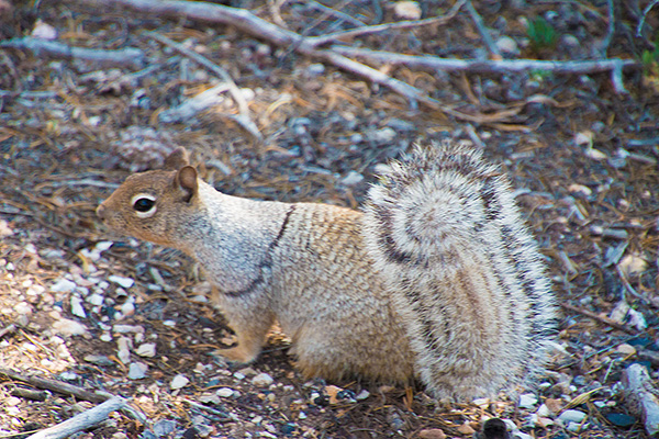 Banded Squirrel [photo by John S.] |
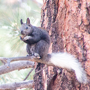 North Kaibab Squirrel [photo by John S.] |
 Northern Flicker [photo by John S.] |
 Desert Checkerspot Fritillary [photo by John S.] |
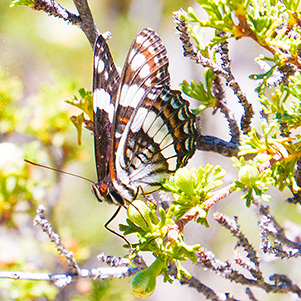 Weidemeyer Butterfly [photo by John S.] |
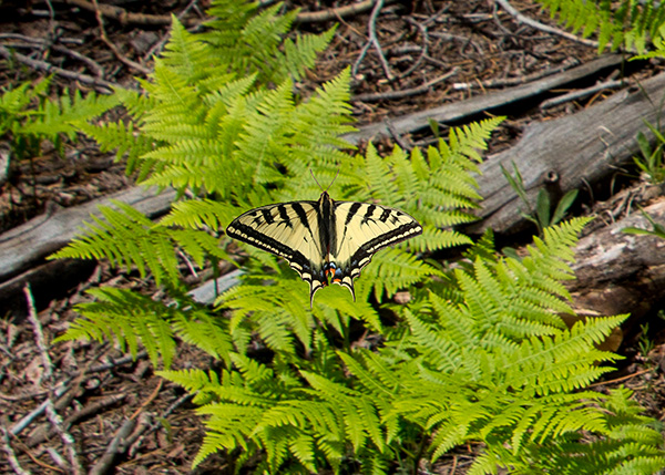 This beautiful Swallow Tail butterfly hovers over a cluster of maidenhair fern. [photo by John S.] |
|
Combining a bit of digital slight of hand with a considerable degree of skill in Photoshop, John used a series of layers, stacking several images with various filters, to produce this final composition, which originated as an injured and exhausted Swallow Tail butterfly resting in the palm of his hand. “Long before we came close, I saw the space. A huge, cleaving space that the photographs and paintings had done nothing to prepare me for. An impossible, breath-taking gap in the face of the earth. And up from this void shone a soft, luminous light. We came to the lip of the Rim. And there, defeating my senses, was the depth. The depth and the distances. Cliffs and buttes and hanging terraces, all sculptured on a scale beyond anything I had ever imagined. Colors neither red nor white nor pink nor purple but a fusion. And stamped across everything, the master pattern. Even before I had accepted what I saw, I heard the silence; felt it, like something solid, face to face. A silence in which the squawk of a blue jay was sacrilege. A silence so profound that the whole colossal chaos of rock and space and color seemed to have sunk beneath it and to lie there cut off, timeless. I looked at its huge, alternating bands of cliff and hanging terrace that reach down, repeating but never repetitious, from Rim almost to river. I looked east and west, as far as my eyes could strain, until cliff and terrace tapered away into hazy distances. It was mysterious and terrible — and beckoning.” Colin Fletcher, The Man Who Walked Through Time. In 1963 Fletcher became the first man to walk the entire 200-mile length of the Grand Canyon, below the Rim. His was a remarkable and perilous two-month journey of almost insurmountable hardships and physical challenges, doing what no man had ever done before as he struggled against draining fatigue, extreme heat and cold, dwindling supplies, water shortages, almost impassable terrain, and the raw power of the Colorado River in the days before Glen Canyon Dam. |
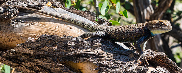 Yellow-Throated Spiny-Tailed Lizard [photo by Quy] |
 Spiny-Tailed Lizard [photo by Wayne] |
 Unknown Butterfly [photo by Lin] |
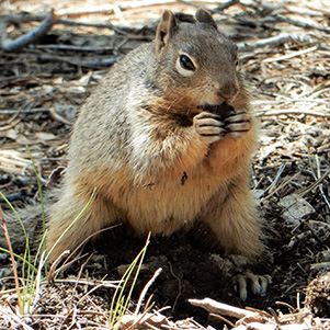 Ground Squirrel [photo by Lin] |
 Cedar Waxwing [photo by Wayne] |
|
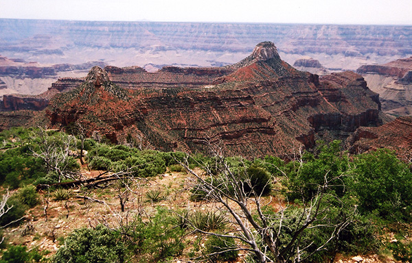
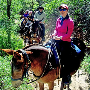
Barry, Megan, Kim B., and Kim Z. had all signed up earlier for a Sunday morning mule ride down the North Kaibab Trail to the Supai Tunnel. My original plan for the rest of the group on Sunday morning was to revisit Point Sublime, which we saw on our 2013 North Rim trip. Following is a picture of Point Sublime from that trip. Although one of the most spectacular points on the North Rim, it’s a long 36-mile round-trip drive over rough stretches of bladder-busting Forest Service roads to reach the point. And once there, the first order of business is to head for the nearest trees for instant relief from the road, then look around and take in the view, take lots of pictures, maybe even get a quick bite to eat, and then turn around and bounce and jostle for another 18 miles back to the main road. While we’re all sitting around the Saturday evening campfire, spinning tall tales and passing around Rudy’s apple pie moonshine, Michael begins talking about an area on the Rim that he visited several years earlier called Indian Hollow Point, which is also the jumping off point for Deer Creek Trail and Thunder River Trail, both iconic Grand Canyon trails that he and several others hiked back then. This starts to sound so intriguing that I ask Michael to describe the trip to the rest of the group. After hearing the full details and getting some input from the others, I decide to shelve the Point Sublime trip and substitute this new adventure since we’ll be seeing a lot more of the canyon than we would by just driving out to Point Sublime – basically getting more bang for our buck so to speak. So that’s our new plan for Sunday. Then after returning from the long drive, we’ll head over to the North Rim Lodge for their famous all-you-can-eat Sunday buffet luncheon. |
 Kim B., Megan, Barry, Kim Z. North Rim mule skinners in training. [photo by Barry] |
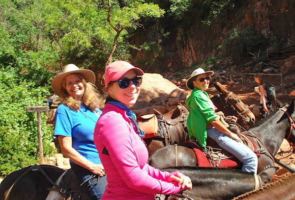 Kim B., Megan, and Kim Z. atop their trusty steeds. [photo by Barry] |
 Jen, what did I just tell you about stopping to munch on the grass? [photo by Barry] |
 Barry leads the charge while riding Watoba. [photo by Barry] |
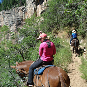
 Kim Z. and Little Joe are ambling down the trail. [photo by Kim B.] |
 Megan and Jen, followed by Barry and Watoba. [photo by Kim B.] |
 View looking down the trail into Roaring Springs Canyon. [photo by Barry] |
|
Sunday morning dawns bright and clear, another beautiful day on the North Rim of the Grand Canyon. After breakfast our four mule riders head over to rendezvous with their mules, while 18 of us pile into four vehicles as we follow Michael out to Indian Hollow Point and parts unknown for a day of adventure and thrill-seeking. After 23 miles of kidney-jarring and bladder-busting jostling over more rough Forest Service roads, we finally reach Timp Point, one of the five major lookout points on the 18-mile long Rainbow Rim Trail that we had actually visited on our 2013 North Rim trip. It’s going to make for an interesting conversation tonight sitting around the campfire, as we compare notes to determine whose rumps are more sore from the days activities – ours or the mule riders. The Rainbow Rim Trail was featured as the “Hike of the Month” in the June, 2013 issue of Arizona Highways magazine. Quoting from the magazine: “The views from this remote trail are priceless and they’re unlike anything you’ll see in the national park or on postcards or in coffee-table books featuring photos of the most beautiful places on Earth.” Descriptions like this are certainly enough to get any hiker’s juices flowing. We make a quick visit to Timp Point, just around the bend from the Rainbow Rim Trail sign, take a few pictures for posterity, and then pile back into our vehicles for the shorter drive out to Indian Hollow Point. |
 Indian Point Caravan. [photo by John S.] |
 Point Sublime in 2013. This was our original goal for Sunday morning. [photo by Chuck] |
 Rainbow Rim Trailhead. [photo by Lin] |
 Rebecca takes in the grand view from Timp Point. [photo by Jim] |
 Trailblazers enjoy the view from Timp Point. Meanwhile, Jade perfects her balancing act. [photo by Lin] |
|
As mentioned earlier, Indian Hollow Point is a trailhead junction for both the Deer Creek Trail and the Thunder River Trail, among others, and sits 850 feet above the vast Esplanade Platform. The Esplanade Platform is a mammoth sandstone shelf or broad terrace about 20 miles in length that sits roughly a quarter of the way down in the Grand Canyon, about 1,500 feet above the Colorado River, and is essentially a canyon within a canyon. After many decades of disagreement, geologists are still uncertain of its exact origins, and a number of different theories prevail to this day. The Esplanade Platform has a counterpart in the form of the much larger Tonto Platform below the South Rim which runs for 95 miles between two major side canyons – Red Canyon on the east end and Garnet Canyon on the west end. The Tonto Trail runs along this platform for its entire length and is by far the longest trail within the Grand Canyon trail system. |
 Rudy is about to take a giant leap of faith. [photo by Lin] |
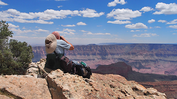
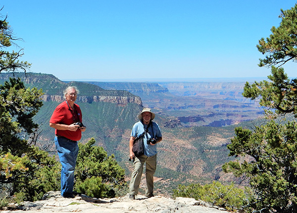 Photographers Michael and Chuck try to capture the view from Timp Point. [photo by Lin] |
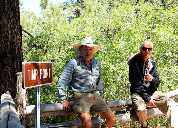 Rudy and Ken take a quick fence railing break. [photo by Lin] |
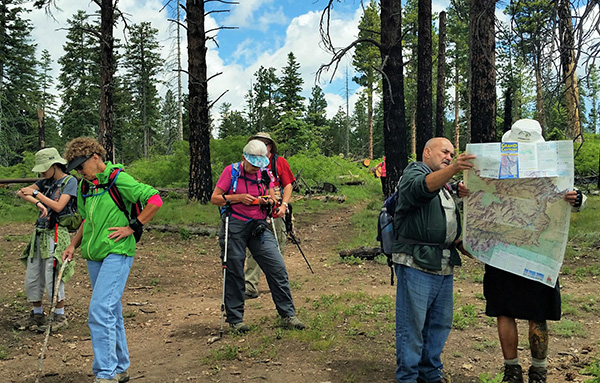
 18 Trailblazers gather at the Indian Hollow Point Trailhead. [photo by Quy] |
|
Front Row: K.G., Sandy, Gabe, Yanis, Vanessa. Back Row: Quy, John S., Ken, Gary, Rebecca, Monika, Mimi, Rudy, Lin, Jade, Jim, Michael, Chuck. |
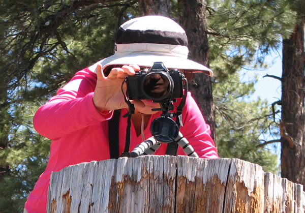 Quy carefully focuses for the perfect image. But whose face is reflected in her lens? [photo by Jim.] |
 View from Indian Hollow Point Trailhead. [photo by Chuck] |
 View from Indian Hollow Point Trailhead. [photo by Wayne] |
 View from Indian Hollow Point Trailhead. [photo by Quy] |
 Mimi and Sandy take in the view from Indian Hollow Point. [photo by Quy] |
|
After we leave Indian Hollow Point, our next stop is Crazy Jug Point. No, I don’t know how it got such a crazy name, but it is kinda catchy, isn’t it? I believe Michael originally had one additional stop in mind, but due to time constraints we turn this long caravan around and head straight back for the barn after leaving Crazy Jug. We’re rolling and bouncing along until we come to this extremely muddy, water-filled stretch of road that we somehow managed to navigate without problems on the way in earlier today. But can we make it through once again without problems? The mud seems even thicker and deeper than it was earlier, if that’s possible. In fact, right now it looks almost bad enough to trap a small herd of elephants. But we don’t expect to see any elephants on the North Rim today. Apparently old Murphy (as in Murphy’s Law) has something else in store for us today as we attempt to make passage back through the quagmire. Michael and Rudy both manage to make it through OK, but Yanis and Vanessa fall victim to Old Man Murphy as their trusty Toyota Highlander becomes hopelessly mired in the muck, its wheels spinning frantically, trying to break free. Well, this is a fine kettle of fish. So what to do now? Call AAA? Hardly. Dial 911? Not a chance. When you’re driving the rugged and isolated back country of the North Rim, you have to resort to your own wits and ingenuity in situations like this because there’s probably not going to be anyone else around to help you. Another good reason to caravan in a group of vehicles whenever exploring in places like this. |
 Wayne looks across the vast Esplanade from Indian Hollow Point. [photo by Quy] |
 Rudy is in the perfection position high above the Esplanade. [photo by Jim] |
 Michael is in his element, high above the Esplanade. [photo by Jim] |
 Rudy and Wayne share a good laugh at the point. [photo by Lin] |
 Gabe has the highest viewpoint of all. [photo by Jim] |
 Monika, meanwhile, takes to slightly lower ground. [photo by Jim] |
 Sandy, Jade, and Rebecca take five. [photo by Lin] |
 The view from Crazy Jug Point. What a crazy name for a viewpoint! [photo by Chuck] |
 Jim at Crazy Jug Point. [photo by Jim] |
 The road gets a bit muddy at this point. [photo by Quy] |
 Uh-oh. Is Yanis stuck? [photo by Quy] |
 Rudy comes to the rescue with a tow strap. [photo by Quy] |
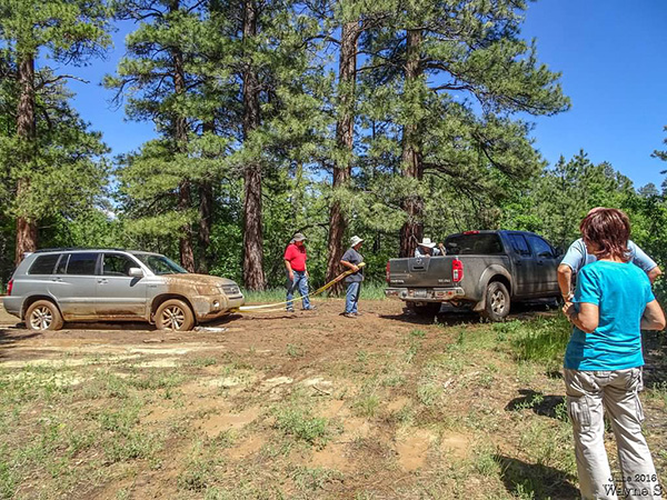 Gary prepares to attach the strap to Rudy’s truck. And now the plot, as well as the mud, thickens. [photo by Wayne] |
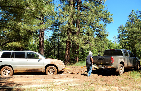 Gary checks the tow strap connection one last time. [photo by Lin] |
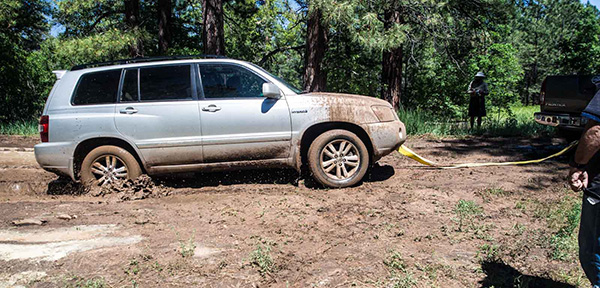 Tires are spinning. Is he going to make it? Yes! Yanis finally clears the mud bog! [photo by Quy] |
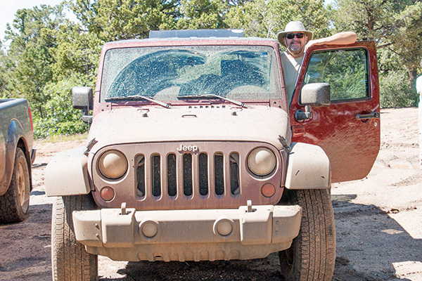 John’s Jeep Wrangler was once cherry red. Now it’s dull brown – sort of mud-colored, actually. [photo by Chuck] |
|
So Rudy breaks out his large yellow tow strap, crawls out in the mud (what a guy!), and secures one end to the Highlander’s frame. He takes the free end and he and Gary secure that to the tow bar on the back end of his Nissan. Michael then places a few branches under the Highlander’s front wheels for extra traction. Now it’s show time. It’s do or die. Will this really work, or will the tow strap simply snap as the Highlander struggles to free itself? We’re about to find out, so stay tuned. Rudy slowly inches his Nissan forward to take up slack in the tow strap, as Yanis gives his Highlander some gas. Giddy up Highlander! C’mon girl! We all keep our fingers crossed as the action unfolds. Is anyone getting pictures of this for the record? Actually, more people are photographing than helping. Ever so slowly, the Highlander begins to creep forward, wheels spinning and slinging mud like nobody’s business, and then suddenly it lurches forward and frees itself from its muddy prison at last. In the rear of the pack, John pushes down firmly on his accelerator and slams his Jeep Wrangler through the quagmire (hang on back there, Wayne and K.G.!), throwing out a thick muddy spray in all directions in a desperate attempt to clear the mud bog before miring down. Oops! Is that one of our people standing on the side of the road covered in a thick layer of mud? Hello? Anyone there? Is that you Gary? No, thankfully its only a small tree. John sails through without incident, as we all regroup on the other side and careen down the road, following Michael’s big F-150 back to the campground. |
 One of the best National Park Service signs ever. [photo by John R.] |
 Trailblazers enjoy a hearty buffet luncheon after a hard day on the road. [photo by Quy] |
 Yanis, Vanessa, Mimi, Monika, Wayne, Jim, Gabe. [photo by Lin] |
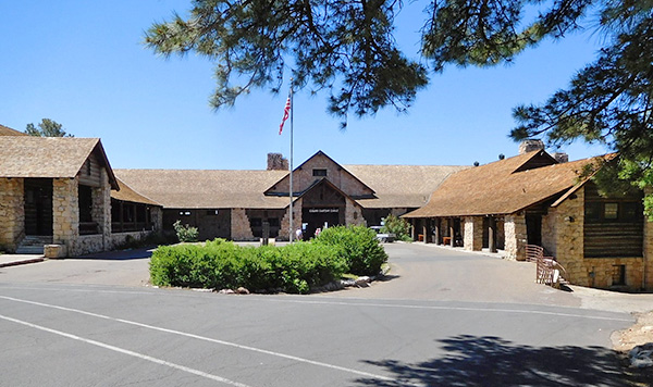 Approaching the North Rim Lodge. [photo by John R.] |
 The Million Dollar View from the spacious lodge patio. [photo by John R.] |
 John and Dottie take in the best view in the house. [photo by John R.] |
|
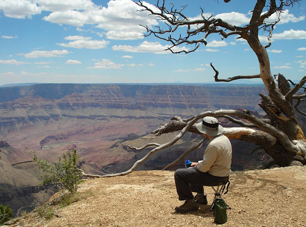
After a satisfying dinner at the all-you-can-eat Sunday buffet luncheon at the lodge, some people head back to the campground while the rest of us hang around for a while to take in the views and make the short quarter-mile hike out to the end of Bright Angel Point for some of the best views on the North Rim. This is also a great place to watch both sunrises and sunsets and often draws large numbers of photographers trying to capture that magical moment of first light or last light in the Grand Canyon. |
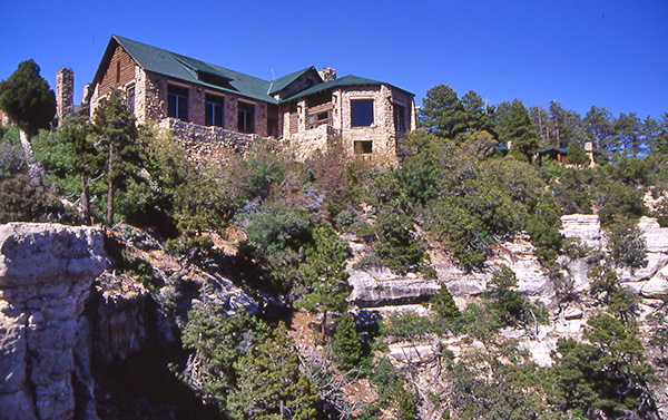 The North Rim Lodge is perched on the very edge of the rim. [photo by Chuck] |
 View of the canyon from the large picture windows inside the lodge. [photo by Quy] |
 Lin and Jade sit in one of the viewing areas beneath the main floor of the lodge. [photo by Wayne] |
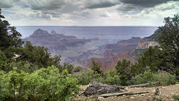 Threatening storm clouds loom over the canyon in this view from the Transept Trail. [photo by Roy] |
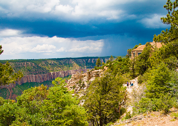 A large thunderstorm is bearing down fast on the North Rim Lodge. [photo by John S.] |
 Another view into the canyon from the Transept Trail. [photo by Roy] |
 Catching the sunset from Bright Angel Point. [photo by Wayne] |
 Wayne's favorite perch on Bright Angel Point. [photo by Lin] |
 Three guys on the point. [photo by Lin] |
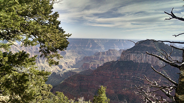
 The setting sun casts shadows deep within Transept Canyon. [photo by John S.] |
 The perfect ending to another perfect day on the North Rim. [photo by Wayne] |
|
Monday morning, our last full day on the North Rim, and six of our campers are departing the group early to start the long drive back to the Phoenix area. Mary is driving back to Flagstaff, while Deirdre is heading back to the valley. Roy and Sandra are also leaving early. Tamar and Ken are leaving as well, but plan on taking the rim drive out to Cape Royal and Point Imperial and getting in one last hike on the Cape Final Trail, so they get an extra early start this morning. The rest of us make the drive down to Cape Royal, farthermost point on the Rim Drive, and will begin working our way back from there, ending up at Point Imperial late in the afternoon. The Rim Drive starts on the Kaibab Plateau, but near the junction with Point Imperial Road we transition to the Walhalla Plateau and most of the drive from there down to Cape Royal hugs the northeastern edge of the plateau, offering several great vista points looking far out into the canyon. |
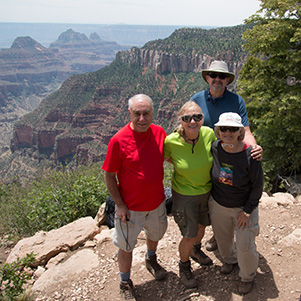
 19 Trailblazers gather for a group picture at Cape Royal. [photo by Quy] |
|
Front Row: Quy, Wayne, Jade, Lin, Monika, Rudy, Gary. Back Row: Barry, Megan, Michael, Rebecca, Kim B., Sandy, Dottie, John R., Jim, John S., Kim Z., Chuck |
 Angels Window near Cape Royal. [photo by Chuck] |
 Close-up of window with view of Colorado River. [photo by Wayne] |
 Vishnu Temple and Wotans Throne from Cape Royal. [photo by Chuck] |
 Wotans Throne is one of the largest formations in the Grand Canyon. [photo by Quy] |
 Vishnu Temple is one of the most widely recognized of the canyon’s many temples. [photo by Chuck] |
 Spectacular view from Cape Royal. [photo by Quy] |
 Lin and Jade high atop Angels Window. [photo by Lin] |
 The beautiful views from Cape Royal are virtually endless. [photo by Wayne] |
 Barry studies the canyon and the river from Cape Royal. [photo by Megan] |
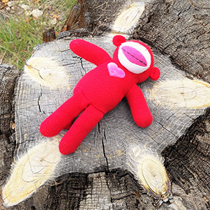
 Sock Monkey poses in front of Wotans Throne. He’s having a blast on this trip, according to Jade. [photo by Lin] |
|
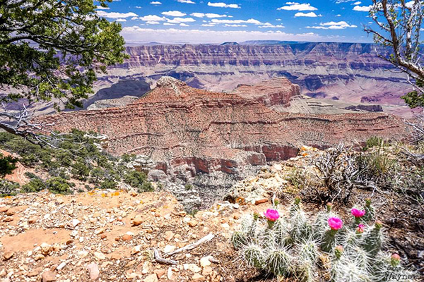
Due to time constraints (so many trails and so little time), we were forced to forego the Cape Final Trail on the last day or our 2013 North Rim trip. But I was determined not to let that happen again this time. For one thing, Quy would have never forgiven me and would be reminding me of my oversight for the next five years. Thus the reason for zipping straight down to Cape Royal today, the farthermost point on the Rim Drive, and then hitting the Cape Final Trail as our third stop of the day right after Walhalla Overlook. This way we can’t possibly run out of time to do the hike. Or at least that’s the plan anyway. And so it is that we begin our final hike on the final full day of the 2016 North Rim car-camping trip on a trail appropriately enough called Cape Final. How is that for good planning? The Cape Final Trail is an easy 4.2-mile round trip hike, with only minor elevation change over the course of the trail, that will take us out to the southeastern-most tip of the Walhalla Plateau. We hit the trailhead around 11:00 am and the weather is ideal, with mostly cloudy skies to shield us from the sun, a light breeze blowing out of the southwest, and a comfortable temperature of about 75 degrees. Does it get any better than this? |
 View from Walhalla Overlook. [photo by Chuck] |
 Trailblazers move out smartly on the Cape Final Trail. [photo by John S.] |
 It’s just a simple walk in the woods for these hardy hikers. [photo by Quy] |
 Kim B. enjoys the views from Cape Final. [photo by Quy] |
 Chuck scopes out the canyon from his rocky perch on Cape Final. [photo by Quy] |
|
The first quarter mile of trail has a steady but gentle ascent and levels off after that. After about 40 minutes we hit what some of us mistakenly believe to be Cape Final since it initially appears to be the end of the trail and offers a great view looking into the canyon. I even remark to Jim that we covered that 2.1 miles in near-record time. But then we look farther down along the rim and see a faint trail continuing on into the distance. There are actually several more great lookout points along the trail, as it runs parallel with the rim, before it finally terminates at the real Cape Final, an elevated rocky outcropping perched right at the edge of the rim. It’s here that I finally re-join the rest of our hikers, some eating a light lunch and others simply admiring the stunning 180 degree panoramic views from the outcropping. Wayne and Quy are both composing and snapping dozens of pictures in all directions, while I carefully pick and choose since I’m on my last roll of film. Film? What the heck is that? Yes, I’m apparently one of the last people left on earth still shooting with film, that little cartridge of light sensitive material neatly rolled up inside that you load into the back of those prehistoric cameras from the dark ages. It’s a hard habit to break, especially with three film cameras and 40+ years of film shooting under my belt. But one of these days ... Reluctantly, but also out of necessity as well since sitting on rough boulders for prolonged periods can be, to put it somewhat delicately, tough on the tushie, we all finally give up our positions on the rocky outcropping and begin heading back down the trail. Next stop: Roosevelt Point. |
 Rudy always prefers living on the edge. [photo by John R.] |
 Wayne is in perfect position for the perfect shot. [photo by Jim] |
 Spectacular canyon view from Cape Final. [photo by Wayne] |
 Parting shot from Cape Final. [photo by Chuck] |
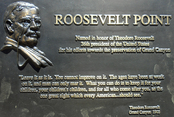 Words of wisdom from a President who was instrumental in the creation of Grand Canyon National Park in 1919. [photo by John R.] |
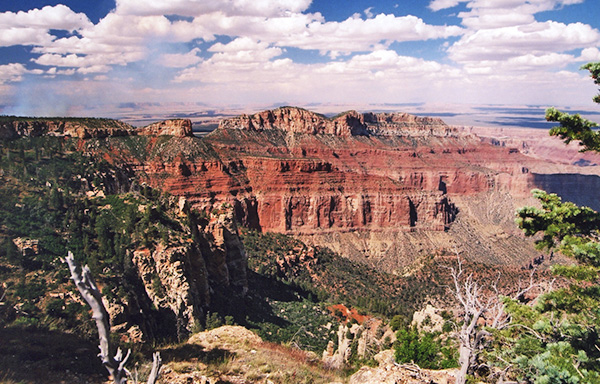
 Terrific view from Roosevelt Point. [photo by Wayne] |
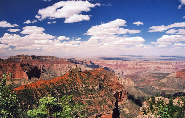
 Sweeping canyon view from Vista Encantada. [photo by Chuck] |
 At 8,803', Point Imperial is the highest viewpoint on the North Rim. [photo by Jim] |
 Sweeping panoramic view from Point Imperial. [photo by Wayne] |
 Panoramic view from Point Imperial, centered on Mt. Hayden. [photo by Wayne] |
 Tighter shot from Point Imperial, still centered on Mt. Hayden. [photo by Quy] |
 And now...will the real Mt. Hayden please stand out? [photo by Chuck] |
 View of Saddle Mountain from Point Imperial. Note the smoke rising from the left side of the picture. [photo by Chuck] |
 Parting shot from Point Imperial at the end of Point Imperial Trail. [photo by Chuck] |
|
Michael, Kim Z., Lin, Jade, Barry, Megan, and Rebecca all decide to split from the main group after leaving Cape Royal and check out the Cliff Spring Trail and other areas of interest instead. |
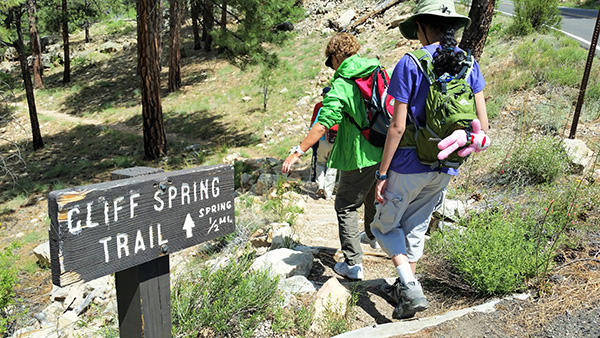 Trailblazers start hiking from the Cliff Spring Trailhead. [photo by Lin] |
 Better watch out for bears in there. [photo by Lin] |
 The trail goes through an alcove in the cliff face. [photo by Lin] |
 Major overhang along this stretch of trail. [photo by Lin] |
 Upside down fern. Life always finds a way. [photo by Barry] |
|
Supplemental Report by Kim Zeman |
|
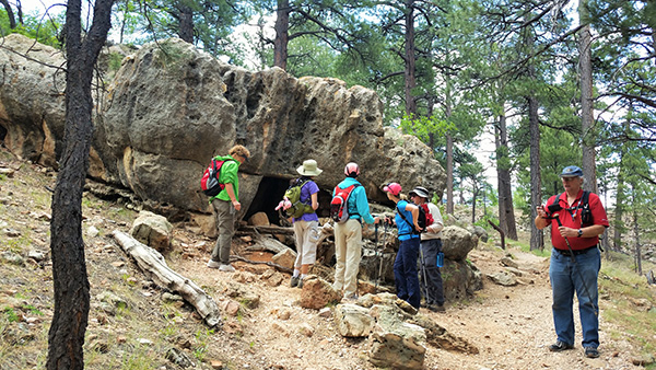
Michael, Kim Z., Lin, Jade, Barry, Megan, and Rebecca all decide to split from the main group after leaving Cape Royal and check out the Cliff Spring Trail and other areas of interest instead. Here is Kim’s supplemental report on their activities for the day. After visiting Cape Royal, six rogue Trailblazers broke off from the group hiking to Cape Final to follow Michael as he led us to some alternative points of interest along the Walhalla Plateau. Our first stop was the Cliff Spring Trail, which is an easy one-mile roundtrip hike along a forested canyon to a spectacular rocky overhang dripping with spring water that feeds the plants and moss growing from the rock. Along the way we passed an ancient Anasazi granary, a small rocky structure in surprisingly good condition, probably because visitors are admonished to “not touch” by the adjacent sign. We didn’t touch! Our next stop along the road was the Walhalla Overlook and Walhalla Ruins. First we visited the Ruin site and were given the facts and history by Jade reading from the Site brochure. Next we walked to the overlook and found the perfect place with perfect sitting rocks to enjoy our lunch while reveling in the canyon views. Lin hacked up a refreshing watermelon and shared some of it with us before she consumed the rest of it herself. From Walhalla we drove to Roosevelt Point and enjoyed the civilized facilities before partaking of some more incredible views from the overlook there. A short path took us to a different perspective view of the canyon. The final treat on our mini road trip was a stop at Greenland Lake, a short distance from the “Y” in the road leading back to camp. We took a short 200 yard stroll through grassy wetlands to a marshy pond that cattle drank from in the 1890s. There was also an old cabin on the site that housed salt for the cattle. Here we also learned the skill of “grass-honking” from Megan, who brought this musical talent from childhood. We serenaded the hills by holding a piece of fat grass between our hands and blowing our melodious notes until our laughter interfered. Kim |
 Jade checks out some interesting lichen growth in this overhang. [photo by Lin] |
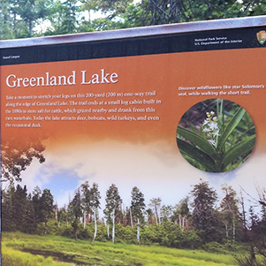 Greenland Lake, source of the perfect grass. [photo by Lin] |
 Trailblazers look over the Walhalla Ruins. [photo by Lin] |
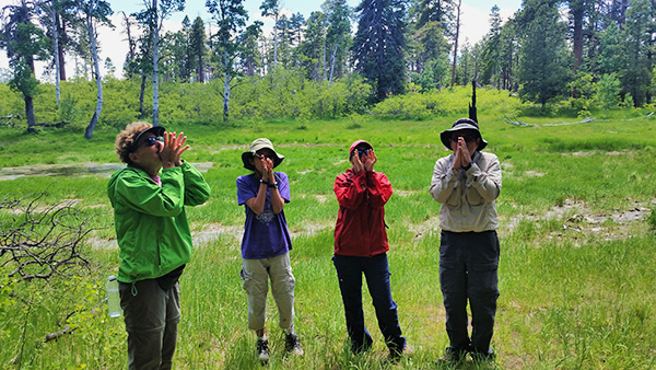 Grass for what, you ask? For grass-honking, of course. Meet the North Rim Grass-Honkers Quartet — Kim Z., Jade, Megan, & Barry. [photo by Lin] |
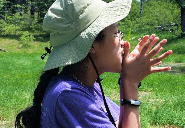 Jade demonstrates the correct technique. [photo by Lin] |
|
I know. It’s a baffling mystery to me as well. So hopefully these explanations from Megan, Kim, and Jade will help clear up any remaining questions. Megan:My dad taught me when I was little how to make an instrument out of a piece of grass. Not just any grass, though, it has to be the right kind...like the kind we found at Greenland Lake. When done properly, it’s loud, and can mimic all kinds of animal noises. We’re pretty sure we scared away any lingering wildlife in the area after our quartet performed. And Jade is now a pro grass honker. Kim Z.: Actually, what grass honking entails is taking a wide blade of grass and securing it vertically along the length of your outer thumbs with them pressed together, holding that apparatus up to your mouth, and blowing forcefully. Musical success is about 50%. Jade: It’s kinda hard to explain but it’s super fun. |
 Megan, Kim, and Jade check out the old salt storage cabin. [photo by Lin] |
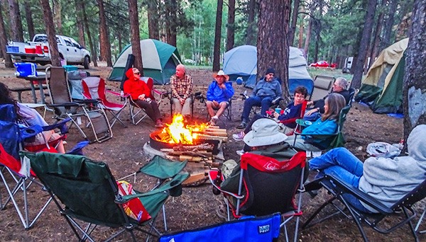 We gather around our last campfire on Monday evening. [photo by Wayne] |
 Rudy stokes the campfire with more firewood. [photo by Wayne] |
 Kim B. finds the perfect spot for watching rafters coming down the river. [photo by Lin] |
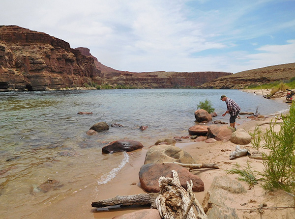 Dottie is doing a little beach combing in the Lees Ferry area. [photo by John R.] |
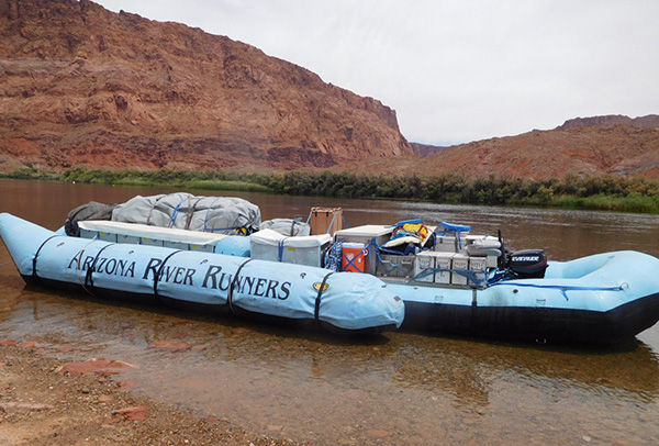 This supply raft is about ready to head down river. [photo by John R.] |
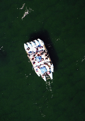 Rafting party beneath the Navajo Bridge in Marble Canyon. [photo by Chuck] I check all around the campground one last time for any lost or forgotten items or stray bits of trash and then start making the rounds among all of our campers. We all wish one another a safe journey back home and after a final goodbye and a wave or two we all start heading out at different times. Yanis and Vanessa will take their time and be our camp guardians as the last two hikers to depart from the campground. I just hope they remember to turn off all the lights and lock the door before they leave. We form a mini three-vehicle caravan with Sandy and me in the lead vehicle, followed by John S., Wayne, and K.G. in John’s Jeep, and then Rebecca in her own vehicle. Our plan is to stop for a few photo ops along Highway 89A as we skirt along the southern edge of the Vermilion Cliffs area, make another stop at the Navajo Bridge and Marble Canyon area, and then head up Highway 89 at the Bitter Springs Junction for one last short hike out to the Horseshoe Bend Overlook on the Colorado River. We missed this on our last two North Rim trips, and I certainly don’t want to miss it again, being this close. After that, we plan on driving into Page for a late lunch at the Mandarin Gourmet Chinese Restaurant that John R. keeps raving about. This better be good John (actually it was quite good). |
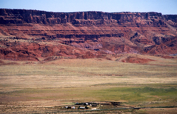 Small ranching community below the Vermilion Cliffs. [photo by Chuck] |
 The colorful Vermilion Cliffs soar high above Highway 89A. [photo by Chuck] |
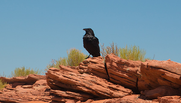 Near the Horseshoe Bend Overlook, this raven is king of the hill. [photo by John S.] |
 View 1: Horseshoe Bend Overlook on the Colorado River. [photo by John S.] |
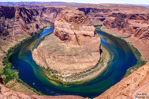 View 2: Horseshoe Bend Overlook on the Colorado River. [photo by Wayne] |
|
And then we finally point our vehicles south once again and make a non-stop beeline for home. Well, not quite non-stop, but close anyway. What a trip and what a grand adventure this has been for everyone. After all the results are in and the number crunching is completed, we have 31 hikers doing 74 individual hikes and completing a grand total of 647 miles on the 2016 North Rim trip, a brand new record for an Arizona Trailblazers car-camping trip. Congratulations to each of you for a job well done! I think all of us are already looking forward to the next Arizona Trailblazers adventure on the North Rim of the Grand Canyon. Be well, take care, and Happy Hiking on the always amazing and scenic trails of Arizona. And always remember that it’s not the destination, but instead the journey itself that really matters. |
|
I can’t even remember how many times I’ve visited the Grand Canyon, both North Rim and South Rim, over the last 40+ years. But every time I come back to this place it’s almost like seeing it all over again for the very first time. The anticipation, the excitement, and the short adrenaline rush are all still there after all these years and decades and never seem to diminish. Most of my time at the canyon is spent on one of the two rims, but I’ve also been fortunate enough over the years to do six multi-day backpacking trips all the way down to the bottom of the canyon and the Colorado River where we typically stay for three or four nights, depending on whether we go in from the South Rim (3 nights) or the North Rim (4 nights). The Grand Canyon below the rim is another world into itself, and if you want to truly understand and appreciate this canyon and absorb the full experience with every single one of your senses, you need to spend several days and nights on the bottom of this very unique and special place that the National Park Service itself describes as “The crown jewel of America’s natural treasures.” To most casual observers the Grand Canyon never seems to change and in fact, geologically speaking, it doesn’t change to any extent that we can perceive during our relatively short time on this earth, mere seconds on the virtually incomprehensible scale of geological time. But if you take the time to stick around long enough and really study the canyon, you can begin to appreciate it more and actually notice very subtle changes taking place — minute by minute and hour by hour — something as basic as clouds. The passage of clouds, particularly large cumulus clouds, creates a constantly changing pattern of shadows throughout the canyon. And when weather conditions are just right, the entire canyon can fill with a thick layer of clouds, allowing only the tallest formations to poke through. Looking deep into the Inner Gorge, with its endless array of temples, buttes, pinnacles, hanging terraces, cliffs, and spires stretching into infinity in all directions, the movement of the sun subtly changes colors from just beneath the rim to deep within the canyon. I like to call it Mother Nature’s light and magic show, especially when watching the sunrise from a place like Bright Angel Point. The first golden shafts of sunlight breach the canyon rim and ever-so-slowly begin to paint the canyon’s cliffs, terraces, buttes, and temples in a kaleidoscopic fusion of soft pastel colors from pink to burning gold, starting from the uppermost points and almost imperceptibly working their way deeper and deeper into the unseen shadowy depths of the canyon, as the sun slowly climbs higher above the rim. Large thunderstorms over the canyon are an entirely different experience and something few visitors ever get to witness. I’ve been one of those fortunate few, although at the time I certainly wasn’t feeling so fortunate, to witness just such a major storm. I’m standing on the South Rim of the Grand Canyon in the middle of a raging thunderstorm, both overhead and below the Rim, and I’m cold and soaking wet down to my water-filled boots. This was certainly not intentional. On our October, 2010 South Rim car camping trip several of us were walking to Hermits Rest at the far west end of the Rim Trail when we were completely overtaken by a fast-moving thunderstorm, with a driving downpour and gale-force winds howling across the canyon. All shuttle service stopped during the storm, and the only shelter was a grove of juniper trees close to the edge of the canyon next to the trail. So I hunkered down here to wait it out, completely alone since we were all separated during the storm, with some catching last-minute rides back to the campground before the shuttles quit running. I watched, completely mesmerized, as the storm unleashed curtains of water, torrents of water, deep into the canyon, with massive bolts of lightning crackling through the atmosphere above and below the Rim, discharging white-hot arcs of electricity instantaneously branching off into multiple fingers deep within the canyon, followed by the deafening sonic boom of thunder that reverberated throughout the canyon and literally shook the ground with shock waves. It’s almost as if I was in another dimension, in another universe, and watching creation itself unfold right before my eyes. So in truth, the Grand Canyon is anything but static, and no two days spent here are ever quite the same. |
 Indian Paintbrush. [photo by John S.] |
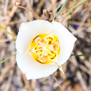 Doubting Mariposa Lily. [photo by John S.] |
 Cliff Rose & pollinator. [photo by John S.] |
 Unknown blooms. [photo by John S.] |
 Yes, prickly pear cactus blooms on the North Rim. [photo by Lin] |
 ... and just as beautiful as they are in the Sonoran Desert. [photo by Quy] |
 Cascade Penstemon. [photo by Quy] |
 Delphinium. [photo by Quy] |
 Lupine. [photo by Quy] |
 Beardtongue [photo by Quy] |
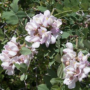
 Fabaceae. [photo by Quy] |
 Primrose. [photo by Quy] |
 Palmer’s Penstemon. [photo by Quy] |
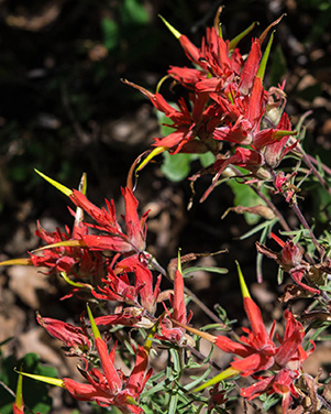 Indian Paintbrush. [photo by Quy] |
 Lupine leaves covered with exquisite drops of dew. [photo by John S.] |
|
→ I invite you to ride with me on my Harley
Davidson from the campsite through the park. Karen Larson. |
|
I calculated all of the distances in my slideshow using the coordinates from Google for each point. Google knows the coordinates for all of the locations that we stopped at on the North Rim if you search for them, e.g., “Coordinates for Uncle Jim’s Point.” I plugged the coordinates into the app Coordinate Distance Calculator. |
| John S. |
|
Coordinates for Humphreys peak 35.3467° N, -111.6785° W Coordinates for Uncle Jim’s Point 36.213318° N, -112.036560° W Distance from Humphreys Peak to Uncle Jim’s Point 63.04 miles, Compass Direction = N (341°) |
|
During our introductions at the Widforss Trailhead on Friday morning, I asked everyone to tell the group if this was their first visit to the North Rim or their first visit to the Grand Canyon. Several people indicated this was their first visit to the North Rim, while a couple of people said it was their first visit ever to the Grand Canyon. So after the trip I asked all the first-time visitors to please send me their thoughts and impressions on seeing either the North Rim or the Grand Canyon for the first time, and here are the responses I received. from John Scruggs:Quiet! That is the main thing I noticed. No busses or trains! I felt closer to nature as soon as I walked away from the tiny “downtown” district around the lodge. Regarding the views, I found that the North Rim has many more capes that extend out into the canyon. In comparison, the South Rim is much more of a straight line of cliffs. Finally, everyone there, from the solitary bicyclists to the large families with pets, seem to me to be more into the park experience. We were all thrilled to be somewhere that fewer people or dogs are privileged to visit. from Gabe:My excitement started as we drove through the meadows towards the entrance of the North Rim. There we were, in Arizona, driving through meadows surrounded by tall evergreens. And then, to top it off, we saw a heard of bison very close to the road, just grazing and enjoying life. It was all so amazing. The sun was shining and there was a nice breeze- not too hot. It was simply perfect. The campground ended up being great. I’m not an experienced camper, by any means, but it was an enjoyable experience and I would do this again. The campground was as convenient as you can get. Bathrooms everywhere, showers and a general store with a nice porch. It was lovely just getting up early, making coffee and enjoying 'being' there. The hiking was great with a variety of hikes such as the tough Roaring Springs hike, or the scenic Widforss trail, or even the pleasant trail that linked the campground to the lodge. I loved that there were trails all over and one could just get out there and walk/hike. There was a hike for everyone. Overall, I thoroughly enjoyed going to the Grand Canyon North Rim and am planning on going back there soon. Thanks again for organizing this trip. from Kim Z.:My impressions of the Grand Canyon North Rim aren’t “novel worthy” and certainly aren’t due credit for the work of writing them down! My experience in backwoods adventures and epic camping trips is so limited, I have little past to provide comparisons. What I will say stood out for me at the North Rim was the vastness unmarred by throngs of people. To be in a renowned national park in peak season and be on a trail where you came across less than 10 other hikers who weren’t in your group was welcome and surprising. I had most of the comforts of any civilized recreational area without it being over-civilized. Definitely worth the extra 4 hours it took to get there over the closer South Rim. Thank you again for putting all this together. from Jade:I know my first impression of the North Rim should be “wow the canyon is so beautiful” or something like that. But it’s not. Sorry. I thought the North Rim was very green and kinda cold. I mean, yeah the canyon was super nice looking and stuff and was definitely less crowded (the food and lodge were good too), but I was super impressed by the sheer amount of greenness on the rim. The South Rim never really had this much vegetation, which made this trip even cooler (haha yeah my puns are terrible I know), considering that the South Rim is the only Grand Canyon I ever really got. Canyon-wise, the North Rim seemed hazier (probably just my glasses) and less panoramic than the South Rim. Maybe it was just me, but the North Rim canyon seemed less humongous and more intimate, like you-could-touch-the-rocks, instead of you-could-take-pictures-of-the-rocks-and-look-at-them like the South Rim. The canyon feels closer, less alien landscape and more down-to-earth real. For the trip, I enjoyed puddle-slamming (sitting in Michael’s truck as he sped up, over, and through puddles and rocks of various kinds) and grass-honking (it’s kinda hard to explain but it’s super fun) and really didn’t enjoy getting up in the morning or mosquitoes who for some strange reason love me. Overall, the North Rim camping trip was really awesome and I would love to go again. Only for Michael’s chocolate chip cookies. Just kidding. Not really. from Megan:The North Rim from my perspective: I had been to the Grand Canyon before, but only to the South Rim. As beautiful as the Canyon is from the South Rim, I was really impressed by the sights from the North Rim. Before I got there, I thought, “well I’ve been to the Grand Canyon before, and once you’ve seen it, you’ve seen it,” but that was definitely not the case. There were so many trees, countless shades of red on the rocks, and great views of Mount Hayden. Even from one lookout point to the next, there was something new and remarkable to see. My favorite vantage point of the Canyon on this trip was from on top of my mule, Jen, who led me down part of the Roaring Springs trail. Although she walked dangerously close to the edge of the pathway, I’d do it again; it was a North Rim experience I will not soon forget. Thanks again for everything! from Jim:For twenty-nine years I lived in Arizona without visiting the Grand Canyon. Of course I saw an infinity of stunning photos, which people told me repeatedly were just poor imitations. But surprisingly, when I first saw the Canyon in real life, it was pretty much as I expected. Huge, unbelievably huge, and deep, unbelievably deep. Lit by ever-changing sunlight and cloud shadows. Showing layer upon layer of stratified rock going back millions of years. Which was, again, pretty much what I expected. But where the canyon really struck me was during our visits Sunday and Monday to an assortment of vistas and lookouts located miles apart from each other. Each had its own view, each had its own features, each had its own wonder. The rock formations were different, the crags and bluffs were different, the mountains were different. Some, to my surprise, were green with vegetation. Some showed traces of Native Americans living there thousands of years ago. There were thousands, perhaps hundreds of thousands, of features to see, each created by nature, each with its own story to tell. It just never ends. And all that from mere glimpses of one tenth or one twentieth of the whole canyon. If only I were an eagle that could soar, dive, and explore the entirety of it. Now that’s Grand. from Rebecca:I admit that my only exposure to the Grand Canyon prior to our trip was the movie Vacation and the occasional photo in National Geographic or as the backdrop for a magazine advertisement. That’s why I jumped at the chance to visit the North Rim with our club, though I also really didn’t understand how much it differs from the South Rim. Apparently, the majority of people including native Arizonans don’t either, because everyone I spoke to about our itinerary before and after our trip had never been to the North Rim or even considered it. But I knew if our club was making the trek, it was going to be good. My first impression is the Grand Canyon is deeply misunderstood. Its very name is misleading since it isn’t one canyon but several with springs and creeks that offer more opportunity to explore beyond the Colorado River if rushing rapids aren’t your idea of a good time. It’s incredibly verdant and diverse in plant life. I just expected rock layers in earth tones. I spent more time looking at all the flowering trees and shrubs, cacti and wildflowers in peak bloom than the actual Grand Canyon. Mother Nature is not only the best artist but the best gardener; the world’s top gardeners couldn’t have achieved the exquisite rock gardens along the trail to Roaring Springs within their lifetimes. There’s a subtle randomness to these plant groupings that results in sophisticated perfection. One must get in the canyon to really understand and experience the canyon. I’m not sure visitors get this point because from the rim-to-rim hikers I met, they seemed to be doing it for the physical accomplishment alone. Did they see anything in their delirium? The temperature varies greatly from rim to rim and depending on depth and season. Why do people visit the South Rim in the summer when it should be enjoyed in the spring and fall especially when schools have breaks during those seasons too? I ask because so many people I spoke to didn’t know they have options. Different destinations within the park can be enjoyed year-round. I never knew one could go in winter and that it snows, a lot. I blame Vacation. |
 Top of Page
Arizona Trailblazers Hiking Club, Phoenix, Arizona
Comments? Send them to the AZHC .
updated October 22, 2022