Outdoor Links
Hike Arizona
Trip Planning Guide
Trip Report Index
Calendar of Events
Library
|
Pipeline Canyon Day Hike Lake Pleasant January 16, 2016 by Gabrielle McConnell |
|
|
Well, the day started out pretty darn cold at 40 degrees for the 20 of us that gathered at the meeting point. Thankfully it would warm up to 57 by the end of the hike. We car pooled over to Lake Pleasant Recreational area trailhead and after a photo and brief hike overview took off. This would be an in and out hike of some 8.5 miles for those taking the long version and 6.1 for those doing the shorter hike. The great thing about this hike would be views of the water from all vantage points, a floating bridge and Yavapai Viewpoint ... and who doesn’t like to see the water? |
||||
 Ready to hike Pipeline Canyon. [photo by John] |
||||
|
||||
|
The first part of the hike was slightly downhill and in the shade, so still somewhat cold. But we hustled along and when we rounded the bend we could see a rather uncommon sight for Phoenix,a floating bridge. This was pretty neat to see and fun to cross. |
||||
 Approach to the floating bridge. |
||||
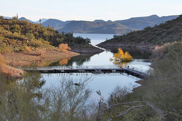 Floating Bridge. [photo by Wendy] |
||||
 Submerged tree seen from the floating bridge. [photo by Wendy] |
||||
|
We followed the trail about 1.4 miles then took the relatively new Yavapai spur to join the Yavapai Point trail. We took this trail for 0.9 miles to the Yavapai Lookout. This part was a bit of a climb, but the views are worth it. As one fellow hiker said “This is the money shot.” Simply spectacular and we had a clear, sunny day to admire it all. |
||||
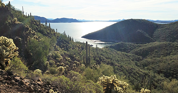 Views on our way to the Yavapai Lookout. [photo by John] |
||||
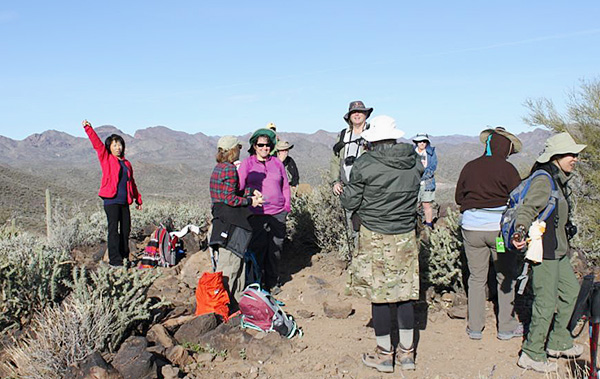 Taking a break at the Lookout. [photo by Wendy] |
||||
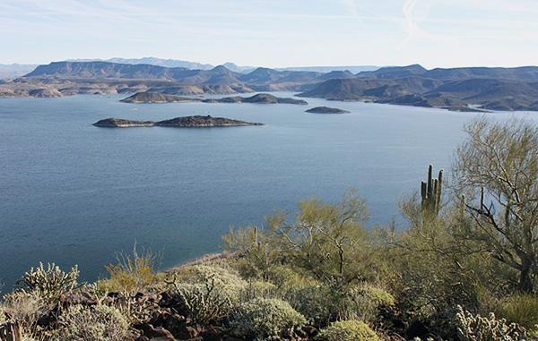 View from the Lookout. [photo by Wendy] |
||||
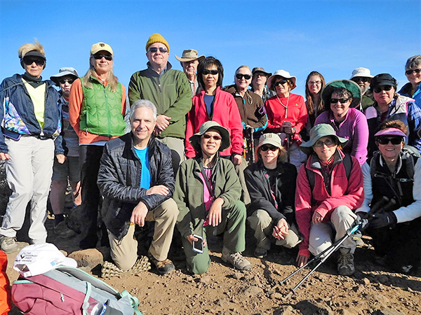 Group Photo at the Peak. [photo by John] |
||||
|
After pausing at the top to admire the spectacular 360 degree views from on high, and doing the belated introductions, we made our way back down taking the Yavapai Point trail to the North Pipeline Canyon Trailhead. |
||||
 Spectacular views along the way. [photo by John] |
||||
|
At this point, we took a bit of a break and those opting for the shorter hike, turned and took the Pipeline Canyon trail back to the South Trailhead. Those on the longer hike pushed on taking the Cottonwood trail. This is a somewhat flat trail that winds through various wash areas. It leads to the North Entrance station, where we turned around and retraced our steps to the originating Trailhead. By this time the temperature had risen nicely to a balmy 57 degrees and the sun was shining brightly, so an absolutely perfect hiking day. We kept a good pace on the hike, not much resting and per Jim’s stats burned 890 calories. So, of course, we needed to eat. A group of us repaired to Azools for a much-deserved lunch. |
||||
 Lunch at Azools table 1. [photo by John] Funyung, Becky, Suzanna, Gabe, Lee, Dottie, John, Robin, Jim |
||||
 Lunch at Azools table 2. [photo by John] Louis, Lin, Laurie, Michael, Julie, Monika |
||||
|
Thanks to everyone for joining us on this beautiful hike! |
|
Supplemental Report by Jim Buyens |
|||||||||||||||||||||||||||||||||||||||||||||||||
|
Thanks to everyone who came out for this hike, and especially to you, Gabe, for finding such a wonderful trail and for doing such a great job leading the hike. Jim |
|||||||||||||||||||||||||||||||||||||||||||||||||
|

|
||||||||||||||||||||||||||||||||||||||||||||||||
 Top of Page
Arizona Trailblazers Hiking Club, Phoenix, Arizona
Comments? Send them to the AZHC .
updated December 31, 2019