Outdoor Links
Hike Arizona
Trip Planning Guide
Trip Report Index
Calendar of Events
Library
|
Salida Gulch Loop/Lynx Lake Loop Prescott November 5, 2016 by Chuck Parsons |
|
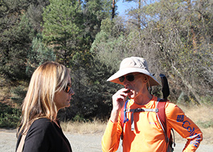
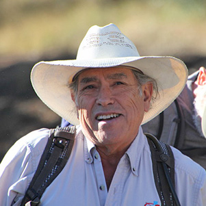
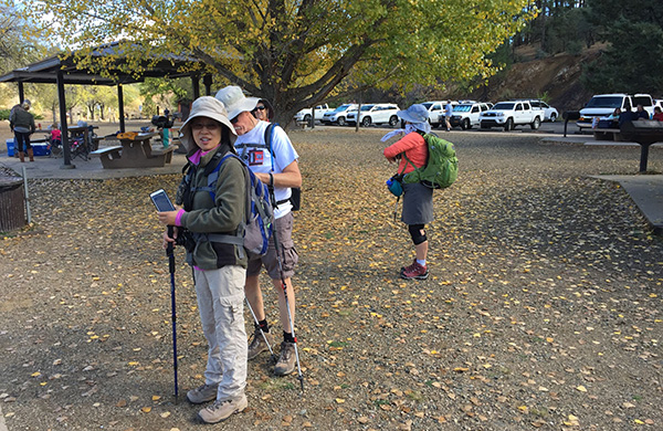
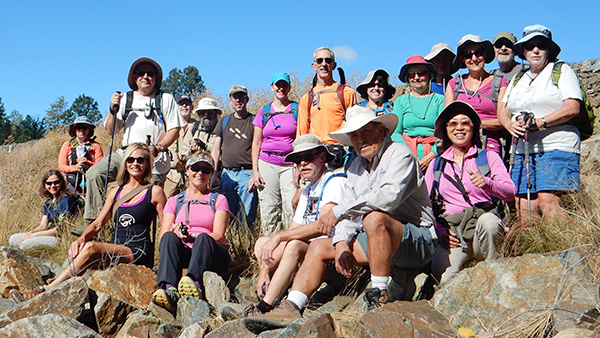 Ready to hike. [photo by Lin] |
||||
|
||||
|
The time is 9:45 AM on a beautiful Saturday morning in the Prescott area, as twenty Arizona Trailblazers gather at the Salida Gulch Trailhead for today’s hike on the Salida Gulch Loop Trail #95. On this perfect fall morning in early November, with clear blue skies and a temperature of 50 degrees, we’re prepared for a terrific day of hiking in the Prescott National Forest. So we strike out in single file down the trail in search of a good location for our mandatory group picture. Today’s hike was originally scheduled to be the Dogie Trail in the Sycamore Canyon Wilderness, north of SR 89A and roughly midway between Cottonwood and Sedona. However, concerned about the amount of rainfall predicted for much of northern Arizona on Thursday and Friday before the hike, I finally got through to someone at the Red Rock Ranger District south of Sedona. I was informed that the entire area got a lot of rain on Thursday, with more predicted for Friday, and therefore they were strongly advising against driving on FR 525C to the trailhead due to very muddy and slippery road conditions. What now? |
 Trailblazers gear up for the Salida Gulch Loop Trail. [photo by Carl] |
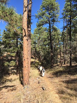
 Twenty Trailblazers charge up the Salida Gulch Trail. [photo by Lin] |
|
In cases like this the hike leader should always have a good solid Plan B as a backup. My Plan B? Help! So I sent out a couple of emails to everyone signed up for the hike, saying that we would have to postpone the Dogie hike and fielding suggestions for alternate hikes. With several good ideas to choose from, I decided on Laurie’s suggestion of the Salida Gulch Loop Trail since this is an exploratory hike the club has never done before, and sounds like a very interesting hike. So the plan now (Plan B, that is) is to hike the 4.1-mile Salida Gulch Loop and then drive a short distance down Walker Road to reach the Ranch Trail #62, which will give us an additional 5.4 miles of hiking, for a total of 9.5 miles for the day. Perfect! |
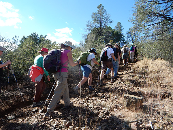 Dang! We’re still charging up the Salida Gulch Trail! [photo by Lin] |
 We’re not quite sure what's going on in this picture. [photo by Carl] |
 Top of the hill and time for a breather. [photo by Carl] |
|
For someone who has never hiked the Salida Gulch Trail before, finding the trailhead from the parking area can be a little confusing. Thankfully we have April with us today who has done this loop hike several times before, most recently during the previous weekend. To reach Salida Gulch Trail #95, you have to first take Salida Connector Trail #9263 across Lynx Creek and just past the gate. Trail #95 begins on the right. |
| A Rogue's Gallery of Hikers, Part I [photos by Carl] | |
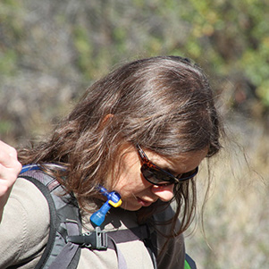 Anikó |
 Marilyn and Dale |
 April and Tom |
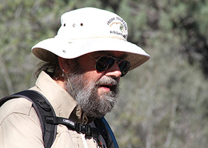 Jim |
 April |
 Darrell |
|
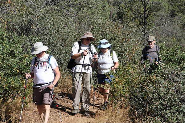
The trail is level for a while, before beginning a gentle but steady uphill climb through typical chaparral landscape of scrub oak, manzanita, and jojoba, with a mix of pinion pine, juniper, and willow thrown in for extra measure. As we steadily gain elevation we’re eventually treated to sweeping views of the Bradshaw Mountains to the south with Mount Union, the highest peak in the range, at just under 8,000 feet. There are at least six peaks in this range over 7,000 feet in elevation. Probably the most well-known of these peaks and one this hiking club has done many times in the past is Spruce Mountain, at 7,696 feet the third highest peak in the Bradshaws and accessed from the Groom Creek Trail. There’s also gold in them thar hills, first discovered way back in 1863, along with silver and copper. Over 150,000 ounces of the precious yellow metal was taken from the famous Crown King Mine alone. In today’s gold prices that works out to about $120,000,000. Not a bad haul for one Arizona mine. |
 Trailblazers strike out on Trail #94 for Lynx Lake. [photo by Lance] Our original plan was to complete the Salida Gulch Loop and then drive a short distance down Walker Road to the trailhead for Ranch Trail #62. But hiking Trail #94 over to Lynx Lake and then hiking the scenic perimeter trail around the lake will give us about the same amount of hiking mileage without having to get back into our vehicles and backtrack down the road to reach the Ranch Trail. It will also be a more scenic hike all the way around Lynx Lake. The old Motorola Hiking Club did a car-camping trip at Lynx Lake many years ago, one of the first such trips that I made with the club. I remember the beautiful hike around the lake as being one of the highlights of the entire trip, that is, outside of gorging ourselves on Jeannie Van Lew’s mouth-watering and totally decadent Dutch Oven peach cobbler. And the biggest thrill for all of us back then, was watching (from a respectful distance, of course) a pair of nesting ospreys feeding and caring for their two young eaglets sitting in their nest, high atop a dead ponderosa pine overlooking the lake. |
 A gathering of Trailblazers at the first trail junction. [photo by Carl] |
 Hmmm — wonder where Trail #94 goes? [photo by Carl] |
 We have a map! How about Plan B, Revision 1? [photo by Lin] |
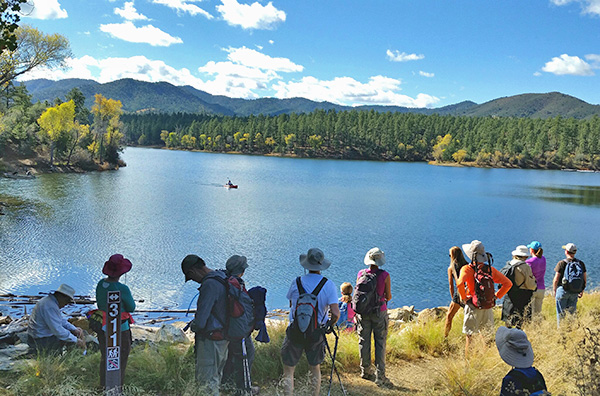 We take a break, as we watch kayakers glide across the lake. [photo by Lin] |
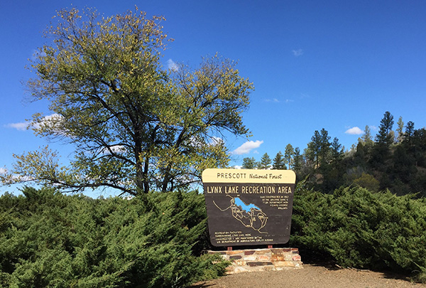 Lynx Lake Recreation Area sign. [photo by Lance] |
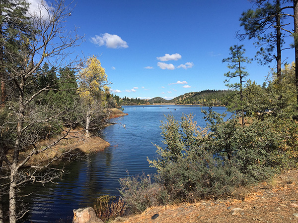
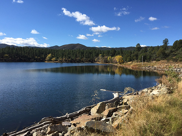 Sweeping view of spectacular Lynx Lake. [photo by Lance] |
 One of numerous boats cruising the lake today. [photo by Carl] |
 Fall colors will soon be at their peak on the shore. [photo by Tom] |
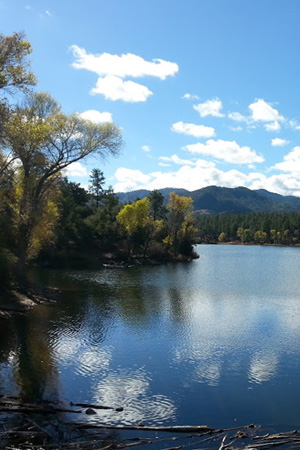
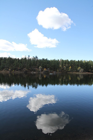 Cloud reflections on the lake surface. [photo by Carl] |
 Fluffy white cumulus clouds lazily drift across the sky above Lynx Lake. [photo by Lin] |
 One last look at Lynx Lake from a secluded cove. [photo by Lance] |
| A Rogue's Gallery of Hikers, Part II [photos by Carl] | |
 Lance |
 Lin |
 Mary |
 Steve |
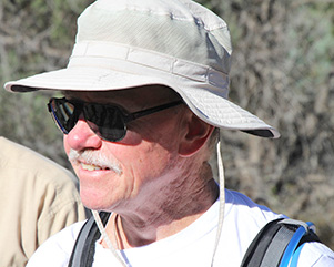
 Rudy |
 Rudy |
|
Lynx Lake was formed when the Arizona Game & Fish Department constructed a dam on Lynx Creek in 1962. The U.S. Forest Service constructed all the facilities around the lake, following the completion of the dam. Sitting at an elevation of 5,530 feet, this is a relatively small lake of 55 surface acres. But the lake is well stocked with rainbow trout, largemouth bass, crappie, and catfish. I definitely need to renew my fishing license and get back here one day to try my luck. |
 Flowers along the trail. [photo by April] |
 Cottonwood, resplendent with fall colors. [photo by Lance] |
|
About halfway around the lake we stop at a convenient picnic ramada to break for lunch and have the entire place to ourselves. On the vast majority of our hikes we’re lucky to find an area with a few large rocks, boulders, or fallen logs to sit on while we have lunch. So this is a totally unexpected and special treat with concrete tables and bench seats and plenty of shade to protect us from the sun. And real restrooms here, so no more hiding behind trees and bushes. The only problem with this kind of luxury on the trail is a general reluctance to get moving again after lunch. Some of us are beginning to turn into slugs and feel ready for a good nap by now. |
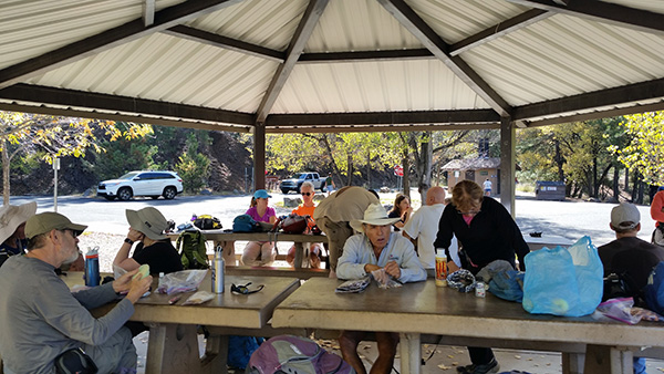 How is this for a convenient lunch spot? [photo by Lin] |
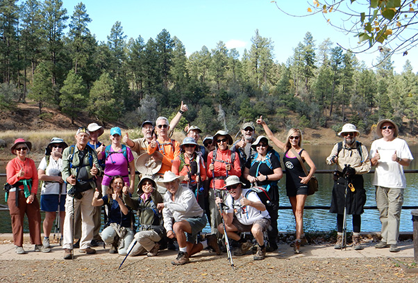 We finally have all twenty hikers together in one picture. [photo by Lin] |
||||||
|
 Lunch is over and Lin is anxious to hit the trail again. [photo by Lance] |
|
But our hike taskmaster Lin starts cracking her wicked whip again to get all of us well-rested hikers motivated and moving back down the trail once again. After all, we still have several more miles of hiking to complete before we can call it a day, and these late fall days are growing shorter and shorter. So we continue working our way around the lake on the two-mile Lakeshore Trail, before finally linking back up with the Connector Trail #94 and taking that back to the Salida Gulch Loop Trail. We make quick work of the east side of the Salida Gulch Trail, and less than a half-mile from the trailhead come across an interesting set of petroglyphs etched into the rock face. We make one final stop here to take a few last pictures before heading back to our waiting vehicles. |
 April and Lin admire the petroglyphs along the trail. [photo by Carl] |
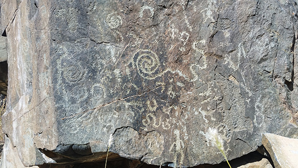 Close-up shot of the largest petroglyph. [photo by Lin] |
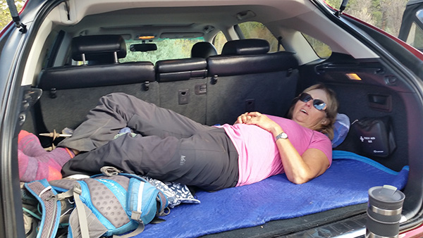 This is the way to relax after a long hike. Just ask Mary. [photo by Lin] |
 Famished Trailblazers are ready to chow down. H'mmm, is boiled boot leather even on the menu? [photo by Lin] |
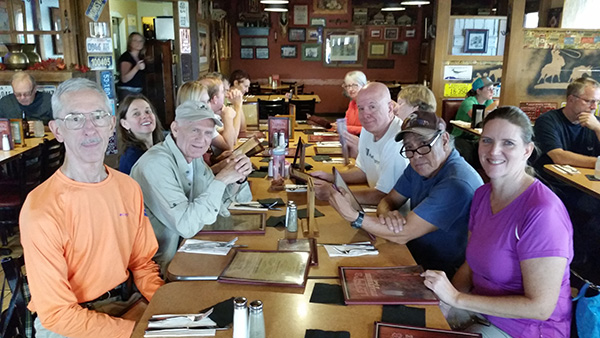
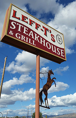 Leff-t’s Steakhouse, one of our favorite Prescott area post-hike lunch stops. [photo by Lin] |
By 2:00 PM we’re all back at the trailhead parking area. By now many of us are hungry enough to eat boiled boot leather, while at the same time reluctant to eat perfectly good hiking boots that have faithfully served many of us for years. So we decide on the next best option and head for Leff-t’s Steakhouse & Grill, located right off AZ 69 in Dewey-Humboldt. We’ve stopped here on several past occasions and have always enjoyed good food and good service. After a relaxing lunch and plenty of good camaraderie we bid one another good bye and head back down that long and winding road that points toward home. It’s been a beautiful day for hiking and another great hiking trail to add to this club’s ever-growing list of favorite Arizona hikes. We’ll definitely be back to do this hike again one day soon. In fact, it’s already on the calendar for November, 2017. |
|

|
||||||||||||||||||||||||||||||||||||||||||||||||
 Top of Page
Arizona Trailblazers Hiking Club, Phoenix, Arizona
Comments? Send them to the AZHC .
updated November 18, 2016