Outdoor Links
Hike Arizona
Trip Planning Guide
Trip Report Index
Calendar of Events
Library
|
Telegraph Pass Day Hike South Mountain April 9, 2016 by Tamar Gottfried |
|
|
|
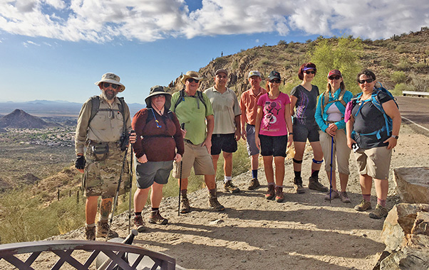
| Jim, Kristie, Joe, Sirous, Lance, Dana, Joan, Becky, Tamar |
|
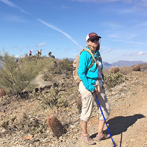
Nine trailblazers set out against a mellow, fluffy-clouded sky from the Desert Foothills South Mountain Trailhead after an easy shuttle from the 19th Avenue Trailhead. The only glitch was a full parking lot at this popular site, but patience helped us snag two spots. After an easy start on the paved trail, passing the cutest little hiker with her own tiny sticks, we started the unpaved steep climb to Telegraph Pass. |
|
|
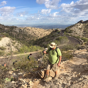
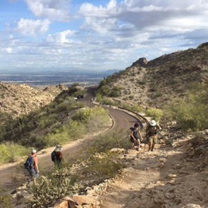
| Part of the trail parallels Telegraph Pass Road on the way up. | |
|
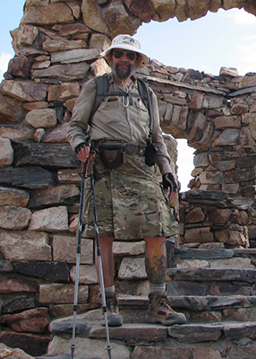
At the top, we paused for a group photo and a breath before taking a short jaunt alongside the busy road, with cars and road bikers whizzing by. Next we turned left onto the National Trail and went up the hill to the little stone house structure, where you have a great views of both downtown Phoenix and Ahwatukee. Jim tried to concoct an appropriate story about the little house to please inquiring minds. |
 I don’t think anyone is at home. |
 Jim figures it out. |
|
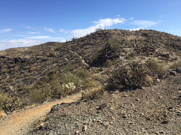
At this spot, we also met and chatted with members of the Arizona Hiking Facebook page who were doing the whole National Trail. Club key chains were bestowed, of course. A little more climbing and more great clear vistas until we got to the intersection with the Pyramid Trail. From there, we had a little more up and a lot of down until we reached the desert floor and traversed the flatter land to the trailhead. |
 There’s the junction. Which way do we go? |

|
|
| Becky admires the view from South Mountain. | |
 You can see much of the Valley of the Sun from here. |
 Cloud plays Peek-a-Boo with the ridge. |
 You see, it's like this ... |
 What are we waiting for? |
 Joan has a great idea. |
|
Refreshed from our morning jaunt, 6 of us went to the vegetarian/vegan Pomegranate Café for some lunch. While we weren’t fully excited about the coffee or nutmilk there, the food was healthy and satisfying. A good morning hike with a great group and one new Trailblazer added: Welcome, Joan! |
|
Supplemental Report by Jim Buyens |
|||||||||||||||||||||||||||||||||||||||||||||||||||||||
|
It was great seeing you all on last Saturday’s Telegraph Pass Hike. Tamar, you did a great job leading the hike, and everyone, it was a joy to be with you. I hope you enjoyed it as much as I did. Here are the statistics I recorded but I must warn you, I forgot to turn on my GPS until we were about a mile into the hike. I’ve restated the numbers to include that distance but the result is still not quite the usual accuracy. I’m also including the track map, elevation chart, some photos, and an HTML version of these stats. You’ll notice that the first mile on the track map is a perfectly straight line; this is where I patched in the distance I forgot to record. Jim |
|||||||||||||||||||||||||||||||||||||||||||||||||||||||
|
|
||||||||||||||||||||||||||||||||||||||||||||||||||||||
 Top of Page
Arizona Trailblazers Hiking Club, Phoenix, Arizona
Comments? Send them to the AZHC .
updated January 3, 2020