Outdoor Links
Hike Arizona
Trip Planning Guide
Trip Report Index
Calendar of Events
Library
|
West Goldfield Vista Day Hike Goldfield Mountains January 2, 2016 by Ted Tenny |
|
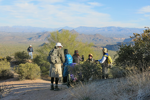
 Windblown hikers pause for a group picture. Bruce, Bob, Nancy, Julie, Lin, Jeanne, Rudy, Dana, Tamar, Sandee, Jim, Carol |
|
The air was calm when I left my house in Mesa. But when I got to Meridian Trailhead a stiff wind was blowing, kicking up dust and giving us all wind chill. We signed in, then car-pooled over to Usery Pass Trailhead to begin the hike. The Userys are named for King Usery, a notorious cattleman of Arizona territorial days. We hiked the Usery Pass Trail up to the place where it joins a road. The road once led to the Chester McGill Homestead. Both the homestead and the road were abandoned 80 years ago. Now the road has been taken over by the Maricopa Trail, with signs in several places. We stopped for a group picture at a prominent overlook. Then I pointed out the Dragon’s Kiss, up on the northwest slope of Pass Mountain. I, and many others, had walked past the Dragon’s Kiss without noticing it, because everyone was looking the other way. |
 Dragon’s Kiss. |
 Four Peaks and the northwest skyline of the Goldfields. |
 Bruce discusses plans for climbing Peak 3004. |
|
From there we walked on up to the Pass, enjoying grand views of the nearby Goldfields and distant Mazatzals along the way. |
 Listen up, everyone: we’re going this-a-way. |
 Pudding stone at the Pass. |
|
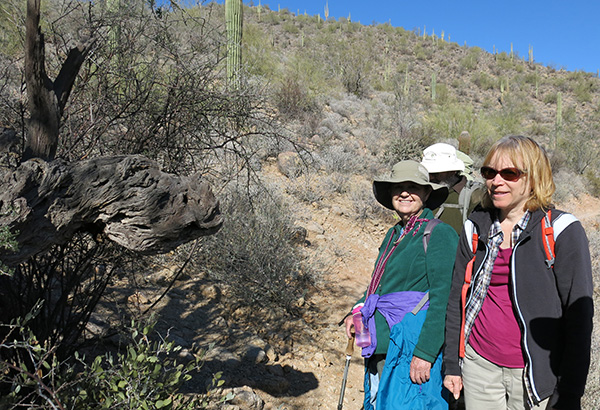
At the Pass we reorganized into three groups: The six of us enjoyed a pleasant hike down to Meridian Trailhead. By this time the weather had warmed up. There were plenty of other hikers on the trail, and some folks riding bicycles or horses. |
 Peak 3205 dominates the western skyline at the Pass. |
 Bright lichens adorn the boulders of Tertiary rhyolite. |
 Pass Mountain Ridgeline, looking westward from the trail. |
 Bulldog Ridge is a volcanic dyke formed in the Miocene epoch. |
 They did it! Our peak-climbing companions made it back to the trail. [photo by Ted] |
 Jeanne, Jim, and Julie admire the Pass Mountain Anteater. |
|
After the hike I took the drivers back to Usery Pass Trailhead, where their cars were waiting. Many thanks to Bruce Wilczynski for leading the climb to Peak 3004, and to Tamar Gottfried for leading the excursion to Bulldog Saddle. |
|
→ More pictures, by Lin. |
|
Supplemental Report by Bruce Wilczynski |
|
Rudy, Sandee, Bob and myself did get to Peak 3004. There was no trail so we had some steep areas and loose rock to contend with, but made it up just fine. The view was good and the wind wasn’t too bad at the peak. We found a small plastic jar hidden at the peak. There were several notes and names from previous hikers with dates. The earliest I saw was 1997. I also saw 2003, 2007, 2011, and 2014. We four added a paper with our names and the Trailblazers’ name. We decided to head back by bushwhacking and rock climbing down the south face of the peak. Quite slippery and steep in parts. Eventually we made it way down and traversed over to the Bulldog Saddle Trail going to the cars. Rudy was the first down and we were all back at the cars by a little after 1 o’clock. Although we looked, we did not see the three hikers doing the back side to the Bulldog Saddle. They should have been way ahead of us, as our climb was a bit slow because of the terrain. My stats are 5.02 miles, 1325' elevation gain, and a peak of 3,008 (stood up at the top). Have a good night and a great New Year. Bruce |
 Dawn on Peak 3004. [photo by Ted, March 3, 2014] |
|
Supplemental Report by Tamar Gottfried |
|
Three of us – Tamar, Dana, and Nancy – split off from the group onto the ancestral Pass Mountain Trail. Luckily for us, it was well marked with closely spaced cairns as it dropped down and traversed the desert. At the level at which we were, north of Peak 3004, the Bulldog Saddle Trail veered off and up into the hills. This section of the trail was a gradual climb and well marked. We paused at the top to consider the 360 degree view of the Goldfields and started down a steeper section of the Bulldog Saddle Trail on the south side, landing us in the parking lot shortly before the Pass Mountain Trail hikers arrived. Tamar |
 Stewart Mountain and the Mazatzals, from the Bulldog Saddle Trail. [photo by Tamar] |
 There’s a fine view of Apache Junction from Bulldog Saddle. [photo by Tamar] |
 Bulldog Saddle has boulders to serve as park benches. [photo by Tamar] |
 Looking back at Bulldog Saddle from Meridian Trailhead. [photo by Tamar] |
|
Supplemental Report by Jim Buyens |
|||||||||||||||||||||||||||||||||||||||||||||||||||||||
|
Thanks, everyone, for hiking with Arizona Trailblazers on our first expedition of the year. I hope you enjoyed it as much as I did. And great job as always, Ted, planning and leading a great event! Happy New Year and hoping to see you all again soon. Jim |
|||||||||||||||||||||||||||||||||||||||||||||||||||||||
|

|
||||||||||||||||||||||||||||||||||||||||||||||||||||||
 Top of Page
Arizona Trailblazers Hiking Club, Phoenix, Arizona
Comments? Send them to the AZHC .
updated November 5, 2019