Outdoor Links
Hike Arizona
Trip Planning Guide
Trip Report Index
Calendar of Events
Library
|
Willow Lake Day Hike Prescott May 14, 2016 by John Richa |
|
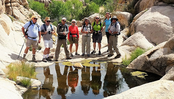
 Nine fine Trailblazers at Willow Lake. [photo by John] |
|
Back row, let to right: Joe, Susan, Eric, Doreen Front row, left to right: John, Carl, Lin, Mimi, Dottie. |
|
At 7:00 AM under bright blue Arizona skies and a glaring sun, seven hikers from the Arizona Trailblazers Hiking Club set out on the hour and a half drive north to Prescott, a quaint small city of some 40,000 inhabitants. In its past history, Prescott was twice designated as the state capital before the latter was finally relocated to Phoenix. Once we reached the trailhead at about 9:00 AM we were greeted by two additional Trailblazers who welcomed our arrival with a surprising quick “champions” breakfast on the run: a box of Krispy Cream donuts. They were delicious and pumped up our carbohydrates for the 4.5 miles hike around the lake. By 9:15 we were on our way following the Red Trail that will “hug” and circumvent Willow Lake, a man-made lake built in 1935. |
 Willow lake and its trails. |
 Aerial picture of Willow Lake and Watson Lake. |
 A sign welcomes us. |
|
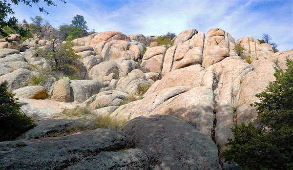
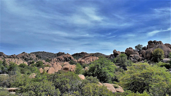
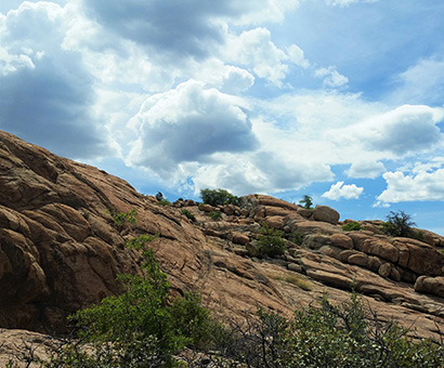
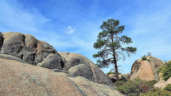
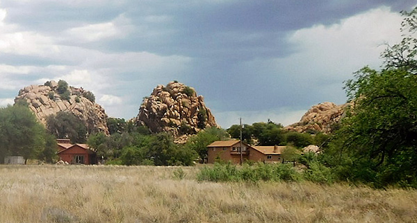
The lake was created by damming a narrow canyon in the rock formation that surrounds it. It is used as a reservoir but also as a recreational lake where you can fish, canoe, kayak or sail. Though the current water level was low, the lake was still very fine for all these activities. You will see in several of the pictures the, once upon a time when we used to have more rainfall, the high water markings, in other words, “bathtub rings” on the rocks, some 15 to 20 feet above current water level. The lake water surface area covers 400 acres. The rock formation called “Granite Dells” around the lake is unusual. One might as well feel being on some other planet. |
 Water Makings. [photo by Joe] |
 Dell Rock shapes. [photo by Joe] |
 Dell Rocks. [photo by Lin] |
 Willow Lake. [photo by Lin] |
|
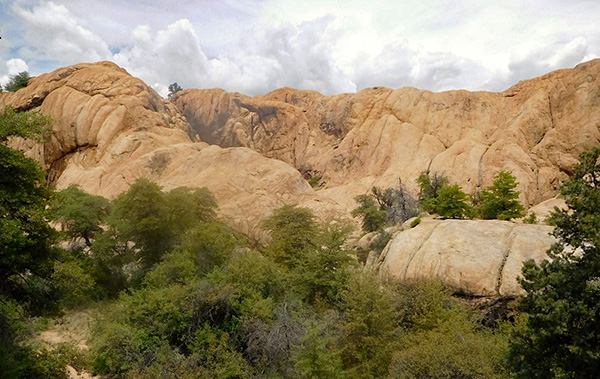
Did I pique your interest about its formation? Here is what the geologists said: The Granite Dells is a geological feature north of Prescott, Arizona. The Dells consist of exposed bedrock and large boulders of granite that have eroded into an unusual lumpy, rippled appearance. Geologically speaking: the “Precambrian Dells” granite has been dated at 1.4 billion years old. Its plutonic rock was intruded at a depth of around one or two miles. These cover rocks have since been eroded away. Weathering along joints produced the rounded boulders and other unusual rock formations that characterize the Granite Dells. This process is called “spheroidal weathering”, and is common in granitic terrains. |
| More rock formations. [photos by John] |
|

|

|
|
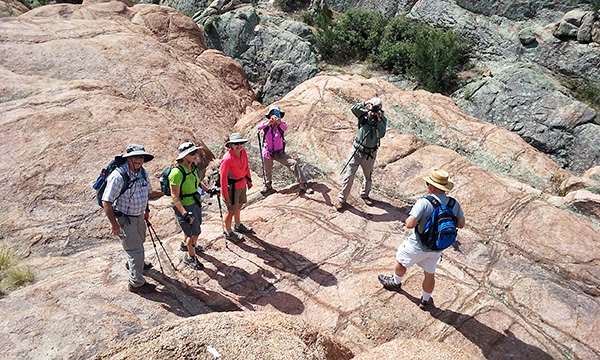
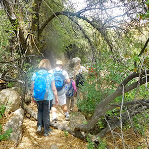
Our hiking in Prescott’s “Granite Dells” was like getting lost in a Stone Age labyrinth. The network of paths on the north shore of Willow Lake coiled through hulking quartz-studded granite buttes squeezing in and out on the paths in heaving accordion style. The rugged meandering loop trails moved seamlessly from claustrophobically tight spaces to airy exposed promontories with unobstructed vista. On these rocks the trail followed spray-painted white dots that serve as directional beacons. |
| Photos by John: | |
 Trailblazers on the march. |
 Starting trail. |
 Trailblazers on the march. |
 Odd looking boulders. |
 A tight spot. |
 Follow the leader. |
 Are we lost already? |
 This way. |
 Don’t push those boulders! |
 Oh, here is the next dot. |
 Just follow those dots, folks. |
| Photos by Carl: | |
 Here we are. |
 Onward marching Trailblazers. |
 Follow the leader. |
 What a view of the lake and skies! |
|
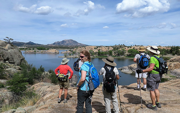
The dotted trail took us high along the rocks ridges and in narrows where one had to squeeze to get through. Frequently we stopped on high ridges and admired the scenery of the lake and the surrounding landscape of the Dells rocks. |
 Trailblazers admiring the lake. [photo by Lin] |
 Alternate rocks and trees. [photo by Lin] |
 Another view of the lake. [photo by Joe] |
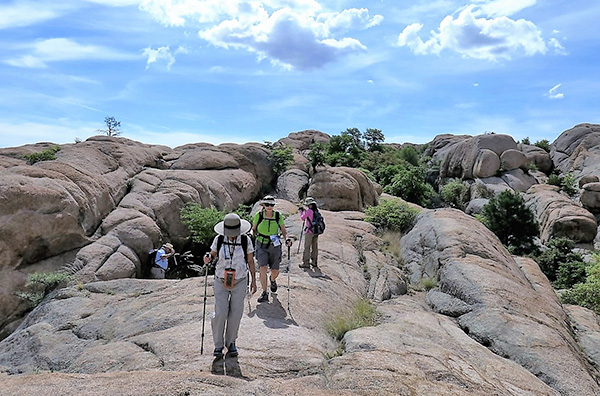 Trailblazers following the white dots along a ridge. [photo by Carl] |
 Trailblazers following the white dots along a ridge. [photo by Carl] |
| Photos by John: |
 Granite Dells. |
 Eric leads. |
 Climbing the slippery rock trail. |
 Now Dottie leads the climb. |
 Susan leads going down a narrow ledge. |
 Lin leads us down the same ledge. |
|
At one point we came across a red bridge that helped us leap across a wide crevice. |
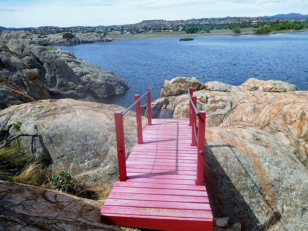 A bridge to somewhere! [photo by John] |
 Trailblazers test bridge weight capacity. [photo by John] |
|
The sun by now was getting a little warmer and it seems to play peekaboo with us. But while hidden behind clouds, we relished the cooler temperature. To our distant west though, we could see “rain streaks” in the clouds. We were lucky we did not get rained upon. There is always this danger of lightening strikes while on the trails, with no place to hide, and not to mention that our aluminum hiking poles could serve as lightning rods. No, we did not want to glow in this manner! |
 Cloudy skies but no threat of rain. [photo by Lin] |
 Billowy clouds over the Granite Dells. [photo by Lin] |

|
|
| A forlorn tree stands watch as more clouds roll in. [photos by Lin] | |
|
From different points along the trail, we could see the low level and the high level markings of the water line etched into the rocks. Do you remember your children bath “tub rings” at home after they had been playing in the mud? |
 Bathtub rings. [photo by John] |
|
There were many photos opportunities and we did not skimp on clicking our cameras’ shutters. |

|

|
| Water puddles. [photos by Carl] | |
 Water everywhere. [photo by Carl] |
 Let’s go ahead. [photo by Lin] |
 Smile, Lin. [photo by Carl] |
 Trailblazers pass muster by the water’s edge. [photo by Lin] |
 Moving on. Just follow those white dots. [photo by Lin] |
 Here’s a tree that marks our way. [photo by Lin] |
 Erosion markings in Dells rocks. [photo by Carl] |
|
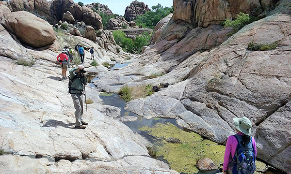
At one point we came across low lying puddles of water in the rock formation and of course Lin did her “signature pose”. |
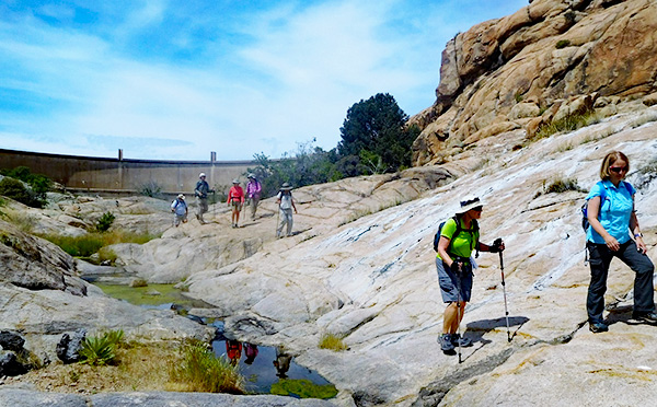 Yes, we made it to the dam. [photo by John] |
 Where there is water, there is life. [photo by John] |
 Lin’s signature pose. [photo by John] |
 Joe approaches the dam. [photo by John] Well, Joe, the flood of water gushing out at a high speed would have carried us miles down the canyon. I can’t swim, Joe! With this morbid thought we continued on our hike with the objective of reaching the end of the Dells rock formation that bounds the northern shores of the lake. |
 The dam, from lake water level. [photo by Lin] |
 Panorama of the dam and the lake. [photo by Lin] |
|
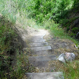
Standing at the bottom of the canyon, we faced a 100 steps climb to reach the Dells rocks above the lake water surface. Once we reached the top, we continued our trek until we found a shady spot and decided to stop and eat our snacks. “Rufus” a dog belonging to another hiker who happened to pass by our rest stop, decided to take a plunge in the lake. Certainly, the water was cold and not very clean. “Rufus” didn’t seem to mind. |
|

|
| 1000 stairs: what goes up must come down. [photos by John] | |
 One step at a time. [photo by John] |
 Let’s take a break. [photo by John] |
 Two-tone rocks by the water. [photo by John] |
 Onward and upward. [photo by John] |
 Yes, I can get up there. [photo by John] |
 Made it. [photo by John] |
 Rufus. [photo by John] |
 Lunch break. [photo by John] |
|
After our snack break, and contrary to past hikes around Willow Lake, this time instead of completing the circumference trail around the lake, where the last two miles run on a nondescript trail shared by dogs, joggers and bicyclers, and literally is a stone throw away from the highway, we decided to come back via the Dells Red rocks trail. This allowed us to get a double whammy of rock hopping, negotiating narrow ridges and slippery rock surfaces. This made our return hike much more enjoyable and much more interesting and exciting rock hopping experience. We followed the “white dots” going out and coming back. We gladly report that no one fell, slipped or twisted an ankle. |
 We’re on top of the world. [photo by John] |
 Climbing the golden staircase. [photo by John] |
 Curious lines mark the granite boulders. [photo by John] |
 Back to the trailhead. Trailblazers follow the white dotted lines. [photo by John] |
 It’s this way, folks. [photo by John] |
 We have another hill to climb. [photo by John] |
|
At the suggestion of Susan we took an inland trail, for part of our return hike, just to change the scenery. At one point, in a clearance along the trail, we came across a house. We wondered who might be living there! |

|
|
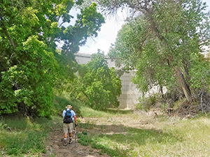
| Return hike through thickets. [photos by John] | |
 Woodsy trail. [photo by John] |
 Squeezing between the rocks. [photo by John] |
 Who might be living in this house? [photo by John] |
|
This side trail exposed us to new great looking Dell rock formation that you do not get to see from the original trail we used during our out trekking. |
 Unusual Dells looking rock formation. [photo by John] |
 Are those caves inhabited? [photo by John] |
 Desert varnish. [photo by John] |
 Trailblazers on the rocks. [photo by John] |
|
We made it back to the trail head by 1:00 p.m. sound and safe and hungry for a good late lunch. We proceeded to Murphy’s restaurant in downtown Prescott, a restaurant we patronized before. We had a private room in the back of the restaurant all to ourselves and enjoyed a good lunch. The service was very good. The restaurant is in a historic building that dates back to 1883. A plaque in front of the restaurant tells its history. |
 Murphy’s. [photo by John] |
 Store front. [photo by John] |
 J. I. Gardner Store. [photo by John] |
 General merchandise. [photo by John] |
 Dinner tastes good after the hike. [photo by John] |
|
We clocked our hike at 4.5 miles in 3:45 hours including a snack break and many photoshoot opportunities. |
|
→ More pictures, by Wendy Rennert. |
| Starting Time: | 9:15 | AM | Finishing Time: | 1:00 | PM |
| Stopped Time: | 0:30 | hrs:min | Duration: | 3:45 | hrs:min |
| Avg. Speed Overall: | 1.43 | mph | Starting Elevation: | 5,151 | ft |
 Top of Page
Arizona Trailblazers Hiking Club, Phoenix, Arizona
Comments? Send them to the AZHC .
updated December 23, 2019