Outdoor Links
Hike Arizona
Trip Planning Guide
Trip Report Index
Calendar of Events
Library
|
Boynton Canyon Day Hike Sedona November 18, 2017 by Chuck Parsons |
|
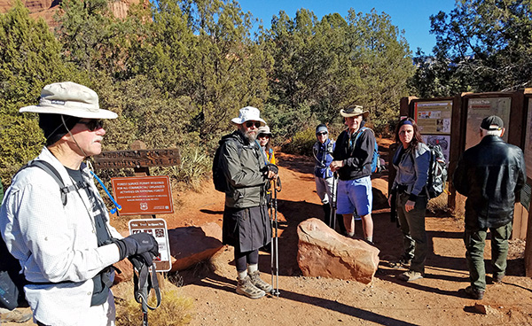 Trailblazers gather at the Boynton Canyon Trailhead. [photo by Tom] |
||||||
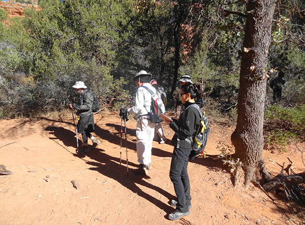
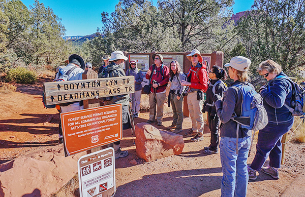 Chuck gets a complete head count before starting the hike. If you’re not here, please speak out and raise your hand. [photo by Wayne] |
||||||
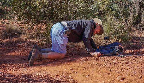 Dave carefully aligns his camera for the all-important group picture. [photo by Wayne] |
||||||
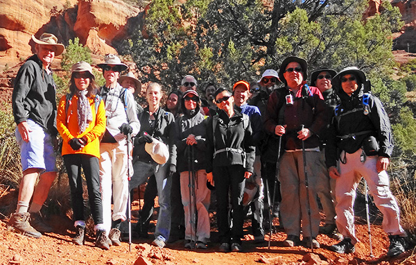 15 Arizona Trailblazers gather for a group picture near the Boynton Canyon Trailhead. [by Dave F.] |
||||||
|
||||||
|
I had originally planned to do the David Miller Loop today. The David Miller Trail, completed in 1999, links the Secret Canyon Trail to the Bear Sign Trail, creating a 7.3 mile loop hike through some of the most scenic and wild backcountry in the Red Rock Secret Mountain Wilderness area surrounding Sedona. But before even putting boots to the ground, the biggest challenge is getting to Secret Canyon Trailhead. From Dry Creek Road you have to navigate 3.4 miles of Vultee Arch Road (FR 152). FR 152 has not been maintained for quite a few years and is now extremely rough and full of large rocks and boulders and stair steps very similar to Schnebly Hill Road. So high-clearance/4WD vehicles (preferable with skid plates) are required. With 20 hikers signed up for the David Miller Loop, we didn’t have the required number of high-clearance vehicles to get all of us to the trailhead. In fact, we didn’t have any. So it’s time to execute Plan B (you always need a backup plan). While deciding on an alternate hike, I searched through all of the past Sedona area trip reports in the Arizona Trailblazers’ vast archives, going all the way back to the early days of our predecessor, the Motorola Hiking Club. I was looking primarily for hikes that we haven’t done in quite a while. In doing so, I discovered that the Boynton Canyon Trail was last done by the Trailblazers on April 18, 2009. At least that was the last trip report filed for this hike. So after an eight-year hiatus, I decided that it was finally time to revisit what is widely considered one of the most scenic hikes in the entire Sedona area. |
 Trailblazers are on the move—well, sort of, anyway. [photo by Dave F.] |
 Trailblazers are seriously on the move now. [photo by Wayne] |
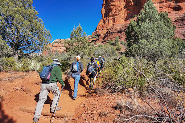
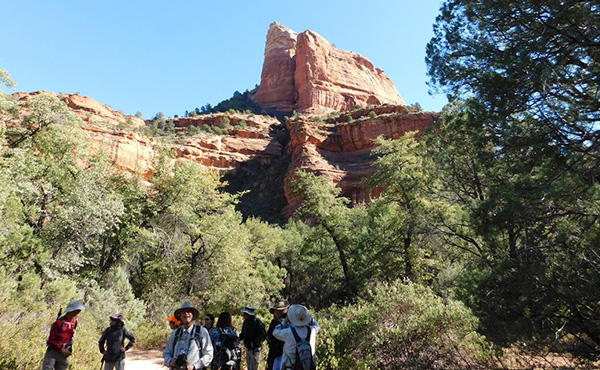
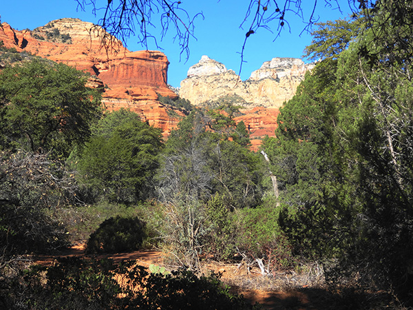
 Panoramic view entering Boynton Canyon. [photo by Tom] |
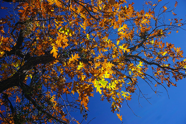
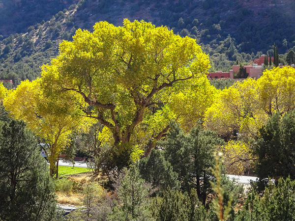 These towering cottonwoods are almost at the peak of their fall colors. [photo by Wayne] |
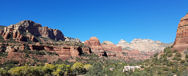
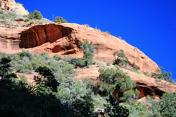
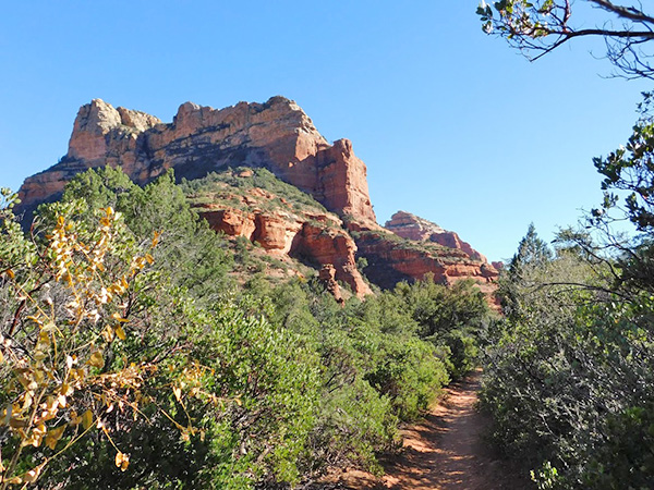
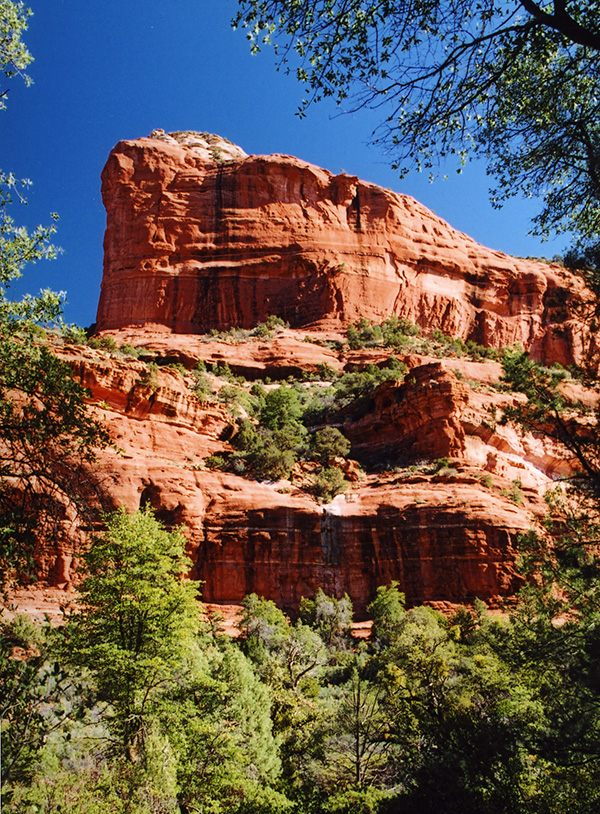 The iconic red rocks of the Red Rock Secret Mountain Wilderness. [photo by Chuck] |
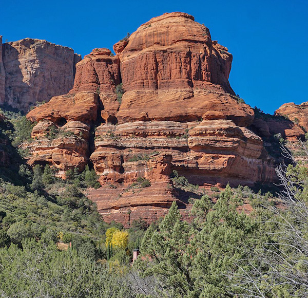
 Massive formations of red-hued sandstone stand guard over Boynton Canyon. [photo by Chuck] |
|
Of the many spectacular canyons that crisscross the Red Rock Secret Mountain Wilderness area north of Sedona, Boynton Canyon stands out as one of the more picturesque of the lot. The temperature stands at a crisp and refreshing 55° on this clear and sunny late fall morning in Red Rock Country on what will likely be our last scheduled hike of the year in Northern Arizona. The time is 10:35 AM as we depart from the Boynton Canyon Trailhead and start climbing up and down through numerous rocks and boulders lining the trail. The narrow trail winds its way along the eastern face of Boynton Canyon, as it overlooks and works its way around the backside of Enchantment Resort, one of the older luxury resorts in the Sedona area. |
 Beautiful example of desert varnish covering the sandstone. [photo by Li] |
 The scenery just keeps getting better. [photo by Tammy] |
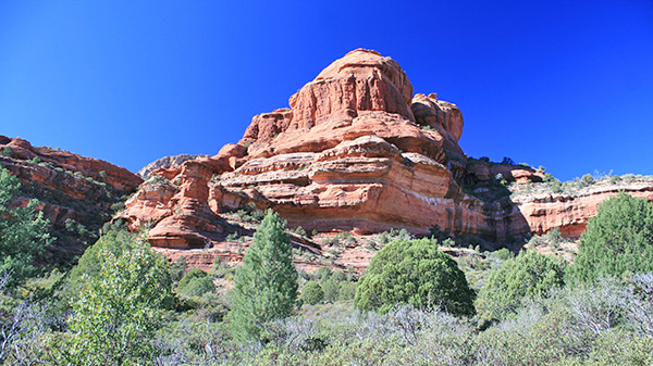
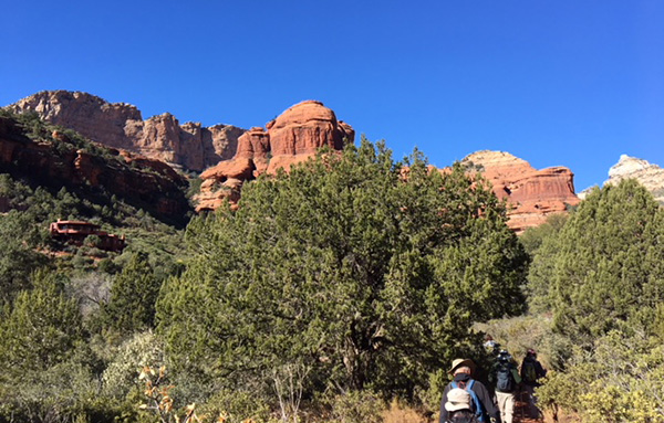
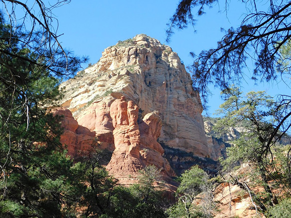
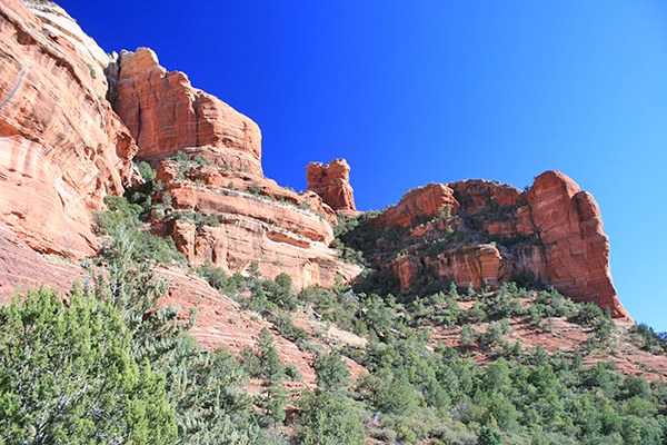
 Red rock monoliths tower over the trail. [photo by Darrell] |
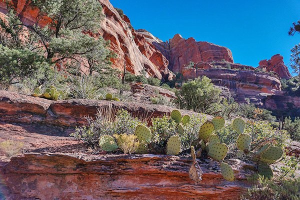 This prickly pear cluster seems to be thriving. [photo by Wayne] |
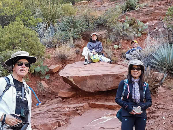
 Trailblazers soak in the surrounding views. [photo by Tammy] |
|
After roughly a mile of hiking, the trail starts running parallel with a wrought iron fence that marks the resort property boundary, with several signs sternly warning hikers not to trespass on resort property. At one point near this fence we come across four large colorful, yet mysterious, rough-cut wooden crosses about 8 feet high and wonder about their origins. One cross was painted white, one black, one blue, and the fourth was painted green. Who would put such crosses right outside of the resort boundary and why? Were some unfortunate hikers actually killed in this area? Or is this some sort of twisted joke? Who knows? Thankfully, we soon leave the resort and all remaining signs of civilization behind us, as the trail drops into a wide and flat sandy wash filled with colorful manzanita thickets, before eventually depositing us onto the shady canyon floor. |
 Notice the narrow rectangular structure at the bottom center of this picture? [photo by Wayne] |
|
Unseen and high above us in the cliff face farther down the trail, lies a hidden alcove containing the remains of ancient cliff dwellings, evidence of early human presence in this area many centuries ago. Unfortunately, the Forest Service was forced to close off all public access to these ruins many years ago to protect them from further destruction by vandals. |
 Trailblazers keep on trekking down the trail. [photo by Darrell] |
 You can almost point a camera in any direction here. [photo by Chuck] |
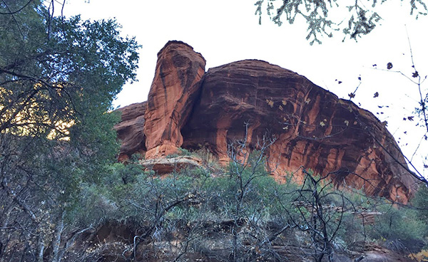
 Interesting juxtaposition of red sandstone and white limestone. [photo by Dave] |
 A beautifully framed monolith graces this colorful picture. [photo by Tammy] |
 It can be challenging to get a clear view of the rock formations along the trail. [photo by Wayne] |
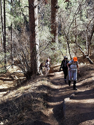 Trailblazers start hiking through heavier forest cover. [photo by Tom] From this point on the trail is relatively level and well-marked with rock cairns, as it bends in a generally westward direction along the cool and shady floor of Boynton Canyon. Upon entering this deeply shaded area, we notice an immediate drop in air temperature. As we traverse ever deeper into the canyon, the surrounding forest becomes even thicker and more dense. The high canyon walls on both sides also serve to create an even shadier environment, allowing the sun to penetrate and warm the canyon floor for only a few short hours a day. |
 How’s the view from the top of this dome? [photo by Chuck] |
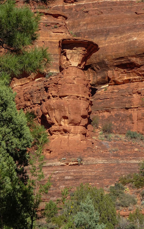 This has to be Mushroom Rock. [photo by Wayne] |
 Chris seems to be having a great time. [photo by Tammy] |
 Tom briefly looks back, as he charges through the forest primeval. [photo by Li] |
|
A heavy, bone-chilling dampness hangs in the air and the temperature steadily drops as we move into deeper and deeper shade. At one point the temperature bottoms out at a chilly 44 degrees, according to Barry’s trusty backpack thermometer, before we will finally emerge on the other side of this forest primeval. |
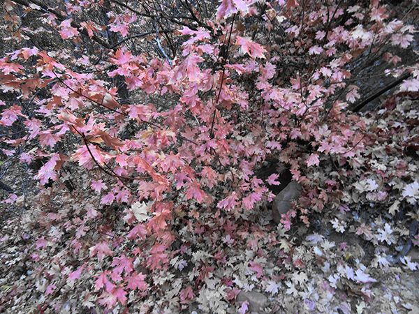 This bigtooth maple is past its prime, but still colorful. [photo by Dave] |
 This large oak tree is still sporting its fall colors. [photo by Wayne] |
|
As we continue on, we begin to gain a little more elevation and the sandy canyon floor becomes littered with a colorful mosaic of fallen leaves, as the deciduous trees of the forest gradually give up their colorful fall foliage and prepare for the dormant winter months that lie ahead. As we approach the three-mile point on this hike, the canyon walls begin to close in and the trail narrows down and becomes even steeper, as it slowly climbs out of the canyon and up and around huge boulders covered with colorful patches of moss and lichens. And the temperature gradually begins to warm up, as we slowly begin to emerge from the thick forest cover of the canyon floor and into a more open, sunny area near the end of the canyon. |
 Sunlight is just hitting the tree tops in this beautiful shot. [photo by Dave] |
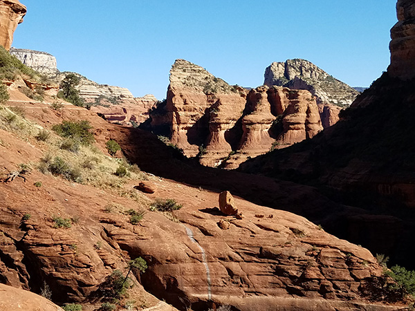
 Boynton Canyon comes to an abrupt end in what is generally referred to as a box canyon. [Tammy] |
|
The last hundred yards of the trail rises steeply through a patchwork of large boulders, and we soon find ourselves out in the open on a large expanse of slickrock in partial sunlight, with a clear view of the box end of Boynton Canyon as seen in this picture taken by Tammy. |
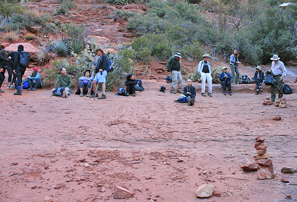 Trailblazers spread out on a natural rock bench for lunch. [photo by Chuck] |
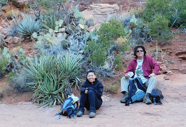 Molly and Chuck take time out for lunch. [photo by Tammy] |
 Darrell, Rebecca, Nancy, and Li. [photo by Tom] |
|
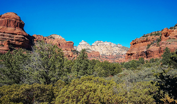
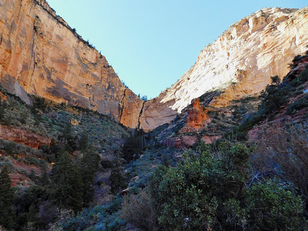
As we find plenty of good places on this expansive shelf of slickrock to sit down and enjoy our lunch and snacks and a well-deserved rest break, we’re rewarded with spectacular views of sheer-walled, thousand-foot high cliffs of Coconino Sandstone and Kaibab Limestone that form a perfect natural amphitheater, marking the head of Boynton Canyon. It is one of many scenic box canyons nestled against the side of Secret Mountain. |
 Chuck and Tammy take in the views. [photo by Li] |
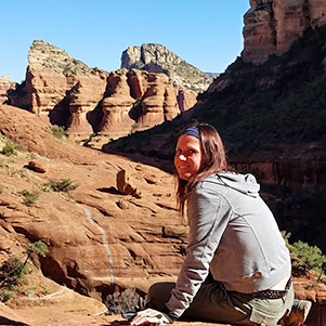
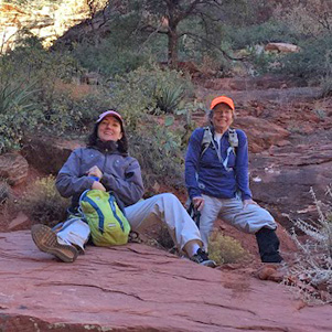 Rebecca and Nancy. [photo by Li] |
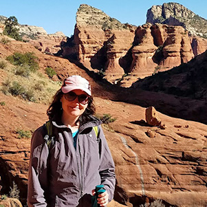
 Debbie. [photo by Tom] |
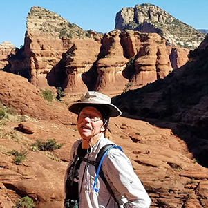 Darrell. [photo by Tom] |
 Rebecca. [photo by Tom] |
 Molly. [photo by Li] |
 Tammy. [photo by Li] |
 Tammy. [photo by Tom] |
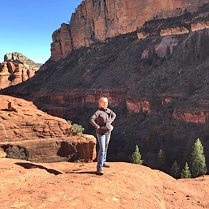
 Tom. [photo by Tom] |
|
Given enough time and determination, it’s possible to bushwhack your way to the very end of this box canyon. I’ve often wanted to attempt it, but the terrain is very rough and the going is very slow. And since my last hike, there are also posted signs warning hikers not to go off-trail or beyond the signs. Boynton Canyon is one of at least four widely recognized vortex sites in the Sedona and Red Rock Secret Mountain Wilderness areas, where the concentration of electromagnetic energy from deep within the earth is believed to give off special healing powers. Whatever your beliefs about this phenomena, you cannot leave this breathtaking place behind without taking away some kind of special feelings or thoughts about the experience and the canyon itself. |
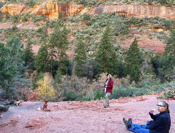
 Lengthening afternoon shadows creep across Boynton Canyon. [photo by Tom] |
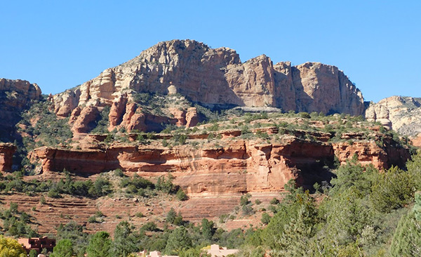
 The colorful cliffs of Boynton Canyon. [photo by Dave] |
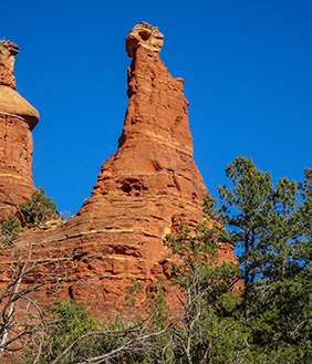 Chimney Rock. [photo by Wayne] |
|
After lunch several of our hikers, including Tom, Darrell, Debbie, Tammy, and Rebecca, decide to walk out to the far end of the slickrock expanse to check out the views. Although typically referred to as slickrock, this sandstone surface offers excellent footing on its relatively rough and dry surface. You just need to watch for loose sand and small pebbles. During and immediately after a heavy rain, however, it more than earns its moniker. After several hundred yards, the five hikers reach a point where they cannot safely or easily go any farther. The walk is definitely worth it, however, as I can personally attest from several previous hikes, with stunning views looking down the spectacular and immense expanse of Boynton Canyon, with its towering reddish-orange and cream-colored walls of sandstone and limestone, soaring hundreds of feet into the brilliant blue Arizona skies and sheltering a rich mosaic of forest cover along the full length of the canyon floor. Unless you’re standing on the rim of the Grand Canyon, the best scenic views in Arizona just don’t get much better than this. |
 The lighting is even better on the hike back out. [photo by Chuck] |
 This path takes us right back to the trailhead. [photo by Tammy] |
 One last parting shot of Boynton Canyon. [photo by Chuck] |
|
We return along the same route, and most of us make it back to the trailhead by 2:30 PM. Along the way, several of us can’t resist taking just a few more pictures, especially since the lighting is better in some areas with the late afternoon sun. Dave had earlier suggested the Enchantment Resort patio for a late lunch, but was unable to make the necessary reservations. So, just as with the hike itself, we have to resort to Plan B, in this case our old reliable standby, the Plaza Bonita Family Mexican Restaurant in nearby Cottonwood. And, as usual, the service is fast and efficient, the staff is friendly, and the food is great and the portions huge, with enough left over for another meal for many of us. |
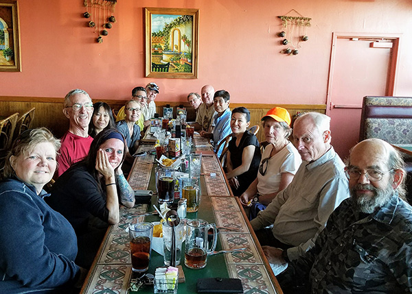 14 famished Trailblazers at Plaza Bonita Family Mexican Restaurant. [photo by Tom] Chris M., Debbie, Tom, Li, Tammy, Barry, Dave, Darrell, Chuck, Wayne, Molly, Nancy, Chris A., Jim |
|
After lunch, we say our goodbyes to one another and split up into our respective carpools for the long drive back to the valley. We couldn’t have asked for better weather on our last hike of the year in Red Rock Country and Northern Arizona. For the next few months, with cooler weather finally arriving, it’s time to reacquaint ourselves once again with desert hiking. |
|
Supplemental Report by Jim Buyens |
|||||||||||||||||||||||||||||||||||||||||||||||||
|
Thanks for leading a great hike on Saturday, Chuck, and thanks to everyone for participating. It was great seeing you all again. Jim |
|||||||||||||||||||||||||||||||||||||||||||||||||
|

|
||||||||||||||||||||||||||||||||||||||||||||||||
 Top of Page
Arizona Trailblazers Hiking Club, Phoenix, Arizona
Comments? Send them to the AZHC .
updated November 25, 2017