Outdoor Links
Hike Arizona
Trip Planning Guide
Trip Report Index
Calendar of Events
Library
|
Haunted Canyon Day Hike Globe December 16, 2017 by Tamar Gottfried |
|
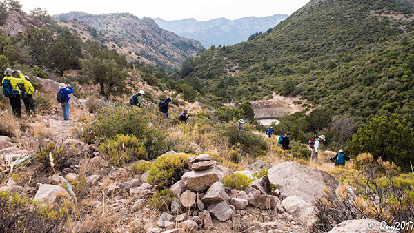
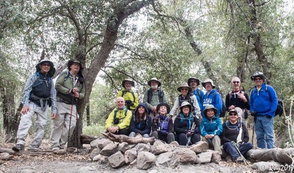 Trailblazers in Haunted Canyon. [photo by Quy] |
|
back row: Wayne, Michael, Pete, Chip , Gary, Dave, Lance, Tom , Mark front row: Terry, Debbie, Sandy, Tamar, Quy , Michelle |
|
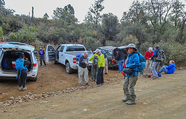
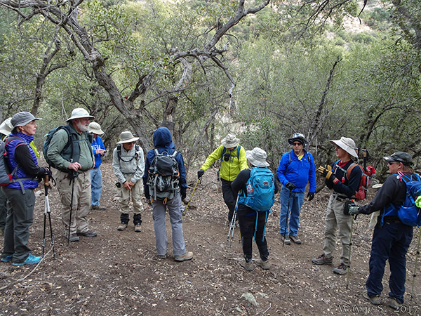
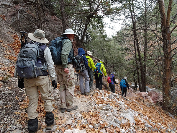
Fifteen Trailblazers met before dawn and shuttled in 4 high clearance vehicles to Superior. Twelve miles north of Superior after the “Top of the World” community, we turned off the highway into the Pinto Mine. We followed the well-marked Forest Road 278 through many intersections as it progressed from pavement to well groomed dirt to bumpy, steeper, curvy dirt over 7 miles. A sedan could traverse this road. Prior to the bridge at the 7 mile mark, we turned left toward the blocked road that leads to the lower 203 trailhead and left one car there. We redistributed into three cars, crossed the bridge, and turned left onto the FR 278A. We were soon faced with the obstacle of two mama cows and their calves, practically in the road and completely uninterested in moving. We gently coaxed them off the road after a few minutes, but the calves were not happy to have their meal interrupted. We continued on the road for approximately 4 miles until we saw the little sign for “203”. We backed into the little parking area across the road from the trail start, and prepared our gear in brisk 32 degree weather. |
 Yes, this is the right trailhead. [photo by Quy] |
 Methinks I’ll wear a jacket today. [photo by Wayne] |
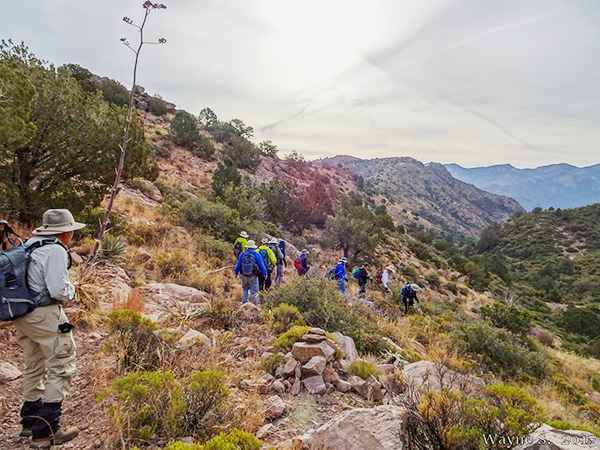
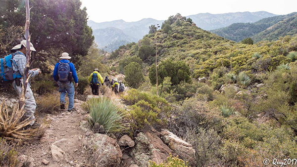
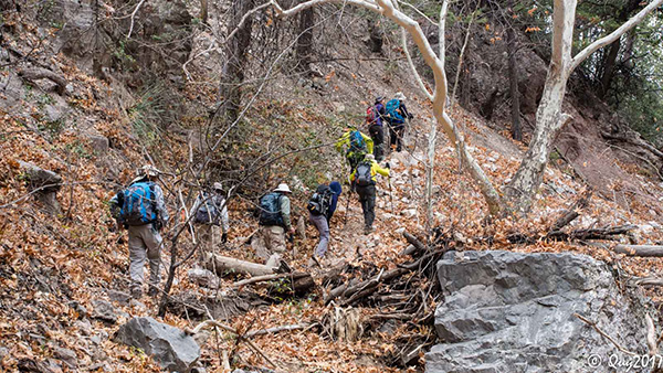
 Our hike begins with a climb. [photo by Quy] |
|
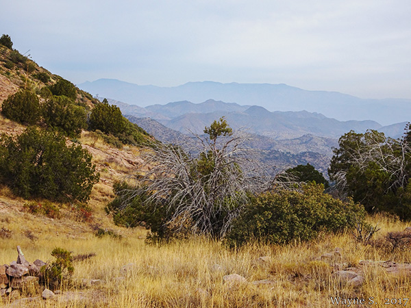
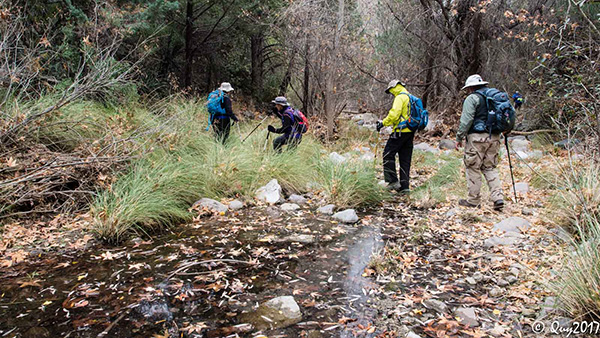
The trail started with a quick ascent to 5000 feet and then a descent into the canyon. We passed a manmade pool and two junctions with other trails. The trail was very easy to follow. |
 Is it really haunted? [photo by Wayne] |
 A’down we go. [photo by Wayne] |
 Follow the trail on down. [photo by Quy] |
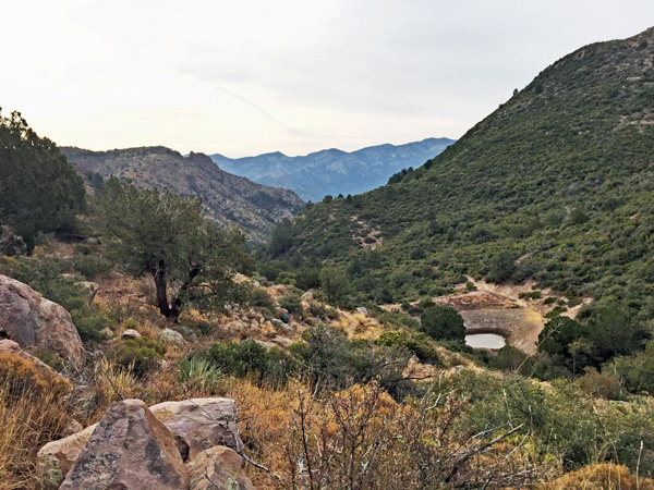 There’s a pond along the way. [photo by Lance] |
 We’re getting closer. [photo by Quy] |
 “Uncle” I said! [photo by Quy] |
|
After about 4 miles, we passed into the private land of the Superstition Area Land Trust/ Tomey Ranch and took the offshoot trail to the Tomey cabin. At the cabin, we took a little break to rest and explore the area. We were careful to observe the rules and not disturb anything in or around the cabin. |
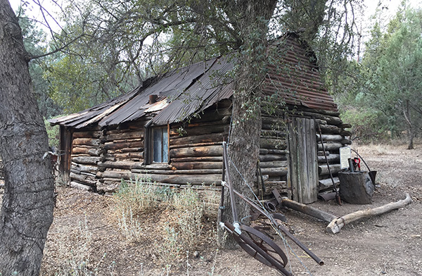 The Tomey Cabin is still standing. [photo by Lance] |
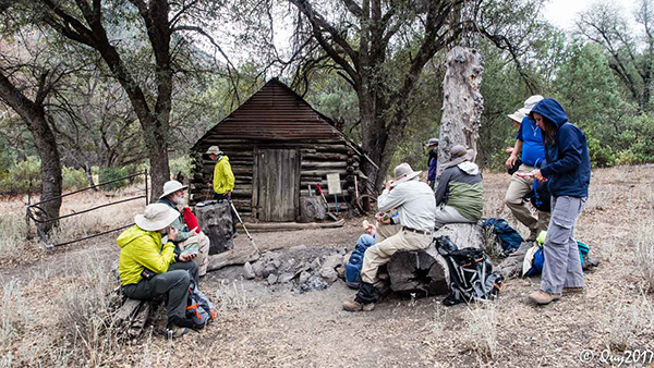 The cabin makes a great picnic spot. [photo by Quy] |
 I don’t think anyone lives here. [photo by Quy] |
 You see, it’s this way. [photo by Wayne] |
 Do you play croquet? [photo by Lance] |
 Twisty tree may be filled with spirits. [photo by Quy] |
|
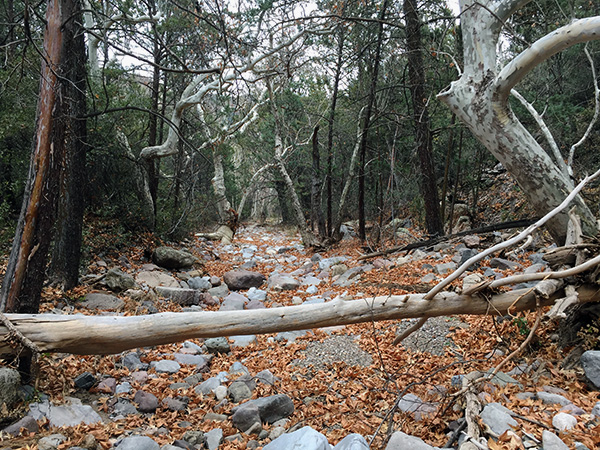
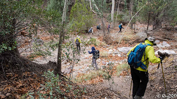
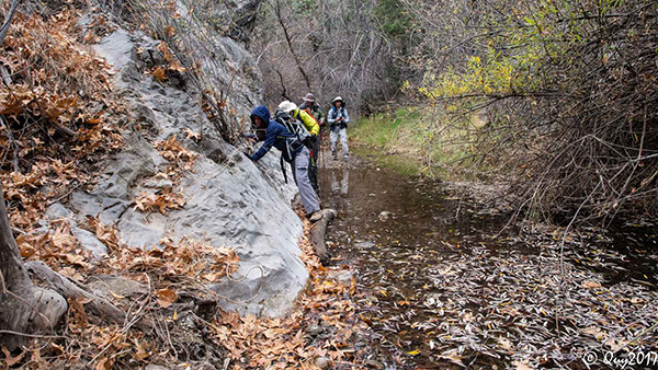
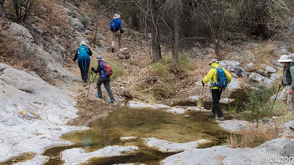
Rested up, we went back to the main trail and continued onward. Here we started to see a lot of fall colors and began a long series of stream crossings, most of them dry. After a while we started to see more water, and even had to do one longer crossing on a thin log that some helpful hiker had left for us. We continued above the creek and down to it again, and at this point lost the trail. Luckily, the only other group hiking in this area that day had found a break in a barbed fence that would allow us back onto the trail. This involved climbing up on some dead wood, stepping on the fence and jumping down. We all made it unharmed. |
 We have a walk in the woods on the way out. [photo by Quy] |
 The trail is taking us that-a-way. [photo by Quy] |
 Follow the trail down to the streambed. [photo by Wayne] |
 You can get across without failling in. [photo by Quy] |
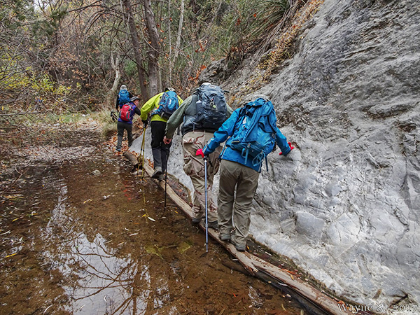 Logs help us get across. [photo by Wayne] |
 Stepping stones are a great invention. [photo by Quy] |
 Is this our last stream crossing? [photo by Quy] |
 The canyon looks haunted to me. [photo by Quy] |
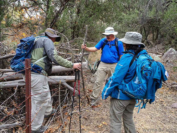 Easy does it! Michael climbs over some branches and a barbed wire fence. [photo by Wayne] |
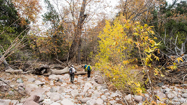 Autumn color cheers us. [photo by Quy] |
|
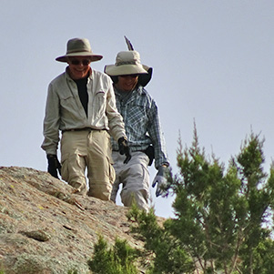
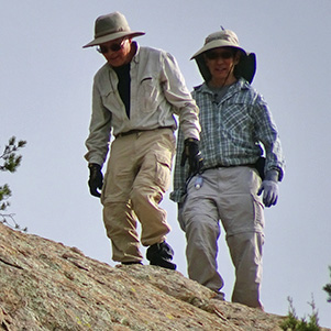
A short while later, we reached the lower trailhead at the ruins of a corral and at the end of the blocked road. A mile and a half along the road brought us back to our cars. The four drivers squeezed into a Jeep and went up to retrieve the other three cars, while the rest of us waited. Gary and Wayne climbed up the side of a mountain to pass the time. |
|
|
| Gary and Wayne climbed up. [photos by Pete] | |
|
After 25 minutes we were reunited. Seven hikers started down to the Valley. The rest of us stopped in Superior to enjoy a nice meal at Los Hermanos. It was a good day. |
 Top of Page
Arizona Trailblazers Hiking Club, Phoenix, Arizona
Comments? Send them to the AZHC .
updated December 21, 2017