Outdoor Links
Hike Arizona
Trip Planning Guide
Trip Report Index
Calendar of Events
Library
|
Maricopa Trail Spur to Spear Cave Creek January 6, 2017 by David French |
|
 Combined group at the meet up place. [photo by Dave F.] |
| Barbara, Deirdre, Sandy, Andy, Laurie, Vern, Monika, Pete, Lin, Gretchen, Terry, Ramona, Tamar, Li, Billie, Mark, Jim, Yanis, Tom, Debbie, Michelle, Dave M, Michael, Katarina, Marilyn, Scott |
 Eastbound group. [photo by Scott] |
| Michael, Pete, Mark, Katarina, Ramona, Yanis, Terry, Monika, Barbara |
 Westbound group. |
| Dave F, Marilyn, Andy, Laurie, Jim, Michelle, Deirdre, Billie, Sandy, Gretchen, Li, Tom, Debbie, Lin, Tamar, Vern, Dave M. |
|
As of the day before the hike we had 35 people signed up. I had sorted them into two groups, one to go eastbound from Spear S Ranch Trailhead to Spur Cross and the other to go westbound. With all the flu and other winter time sickness going around only 27 actually showed up. We met at a Wal Mart on Cave Creek Road just south of Carefree Highway at 7:45 AM. It was surprisingly warm for this time of year, only a light jacket or sweater was needed. In the hustle and bustle of trying to sort out the large group into the two hiking groups, we ended up with 17 going westbound and 10 going eastbound. Not sure how that happened, except there were more last minute cancellations and two no shows among those hikers I had assigned to the eastbound group. Fortunately it all worked out just fine. Drivers were selected, exchanged keys, and the two groups loaded into other people’s cars and headed to the respective starting points. I will describe the hike of the westbound group. The westbound group arrived at the Spur Cross main parking area, got our gear, passed by the $3 toll booth, used the toilet facilities and then gathered for a group photo. After quick introductions we headed west on the Spur Cross Trail, which is also the Maricopa Trail. Hiking through Spur Cross is always a delight, it is such a pretty area. We followed the Spur Cross Trail as it zig zags through the Conservation Area with several trails that branch off at well-marked junctions. After less than an hour of hiking we took a break to take off than extra jacket or sweater we had on. |
 Off we go. |
 Hikers dwarfed by the saguaro. |
 This is the way. |
 Finally some down grade. |
 On the trail. [photo by Tom] |
 Nice place for a break. |
 Short Break in Spur Cross. [photo by Tom] |
 Come on, give me a break. [photo by Li] |
|
Most of us had hiked in Spur Cross Conservation Area many times, but few of us (me included) had never hiked the last leg of the Spur Cross Trail from the Elephant Mountain trail junction to the Area boundary. The boundary is marked by a fence with a gate that can be opened for horses to walk through and one of those metal ramps that hikers and bikers can use but most animals will not. Once through the gate the terrain became much flatter, with Palo Verde and mesquite trees dotting the landscape. It looks like good ranch country. We reached a junction with a road going to the west and a trail going southwest. The official website map for the Maricopa Trail has it following the road. Another website I was directed to has more detailed maps and it showed the C4 Reroute. |
 Dave M smell tests. [photo by Li] |
 Tamar, Deirdre, and Laurie take a short break. [photo by Li] |
 Nice view. |
 Spur Cross Boundary. |
 Marilyn and Billie. [photo by Marilyn] |
 Are there any ghosts by the sign? |
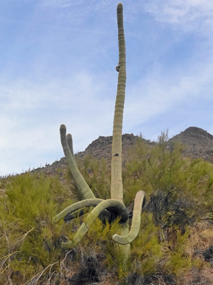 Gnarly saguaro. There was a brown sign at the beginning of the reroute that said “Temporary connection to Cave Creek Regional Park.” We were not going to that park but were going in that direction. I hope this trail is not temporary, because it is a lot better than the road. Sure enough, at about 5.6 miles we meet the eastbound group led by Scott. We stopped for a while for snacks and conversation, swap keys, and a combined group picture. There were no rocks or logs to sit on, so we did not stay there too long. Note on the GPS trek above, the red is the eastbound group trek transferred to my GPS by Scott at the meet up place. The westbound group continued southwest to the marked junction with the trail the leads to Cave Creek Regional Park. Taking that trail and the Go John Trail would also make a good but shorter one-way hike. However, since our cars were parked at the Spear S Ranch Trailhead, we continued westward on the Maricopa Trail. This part of the trail passed through more densely spaced trees and more rolling terrain. There are a couple of springs in the area, hence the more dense vegetation. The trail turned to the northwest and we came to some new road construction. The Maricopa Trail sign was somewhat leaning over but it appeared to direct us down that road. Tom and a few others hiked down the road. Some of us saw a trail that more or less paralleled the road so the rest of us took it. Tom and I kept in radio contact so we did not lose each other. |
 Snack break at meet up place. |
 Hmmm, I thought we’d meet here. |
 Have you heard the latest? |
 Dave M and Mark hold high-level discussions. |
|
The road under construction curved to the south and the trail we were on came to a newly constructed bridge over a wash and then led us up the embankment to the road. We could see Tom and the others on the road to the north and Tom said he could see a Maricopa Trail sign leading to the west. We followed the road to Tom and then all headed west through an area that is increasingly rolling terrain with some pretty good hills to climb and descend. Nothing difficult, but when closing in on 10 miles of hiking everything gets a little more difficult. At one point we came to a T junction with a sign that showed the Maricopa Trail going either way. Looking to the south we could see another Maricopa Trail sign showing the trail going west, so we took that one. I suspect the other direction would have taken us to a road. We also encountered a side trail to the north with a marker that said Cave Creek. No trail was shown on the more detailed maps I downloaded, so we continued straight west up and down the hills until we finally saw our cars in a parking area. |
 Made it to the Spear S Ranch. [photo by Tom] |
 Lest we forget. |
 Pyramid Peak from Spear S trailhead. |
 Li, Debbie. and Jim wait a the trailhead for the rest of us to arrive. |
|
For future information, the Spear S Ranch Trailhead is reached by going north of Carefree Highway on 7th Street which becomes New River Road. There is a large sign near the entrance to the unpaved parking area. The road to the trailhead is all paved. The Maricopa Trail continues west from the Spear S Ranch for a future hike. In fact the Maricopa Trail forms a 310 mile loop around the greater Phoenix area, so there are lots of future hikes. We returned to the Wal Mart and met some of the hikers from the other group. Most hikers headed for home, but several of us went to Brisam’s on Cave Creek Road at Lone Mountain Road for drinks and eats. |
 Trailblazers after the hike at Brisam’s. |
 Bring on the food! |
|
My GPS said we hiked 10.8 miles with 1462 elevation gain and 1683 descent. The hike took about 5 hours. Thanks to Scott Green for serving as deputy leader for the eastbound group. |
 Top of Page
Arizona Trailblazers Hiking Club, Phoenix, Arizona
Comments? Send them to the AZHC .
updated January 10, 2018