Outdoor Links
Hike Arizona
Trip Planning Guide
Trip Report Index
Calendar of Events
Library
|
Salida Gulch Loop Prescott April 21, 2018 by Chuck Parsons |
|
 26 Arizona Trailblazers gather for a group picture, with Lynx Lake in the background. [photo by Dave] |
|
Kneeling in Front: Dave, Biljana, Mimi, Pete, Darrell, Li, Carol, Dan Back Row: Debra, Jen, Jim, Tom, Dubravka, Barb, Becky, Billie, Katarina, Deirdre, Ramona, Molly, Stacy, David, Terry, Vicky, Chuck, Michael |
|
On a beautiful Saturday morning in late April and at this point half-way through the hike, 26 smiling Arizona Trailblazers gather for a group picture with the shimmering blue waters and heavily-forested slopes of Lynx Lake in the background. Earlier in the day, we started from the Salida Gulch Loop Trailhead at 9:05 AM, under brilliant clear blue skies with a perfect starting temperature of 58 degrees. Today’s expected high is forecast to be 75 degrees. It just doesn’t get much better than this. |
 Trailblazers gather in a large circle for personal introductions. [photo by Tom] |
 We also discuss important details of the trail and what to expect on the hike. [photo by Tom] |
 Arizona Trailblazers hiking the trail. [photo by Tom] Looking at the attached GPS map, you can see that this is basically a double loop configuration, with a connector trail tying the two loops together. We will be hiking both loops in a counter-clockwise direction. After a long rest and lunch break at the ramadas overlooking Lynx Lake, we’ll then finish the second half of the perimeter trail around the lake, before rejoining the connector trail and hiking that back to the Salida Gulch Loop Trail, where we’ll finally complete the second half of the loop back to the trailhead and our vehicles. Total hiking distance is 9 miles, with about 1,200 feet of cumulative elevation change over the course of the entire trail. Group introductions and trail descriptions out of the way, it’s time to move out, Trailblazers. The Salida Gulch Loop Trail starts climbing right out of the starting gate and continues to climb in a steady uphill grind for the next mile or so, leveling off from time to time through grey-green hillsides of thick chaparral, consisting of scrub oak, manzanita, and jojoba, with a mix of pinion pine, juniper, and willow thrown in for extra measure. We even run into the occasional prickly pear cactus along the way. Without a well-defined trail to mark the way, we could easily become lost and disoriented in this rugged terrain. As we steadily gain elevation we’re eventually treated to sweeping views of the Bradshaw Mountains to the south with Mount Union, the highest peak in the range, at just under 8,000 feet. |
 Taking a much-needed time-out on the trail. [photo by Dave] |
 Trailblazers gather at the first major trail junction. [photo by Tom] |
 Time to move out once again, this time on Trail #94. [photo by Tom] |
|
There are at least six peaks in the Bradshaws over 7,000 feet in elevation. Probably the most well-known among them and one this hiking club has done many times in the past is Spruce Mountain. In fact, one of our own hike leaders, Gabe, is actually leading that hike today. So we have two separate groups of Arizona Trailblazers hiking in the Prescott National Forest today. At 7,696 feet, Spruce Mountain is the third highest peak in the Bradshaw Range and accessed from the Groom Creek Trailhead. There’s also gold in these mountains, first discovered way back in 1863, along with silver and copper. Over 150,000 ounces (4.7 tons) of the precious yellow metal was taken from the famous Crown King Mine alone. In today’s gold prices that works out to about $120,000,000. Not a bad haul for a single Arizona mine. |
 Biljana and Dave are deep in discussion. [Tom] |
|
After two miles of hiking, much of it uphill, we all regroup near the bottom of the Salida Gulch Loop at its junction with Lynx Lake Connector Trail #94. We take a time-out to rest and wait for the rest of our group to catch up, while we soak in the surrounding scenery. From here it’s only another 1.5-miles to the lake on the connector trail. Compared to the two-mile stretch of the Salida Gulch Trail, the connector trail is relatively level, with occasional short climbs and descents through tall ponderosa pines, other large pine species, and Arizona walnut trees, all providing welcoming shade. We also enjoy cooling breezes from time to time, as we move quickly through this seemingly old-growth section of Prescott National Forest. |
 Making the final trail descent to Lynx Lake. [photo by Tom] |
 Li, Vicky, and Molly are ready to start moving again. [photo by Tom] |
 What can all these hikers be looking at? The lake, of course! [photo by Tom] |
 Tom is grinning as if he just discovered gold. (10% goes to the hike leader, Tom) [photo by Li] |
 Tom and Darrell in a heated debate, presumably about the price of gold. [photo by Li] |
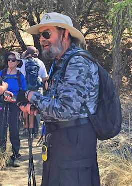
 Jim appears to be deep in thought. [photo by Li] |
 Dan, Molly, Li, and Katarina by the lake. [photo by Tom] |
 Panoramic view of Lynx Lake. [photo by Deirdre] |
|
Our predecessor, the Motorola Hiking Club, did a three-day car-camping trip at Lynx Lake many years ago, one of the first such trips that I made with this hiking club. I remember the beautiful hike around the lake as being one of the highlights of the trip, in addition to watching (from a respectful distance, of course) a pair of nesting ospreys feeding and caring for their two young eaglets sitting in the nest, high atop a large dead ponderosa pine (also known as a snag) overlooking the lake. Just like bald eagles, ospreys (also known as fish eagles) feed primarily on fish and routinely build their nests in the tops of tall dead trees, or snags, overlooking lakes and rivers for easy access to their food source. In what seems to be record time, we blaze through the connector trail and soon come to the junction with the Lynx Lake Perimeter Trail, a scenic two-mile trail that circles the entire lake. Here we take another breather and wait for the rest of our hikers to rejoin us. In the meantime, we take in the breathtaking scenery of Lynx Lake, with its lush forests of tall pines and assorted deciduous trees surrounding most of the lake and creeping right down to water’s edge. We watch as kayakers paddle swiftly across the clear blue waters of the lake and a few determined fishermen try their luck with the lake’s trout and bass. |
 Another panoramic view of Lynx Lake. [photo by Dave] |
 View looking back toward the dam, about halfway around the lake. [photo by Dave] |
 Trailblazers sit at a partially-shaded table overlooking the lake. [photo by Tom] |
 The perfect location to stop for a lunch break. [photo by Tom] |
 “We have room at this table. Anyone?” [photo by Tom] |
|
Lynx Lake was formed in 1962 when the Arizona Game & Fish Department constructed a dam on Lynx Creek. Following the completion of the dam, the U.S. Forest Service begin construction on the various facilities around the lake, including the perimeter trail, launch ramps, parking areas, picnic ramadas, and restrooms. Sitting at an elevation of 5,530 feet, this is a relatively small lake of only 55 surface acres. But it’s well-stocked with rainbow trout, largemouth bass, crappie, and catfish. I definitely need to renew my fishing license one of these days and get back here to try my own luck. There’s a long-standing creed among dedicated fishermen that the worst day of fishing is always better than the best day of working. Works for me. |
 Regrouping once again at the Connector Trail #94 junction. [photo by Tom] |
 Tired Trailblazers put away their gear and rest for a bit. [photo by Tom] |
|
After lunch we reluctantly gear up for the return hike back to the trailhead. We make quick work of the second half of the Lynx Lake Perimeter Trail, before linking up with the connector trail once again and hiking that back to the Salida Gulch Loop Trail. I mention the interesting set of petroglyphs that we saw on our 2016 hike and told everyone where to start looking for them. But while doing additional research online for this hike, I had also read that by now the trail might be rerouted around the petroglyphs because of earlier vandalism to the site. Apparently (and unfortunately) that seems to be the case, since many sets of eyes today fail to spot the petroglyphs anywhere in the general vicinity where they’ve been seen in the past. So strike up yet another victory for the ignorant and thoughtless vandals who always ruin it for the rest of us. |
 Clockwise: Carol, Vicky, Li, Molly, Tom, and Chuck. [photo by Tom] |
 Clockwise: Mimi, Terry, Darrell, and Barb. [photo by Tom] |
 Clockwise: Michael, Debra, Jen, and Jim. [photo by Tom] |
 LEFF-T’s Steakhouse & Grill. An iconic Dewey, Arizona landmark. |
On a lighter note, other than one small cluster of tiny (barely 1/8th inch across) yellow flowers, we do not spot another flower anywhere along today’s 9-mile route. As tempting as it would be to blame that on the vandals as well, in this case Mother Nature is to blame. All hikers are finally back at the trailhead by 1:15 PM. The temperature has risen to a still ideal 70 degrees, and we’re all famished. If it was available, I would almost consider eating some boiled boot leather at this point. But that not being the case, I suppose I’ll just have to wait. The group is split down the middle on stopping for a late lunch/early dinner, with 12 people opting to head back home while the rest of us decide to stop at LEFF-T’s Steakhouse & Grill, one of our favorite restaurants and watering holes, located on State Route 69 in Dewey. |
|
Supplemental Report by Jim Buyens |
|||||||||||||||||||||||||||||||||||||||||||||||||
|
It was really wonderful seeing everyone on Saturday’s Salida Gulch hike. I hope you had as great a time as I did. Chuck, thanks for choosing, organizing and leading this delightful hike. Jim |
|||||||||||||||||||||||||||||||||||||||||||||||||
|
|
||||||||||||||||||||||||||||||||||||||||||||||||
 Top of Page
Arizona Trailblazers Hiking Club, Phoenix, Arizona
Comments? Send them to the AZHC .
updated April 25, 2018