Outdoor Links
Hike Arizona
Trip Planning Guide
Trip Report Index
Calendar of Events
Library
|
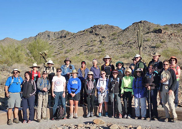
Skyline Regional Park Buckeye January 27, 2018 by Yanis Braukis |
|
|
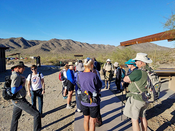
Located near Buckeye at the very southern point of the White Tank Mountains. Organized and led by Yanis Braukis. This was his first hike as a hike leader. 22 hikers participated. Hikers met near the restrooms adjacent to the parking lot at the end of Watson Road as it dead-ends into the park. The parking lot was found to be very full on this Saturday. In the future, hikers should arrive earlier. |
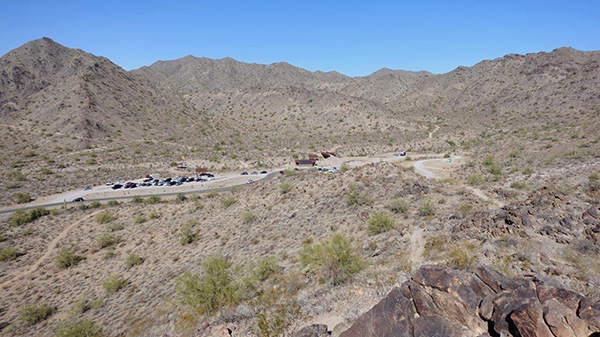 The Start and Finish point. |
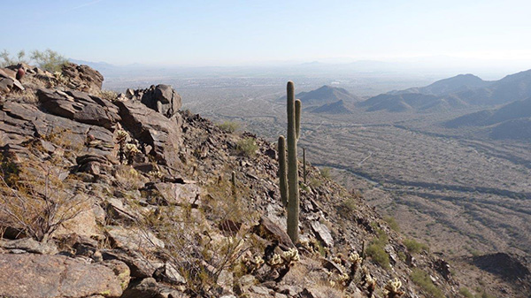
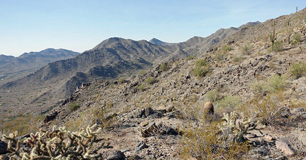 Desolate but Beautiful. |
 Views All Around. |
|
On this weekend the I-10 freeway westbound was closed in two places: at the Deck Park Tunnel for maintenance, and between 43rd Ave and 59th Ave for South Mountain Freeway construction. This impacted our group’s travel to the hike. It was necessary to travel on surface streets to avoid the freeway closures, and this delayed the start of the hike. |
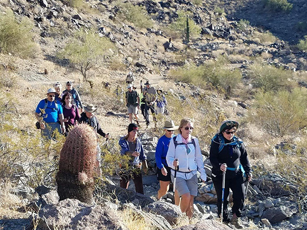
 A Fresh Group of Hikers. |
 Getting Ready. [photo by Tom] |
 Heading out. [photo by Tom] |
|
The group gathered for a group photo near the footbridge that is the locus for several trails in all directions. The hike was led clockwise around the outer perimeter of the trail system. We walked a short distance on the Mountain Wash and Turnbuckle Trails and reached the main trails of our trek: Granite Falls, Chuckwalla, and Turnbuckle (upper part). |
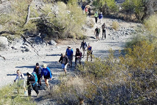 Wash Crossing. [photo by Tom] |
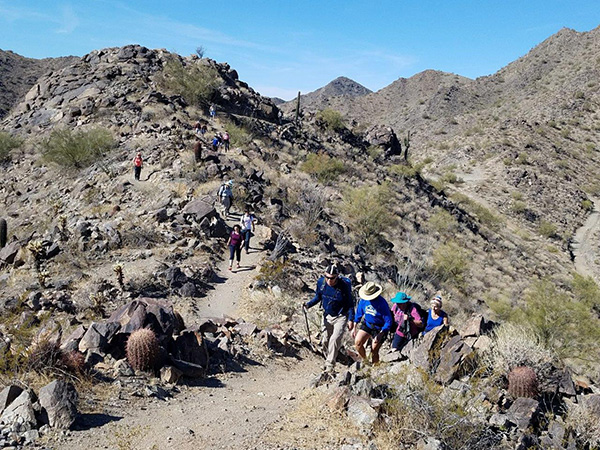
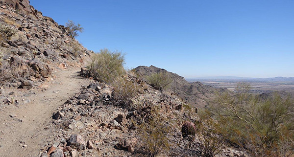 Trail Climbing High. |
|
Then short distances on the Mountain Wash (upper end) and Lost Creek Trails leading us to the Skyline Crest and Quartz Mine Trails which completed our loop of the trail system and back to our cars. Does this seem complicated? Yes it is, until one looks at a map of the trails. A map is imperative for this trail layout: it consists of six concentric loops. We walked on parts of all of them. Several maps were printed beforehand and disseminated. On any future trips maps should be printed as well and given to several hikers, especially the fastest and slowest, otherwise confusion will occur at trail junctions. The maps must be printed in color, or confusion will still reign. With a good color map the trail system is easy to understand and follow, but in color only! |
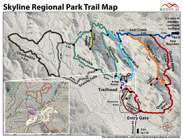 Trail map. |
|
For the most part, the 22 hikers seemed pleased with the hike and offered positive feedback about it. However, this was no easy walk in the park. Many expressed that it was more strenuous than they expected, and found it challenging. |
 Trail. [photo by Tom] |
 Hikers. [photo by Tom] |
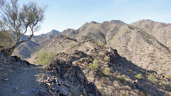 Ridgetop Trail. |
 Sentinel. [photo by Tom] |
|
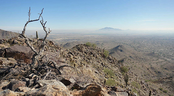
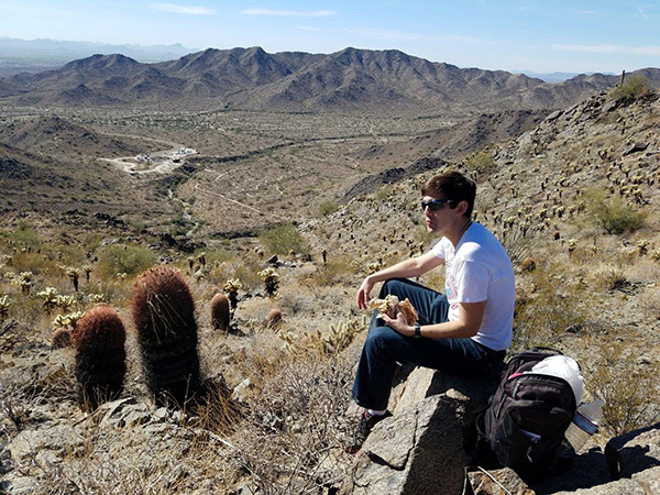
The first 4 miles of the hike was over rather flat terrain, but then the climbing started. The trail led upwards at a rather steep angle that could have used a few more switchbacks and climbed up to the ridge tops. There were several down and up segments along the ridges interspersed with flat sections, ending in a long steep descent that could have used a few more switchbacks as well. Finally, a half mile or more of upward sloping flat terrain led us to the cars. Breaking for lunch took place in two parts because of some confusion on the hike leader’s part. A perfect place for lunching was the Valley Vista viewpoint at the end of a short spur trail. It offered a panoramic view and lots of boulders and outcrops to sit on. Since this was only two and a half hours into our excursion it seemed better for snacking than eating, but many hikers took it for a lunch break and ate their meals there. |
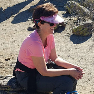 Monica. [photo by Tom] |
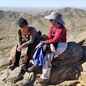 Debbie and Heather. [photo by Tom] |
 Dan. [photo by Tom] |
|
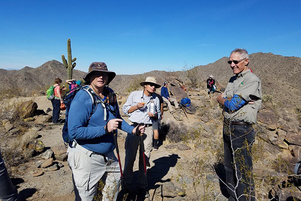
An hour or so later we stopped again on a saddle on a high ridge and spent more time eating or snacking. In any case we had two protracted stops to enjoy the scenic views, and each other’s company. |
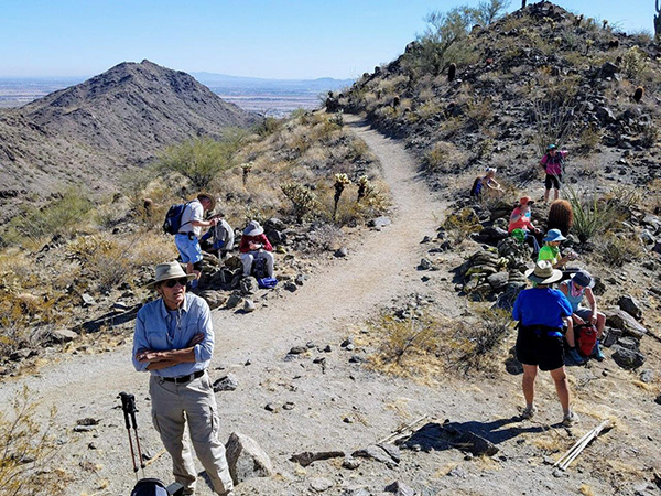 Break at Saddle. [photo by Tom] |
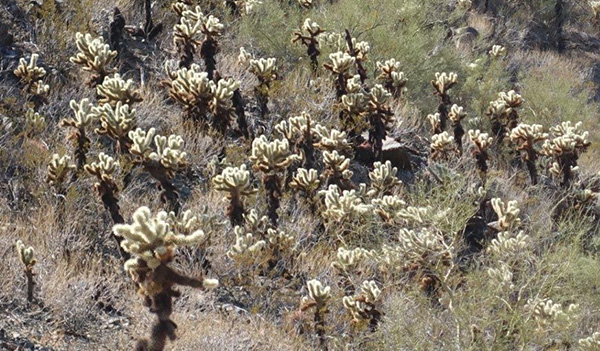 Cholla Friends. [photo by Tom] |
|
Those who desired to move on before others were ready to do go, did so at their own pace. As a result, our group became very stretched out, but everyone made it back to the starting point safely. A second viewpoint, Crest Summit, near the tail end of the trek was passed up by most of our hikers; only a group of four made the side trip to the top. |
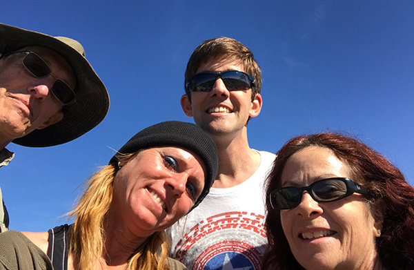 Summit-eers Dan O., Debbie, Daniel, Heather. [photo by Dan O.] |
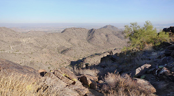 Trails Along the Top. |
|
Afterwards a group of eleven of us gathered for lunch across the freeway at Natural Wings Grill and had an amicable time eating and drinking in a relaxed atmosphere around a patio table. The consensus was that we had experienced a challenging but enjoyable hike, and had had a good time throughout. |
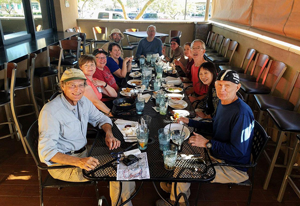 Group Lunch. [photo by Tom] |
|
Garmin data informs us of the following: Distance covered: 9.3 miles 2100 ft elevation change 5 hours of hiking Avg moving speed 2.4 mph Minimum elevation 1234', maximum elevation 2319'. |
 Top of Page
Arizona Trailblazers Hiking Club, Phoenix, Arizona
Comments? Send them to the AZHC .
updated February 15, 2018