Outdoor Links
Hike Arizona
Trip Planning Guide
Trip Report Index
Calendar of Events
Library
|
Willow Lake Day Hike Prescott May 5, 2018 by John Richa |
|
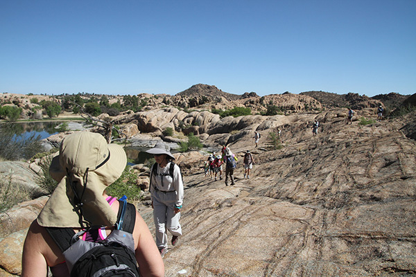
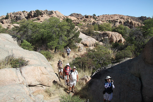
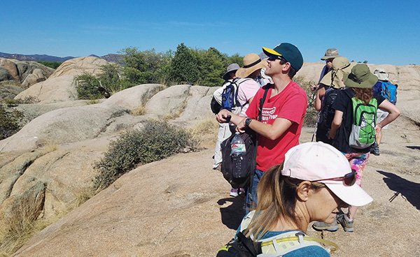
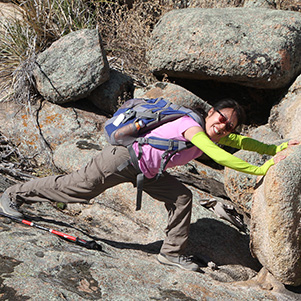
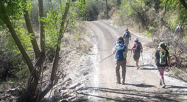
 Trailblazers at Willow Lake. [photo by John R] |
||||||
|
||||||
|
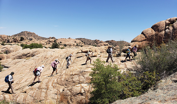
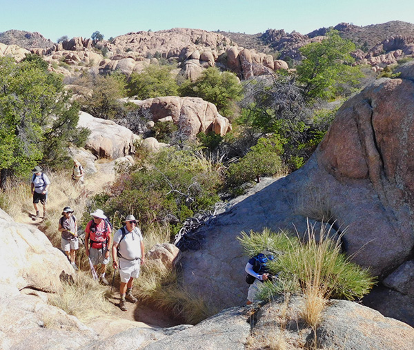
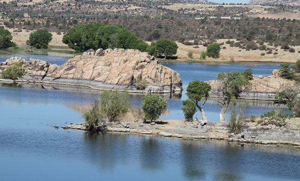
At 6:45 AM on a bright blue Arizona skies and a glaring sun, 21 hikers from the Arizona Trailblazers Hiking Club set out on the one hour and a half drive north to Prescott, a nice and quaint small town of some 40,000 inhabitants. In its past history, Prescott was twice designated as the state capital before the latter was finally relocated to Phoenix. Once on location, we met up with our 22nd hiker. We saddled up and by 9:00 AM after our traditional group picture taking and names introductions, we were on our way following the Red Trail that will hug and circumvent Willow Lake, a man-made lake built in 1935. |
||||||
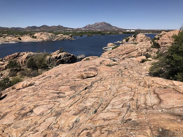
 Sure enough, this is Willow Lake. [photo by John R] |
||||||
 Granite Dells are on the east side. [photo by John R] |
||||||
 Willow Lake and Watson Lake from the air. |
||||||
 Yes, we can see the dam from here. [photo by John R] |
||||||
 What a great day for rowing! [photo by Wayne] |
||||||
 Boatman enjoys a pleasant time on the water. [photo by Wayne] |
||||||
 Bathtub rings, from when there was more water in the lake. [photo by Wayne] |
||||||
 The lake has many bays and inlets. [photo by Wayne] |
||||||
 Enough of this. Let’s get going. [photo by Carl] |
||||||
|
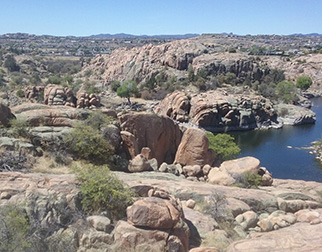
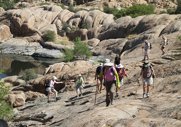
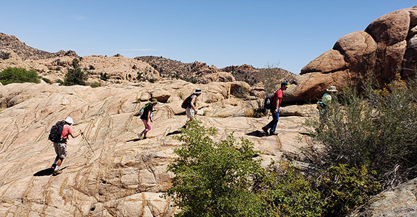
The lake was created by damming a narrow canyon in the rock formation that surrounds the lake. The lake is used as a reservoir but also serves as a recreational lake where you can fish, kayak or sail peacefully on a very calm water surface. Due to recent years of severe drought, the current water level was very low. You will see in several of the pictures, the once upon a time when we used to have more rainfall, the high water markings, in other words, “bathtub rings” on the rocks, some 15 to 20 feet above current water level. The lake water surface area covers 400 acres. 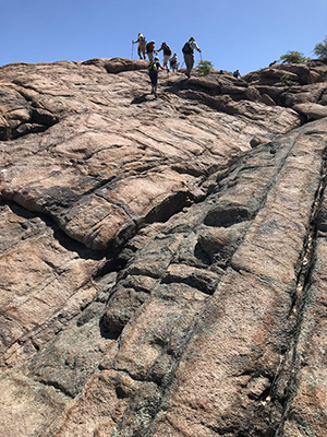 Yeah, but we have tro get down. [photo by Michael] The circumference trail would have taken us by the highway (see lake map above), which is not a sight we wanted to entertain. At the end of the rock formation, we would return by taking an inland side trail called the “Red Bridge Trail”, a less treacherous trail and which would allow us to explore new rock formation scenes not experienced on our “out” hike of this morning. At midpoint, the Red Bridge Trail would link up with the Shore Line Trail and take us back to the parking lot. The rock formation called Granite Dells around the lake is unusual looking. One might as well feel being on some other planet. |
||||||
 Plenty of granite. [photo by Wayne] |
||||||
 Are you sure this is the trail? [photo by Wayne] |
||||||
 Granite erodes smoothly, because it doesn’t have a preferred direction. [photo by Wayne] |
|
|
| Strange erosional patterns in the Granite Dells. [photos by Joe] | |
 Desert varnish coats the rocks in this section. [photo by Wendy] |
 Looking toward the sun, the colors come out different. [photo by Wendy] |
 Yes, this is the trail. [photo by Wendy] |
 Willow Lake is in the northern part of Prescott. [photo by Wendy] |
 Is is a metate? [photo by Michael] |
 Desert varnish. [photo by Michael] |
 Hmmm, this part looks reasonable. [photo by Michael] |
 ... but this sure doesn’t [photo by Michael] |
|
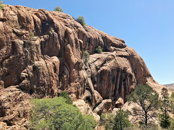
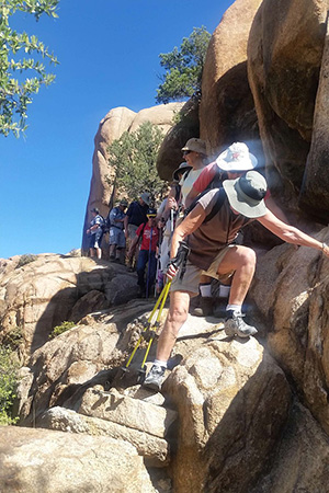
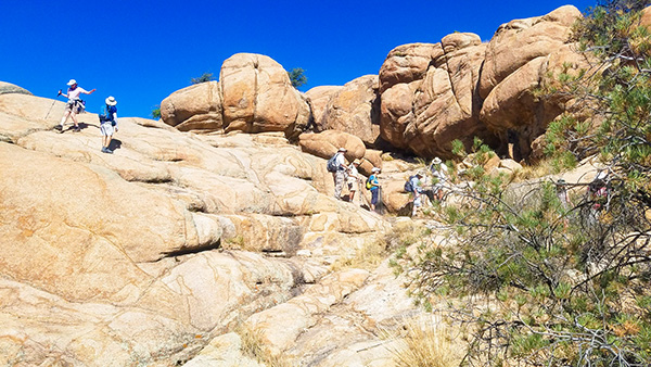
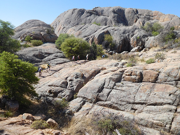
At first, our trail looked unusual: dirt trail bound by desert shrubs and tall grass, unpretentious. Soon after, we encounter the Granite Dells rock formation that will form our trail formation for the rest of our hike. Here is what the geologists said about the Granite Dells rock formation: The Granite Dells is a geological feature north of Prescott, Arizona. The Dells consist of exposed bedrock and large boulders of granite that have eroded into an unusual lumpy, rippled appearance. Geologically speaking: the “Precambrian Dells” granite has been dated at 1.4 billion years old. Its plutonic rock was intruded at a depth of around one or two miles. These cover rocks have since been eroded away. Weathering along joints produced the rounded boulders and other unusual rock formations that characterize the Granite Dells. This process is called “spheroidal weathering”, and is common in granitic terrains. |
 Finally, a level stretch of trail. [photo by Carl] |
 We’re well past the dam at this point. [photo by Carl] |
 Let me give you a hand. [photo by Carl] |
 Thank goodness for those white dots. [photo by Carl] |
 Easy does it on the way down. [photo by Carl] |
 Upsie Daisy in the Granite Dells. [photo by Carl] |
 We all made it to a local summit. [photo by Carl] |
 What a great place for pictures! [photo by Carl] |
|
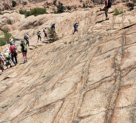
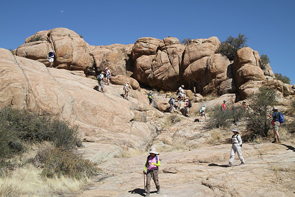
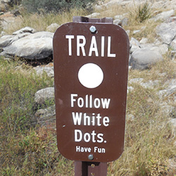
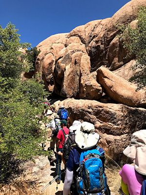
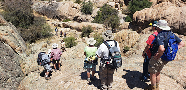
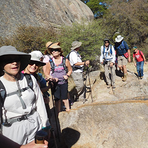
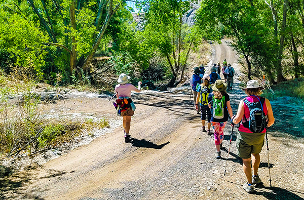
Our hiking in Prescott’s Granite Dells was like getting lost in a Stone Age labyrinth. The network of paths on the north shore of Willow Lake coiled through hulking quartz-studded granite buttes squeezing in and out on the paths in heaving accordion style. The rugged meandering loop trails moved seamlessly from claustrophobically tight spaces to airy exposed promontories with unobstructed vista. On these rocks the trail followed spray-painted white dots that serve as directional beacons. |
 Trail signs here and there. [John R] |

|

|
| Just follow those white dots. [photos by Michael and John R] | |
 Not bad on the way up. [photo by Wendy] |
 ... but then, on the way down. [photo by Wendy] |

|
|
| So why don’t we just go up? [photos by John R and Michael] | |
 The view from the top. [photo by Michael] |
 ... but first we have to get there. [photo by Wendy] |
|
Our starting point trail was a dirt trail bordered by desert shrubs and short trees. The trail soon led to an open panoramic view of smooth and weathered Dells rocks and loose boulders which seemed ready to roll down with a simple and gentle push. No, we did not attempt to roll down any of them though! Except, except for two daring and seemingly powerful hikers. They pushed and pushed and pushed, but alas, to no avail. Not enough Cheerios for breakfast this morning. |
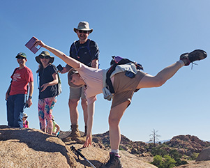
 Trailblazers pose for posterity. [photo by John S] |
 I like the view from here! [photo by John S] |
 There are caves in the rocks. [photo by John S] |
 We’ve made it up here. Now what? [photo by John S] |
 A great place for a break! [photo by John S] |
 Upward mobility. [photo by Lin] |
 Yes, we can all make it. [photo by Lin] |
 What a great day for hiking! [photo by Lin] |
 Why don’t you come down and join us? No, you come up. [photo by Lin] |
 We’re climbing in the shade now. [photo by John R] |
 Now it’s my turn. [photo by John R] |
 Yeah, we can get up there. [photo by John R] |
 Watch me make the climb. [photo by John R] |
|
|
| Is this the trail, or what? [photos by John R] | |
|

|
| Push! [photos by John S] | |
 Wendy’s “haute coiffure” and long flowing blond hair. [photo by Lin] |
|
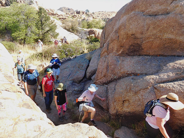
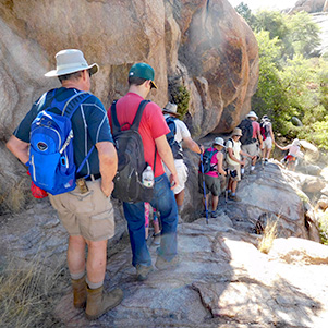
The dirt trail quickly disappeared and now our only navigation reference without getting lost is to follow the white painted dots on the rocks. Without the dots, one can easily get lost in the maze of rocks with no clear path. The dotted trail took us high along the rock ridges and in narrows where one had to squeeze to get through. Frequently we stopped on high ridges and admired the sceneries of the dark blue lake waters and the surrounding landscape of the Dells rocks. At one point we came upon a red wooden bridge that helped us leap across a wide crevice. |
 The red bridge is still there. [photo by Lin] |
 Now don’t you dare collapse on me. [photo by Lin] |
|
Despite the beaming down hot sun, some of us managed to have some fun with Lin doing her signature leap and Wendy enjoying for a moment her newly discovered coiffeur transformation into this dizzying long and flowing blond hair. What a quick and beautiful transformation! |

|
|
| Lin and Wendy show us their latest dance steps. [photos by Carl] | |
|
From different points along the trail, we could see the low and the high level markings of the water line etched into the rocks. |
 The lake traces out its water level contour. [photo by Carl] |
 There’s a better view of the water here. [Carl] |
 These islands are for the birds. [photo by Carl] |
 From when the lake had more water in it. [photo by Carl] |
 The Granite Dells are on the east side of Willow Lake. [photo by Carl] |
 Granite Dells reflect off the water. [photo by Carl] |
|
There were many photos opportunities and we did not skimp on clicking our cameras’ shutters. As Lin eloquently said: how amazing it is that we all take pictures of the same scene, yet with different cameras, lenses, shutter speeds, each person’s picture is uniquely different. At its narrowest point in the Dell rock formation a dam was built, thus creating this manmade lake. |
 You can get close to the dam on this side. [photo by John S] |
 We’re the best dam guys in the business. [photo by John S] |
|
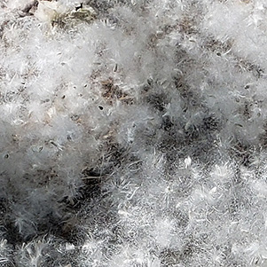
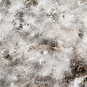
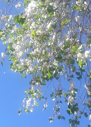
Walking behind the dam in the riparian canyon there were large cottonwood trees, 50 to 80 feet tall and thriving. They provided us with a welcome relief under their shade. It is now 10:00 AM and it is getting hot with the sun glaring overhead and beaming down on us. We regrouped here and proceeded towards the dam and the 75 or so stairs climb in order to reach the top of the rock formation. On this walk we noticed that the cottonwood trees were in full bloom and the seeds were being blown all over by the wind as if they were cotton balls, before they settle to the ground. It seemed as if it were snowing in May in Arizona. |
 This part of the trail is a road. [photo by John S] |
 Merrily we roll along. [photo by Wendy] |
 Somebody built a tree house above us. [photo by Lin] |
|
|
| Is it cotton balls or snow? [photos by Lin] | |

|
|
| It is cottonwood blossoms. [photos by Wendy] | |
|
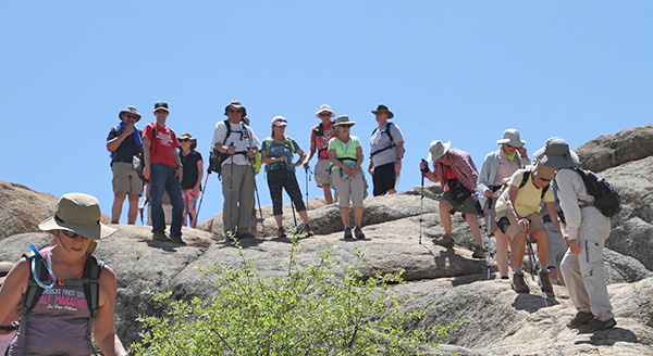
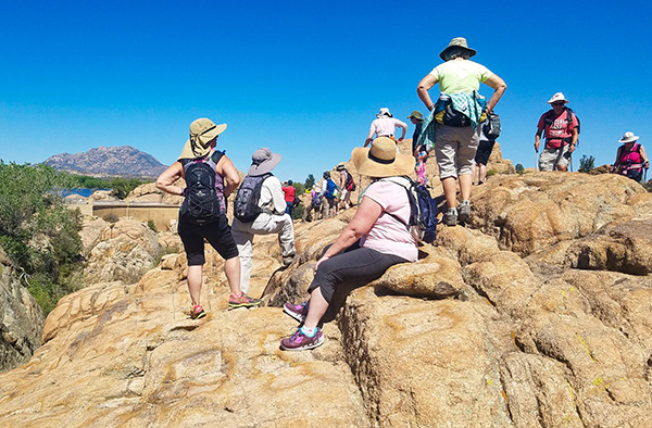
We climb these 75 stairs to reach again the Dells rocks formation above the lake water surface and continue our hike up a tall rocky hill. The view from this vantage point was breathtaking. Nine of us decided to stop here at the peak, and what a better location to have our snacks break than from this pinnacle peak. The sun was beating down on us, but it was tempered by a nice and cool breeze. |
 Is it Jacob’s ladder? [photo by Lin] |
 Don’t know, byt we’re climbing it. [photo by Wendy] |
 King of the mountain? [photo by Wendy] |
 What goes up must come down. [photo by John R] |
 On top of the world! [photo by John R] |
 Willow Lake reflects the trees on the opposite shore. [photo by Michael] |
 Curious cross-hatch pattern in the rocks. [photo by Michael] |
 Why don’t we have races here? [photo by Michael] |
 What a great picnic spot! [photo by Michael] |
 Slickrock isn’t slick when it’s dry. [photo by Wayne] |
 Here we go again. [photo by Wayne] |
 I’m glad we didn’t go around the lake the long way. [photo by Joe] |
 The view from on top. [photo by Joe] |
|
Ten of our colleagues decided to go down toward the lake shoreline and explore. We had our two ways radios so we were in touch with them all the time. They found a shady spot under a large cottonwood tree by the shoreline and ate their snacks there. |
 Expansive view from the top. [photo by John R] |
 Here’s a white dot, so we must be on the trail. [photo by John R] |
 This is the life! [photo by John R] |
 Did anyone notice that the rocks are soft and cushiony? [photo by John R] |
 We found a nice shade tree. [photo by John R] |
 The water looks so inviting. [photo by John R] |
 We’ll save Granite Mountain for another time. [photo by Wendy] |
 Erosion has carved the rocks intricately. [photo by Wendy] |
 On top of the world! [photo by Wendy] |
|
After our snack break, we decided to go back via the Dells Red Rocks Trail back to the trailhead and skip the lake circumference trail, a rather nondescript trail. This allowed us to get a double whammy of rock hopping, negotiating narrow ridges and slippery rock surfaces. This made our return hike much more enjoyable and much more interesting and an exciting experience. On our return trek, just below the dam, we took a side trail, an inland trail called the Red Bridge Loop. This allowed us to see additional Dells rock formations, but the trail was less strenuous. We were approaching “high noon” by now and we could feel the heat radiating back at us from the rocks. The Dells rocks had been sizzling under the hot sun for a few hours by now. By now, some of us started to think about our lunch awaiting us at Murphy’s restaurant and maybe even salivated at the thought of a juicy and loaded “big and thick” burger. Some of us probably could even taste in “their mind” the cold beer quenching their thirst. There were quite a few hikers in our group in our group today who have never hiked this trail before. I am sure this was a unique experience for them not likely to be forgotten any time soon. We made it back to the trailhead by noon, sound and safe and hungry for a good late lunch. We proceeded to Murphy’s restaurant in downtown Prescott, a historic restaurant we patronized before and where we had a prior reservation for today’s lunch. A couple of waiters waited on us. I thanked the manager on behalf of the club and our hiking group for accommodating our 17 hungry hikers us on a busy Saturday during a lunch period. The service was very good and everybody was happy and satiated. |
 The plaque says it all. [photo by John R] |
 Murphy’s Restaurant. [photo by John R] |
 A satiated and happy bunch. [photo by John S] |
|
The restaurant is in a historic building that dates back to 1883. A plaque in front of the restaurant tells its history. Thank you all for participating. It was a great day. |
|||||||||||||||||||||||||
 Top of Page
Arizona Trailblazers Hiking Club, Phoenix, Arizona
Comments? Send them to the AZHC .
updated May 21, 2018