Outdoor Links
Hike Arizona
Trip Planning Guide
Trip Report Index
Calendar of Events
Library
|
Arizona Trail 12 & 13 Day Hike Oracle October 12, 2019 by David French |
|
 Everybody smile for the group photo. [photo by Quy] |
||||||
|
||||||
|
This hike was part of the second annual Arizona Trail in a Day celebration. The Arizona Trail Association divided the 800 mile long trail into 100 segments and asked for people to sign up for one or more segments so that hikers/bikers/equestrians would be on all segments on this one day. I chose segments 22b and 23. Segment 22b is the northern end of Passage 12, Oracle Ridge and Segment 23 is all of Passage 12, Oracle, which passes through Oracle State Park. |
||||||
 Do we really want to drive there? [photo by Dave] |
||||||
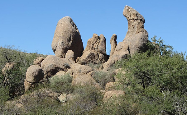
 The Catalina Mountains to the south. [photo by Dave] |
||||||
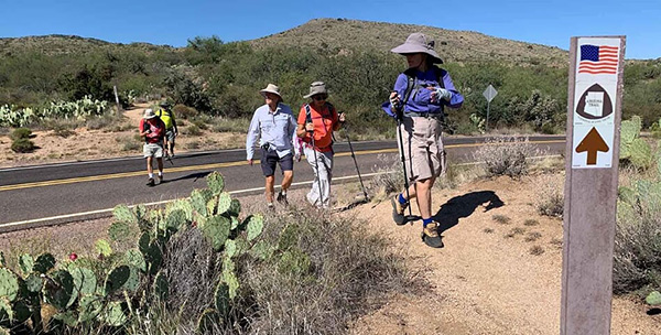
 We’re off! [photo by Quy] |
||||||
 The High Jinks Ranch. [photo by Dave] |
||||||
 Bedrock City. [photo by Quy] |
||||||
 Galiuro Mountains in the distance. [photo by Quy] |
||||||
|
We started at the High Jinks Ranch Trailhead, hiked 1.8 miles to the American Flag Trailhead, which is the end of Passage 12 and the beginning of Passage 13. We continued north, crossed Mount Lemmon Road and Webb Road, and then entered Oracle State Park, where we remained all the way to SR 77. No state park fee is required as long as you stay on the Arizona Trail. |
||||||
 Beautiful country! [photo by Quy] |
||||||
|
Thirteen hikers left the Home Depot in Mesa at 7 AM and drove east on US 60 to SR 79 and continued south to Oracle Junction and then east through Oracle to Tiger Mine Road. We drove north on an unpaved but good road for about 1.5 miles to the trailhead. We realized that this busy road was the Arizona trail from SR 77 to the trailhead, and we would have to hike it. There were lots of pickups pulling horse trailers arriving about the same time. We found out later that the equestrians were part of the Arizona Trail in a Day event and, fortunately, they headed north from that trailhead. We met one more hiker, left one car, and then drove back into Oracle and took Mount Lemmon Road and then branched off onto Campo Bonito Road, which is an unpaved road to the High Jinks Trailhead. It was a bright sunny day, cool but pleasant with a slight breeze. After the group photo we headed on a short connecting trail to the Arizona Trail and headed north on the AZT. The trail was almost all downhill for the first several miles. We met several southbound hikers on Passage 12 that were part of the celebration. We reached the American Flag Trailhead, took a second group photo, and met many more people that were part of the AZT event. |
||||||
 American Flag Trailhead. [photo by Dave] |
||||||
|
||||||
 Trekking. [photo by Dave] |
||||||
 Crested barrel cactus. [photo by Dave] |
||||||
 Hey, wait for us! [photo by Dave] |
||||||
 Crossing under AZ 77. [photo by Dave] |
 Service with a smile. [photo by Quy] |
 It’s that-a-way. [photo by Dwight] |
 Windmill. [photo by Dwight] |
 Don’t fence me in! [photo by Dwight] |
 The Three Musketeers?—Don’t think so. [photo by Dwight] |
 Don’t mess with this guy. [photo by Dwight] |
 Yuccas galore! [photo by Quy] |
 Crossing Mt. Lemmon Road. [photo by Quy] |
 Who says I’m long-winded? [photo by Quy] |
|
We continued northward on Passage 13 through rolling hills and washes with nice vegetation and distant views. Several hikers asked me the name of the mountain range to the east. It is the Galiuro Mountains with Kennedy Peak as the tallest point at 7549 feet. At mile 4, we met a large group headed south and part of the AZT event. We continue on for another couple of miles and then decided to stop for a snack/lunch break. We continued on and dropped down into Kannally Wash, where there is a windmill that is supposed to provide water for through hikers. We were not able to extract any water from the faucet. There was a picnic table and some benches, so this would have been a much better place to have the snack break. We continued on and began the long climb out of the wash. That was the toughest part of the hike. We again dropped down into a wash near SR 77. We gathered there and decided that some of the faster hikers would hike up the Tiger Mine Road and retrieve the car we left there, while the rest of us stayed at small parking area on the north side of SR 77. |
 Waiting for a car to be returned. [photo by Dwight] |
|
When the car returned, we got our cold drinks and change of shoes and relaxed for a short while before piling the 5 drivers into the car and headed back to High Jinks to retrieve the other cars. Most of us hiked 9 miles in 4:42 hours gained 896 ft elevation and descended 1710 ft. The elevation range was 3970 to 4943. The four hikers that retrieved the car at the Tiger Mine Trailhead hiked 10.5 miles. About half of the hikers went to the Ore House in Oracle for eats and drinks. |
 Top of Page
Arizona Trailblazers Hiking Club, Phoenix, Arizona
Comments? Send them to the AZHC .
updated October 15, 2019