Outdoor Links
Hike Arizona
Trip Planning Guide
Trip Report Index
Calendar of Events
Library
|
Awards Potluck and Hike Papago Park, Phoenix January 19, 2019 by Mark and Michelle Jelsma |
|
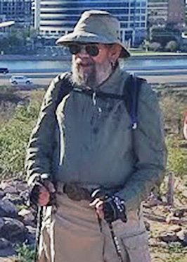
 Trailblazers ready to hike, at Ramada 2 in Papago Park. [photo by Lin] |
|
Finding Ramada 2 turned out to be a bit of a challenge. I think we all ended up going around the circle at least twice before finding the entrance. Once everyone found the ramada and we got our food dishes coordinated and plugged in, we turned the watch duty over to Barbara to keep an eye on our food. Thank you, Barbara! We gathered to take a group picture and do some small introductions. |
 Let’s get organized! [photo by Carl] |
 We have a fine view of the park and the city. [photo by Dave F.] |
|
After introductions, 35 Trailblazers hit the pavement around 8:30, headed for the first stop at Hunt’s Tomb with Mark in the lead and Michelle sweeping. Turns out we should have put Michelle in the lead and Mark as sweep. It wasn’t long before Mark took a wrong turn and continued on pavement when we should have been hitting the dirt. Michelle quickly got in touch with Mark, and the front group held up until Michelle could catch up and get the group going the right direction. |
 Trailblazers on the march. [photo by Tom] |
|
From here it was a short jaunt down the road before we found the trail and headed up for our first climb. It was a pleasant surprise to see a herd of bighorn sheep standing on the side of the mountain watching us as we approached Hunt’s tomb. After a few minutes of reading up on the history and taking pictures, the group moved on. We continued around the back side of the Papago Buttes behind the Phoenix Zoo fence line, where we encountered a few more bighorn sheep for close up pictures. We continued on behind the zoo, making our way around the edge of the mountains going up and down past the canal and over into another area of Papago Park. |
 Bighorn Sheep. [photo by Dave F.] |
|
As we enter this area there is a sidewalk trail and a dirt trail. Mark headed up the sidewalk for a short distance and decided he wanted to jump the railing to hit the dirt trail (he was supposed to hit the dirt trail to start with, imagine that). The railing was high and not so easy for everyone to jump over, so most of us followed the sidewalk up to where the railing ended. We then moved over to the dirt trail and climbed up over and through the Buttes and headed towards the tall electric pole and climbed up the hill next to the water tank. From here we have vast views of the urban infrastructure and populated areas surrounding us. We descended along the fence line and around to another butte. There we gave the hikers the option to split off for a tougher route around the west side or take the easier route along the east side of the Butte. It wasn’t long before the east side hikers could hear the hooting and hollering of the west side hikers from atop the Butte. You always have your show offs! |
 We made it to the top! [photo by Carl] |
 Come on up here, you all. [photo by Li] |
|
After a short break, we got the group back together and made our way down to a culvert where we could pass from the north side of Curry Road to the south side. Here we headed west and took a loop around the Papago Park area between Curry Road and Loop 202. Along the way we passed some archaeological sites, including ancient Hohokam ruins. The loop took us around where we caught a glimpse of Tempe Town Lake before heading back down through the culvert and to the north side of Curry Road. |
 There once was a railroad here. [photo by Tom] |
 We’re almost to Tempe Town Lake. [Tom] |
 Heading back. [photo by Tom] |
|
We stayed more to the east side of The Buttes and walked along past the O’Conner house. There was much intrigue as to what the O’ Conner house was, so I did a little research. The house was originally built in 1956 in Paradise Valley and belonged to Justice Sandra Day O’ Conner. It was moved to Papago Park in 2009 to be a center of civil discourse on matters of public policy. Here’s the link. At this point we had pretty much divided into two groups. Michelle led the faster group and Mark kept an eye on the slower folks. We trekked back over some of the same trails we had been on and made our way past Hunt’s Tomb on the lower side, found our way around the lakes and eventually to the hole in the rock. Everyone went their own way to play and take pictures before heading back to the ramada where the food was waiting. Thanks to all for the delicious food! Thank you, Debbie, for picking up all the trash! Mark & Michelle → More pictures, by Dave F.→ More pictures, by Carl → More pictures, by Li → More pictures, by Tom |
 It’s that-a-way. [photo by Li] |
 Hole in the Rock. [photo by Li] |
 Hole in the Rock. [photo by Carl] |
 I can’t hold this up much longer. [photo by Li] |
 Need some help? [photo by Li] |
 Let’s chow down. [photo by Carl] |
 Let’s chow down. [photo by Carl] |
 Let’s chow down. [photo by Tom] |
|
Supplemental Report by Ted Tenny |
|
|
|
What a lovely day for a hike! Cool and sunny, with a mild breeze. We all started southeast from Ramada 2, walking first along a paved road and then a trail to Hunt’s Tomb. Afterwards we walked beside the edge of a fenced enclosure with rocky buttes and bighorn sheep. Being a natural slowpoke and stopping to take pictures, I found myself bringing up the rear. Michelle graciously accepted Andy’s offer to replace her as sweep, and we marched on. Andy and I last saw our hiking companions at an overlook. We had missed a turn, and had to take a side trail to get up there. By the time we got to the overlook no one was in sight. Which trail should we take? There were several trails going in different directions, and we didn’t see a soul on any of them. Finally we took one of the trails, and still couldn’t see anyone. So we decided to go back. Hunt’s Tomb was a helpful landmark on our way back. We arrived at Ramada 2 and joined the crew guarding the food, then I called Tamar to let her know that Andy and Ted made it. Thanks to Andy for staying with me. Ted |
||
 Was Ramada 2 hard to find? [photo by Ted] |
 Montezuma Sleeping and Peak 4512 in the Sierra Estrella. [photo by Ted] |
 Trailblazers pass a ramada on the way out. [photo by Ted] |
 Hunt’s Tomb serves as a navigation landmark. [photo by Ted] |
 The bighorn sheep are well protected. [Ted] |
 King of the Mountain! [photo by Ted] |
 Which way did they go? [photo by Ted] |
 A popular destination. [photo by Ted] |
|
Supplemental Report by John Scruggs |
 A nice reflection. [photo by John] |
On Saturday January 19, 2019, our hiking club held our awards potluck and hike at Papago Park, Phoenix AZ. This jewel of the valley of the sun, mounted between Phoenix, Tempe, and Scottsdale and sharing borders with the Phoenix Zoo, has 360 degree scenery. I was given a club award certificate and gas card as the number four carpool driver for 2018 at 3,178 miles in twelve trips. Yes, I won a hiking club award for driving! I was number 17 for hiking distance at 158 miles on 23 hikes. John |
 We’re walking southeast, into the bright sun. [photo by John] |
 Chris [photo by John] |
 Lin [photo by John] |
|
Actually, we found the golf clubs and picked them up along with several bags of trash that some of our dedicated hikers collected. No golf balls though. So, Chris hit the big ball. The lines of rocks around Lin’s tee box are the footings of a prehistoric Papago pueblo. The mountain on the distant horizon is Camelback. |
 Tropical Splendor in the Heart of the Tri Cities. [photo by John] |
|
One white heron shared the lakes with many ducks who are migrating through or are permanent Zoo residents. This exquisite bird reflects well on the purity of the water in our wonderful tri city resource, Papago Park. |
 Trailblazers Passing Through. [photo by John] |
|
No visit to the park would be complete without a climb up Hole in the Rock. It was good to see Nancy back on the trails again. This was great to hike with so many good friends and many new members. A nice morning workout. Hopefully you will see photos of our excellent potluck dinner from others who took time out of chowing down, unlike me. |
|

|
||||||||||||||||||||||||
|
Supplemental Report by Jim Buyens |
|||||||||||||||||||||||||||||||||||||||||||||||||
|
After my recent absence it was great seeing you all again and hiking together. It was a great event on a great day and I hope each of you enjoyed it as much as I did. And thanks, of course, for all your warm wishes. Jim |
|||||||||||||||||||||||||||||||||||||||||||||||||
|
|
||||||||||||||||||||||||||||||||||||||||||||||||
 Top of Page
Arizona Trailblazers Hiking Club, Phoenix, Arizona
Comments? Send them to the AZHC .
updated January 24, 2019