Outdoor Links
Hike Arizona
Trip Planning Guide
Trip Report Index
Calendar of Events
Library
|
Chimney Mountain Mocha West Sedona February 16, 2019 by Mark Purcell |
|
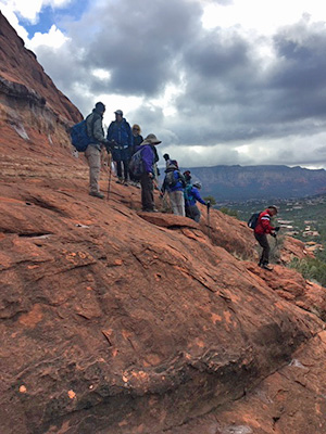
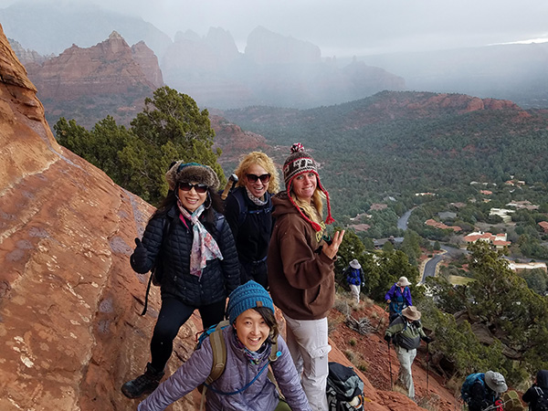
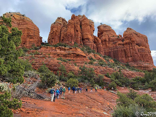
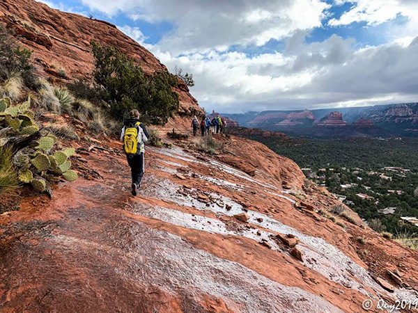
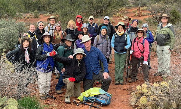 We are the Trailblazers. [photo by Quy] |
||||||||
|
||||||||
|
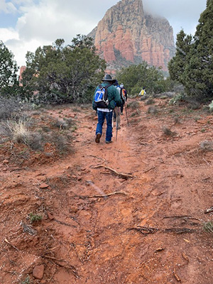
Generally, when I have identified a Sedona area hike to lead, several factors are considered. Included are incorporation into my work schedule, sufficient lead time to allow participants the option to plan other activities in the area over multiple days, and historical trends in weather conditions. The latter was integral as the average high temperature at this time of year was in the upper 50s—perfect for a hike of considerable distance with little shade. On the Saturday before (9th), it was a cold and wet day. So, my assumption (OK, hope) was that the law of averages favored a vast improvement for the day of the hike. Alas, the forecast deteriorated as the week progressed to a point where it was going to be even colder (in the mid 40s) and we could be exposed to frozen precipitation to start the hike. However, in a testimony the durability and sense of adventure of my roster, I only had one cancellation that was not even due to the expected conditions. Indeed, as the 23 hikers gathered at the Sugarloaf Trailhead, the skies were tantalizing blue in spots but pellets of snow also periodically appeared as we walked a short distance to an open area for introductions and a hike briefing. As intimated in the trip title, this hike featured three significant highlights, being Chimney Rock, trekking the newly rerouted Thunder Mountain Trail, and a ascent to an elevated social trail abutting Coffee Pot (the Mocha) but executed in reverse order. |
||||||||
 Light and shadows at play. [photo by Quy] |
 Don’t tread on me. [photo by Debbie] |
 The view ahead. [photo by Debbie] |
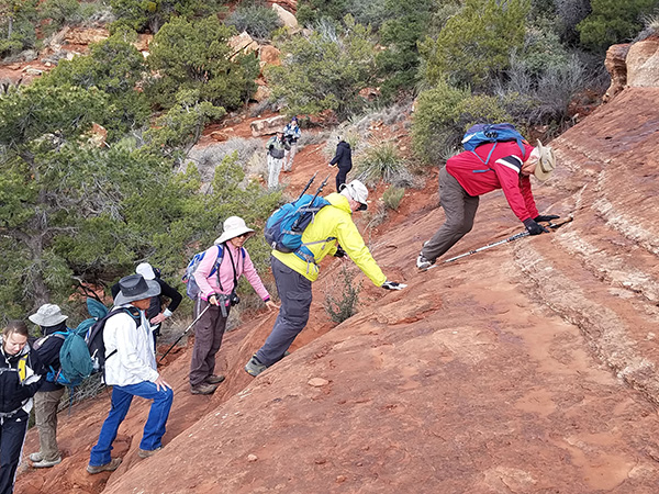
 It gets mighty steep. [photo by Mark] |
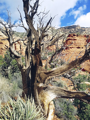 A twisty tree. [photo by Debbie] |
 Trailblazers are up to it. [photo by Tom] |
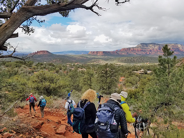
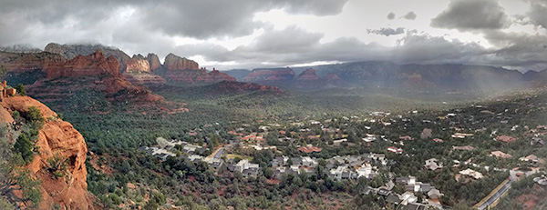 Grand overview of Sedona. [photo by Tom] |
 We got this high. [photo by Tom] |
|
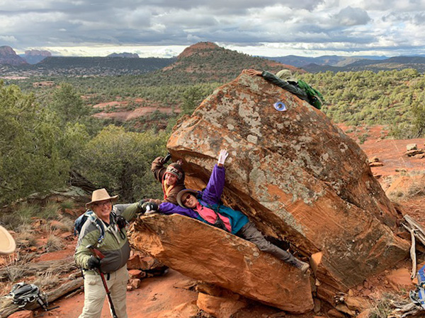
Coffee Pot—From the Teacup Trail we detoured onto a gradually ascending social trail (informally Coffee Pot Rock) that is largely used by locals, mountain bikers, and inadvertently visitors who take a wrong turn. After roughly a ¼ mile we turned onto another social trail that abuts the face of Coffee Pot. We made an intermediary stop at a large boulder that had cleaved to resemble an open-mouthed whale. This was the “set” for the debut of the “Trailblazer Players” where two damsels in distress inserted themselves into the mouth of the “beast” pleading for rescue by a burly passing acquaintance. Although entertaining, the production did suffer from lack of rehearsal time and a director who did not extract true expressions of angst and fear from the actors. The set itself was enhanced with an “eye” towards being authentic. |
 Watch your step on that trail. [photo by David] |
 Lofty sentinels over Sedona. [photo by David] |
 Desert varnish. [photo by David] |
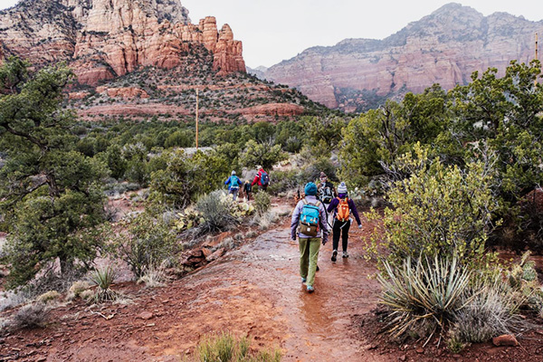
 Merrily, merrily, down the trail we go. [photo by Quy] |
 The sun comes out. [photo by David] |
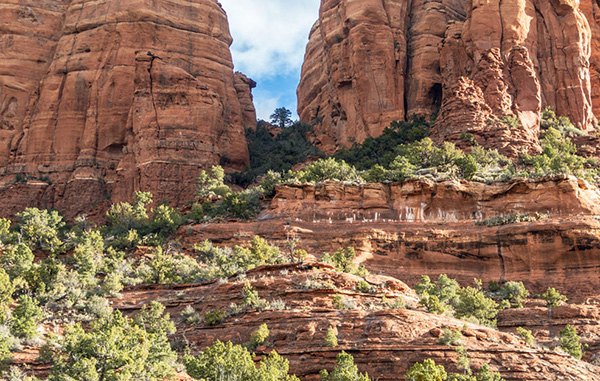
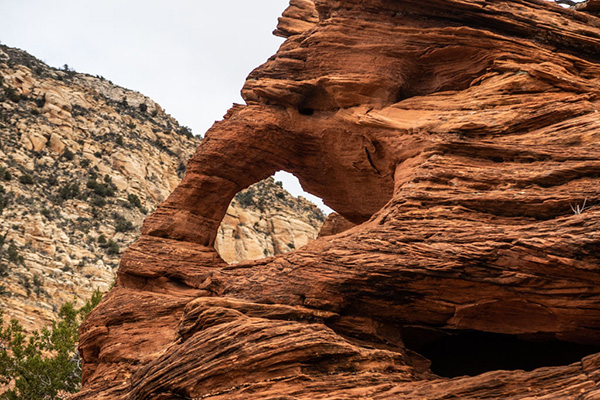 Arch in the red rocks. [photo by David] |
|
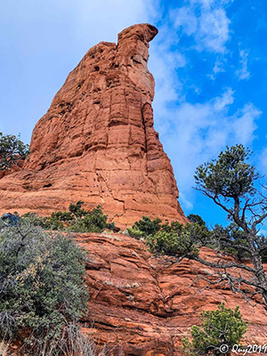
Moving on, we continued on the trail and after a brief but steep climb onto a rock shelf that extends beyond the “spout” although for reasons of safety I asked participants not to fully explore. At this point we were perhaps one hundred feet above the USFS Teacup Trail with magnificent views of Devil’s Kitchen, Steamboat Rock, Cathedral, and the subject of another later stop in Chimney Rock. Many continued on another social trail that further raised the elevation to being able to touch the highest accessible point on Coffee Pot without the necessity of climbing gear. |
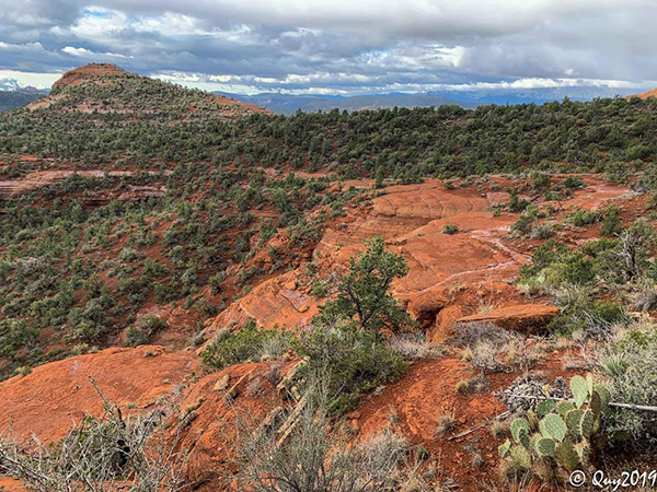 Red rock everywhere. [photo by Quy] |
 It rained recently. [photo by Quy] |
 Onward and upward. [photo by Sheila] |
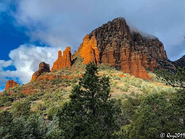
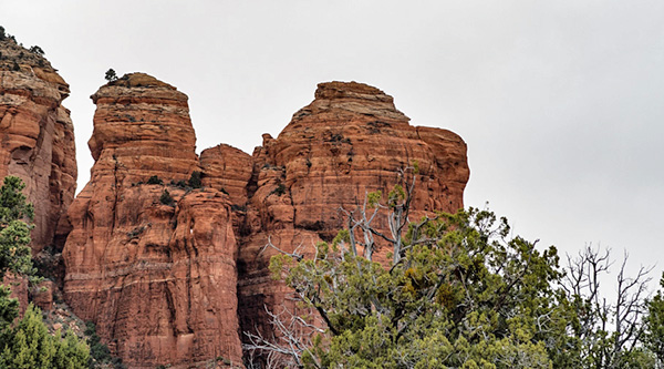
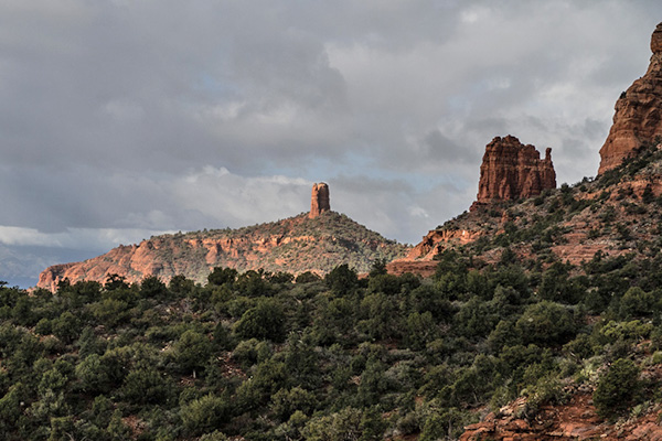
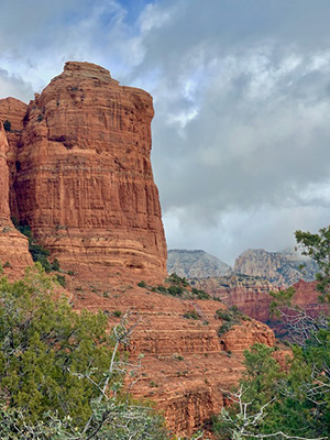 Coffee Pot, our first stop. [photo by Sheila] |
 There’s nothing funny going on here. [photo by Sheila] |
|
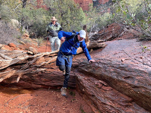
Thunder Mountain Trail—also known as Capital Butte, Thunder Mountain rises to around 6300 feet. It’s possible to hike to the top, but it is quite challenging and there have been numerous rescues of stranded or injured over the years including a daring helicopter extraction just a few months ago. Therefore, we will instead explore the trail that skims the base of the mountain—but first we have to get there from Coffee Pot. Knowing the adventurous nature of Trailblazers, instead of established routing we bushwhacked our way to and through a wash to the next trail and enjoyed the varied geology that is present in Sedona. |
 Trails are well marked with signs. [photo by Tom] |
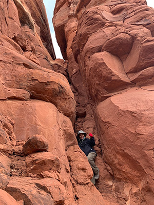
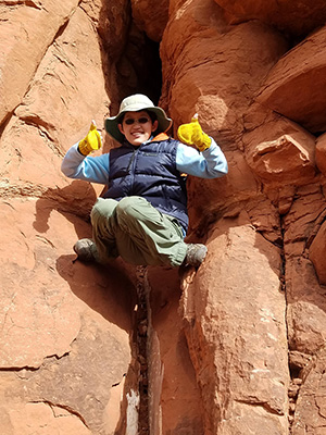 Lin climbs a crack in the rock. [photo by Tom] |
 A’ down we go. [photo by Tom] |
 I am taller than you. [photo by Quy] |
 ... but I can climb partway up. [photo by Quy] |
 One more step ... [photo by Quy] |
|
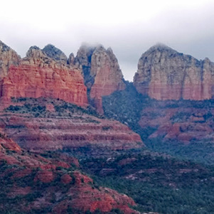
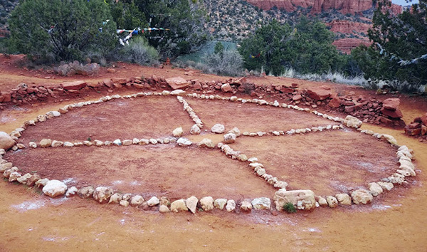
Up till a couple years ago, the Thunder Mountain Trail, relatively speaking, was rather mundane as it paralleled its namesake. However in 2016-17 the trail was rerouted to elevate closer to the Mountain and significantly enhancing the views without greatly increasing the level of difficulty. Up to this point, I had controlled the pace of our outing but I had designed this section to be SYOP “Set Your Own Pace” where hikers so moved could have an opportunity to challenge their metabolism. 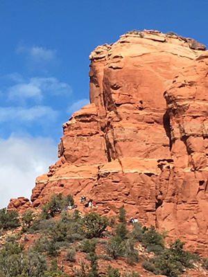 Hikers at Chimney Rock. [photo by Mark] Chimney Rock—at the intersection of the Upper Chimney Rock Trail we reconvened for a steeper ascent. At the saddle (which is designated Wilderness), we exited onto another social trail that rose quickly to the base of Chimney Rock. This is not a frequently accessed trail, and even less known is the ability to completely walk the circumference which seems improbable from the trails below—I offered this as a “bonus” hike. As this was a slightly higher elevation from our position on Coffee Pot, even more surface of the Sedona Landmarks of Courthouse, Cathedral, and Bell Rock were viewable. Alas, however, the wind had picked up and precipitation was threatening so the group descended back to the main trail and followed it to the other side of Chimney Rock. Amitabha Stupa and Peace Park—this was offered as an optional brief stop on our way back to trailhead as it is a renowned location for selected visitors to visit and use as a venue for meditation and contemplation. |
 From the grounds of the Stupa. [photo by Debbie] |
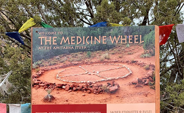 Welcome to the Medicine Wheel. [photo by Quy] |
|
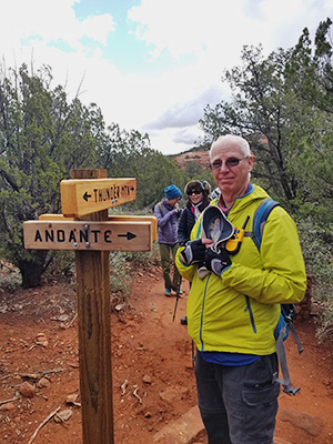
After departing Amitabha, another SYOP was designated on the Andante Trail. After the hike, I was gratified that all trekkers agreed to gather for a meal at Cafe Jose where we could further interact and enjoy the generous portions we all had earned with our 8 mile day. Feedback was quite positive and I may repeat this hike again but maybe a month later. |
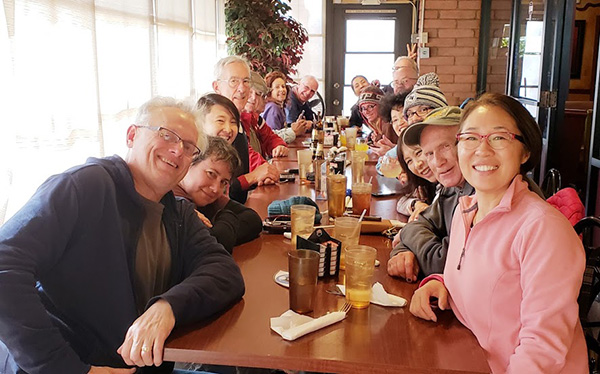 Cafe Jose. [photo by Tom] |
|
What if Coffee Mountain Mocha had been a week later on the 23rd—surely the usual sunny and mild conditions mentioned in the first paragraph would have returned. NOT!! We had a foot of snow on the ground in Sedona. → More pictures, by Debbie.→ More pictures, by Quy. |
 Top of Page
Arizona Trailblazers Hiking Club, Phoenix, Arizona
Comments? Send them to the AZHC .
updated March 22, 2019