Outdoor Links
Hike Arizona
Trip Planning Guide
Trip Report Index
Calendar of Events
Library
|
Clover Creek Day Hike Mogollon Rim August 3, 2019 by Chuck Parsons |
|
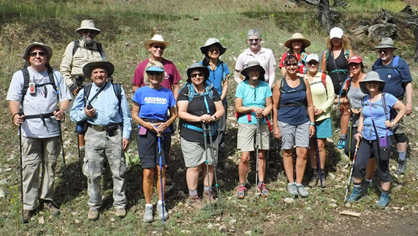 Trailblazers start from the trailhead under full sun. [photo by Michael] |
||||
|
||||
|
On our June, 2018, Clover Creek hike we encountered a heavy downpour well before we hit the Payson area and were beginning to wonder about the sanity of attempting the hike at all that day. But on this Saturday morning in early August the skies are mostly clear, with only a few non-threatening clouds sitting on the distant horizon. However, during Arizona’s notoriously fickle monsoon season we never know for sure just what Mother Nature actually has in store for us. |
||||
 Two javalina are busy cruising the Target Center parking lot. [photo by Wendy] |
||||
|
The weather forecast might only call for a 20% chance of rain showers with light breezes. But we’re barely out of the starting gate before a full-blown rainstorm starts to slam us. And those light breezes suddenly morph into full gale-force winds. On the other hand, the forecast might call for an 80% chance of thunderstorms with high winds, but all we encounter on the trail are light showers at most or no rain at all and only light breezes. Predicting Arizona’s monsoon weather is often little more than a crap shoot at best. Despite state-of-the-art forecasting models and an armada of weather satellites circling the globe, Murphy’s Law often prevails when it comes to Arizona’s weather. |
||||
 Trailblazers gather in a large circle for introductions, [photo by Wendy] |
||||
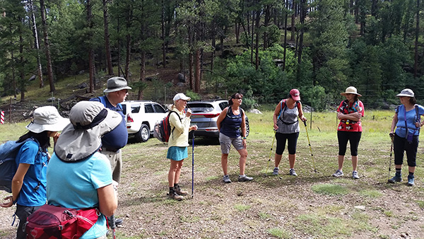 ... as well as an accurate head count. [photo by Wendy] |
||||
|
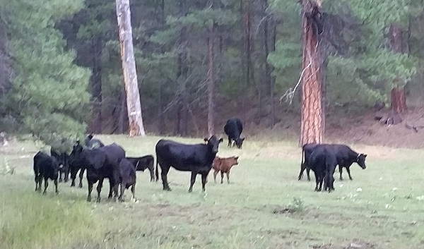
Seventeen hikers in five vehicles arrive at the Clover Creek Trailhead, about five miles south of Clints Well, on a warm Saturday morning in early August. We gather in a circle for introductions and an accurate head count, since the numbers kept changing literally up until the last minute on this hike. Those formalities out of the way, we hit the trail and begin hiking at 9:30 AM. Last June, under solid, heavy overcast and a light mist, it was a cool 53 degrees at the trailhead, and we never saw the sun once on the entire hike. Today, under full sun, it’s a warm and muggy 80 degrees right out of the starting gate. Only in Arizona. The first part of the Clover Creek Trail passes through open range, with cattle roaming everywhere and leaving their ripe calling cards along the trail. So we carefully maneuver our way around and between the numerous fresh cow pies. Slipping and falling into one of these huge pies would be a major disaster to say the least. And the poor victim would most likely have to hike in the far rear of the group and perhaps even suffer the indignity of being transported back home, strapped to the top of the vehicle they rode in. |
||||
 “Wildlife” encounter along the Clover Creek Trail. [photo by Wendy] |
||||
|
From the trailhead we pass through a heavy brown metal cattle gate and then shortly afterward enter the West Clear Creek Wilderness, accessed by a second gate through barbed wire fencing. Most of the Clover Creek Trail lies within the West Clear Creek Wilderness area, and Clover Creek eventually empties its waters into West Clear Creek. |
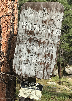 This sign marks the official West Clear Creek Wilderness boundary. [photo by Jeanne] |
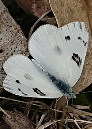 This delicate white butterfly pauses to rest on the forest floor. [photo by Angel] |
 Michael, the official gate keeper. [photo by Jeanne] |
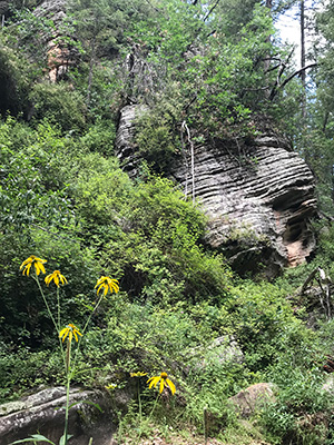 Soaring cliffs of ancient Kaibab Limestone. [photo by Jeanne] |
 Neil and Billie pause for a short break. [photo by Jackie] |
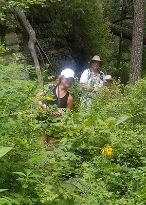 Kari, Michael, and Neil, almost hidden by the underbrush. [photo by Billie] |
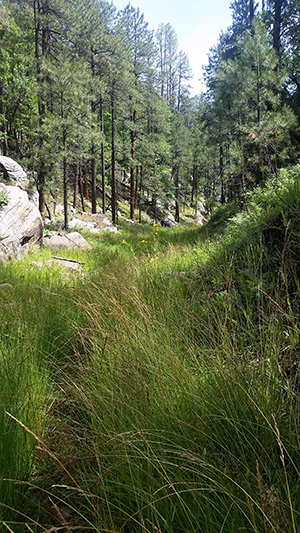
 A typical forest scene along the Clover Creek Trail. [photo by Tamar] |
 A dense canopy of trees shades much of this trail. [photo by Michael] |
|
This trail is an easy walk along Clover Creek and through a large lush green meadow, as it meanders back and forth across the creek numerous times and gradually winds its way down toward West Clear Creek. Large stands of Ponderosa pine and Douglas fir, along with willows, alders, New Mexico locusts, and numerous other tree species line both sides of the creek. And today the creek is actually flowing, although barely. So we carefully navigate our way through the crossings to avoid slipping on wet rocks. 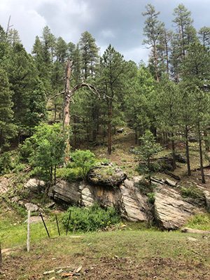 Large slabs of Kaibab Limestone line this stretch of trail. [photo by Tamar] Nevertheless, we still need to be wary and stay alert of our surroundings, especially in the event of a sudden change in the weather. After roughly a mile and a quarter of hiking, the canyon begins to narrow down, with soaring cliffs of lichen and moss-covered Kaibab Limestone on both sides of the creek bed. And there’s only minimal elevation change along this trail, as we continue making our way up the canyon and crossing back and forth across the creek from time to time. This hike would definitely be a lot more challenging, and perhaps even impossible, in the event of higher water levels in the creek. |
 Three butterflies and a busy bee work these large sunflowers. [photo by Angel] |
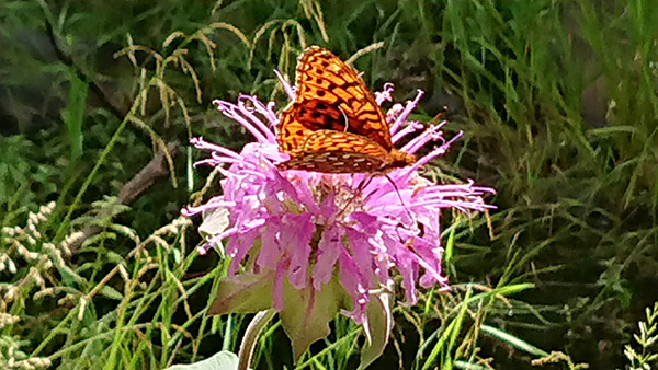 Angel certainly has a talent for capturing butterflies. [photo by Angel] |
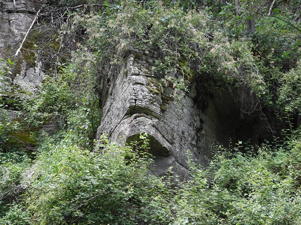 Does anyone see a face in this ancient rock formation? [photo by Michael] |
|
After roughly 90 minutes of hiking, we decide to stop for a rest and snack break in a heavily forested area of the canyon, where strategically placed large rock slabs provide the ideal sitting area. That is, providing that we don’t hang around a little too long and wind up with, shall we say, debilitating derrieres. |
 Trailblazers continue working their way up the canyon. [photo by Wendy] |
 … meanwhile, Sally takes a breather along the trail. [photo by Wendy] |
 Trailblazers take a time out for a short snack break. [photo by Angel] |
 … while the rest of us catch up and join them. [photo by Wendy] |
|
It’s close to 11:00 AM, by the time we all sit down for a rest break. So far the scenery grows increasingly spectacular along the Clover Creek Trail, and there’s anticipation and excitement around every bend in the trail. After the break we continue hiking and exploring deeper into the canyon for another hour or so until the trail eventually becomes choked with overgrowth and seems to disappear altogether. Here, we decide to take a well-deserved lunch break in a scenic and shaded area of the forest with plenty of seating. Michael decides that he wants to explore further into the canyon, beyond our normal turnaround point, and after lunch recruits several others to join him. However, within minutes this intrepid group of adventurers is forced to turn back by a large, deep pool of water lying across the path, with no clear way through other than by swimming or a rather risky rock scramble maneuver. In addition, there’s a foreboding and uneasy feeling that this may be one of the favorite hangouts of the dreaded Mogollon Monster. |
 Wendy and Angel try to get a shot of ??? Perhaps the elusive Mogollon Monster? [photo by Jahonda] |
 Trailblazers pause for a relaxing lunch break. [photo by Jahonda] |
 Jackie and Roseanne stop for a quick picture. [photo by Jackie] |
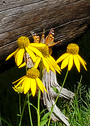 Sunflowers and butterfiles brighten the trail. [photo by Jackie] |
|
Unknown to most Rim area hikers (and scoffed at by a few), this very elusive creature, similar in size and appearance to the famed Sasquatch, or Bigfoot, of the Pacific Northwest, has been seen more frequently in recent years as he roams the Mogollon Rim area in search of food and shelter. Perhaps one day we Arizona Trailblazers might cross paths with him on one of our Rim hikes. Don’t believe me and just assume that I’m spinning tall tales here? Google Mogollon Monster and see for yourself. Anyway, this will mark our turnaround point, and we decide to head back to the trailhead from here. The hike back is noticeably cooler since we have cloud cover and a nice breeze from time to time. About a half mile from the trailhead, that 20% chance of rain starts to catch up with us, as a brooding thunderstorm begins to close in. The loud sonic boom of distant thunder hastens our pace. |
 We all gather for a relaxing lunch break in the shade. [photo by Jeanne] |
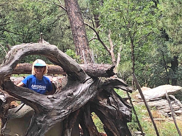 Billie is perfectly framed by Mother Nature in this shot. [photo by Tamar] |
 Photographer Michael photographs photographer Kari photographing Billie. [photo by Michael] |
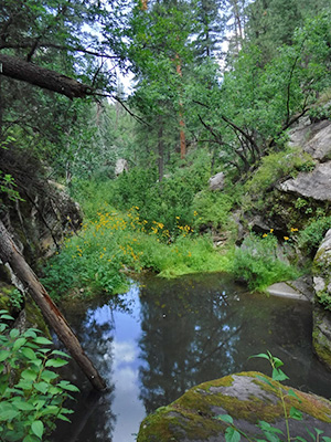 This large pool of dark water marks the end of the line and our turnaround point. [photo by Michael] |
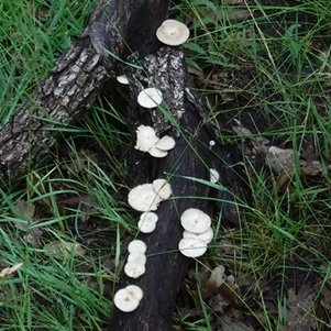 Anyone hungry for fresh mushrooms? [photo by Michael] |
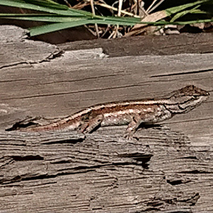 This lizard is soaking up the morning sun. [photo by Angel] |
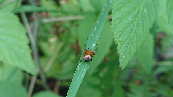 … while this little guy is searching for breakfast. [photo by Angel] |
|
We cap off the hike at THAT Brewery & Pub in Pine, which has become our Go To place to imbibe after Pine area hikes. |
 Top of Page
Arizona Trailblazers Hiking Club, Phoenix, Arizona
Comments? Send them to the AZHC .
updated August 14, 2019