Outdoor Links
Hike Arizona
Trip Planning Guide
Trip Report Index
Calendar of Events
Library
|
Cottonwood Canyon AZT 19 Superstition Wilderness March 2, 2019 by David French |
|

| ||||
|
||||
|
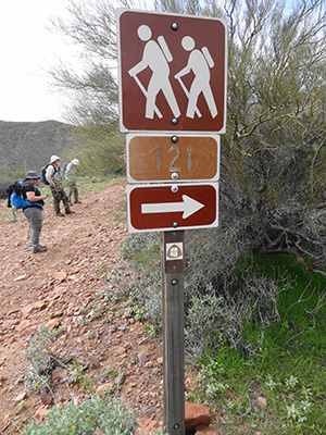
This hike continued my quest to hike as much of the Arizona Trail as I can on a day-hike basis. The hike was located on the west side of Roosevelt Lake and encompassed four very different sections. We started out at the Two Bar Ridge Trailhead on FR 83 and followed Forest Trail (FT) 120, north and down through Cottonwood Canyon. The creek was flowing and we crossed it many times with a rock hop or a giant step. Nice tree cover, but the trees were still dormant. At the north end of the canyon we hiked along FR 341, a steep up and down road used by four-wheelers. Then we transitioned onto FT 121, which appeared to me to be a newly constructed trail that zigzagged back and forth to avoid dropping down into the deep ravines that lead to the lake. There was quite a bit of up and down in this section as well. The final section was a gentle walk along SR 188 across the bridge to our end point, the Vineyard Trailhead, just north of the bridge and on the lake side of the road. |
||||
 Now you all listen to me. [photo by Tom] |
||||
 Starting down Cottonwood Canyon. [photo by Kevin] |
 Splashing through the creek. [photo by Li] |
 Saguaro stair steps. [photo by Kevin] |
 The Cottonwood Creek Rock-Hop. [photo by Tom] |
 Where have all the cattle gone? [photo by Dave] |
 Let’s lock ’em up. [photo by Dave] |
|
The AZ Trail Association Day Hike Book described FR 83 as “rough and rocky” and suggests that if it is too much just stop and hike. Based on this, I knew we had to have enough high clearance all-wheel vehicles to get the hikers to the start point. At one point I had 25 hikers signed up and only 5 appropriate vehicles committed. So I closed the hike to more sign ups. As it turned out, we had 23 hikers and 7 vehicles which was just prefect. We met at the Target parking lot in Fountain Hills at 6:30 and drove north on SR 87 to SR 188 and then south. We stopped at the Vineyard Picnic Area for a restroom break and then on to Vineyard Trailhead, where we met three more of our hikers. We got into 5 vehicles (leaving 2 to get drivers back to where their vehicles are to be left) and drove south on SR 188 to FR 83, which is signed much better than most forest roads. We started west on FR 83, which was unpaved but quite smooth for a couple of miles until we reached a ranch house and made a sharp turn to the left to continue on FR 83. The road became much rougher with some steep sections and very sharp vertical changes. I had been told by a ranger that the road had been graded last fall, as we should not have any problems with all-wheel vehicles, and we did not. After passing through two gates and a fence with no gate, we dropped steeply and found the signs for the AZT and FT 120. We managed to get all five cars parked off the road, took our group photo and headed north into Cottonwood Canyon. There was lots of evidence of cows in the area but we did not see any. At one point I led a group up out of the bottom of the canyon on what turned out to be a cow path. We reached a cleared area that looked to me to be a spot where they placed salt blocks for cattle. The path then faded out. I was in radio contact with Tom, who had stayed in the bottom so we bushwhacked down to them and continued on the right trail. We passed by some watering troughs and tanks that were very full. Nice to see. |
 Water for the cattle. [photo by Kevin] |
 What a great lunch spot! [photo by Dave] |
 The trail is that-a-way. [photo by Dave] As the trail made its final descent toward SR 188 and the bridge, we saw the standard metal AZT sign that denotes the end of one passage and the beginning of another. I suspect the sign can be seen from the road, but you would really have to look carefully. We walked across the bridge that the AZT literature calls a “suspension” bridge, which it is not. It is a “through arch bridge”. The Golden Gate Bridge is a suspension bridge. The new bridge at Hoover Dam is a deck arch bridge. Now you know. |
 Careful steps across the raging river. [photo by Dave] |
 What a life! [photo by Dave] |
 Our first view of Roosevelt Lake. [photo by Li] |
 Roosevelt Lake. [photo by Kevin] |
 North end of Cottonwood Canyon. [photo by Dave] |
 Arizona Trail sign. [photo by Dave] |
 Let’s rest here. [photo by Tom] |
 Pretty ladies and pretty view. [photo by Li] |
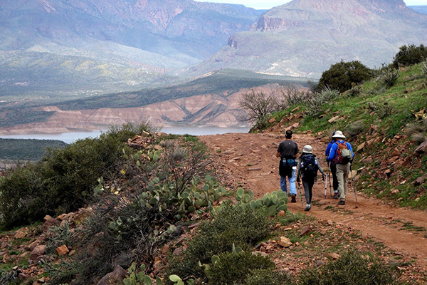 The view from FR 341. [photo by Kevin] |
 The Four Peaks are snowcapped. [photo by Carol] |
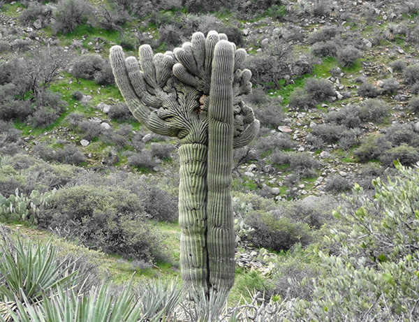 Would you hug a crested saguaro? [photo by Dave] |
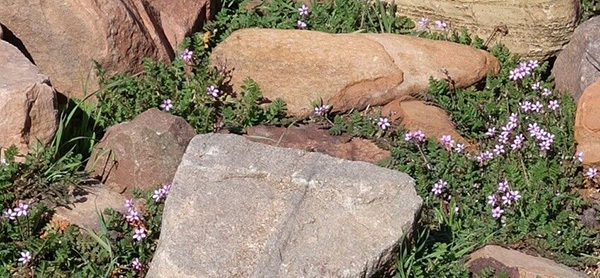 Rocks and flowers. [photo by Kevin] |
 The poppies have popped! [photo by Li] |
|
We all arrived back at the Vineyard Trailhead where we left two vehicles. After a quick break and some libations, we loaded into those vehicles and drove back to FR 83 and to where we left the 5 vehicles earlier. Everyone got out fine. |
 Remains of walls for the old road near the dam. [photo by Dave] |
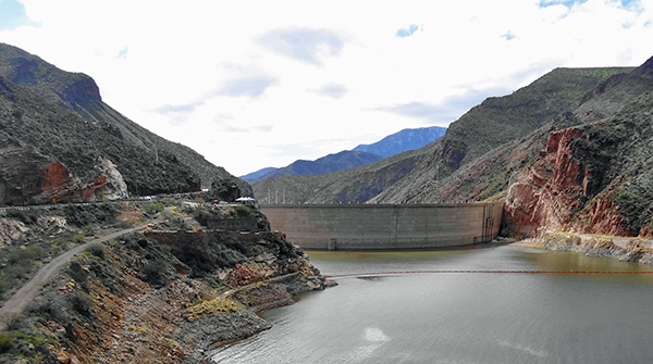 Roosevelt Dam. [photo by Dave] |
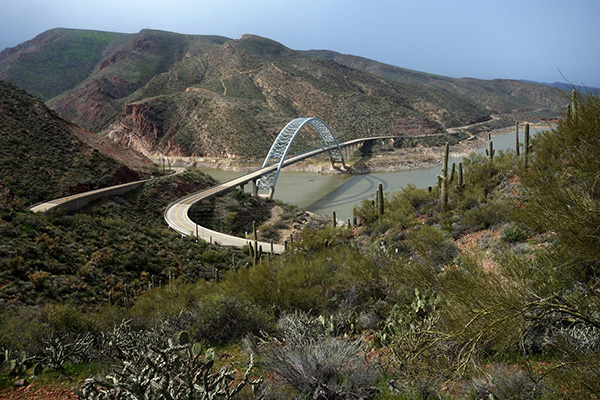 Approaching the bridge. [photo by Kevin] |
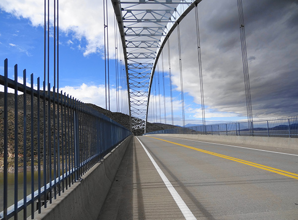 Walking across the arch bridge. [photo by Dave] |
 Looking back from Vineyard Trailhead. [photo by Carol] |
 Waiting for the drivers to return. [photo by Tom] |
 Lunch at Vu in Fountain Hills. [photo by Tom] |
|
My statistics are: 10.5 miles in 6 hours. Elevation range was 3777 ft at the start to 2207 at the end. We climbed 1278 feet and descended 2831 feet. I put the GPS trek on aerial background because the topo maps in Garmin Birdseye are way out of date for that area since the dam was raised, the road rerouted and the bridge was built. → More pictures. |
 Top of Page
Arizona Trailblazers Hiking Club, Phoenix, Arizona
Comments? Send them to the AZHC .
updated March 5, 2019