Outdoor Links
Hike Arizona
Trip Planning Guide
Trip Report Index
Calendar of Events
Library
Superior
February 17, 2019
by Debbie Rowray
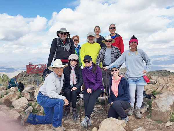
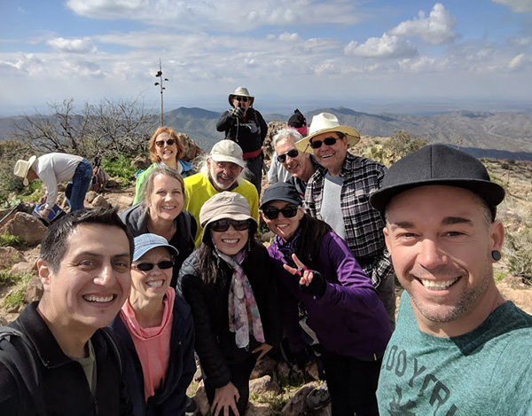 Trailblazers at the top. [photo by Debbie N.] |
||||||
|
||||||
|
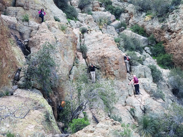
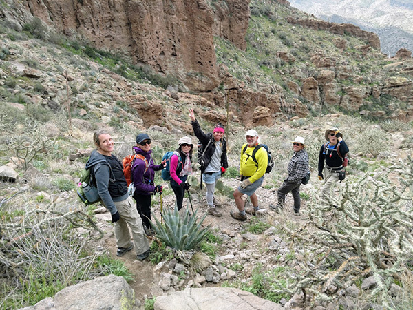
The day finally came, and I was more than elated to share it with the eleven adrenaline-seekers that climbed this ruthless yet magnificent mountain with me. Tense all week about the weather prior to the hike, this entire day could have not been more perfect. This mountain is all about drive, challenge, and apprehension. With Picketpost towering above us, we ventured toward the base, catching glimpses of the route we would climb. As the trail became steeper, it was obvious what we were in for. |
||||||
 Yes, we’re going up there. [photo by Debbie R.] |
||||||
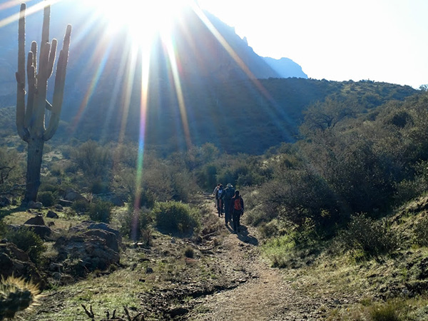 Walking toward the sun. [photo by Debbie N.] |
||||||
|
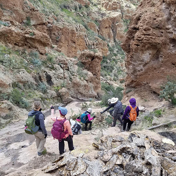
Blazing precipices of red, tan, and green welcomed our ascent. The trail is hard to navigate in certain areas, yet there were cairns and white arrows or dots to guide us. At times, backtracking was necessary to find the safest route. |
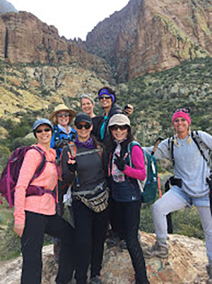 Front: Debbie N, Heather, Li, Debbie R. Back: Karen, Janet and Rhonda [photo by Li] |
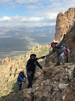 Let me give you a hand. [photo by Li] |
 The trail just goes up and up. [photo by Allan] |
 Boulder-scrambling. [photo by Tom] |
 Aw, that wasn’t so bad. [photo by Tom] |
 This seems to be the way. [photo by Debbie R.] |
|
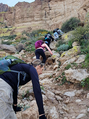
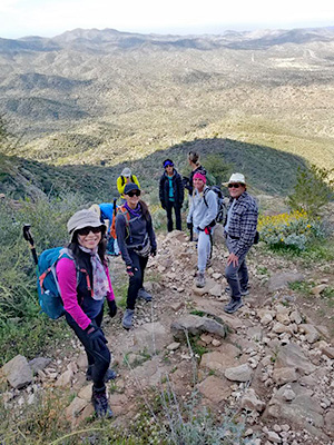
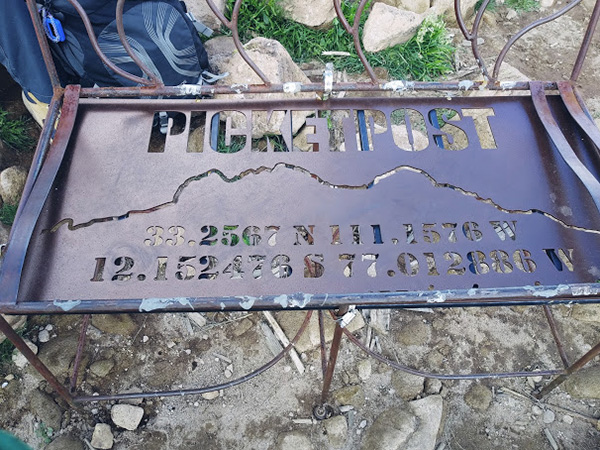
Scaling this mountain takes scrambling and navigation to a whole new level, leaving the hiker exhilarated at the end, with adrenaline beyond words. Once at the summit we enjoyed the 360 degree view, along with sharing messages to save in the infamous mailbox. There is a fancy bench at the top to commemorate such a fantastic place. |
 This must be it. [photo by Debbie R.] |
 Made it to the top. [photo by Li] |
|
| Front: | Rudy, Li, Heather, Debbie N., Debbie R. |
| Back: | John, Karen, Allan, Janet, Neil, Tom |
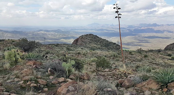 We get a 360° view from the top. [photo by Allan] |
|
We met two friendly gentlemen, Jeff and Jorge, using a drone to witness exactly what it takes to conquer this majestic beast of a mountain. In turn, they were generous enough to share the drone experience with all of us for a creative and wonderful memory of all of our efforts. After snacks, conversation, and memorable pictures, we started down. Perception of descent is entirely different. There are many arteries flowing down from the summit, both from human wear, and erosion. It is not uncommon to backtrack to find a secure path, or to use all four limbs to make our way down slickrock and scree. This mountain is notorious for ripping holes in clothing, and making one well aware that we are lucky to have a default: using our tush! |
 Yes, we were up there. [photo by Debbie N.] |
 Watch your step! [photo by Tom] |
 What a fine mountain! [photo by Tom] |
|
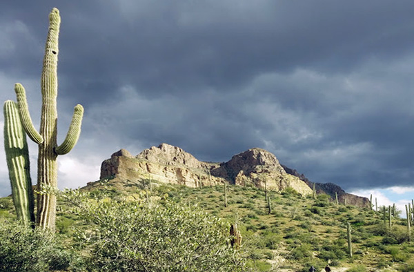
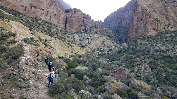
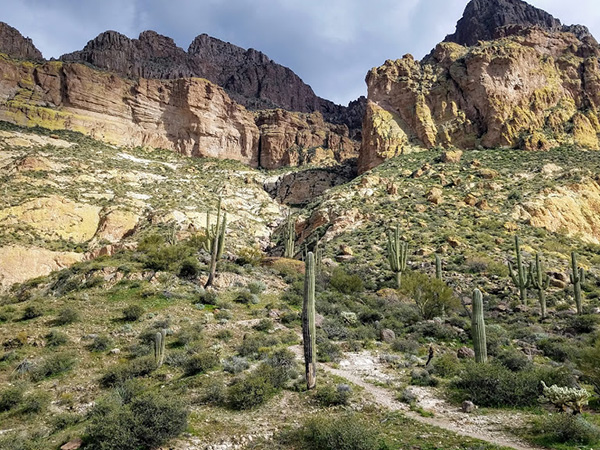
As we wandered down the mountain, we realized we were trekking on the south side of the canyon that splits the two highest points of the mountain. We could see the trail we had ascended to the north, and decided to keep travelling down the path we inadvertently chose. Along this trail, bright-colored wildflowers adorned the desert, and in the distance we could see the Picketpost Perimeter and the Arizona Trail. With teamwork and patience we made our way down, bushwhacking to reach the original trail again. This was a very major surprise to all of us, for we had found an alternate route, laden with cairns. Once back to the trailhead, the backdrop of Picketpost was dancing with the eventual promise of a storm. The timing and scouting of this day was impeccable. I want to thank everyone for joining me on this adventure. This hike is one of my all-time favorites! We all worked together as a team; finding routes, assisting each other at rough patches, while keeping all safe with positive, motivating moral support. I foresee another summit, using the alternate route, in the future! Elevation change +-2612 feet, distance 5.9 miles. |
 Top of Page
Arizona Trailblazers Hiking Club, Phoenix, Arizona
Comments? Send them to the AZHC .
updated February 24, 2019