
Outdoor Links
Hike Arizona
Trip Planning Guide
Trip Report Index
Calendar of Events
Library
|
West Boulder Saddle Superstition Mountains March 16, 2019 by Tom Simonick |
|
 We’re all together at the trailhead. [photo by Quy] |
||||||
|
||||||
|
After a group picture and introductions, thirteen hikers started from the Lost Goldmine trailhead, heading west to the junction with the Carney Springs trail. |
||||||
 We started from the Lost Goldmine Trailhead. [photo by Tom] |
 Haven’t I been here before? [photo by Li] |
Originally we were going to start from the Carney Springs Trailhead, but the parking lot was full (again), so we drove the short distance to the Lost Goldmine parking lot, which was almost empty. It was another beautiful day in the Superstitions and we had the trail to ourselves. Shortly after the junction, Bruce showed us the remnants of the old Carney Spring watering hole. The Carney Springs trail starts off easy, but we soon began a very steep climb, gaining 1000 feet in a mile to reach a lower saddle with hoodoos. The trail is pretty well marked with cairns, but there are no switchbacks; instead, we scrambled up the canyon. |
 You see, it’s this way. [photo by Quy] |
 Let’s take a break here. [photo by Li] |
 I’ll take you up, up, up to the top. [photo by Li] |
 That balanced rock won’t topple on us. [photo by Quy] |
|
Some people continued with hiking poles, whereas I gave up and relied on my gloves to keep my balance as we climbed over exposed rock and loose gravel. Because of the recent snow and rain, we had the rare sight of trickles of water running down the side of the canyon. We took a short break after reaching the low saddle enjoying a cool breeze on a day that was getting warm. |
 Ian at West Boulder Saddle. [photo by Li] |
 Li before the Superstition Ridgeline. [photo by Tom] |
 It’s a steep climb. [photo by Tom] |
 Mark and Michele take a break. [photo by Quy] |
|
Three hikers decided they had scrambled enough and waited there, while the rest of us took off, climbing 400 feet over the next 0.4 miles to reach West Boulder Saddle. |
 Trailblazers at West Boulder Saddle. [photo by Quy] |
 Quy finds a sign. [photo by Quy] |
|
At this point we had hiked about 2.7 miles (leader’s GPS) and the plan was to turn around and head down. However, Bruce suggested hiking to Robbers’ Roost and returning by way of the Peralta Trail. He took Nancy, Carolyn and Ian on that route, while the rest of us made our way down on the Carney Springs Trail. Do to the loose rock and steepness, hiking down the trail was pretty challenging. |
 Our steep descent. [photo by Tom] |
 Our steep descent. [photo by Li] |
|
Arriving back at Lost Goldmine trailhead, we said our goodbyes, with some of us going to lunch at De La Cruz Mexican restaurant in Gold Canyon. |
 De La Cruz Mexican restaurant in Gold Canyon. [photo by Tom] |
|
We knew that the Bruce’s group would take longer and since they had a car, they would get back on their own to our Home Depot meet-up. The Club rated this hike as a "B-", but I think the rating should be "B+" due to the steep ascent and tough descent. According to my GPS we hiked 5.4 miles in 4 hours 13 minutes, with an elevation change of 1473 feet and an accumulated elevation gain of 2100 feet. |
|
Supplemental Report by Bruce Wilczynski |
|
|
It was about 2.5 miles to the West Boulder Saddle from Lost Goldmine Trailhead. We got down into Robbers Roost in about one mile, where we had a lunch break. Then we took the Cave Trail on our return after passing through Fremont Saddle. My GPS showed 7.75 miles and 2,505 ft. elevation gain. We finished the hike at the Peralta parking lot about 2:35 PM. As soon as I arrived at the lot, I hopped a ride with an ATV passing through back to the Goldmine Trailhead to get my car, then picked up the other hikers. Bruce |
|
 Great boulders at Robbers Roost. [photo by Ian] |
|
 Really big hoodoos around here. [photo by Ian] |
|
 See, I can hold it up. [photo by Ian] |
|
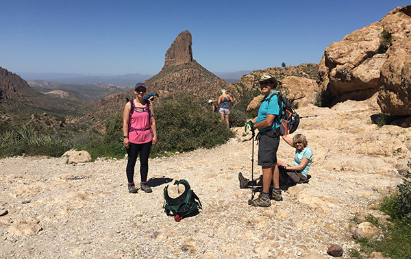 We came back by way of Fremont Saddle. [photo by Ian] |
|
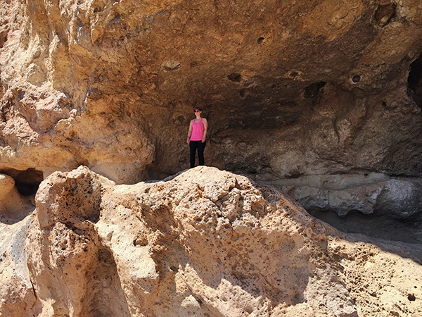 Geronimo never slept here, but it’s Geronimo Cave. [photo by Ian] |
|
 Top of Page
Arizona Trailblazers Hiking Club, Phoenix, Arizona
Comments? Send them to the AZHC .
updated March 20, 2019