
Outdoor Links
Hike Arizona
Trip Planning Guide
Trip Report Index
Calendar of Events
Library
|
Pyramid Loop Day Hike South Mountain Park February 23, 2020 by Tom Simonick |
|
 Group Photo. [photo by Quy] |
| Steve, Kevin C., Tamar, Tom, Quy, Michael, Li, Kevin E |
|
Eight club members meet at the Pyramid trailhead in the southwest corner of the Phoenix South Mountain Park. The day before was heavy rain, but this morning the ground was dry and partially sunny. We started off on the Pyramid trail, hiking east over open desert and a few washes before beginning a steep ascent up to the top of the Gila Range. |
 The Sonoran Desert at its best! [photo by Quy] |
 We have a wash to cross. [photo by Steve] |
|
We’re not the only ones on the trail this Sunday, but it isn’t crowded. There are plenty of switchbacks as we ascend 850 feet in one mile, but we have nice views of Ahwatukee, the farmlands to the south and the Estrella Mountains to the west. |
 Clouds form over the mighty Sierra Estrella. [photo by Steve] |
 What a view! [photo by Quy] |
|
We paused at the top of the ridge to catch our breath and take some pictures. |
 Tamar, Quy, Li. [photo by Kevin E] |
 Steve, Kevin E, Tom, Kevin C. [photo by Li] |
|
Continuing on the Gila range, we hiked east in the direction of Telegraph Pass. |
 Hiking the high country, with the mighty Sierra Estrella in the background. [photo by Quy] |
 Trailblazers approach Telegraph Pass. [photo by Quy] |
|
Above the pass, we turned north onto the National trail, pausing for a picture with downtown Phoenix in the background. |
 Michael, Steve, Quy, Kevin C, Li, Kevin E, Tamar, Tom. [photo by Quy] |
|
We are now on the north side of the Gila Range, overlooking Phoenix as we proceed west on the National Trail for five miles. |
 Hiking the National Trail. [photo by Quy] |
 Trailblazers having a good time. [photo by Tom] |
|
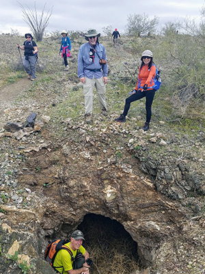
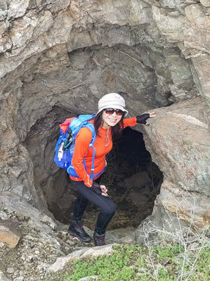
The trail passes below Goat Hill, the high point of the Gila Range, and along the way we pass several groups of mine shafts. |
|
|
| Exploring the mine. [photos by Tom] | |
 Exploring the mine. [photo by Li] |
 Steve liked what he saw. [photo by Li] |
|
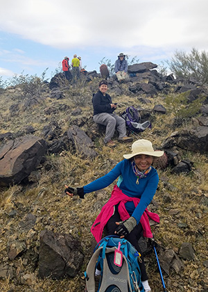
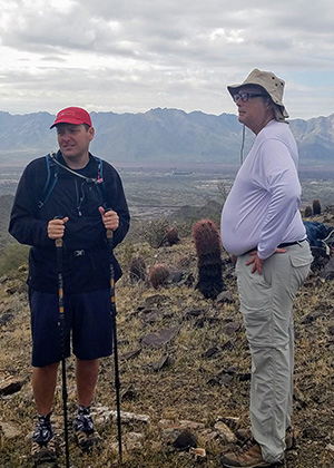
This part of the trail doesn’t offer a lot of good sitting rocks, but we find enough for a break, before continuing west. |
|
|
| Taking a break. [photos by Tom] | |
|
At the far end Gila Range, the National trail meets the Bursera Trail. The National descends, continuing west towards San Juan road. However, we take Bursera climbing a short distance, before heading south and descending to the Gila wash. We’re now less than 2 miles from the trailhead, but first we have a 600 foot climb over the next 1.2 miles to reach the trail summit. |
 Bursera Trail. [photo by Quy] |
 We’re heading down, at last. [photo by Li] |
|
After the summit, everyone is happy that it is downhill (mostly) and less than a mile back to the trailhead. We go our separate ways, after enjoying a rugged hike close to home. Statistics: 10.4 miles in 5.5 hours, with an accumulated elevation gain of 2400 feet. |
 Top of Page
Arizona Trailblazers Hiking Club, Phoenix, Arizona
Comments? Send them to the AZHC .
updated February 29, 2020