Outdoor Links
Hike Arizona
Trip Planning Guide
Trip Report Index
Calendar of Events
Library
White Mountains
July 3-10, 2020
by Tamar Gottfried
|
How do you vacation during a pandemic? In our beautiful state of Arizona, that’s how! Making great use of July vacation time, eight Trailblazers stayed in a variety of housing options—house rental, RV, hotel and camping—and met daily to hike the White Mountains. |
| Railroad Grade Trail |
|
|
On July 3rd, we assembled late morning planning to hike the ever popular Thompson Trail. However, one look at the overfilled parking area, send us back on FR 116 to the junction with the 273. Fortuitously, this is actually one of the many trailheads for the 22 mile long Railroad Trail. Since we were already way out there and ready to hike and needed to acclimate to 9000+ foot elevation, we made the best of the situation and did 2 miles out and 2 miles back on this nice flat and scenic trail, heading toward Sheep’s Crossing. Not only were we able to keep a brisk pace, but we did not see another human the entire time we were hiking. It was a good, gentle start to our hiking week. |
| Timber Mesa |
|
|
July 4th was looking to be a scorcher, even in Pinetop, so we met by 8 AM at the trailhead, which is only slightly off the main Pinetop drag. We saw some cows and some ATV-ers in the parking lot, but no one else on the trail for 7.8 miles. The trail was well marked, which is typical for the trails in the White Mountain Tracks system, and led us up and down and around the small mountain. Due to almost 85 degree heat by 11 AM, it was a warm and good enough workout for the day and we were glad to see the trailhead at the end. While the Pinetop trails are warmer and not as green and lush as the trails further east, this was a good way to celebrate our nation’s birthday. |
| Los Burros |
|
|
July 5th brought the rest of our hiking group up from the valley so we started hiking late morning. Several of our hikers had a short commute that day as they were staying on National forest land near the trailhead. |
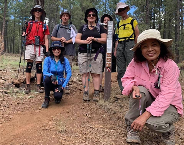 Trailblazers on the Los Burros Trail. [photo by Quy] |
|
We met beyond the closed campground at the second trailhead and did the longer loop clockwise, going the opposite way than what we did in 2019 during a thunderstorm. Sunnier skies allowed us to have a new appreciation of the terrain at a less frantic pace. |
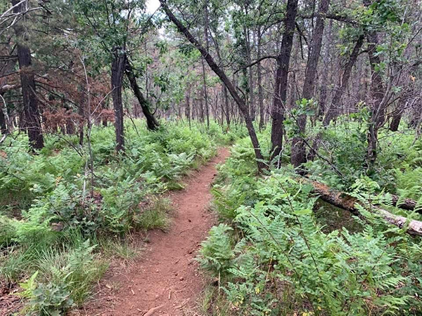 Where the green ferns grow. [photo by Quy] |
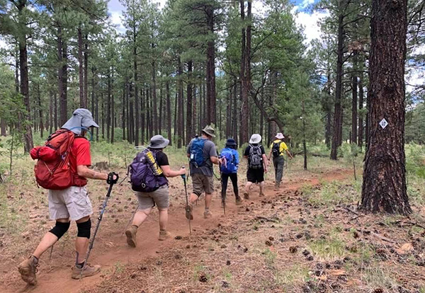 Trailblazers on the march. [photo by Quy] |
 Time for a break. [photo by Tom] |
 Our big climb. [photo by Quy] |
|
As the mileage was undercounted on the longest loop (14.4 miles rather than 13), it was no surprise to us that this 9 mile loop was actually 10.5 miles long. The trail was a bit dusty in places, but the forest provided shade and we felt accomplished and fatigued by time the cars were in sight. → More pictures, by Tom. |
| Baldy Crossover |
|
|
While we have climbed Mt. Baldy several times, none of us had done the crossover trail before. We started at the West Baldy Trailhead, which adds a little distance, but also more time along the river. We found the Crossover trail well marked and had an easy river crossing before immediately beginning a series of steep climbs, which felt even steeper than they were due to the 9000+ ft elevation. |
 Trailblazers in the Mt. Baldy Wilderness. [photo by Quy] |
|
The trail went up and down and up again, pausing in a large verdant meadow with plants and butterflies flitting about. We couldn’t resist pausing for a break and photo ops there. The trail continued on through the forest, making me think that the term “forest bathing” had to apply to our experience there. Very few humans were encountered here, mostly backpackers returning to the trailheads. |
 Clouding up, but real cool. [photo by Quy] |
 We’ve had it. [photo by Quy] |
 Time for a break. [photo by Quy] |
|
After a few more large meadows with stream crossings (one small stream had a deceptively weak log traversing it—sending one hiker into the water), and a few more forest jaunts, we ended up on the East Baldy trail, minutes from the parking lot. We hadn’t planned to have a 9-mile day, but who can resist exploring the length of a new trail. After a short break, we picked ourselves up and reversed course, a little grumbly that several climbs were in front of us. When we finally reached the river, we couldn’t resist flopping on the grassy banks and taking a break to look at the clouds above. We reluctantly arose one last time to walk the 1.5 miles back to the trailhead and complete 9.5 miles on our “rest” day. |
 It’s all over now. [photo by Tom] |
|
→ More pictures, by
Tom.
|
| East Baldy |
|
|
This was our long day and we hit the trail by 7 AM. We were blessed with perfect weather—no rain, slight breeze and with a midweek gift of having the mountain to ourselves. In 14 miles and 8 hours out, we only ran into 4 other humans. We paused to admire Chiricahua-like rock formations and scenic views. We climbed over and under many fallen trees. This was new from our last summit in 2017. We appreciated 4 previous days of altitude conditioning as we made the final 2 mile ascent to 11,200 feet at the meeting of the trails at the top. |
 Fallen logs make an obstacle course. [photo by Quy] |
 This section of trail isn’t too bad. [photo by Quy] |
|
We didn’t venture onto tribal land to find the true summit as we had no permit and the White Mountain Apache land was closed due to COVID19. We did briefly lose track of one hiker, and in the process, learned that there is an alternate route to the true summit about a mile from the top where the East Baldy trail used to officially end. It requires some route finding and presents a dilemma where it branches off to anyone not familiar with the path of the actual official trail. |
 Tom made it this far. [photo by Tom] |
|
When the group reassembled, we started down the mountain and spent some time exploring the plane wreckage not far from the top. There is a metal pipe on the trail that is at the same level as the wreck. We made our way down uneventfully and enjoyed cold drinks at our cars before heading back to town.
A little history on the Baldy plane crash. |
| Thompson Trail |
|
|
Wednesday proved to be way less popular at this trailhead. We ran into four family groups on this trail. It was a nice picturesque walk along the river on a warm day. We saw some fire-scarred areas in the hills above. At the end of the trail, we paused by the river, viewing the two trail options if we were to continue on. We went with our original plan, and headed back the way we came and enjoying the views, the sounds of babbling water and the relative solitude. |
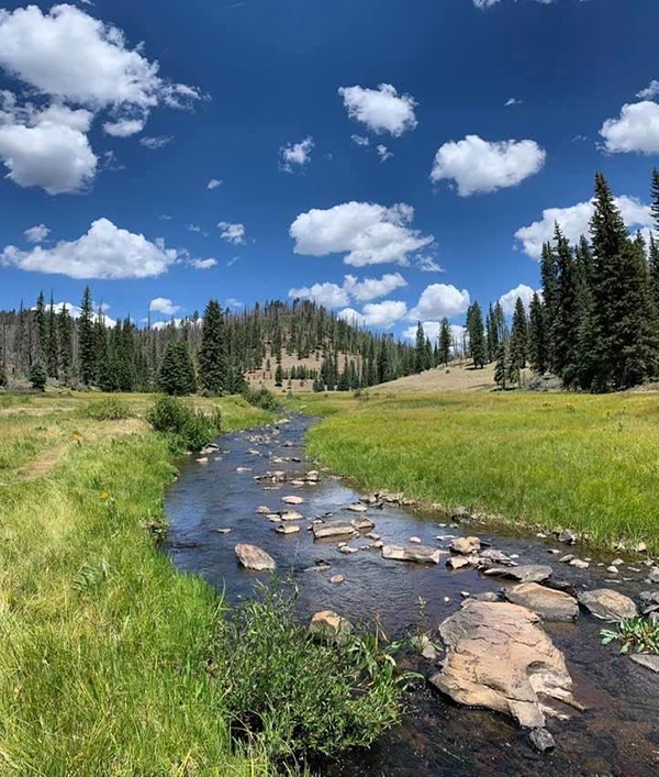 A pleasant stream. [photo by Tamar] |
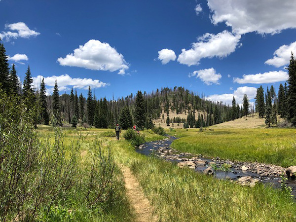 The trail takes us by rocks in the water. [photo by Tamar] |
 I’ll drink to that. [photo by Tom] |
|
→ More pictures, by
Tom.
|
| Blue Ridge |
|
|
We ended our week back on the White Mountain trail system on what was supposed to be a pretty forest trail. Due to heat and sheer length, the trail wasn’t as impressive as we had hoped and we kept a brisk pace. Few others were on the trail. There were no impressive views or water experiences, but it was a nice combination of forest, forest roads and meadows. |
 Trailblazers on Blue Ridge. [photo by Quy] |
|
We were quite pleased to reach our cars after almost 10 miles of hiking as the temperatures were rising and we said our goodbyes to our week of hiking in the White Mountains of Arizona. |
 Top of Page
Arizona Trailblazers Hiking Club, Phoenix, Arizona
Comments? Send them to the AZHC .
updated July 20, 2020