Outdoor Links
Hike Arizona
Trip Planning Guide
Trip Report Index
Calendar of Events
Library
|
Bulldog Canyon Loop Goldfield Mountains March 6, 2021 by Ted Tenny |
|
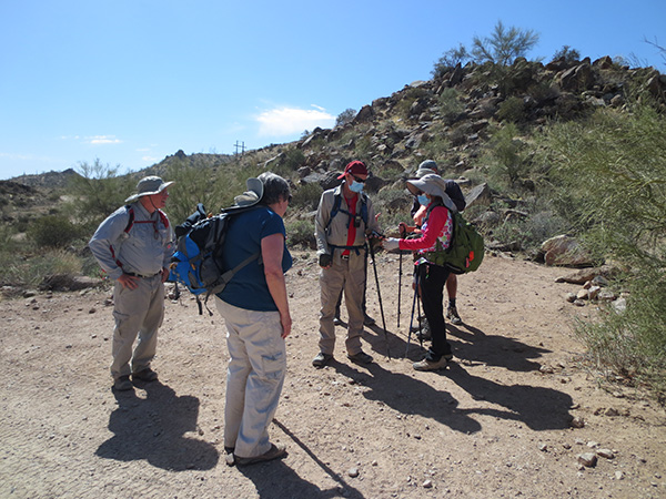
 Trailblazers at Dome Mountain Trailhead. [photo by Lin] |
|
The Trailblazers hadn’t done this hike since 2017, so it’s high time. I volunteered to do hike leader training. My only handout was a map. The rest of the leadership training resources are online. “The most important lesson is attitude,” I told the hike leaders, “You must love your fellow hikers. Now Greek has three words for love: eros, the love of husband and wife; philos, brotherly love; and agape, God’s love. Try for agape.” I went on to discuss the topics in the hike description, and answer questions. 23 enlightened Trailblazers set out from Dome Mountain Trailhead, walking north on FR 10 and FR 1356, before turning west on the Bulldog Canyon Trail. We passed the turnoff for Bulldog Wash Ridge, and the horse trail (signed!), which goes up to the turnoff for hill 2685. |
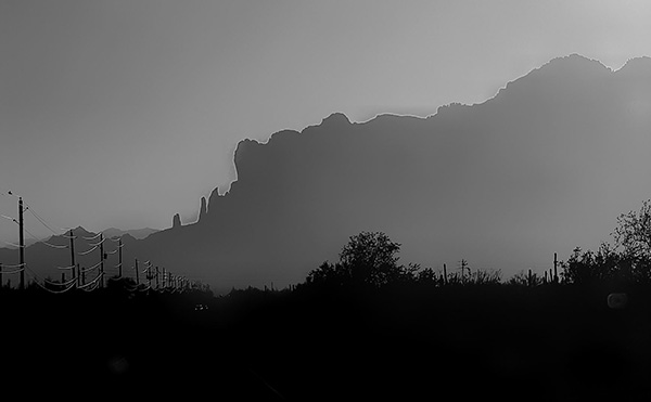 Profile of the Superstitions before dawn. [photo by Lin] |
 Foreground: The Trailblazers. Background: Peak 3269, Dome Mountain, Peak 3134. [photo by Ted] |
 Are you sure this is on the up and up? [photo by Lin] |
 Ted’s favorite tree, growing ouf of lichen-encrusted rock. [photo by Ted] |
 On chain fruit cholla, the fruit hangs down in chains. [photo by Lin] |
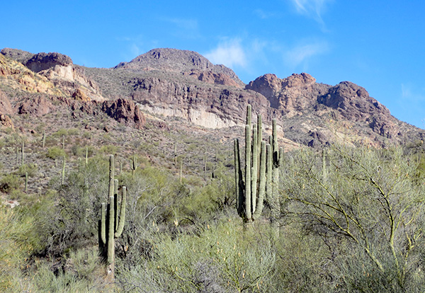
 Chain fruit cholla and Peak 3269. [photo by Laura] |
 Dome Mountain and “The Frog”. [photo by Ted] |
|
The trail is first on one side of the canyon, then the other. Finally we saw the Pyroclastic Cave in its foliated hillside. “There’s an arch by the cave,” I told everyone. |
 Pyroclastic Cave. [photo by Ted] |
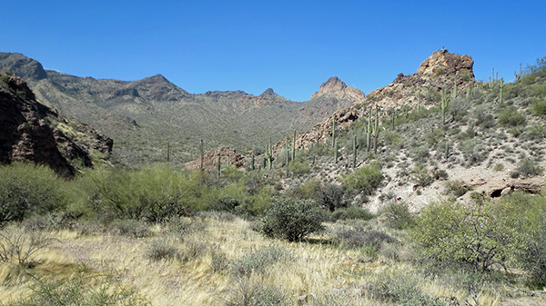
 Peak 3269. [photo by Ted] |
 Water in Bulldog Canyon. [photo by Amy] |
|
We also saw the solution to the Frog Peaks mystery. The Frog Peaks appear 15 miles east of Maryville on N.C. McFarland’s 1883 map of Arizona Territory. This map can be seen at the Fort Lowell Museum in Tucson. From their location on the map, the Frog Peaks have to be Dome Mountain and Peak 3269. But why would anyone call them “Frog Peaks”? The name remained a mystery until 2011, when I recognized the frog. It’s a butte between Dome Mountain and Peak 3134, which looks like a frog under certain light conditions. The frog is best seen looking north from the horse trail that runs from FR10 to Bulldog Canyon, west of Bulldog Wash. |
 Ted tells it like it is. [photo by Li] |
|
I did Hike Leader Training where I expected to. Next, the groups hiked together
for a short distance, then we split up into those doing the 4-mile hike and
those doing the 6½-mile hike: Us “short” hikers followed a tributary of Bulldog Canyon to Forest Road 10, where we tuned left, went up to the gate, and then to the road that goes to the microwave tower. We saw lots of recreational traffic on FR10, and were impressed by how much smoother the road that goes up to the microwave tower is. |
 Looks like salt water taffy, but it tastes like rock. [photo by Ted] |
 Each color of lichen is a different species. [photo by Ted] |
 The “long” hikers disappeared down Bulldog Canyon. [photo by Ted] |
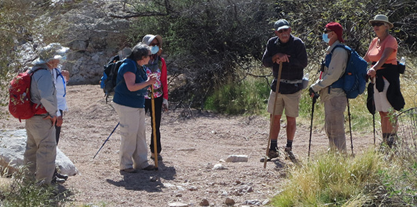 “Short” hikers Sonny, Karen, Bettye, Lin, Ron, Carl, Patty. [photo by Ted] |
 Let’s talk this over. [photo by Ted] |
 We won’t contest the road with recreational traffic. [photo by Ted] |
|
Our hike ended on the Wolverine Pass Trail and the Powerline Trail. Amazingly. the “long” hikers ended at the same time! → More pictures, by Li.→ More pictures, by Lin. → More pictures, by Tom. |
|
|
||
|
Supplemental Report by Tom Simonick |
|
|
|
Fifteen hikers headed west from Bulldog Canyon and picked up the Deer Tanks Trail. There were some nice rock formations in the wash, which made for a good group picture. After consulting our map and GPS, we found the spot to climb out of the wash on the Deer Tanks Trail. Heading south towards the tanks, some of up picked up some companion cholla, but nothing serious. Eventually the trail turned east, paralleling McDowell Blvd for about 0.5 miles, before heading northeast on the Wolverine Pass Trail. The temperature was around 85 and a couple of hikers felt the effects. A dose of electrolytes, more water drinking, a cool cloth, and some sliced apples got them going again. It was a good reminder to be watchful of each other, carry and drink more water, and take electrolytes. We returned to the trailhead without a problem. |
||
 Li explores a cave. [photo by Li] |
 group [photo by Li] |
 This doesn’t faze me. [photo by Li] |
 Chuparosa. [photo by Li] |
 Tree growing out of the rock. [photo by Li] |
 The Three Musketeers (right). [photo by Li] |
 Coyote Rock. [photo by Li] |
 Top of Page
Arizona Trailblazers Hiking Club, Phoenix, Arizona
Comments? Send them to the AZHC .
updated March 8, 2021