Outdoor Links
Hike Arizona
Trip Planning Guide
Trip Report Index
Calendar of Events
Library
|
Maricopa Trail Exploratory Hike Cave Creek April 10, 2021 by Chuck Parsons |
|
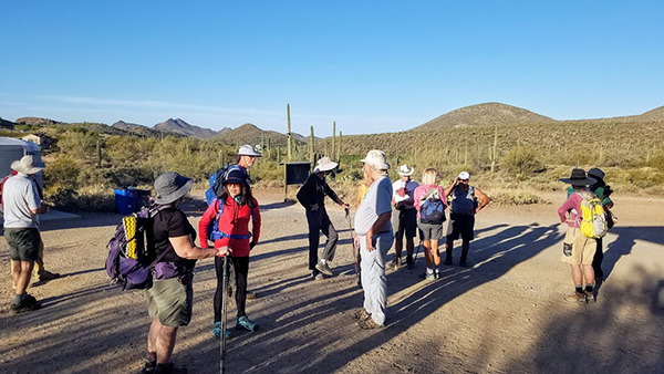 Trailblazers start gathering near the trailhead. [photo by Tom] |
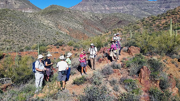
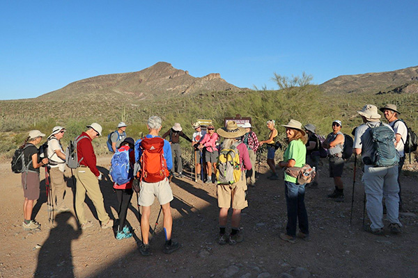 We form a circle for introductions and hike details [photo by Kevin] |
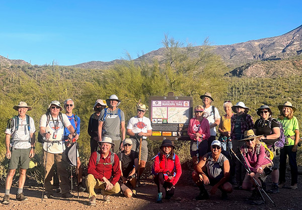 18 Arizona Trailblazers gather around the Maricopa Trail sign. [photo by Li] |
||||
|
|
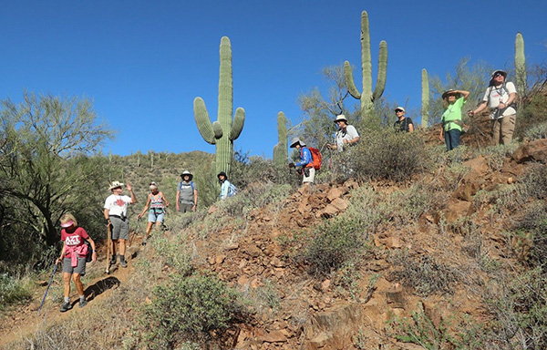
On a clear and cool morning in early April, 18 Arizona Trailblazers meet at the Spur Cross Ranch Conservation Area parking lot at 7:00 AM for a day of hiking and exploring the Maricopa Trail. The plan today involves both a shorter and a longer hike. I’ll be leading a smaller group of 5 hikers on a 6-7 mile hike on the Maricopa Trail, while Billie and Neil will be leading a larger contingent of 13 hikers on a longer 10-mile hike. This hike was recently featured in an article by outdoor columnist Mare Czinar in the Arizona Republic. |
 We’ll hike the Spur Cross Trail. [photo by Kevin] |
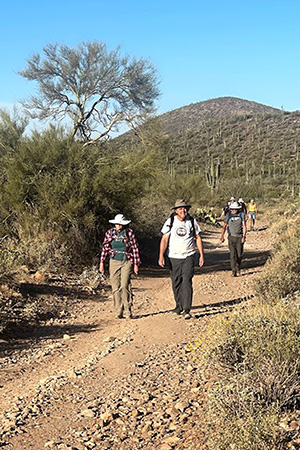 Trailblazers are on the move. [photo by Li] |
|
After a round of personal introductions, a final head count, and a group picture, we hit the trail at 7:20 AM and start heading northeast on the Spur Cross Trail. We soon come to an area on the map, marked as “Old Gate”, where we exit the Conservation Area and start hiking north on the Maricopa Trail through Tonto National Forest. |
 Li approaches the first creek crossing. [Tom] |
 Terry and Randall are next. [photo by Li] |
|
Many thanks to Billie and Neil for their earlier exploratory hike to check out Skull Mesa as a possible hiking opportunity for the Arizona Trailblazers. They both went above and beyond for this hiking club in their efforts. Based on their exploratory hike, it was decided not to do Skull Mesa as part of today’s hike. In Billie’s own words, here is her story: We intended to do the loop to the top of Skull Mesa and back using trails 247 and 248. We never could find the way to get down once we explored the Mesa (spent way too much time/mileage searching). So we decided to go back the way we came, 248 down to 247. It was getting late and we knew we would be in darkness soon. This trail is difficult due to steepness and loose rocks. Relentless to ascend, not fun to descend. Short story, we reached the 247 and then kicked into high gear for the next very steep 5 miles. The last 2.2 miles and 4 water crossings we did in pitch darkness using cellphone lights, arriving back at the car after 8 PM. Total miles, 19.75. Total hrs. 10+. |
 Trailblazers reconnoiter by the creek. [photo by Li] |
 And, we’re off again. [photo by Li] |
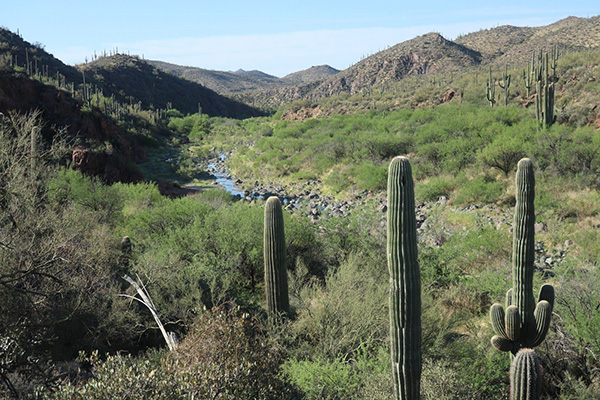
 Spectacular Upper Sonoran Desert scenery along the Maricopa Trail. [photo by Kevin] |
 It’s always a treat to see flowing water in the desert. [photo by Li] |
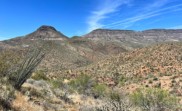
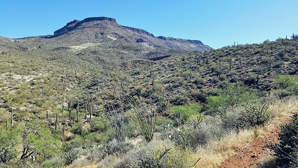 Skull Mesa dominates the skyline in this picture. [photo by Tom] |
|
Created in early 2001, the present day 2,154 acre Spur Cross Ranch Conservation Area is the newest addition to the Maricopa County Regional Parks System. Recently completed, although still expanding and improving with even more access points, the 315-mile-long Maricopa Trail is one of Arizona’s newest trail systems, circling the entire Valley and connecting all 10 county parks in one continuous loop. Although designated as the Spur Cross Trail on maps and stretching from the SW corner to the NE corner of the Conservation Area, this is all part of the Maricopa Trail. |
 Trailblazers make yet another creek crossing. [photo by Li] |
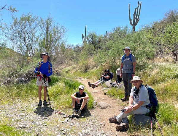
 Taking a quick shade break by the creek. [photo by Tom] |
 Tamar, Barb, and Randall on the Maricopa Trail. [photo by Li] |
 Trailblazers enjoying the sights and sounds along the Maricopa Trail. [photo by Li] |
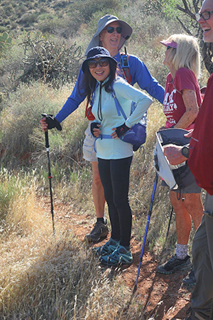
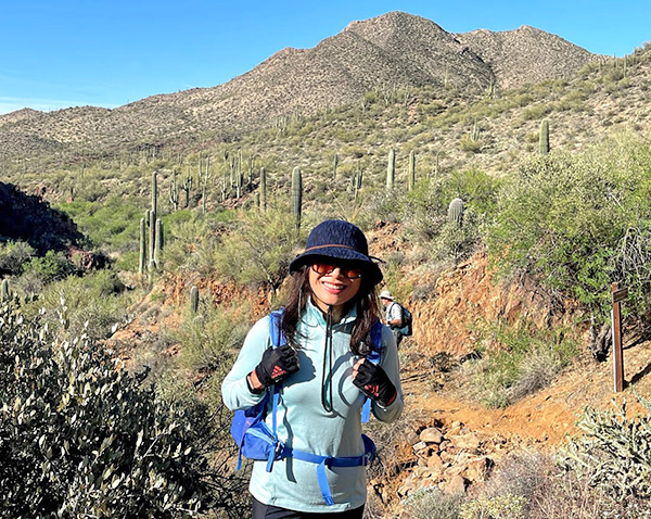 Li is in her element whenever hiking the trails of Arizona. [photo by Tom] |
|
Although we don’t see any on today’s hike, the Conservation Area has a number of archaeology sites, as well as remnants of early ranching and mining operations. Like so much of Arizona, this area is rich in history, going all the way back to the first Hohokam inhabitants in 800 A.D., followed by Apaches in 1400 A.D. who carved out the initial trail, to later become a rough dirt road used by stagecoaches and early miners with their mule trains, followed by 15 years of bloody skirmishes between the U.S. Calvary and bands of renegade Apaches hiding out in the area. |
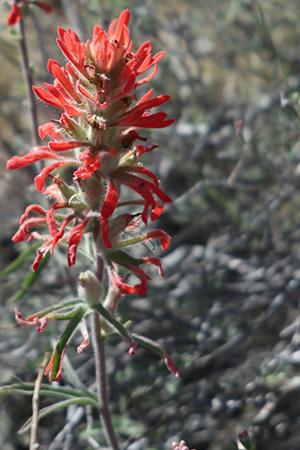 Indian Paintbrush. [photo by Kevin] |
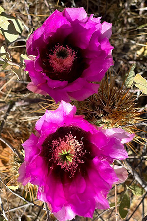 Hedgehog cactus blooms. [photo by Li] |
 Hedgehog cactus bloom. [photo by Li] |
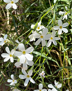 Desert Paperwhites. [photo by Li] |
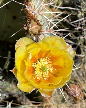 Prickly Pear bloom. [photo by Li] |
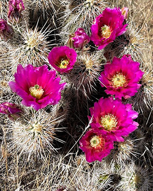 Hedgehog blooms. [photo by Li] |
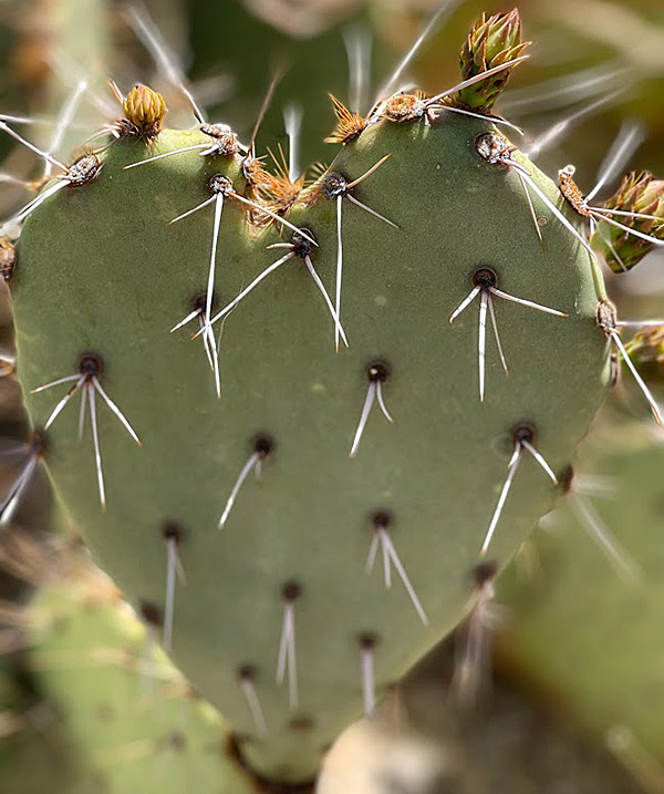 I love you, but back off! [photo by Li] |
|
By the 1890s cattle ranchers began moving into the area, using the old road for decades to drive their cattle, until ranching gradually became too unprofitable to sustain. The last remaining working ranch eventually converted into a guest ranch in the late 1920s to continue operating, with one of Arizona’s first swimming pools and a small runway strip in a narrow canyon for landing small planes. The last guest ranch owner crashed and died while attempting a landing on the narrow strip in 1953, and his wife sold the property later that year. The new owners razed all of the structures on the property to reduce their taxes, leaving only scattered remnants of concrete foundations that can still be seen today. |
 Cave Creek just keeps rolling along through the desert. [photo by Kevin] |
 Beautiful reflection shot along Cave Creek. [photo by Kevin] |
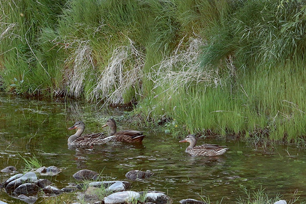 This trio of mallards is in paradise. [photo by Kevin] |
|
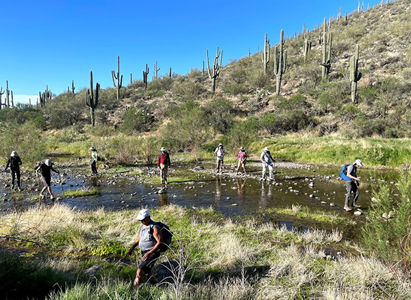
After less than a mile of hiking along the old dirt road, known as Spur Cross Road for many years, we encounter our first two crossings over Cave Creek, one of the last remaining spring-fed streams in the area that flows year-round. Due to Arizona’s prolonged drought, however, stretches of Cave Creek now completely disappear underground, only to reemerge hundreds or thousands of feet downstream. |
 Trailblazers descend yet another steep section of trail. [photo by Kevin] |
 Tom, Li, Billie, and Terry enjoy a good laugh. [photo by Kevin] |
 Terry and Randall are in the lead along this stretch off trail. [photo by Li] |
 Ocotillo in full bloom, with Skull Mesa in the background. [photo by Kevin] |
|
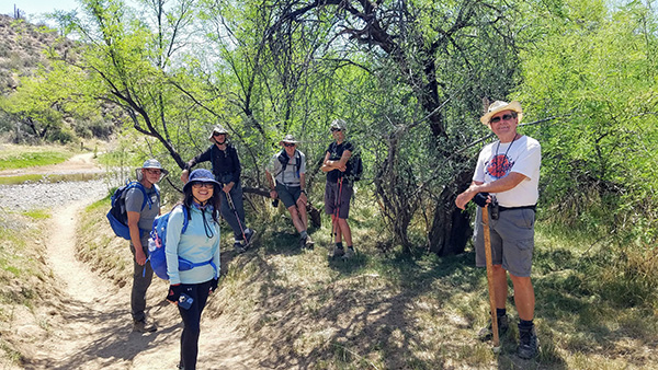
The stretches of Maricopa Trail that run near or parallel with the lush Cave Creek riparian corridor are the most scenic of all, with a wide variety of trees, including cottonwood, sycamore, desert willow, paloverde, and mesquite, with lots of creosote, ocotillo, chollas, and wildflowers thrown in for extra measure. A botanical wonderland. Within the second mile of trail we cross Cave Creek three more times. Due to low water levels in the creek, all the crossings are fairly easy, with some hikers just plowing straight across the creek and others trying to stay dry by carefully using the many rocks in the creek bed as stepping stones. After the fifth and last creek crossing, at 2.2 miles from the trailhead, we come to a large brown and well-weathered Tonto National Forest trail sign, with a map of all the trails in the area. Cave Creek Trail continues following the creek to the north all the way to the Seven Springs area. The Skull Mesa Trail takes hikers to the top of Skull Mesa. Due to time constraints and warm weather, we’ll have to save those hikes for another time. |
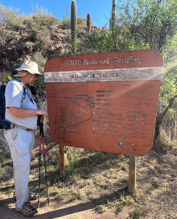 Michael studies the Skull Mesa Trailhead sign. [photo by Li] |
 Scenic gorge off the Maricopa Trail. [photo by Barb] |
 Trailblazers regroup once again. [photo by Tom] |
|
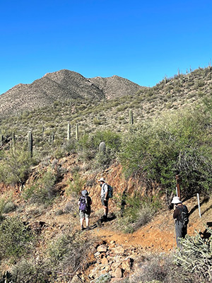
So we continue on our present course. As we leave the creek behind, the trail begins climbing, gently at first and then gradually becoming more aggressive in a long series of steep switchbacks. At the top of each set of switchbacks, the views become even more panoramic and impressive, taking in expansive mountain ranges, large mesas, soaring cliffs, and hundreds of thousands of acres of lush and totally unspoiled Upper Sonoran Desert as far as the eye can see. |
 Tamar and her hot pink cool towel. [photo by Li] |
 Julia enjoys her first Arizona Trailblazers hike. [photo by Li] |
 Michael is pointing at? No, it can’t be. [photo by Kevin] |
 Neil and his trusty hiking staff. [photo by Li] |
 Billie finds the perfect rock. [photo by Li] |
 Ramona relaxes by the lily pond. [photo by Li] |
 Ken is a happy hiker today. [photo by Li] |
 Kevin, with his camera at the ready. [photo by Li] |
 Li and her always radiant smile. [photo by Tom] |
 Tom, is that a fish jumping behind you? [photo by Li] |
 Randall stands next to Cave Creek, taking it all in. [photo by Kevin] |
 Terry is chowing down on? Really? [photo by Li] |
|
It’s little wonder that Mare Czinar describes the hike like this in her article: “Rich in biodiversity, ecozones, history and scenic beauty, this short, easy hike (up to the Tonto National Forest sign just discussed) is a great way to sample and get hooked on the Maricopa Trail.” After almost another mile of hiking past the large Tonto National Forest sign and too many switchbacks to remember, we all regroup at the top of yet another switchback to take a well-deserved break. According to Kim’s tracking device, we’ve already reached the 3-mile mark and have climbed a total of 830 feet to this point. So the five of us short-haul hikers decide to make this our turnaround point and head back down the trail to the Conservation Area. I ask Billie to text me when her group of long-haul hikers finally arrives back at the trailhead, as we wave goodbye and watch the Temerarious Thirteen hike up, up and away into the vast unknown. Will we ever see them again? Keep reading. The hike back to the trailhead goes quickly and relatively uneventful for us five short-haul hikers. At a tenth of a mile inside the north boundary of the Spur Cross Ranch Conservation Area, we divert onto the Metate Trail and hike that back to the trailhead per Billie’s earlier suggestion. This is a more scenic route that runs parallel with the Spur Cross Trail for 0.8 mile before rejoining it near the trailhead. It features some of the largest giant saguaros in the area and dozens of huge mesquite and paloverde trees, in addition to two easy plank crossings over Cave Creek instead of the five more challenging boulder crossings we navigated earlier. |
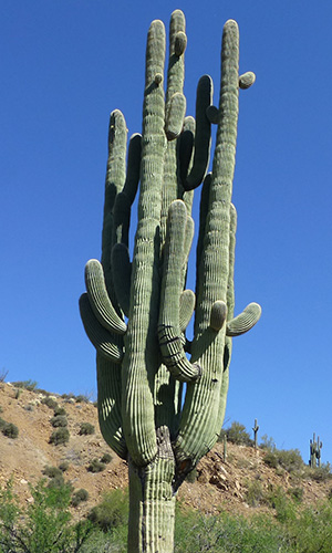 The granddaddy of all saguaros on the Metate Trail. [photo by Barb] |
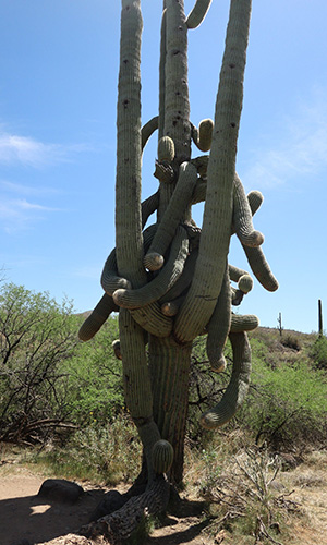 This poor saguaro seems to be all tied up in knots. [photo by Kevin] |
 Riders are heading out on the Spur Cross Trail. [photo by Barb] |
|
We take our time exploring this area before finally arriving back at the trailhead by 10:45 AM. We still have most of the day ahead of us.
Following are additional pictures from Li, Kevin, and Tom featuring the rest of their hike with the group of 13 long-haul hikers and concluding with Billie’s supplemental report on the longer hike. |
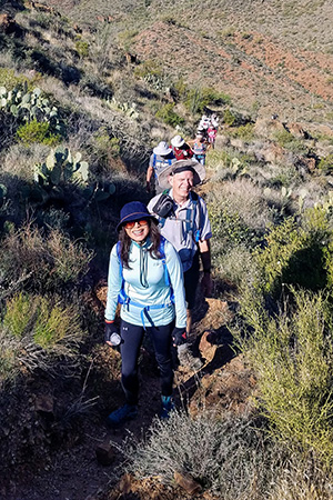 Li leads the charge up another set of switchbacks. [photo by Tom] |
 Whew! The trail gets even steeper now. [photo by Li] |
 A stretch of level trail at last—at least for a minute or two. [photo by Kevin] |
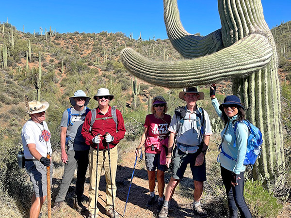 Don’t reach any higher, Li! [photo by Li] |
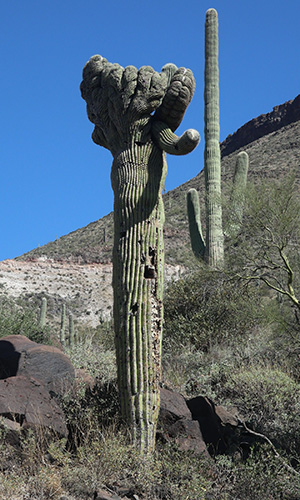 Crested saguaro, just off the main trail. [photo by Li] |
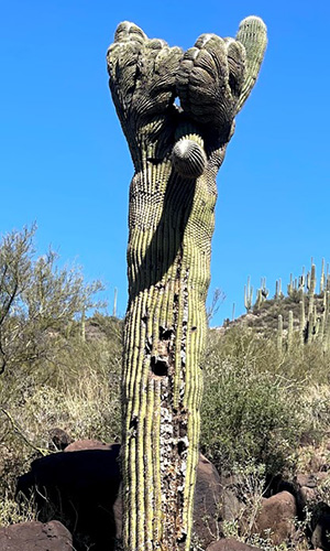 Second view of the crested saguaro. [photo by Kevin] |
 Nobody gets by me without the password! [photo by Kevin] |
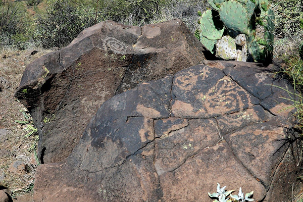 Petroglyph 1 [photo by Kevin] |
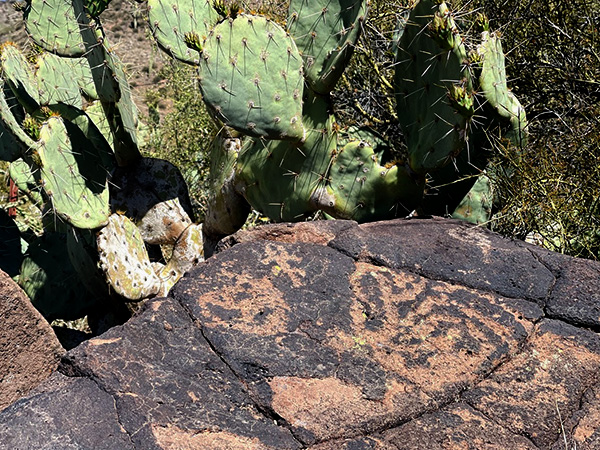 Petroglyph 2 [photo by Li] |
 Petroglyph 3 [photo by Kevin] |
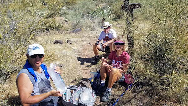 Taking time out for a quick snack break. [photo by Tom] |
 More Trailblazers taking time out. [photo by Tom] |
 A forest of saguaros, with Skull Mesa in the background. [photo by Li] |
 Starting the long trek back to the trailhead. [photo by Kevin] |
 The trail is gradually dropping in elevation. [photo by Li] |
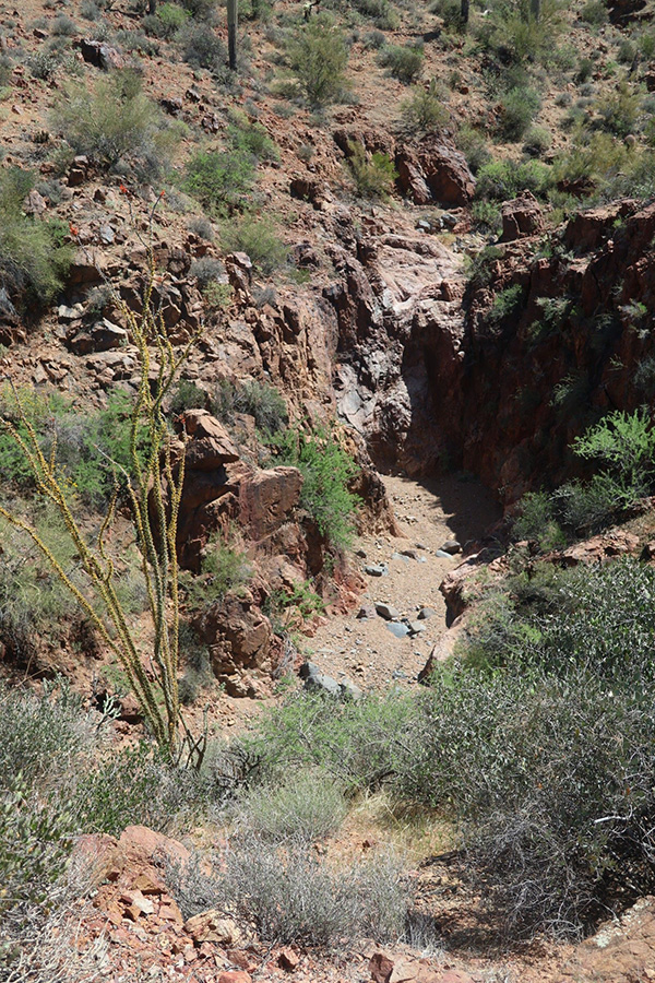 A second look at the gorge we saw earlier. [photo by Kevin] |
 Break time after that long descent. [photo by Li] |
 One last creek crossing to go. [photo by Kevin] |
 Kevin tries the time-honored method of cooling tired, hot feet. [photo by Li] |
 Trailblazers are on the move again. [photo by Kevin] |
 Taking a final break at the Metate Trailhead. [photo by Kevin] |
 Crossing the creek is much easier on the Metate Trail. [photo by Li] |
 There’s plenty of shade on the Metate Trail. [photo by Li] |
 Billie and Neil found the perfect spot for a break. [photo by Li] |
 Ramona takes a break along the oasis pond. [photo by Kevin] |
 Lily pads in the desert? Where there’s water, there’s life. [photo by Li] |
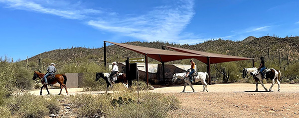 A group of riders starts up the Spur Cross Trail. [photo by Li] |
 A fallen giant saguaro lies bleached in the harsh sun. [photo by Kevin] |
|
Supplemental Report by Billie Horn |
|
It was nice to see so many Trailblazers gather for this hike, and I am always happy to see new faces at the trailheads. This was a great day if a bit hot. I felt like most of the day we had a little breeze to cool us. Chuck lead the entire group to the beautiful gorge at about the 3+ mile mark. This is truly the most scenic part of the trek. At this point, 13 of us continued on, up down, up down, for a couple more miles. The ups seemed to get longer as the sun got higher. Neil, Rodney, and I kind of spaced ourselves amongst the group without really planning to, and so we stayed within sight of everyone. I was impressed at how we all watched out for each other. Thank you, Tom and the other hikers, for stopping often to keep us in sight. When the lead hikers were nearing the last of many deep valleys, I hollered up to them to keep watch for a crested saguaro we were told is just off trail before the climb out of that valley. Neil and I passed that exact spot a couple of times and never knew it was there. That last climb brought us to the gate and our destination. Two of our hikers decided not to make the last uphill and turned back, probably less than a quarter of a mile before the gate. It was a wise decision, since there was not much shade. We took a well-deserved rest and food break here. Most of our devices registered 5 miles at this point. At this gate, Trail 248 takes off to the left and the Maricopa Trail continues to Seven Springs Trailhead. It was here that I made a special request of the hikers, “When you get to the Metate Trail sign, please stop. I want to take that trail as a group. There are some sights on this leg of the trip and I hope to hear everyone say WOW,” and they did! I love to witness reactions when people see the large saguaro on this trail. Many pictures were taken here, so we all get to enjoy them in Chuck’s report. We took a short break at the pond and relaxed in the shade for a few minutes. At this point we were nearing the end of the hike and I think everyone was happy to see the parking lot. Many of us had cool drinks waiting in the car. I know I was low on drink and Neil always provides. Thanks, Neil. I want to thank everyone for this experience. We had a great group today, and I enjoyed it so much. Thanks to all of our photographers. It’s a scenic area, so cameras were clicking all day. Thanks, Rodney, for rescuing a couple of hikers over heated or hurting. You have become a very important member of this club in a short time. Thanks, Chuck, for planning and leading this hike and for allowing us to co-lead. I hope to see you all again very soon for more adventures. |
|
|
|||||||||||||||||||||||||||||||||||||||||||||||||||||||||||||||||||||||
 Top of Page
Arizona Trailblazers Hiking Club, Phoenix, Arizona
Comments? Send them to the AZHC .
updated May 2, 2021