Outdoor Links
Hike Arizona
Trip Planning Guide
Trip Report Index
Calendar of Events
Library
|
Sycamore Rim Day Hike Kaibab National Forest August 21, 2021 by Li Li |
|
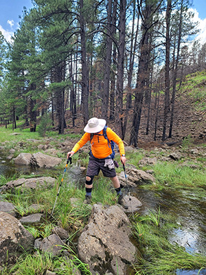
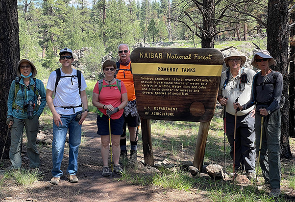 Trailblazers at Pomeroy Tanks. [photo by Li] |
| Lin, Daniel, Carol, Terry, Michael, Ken |
|
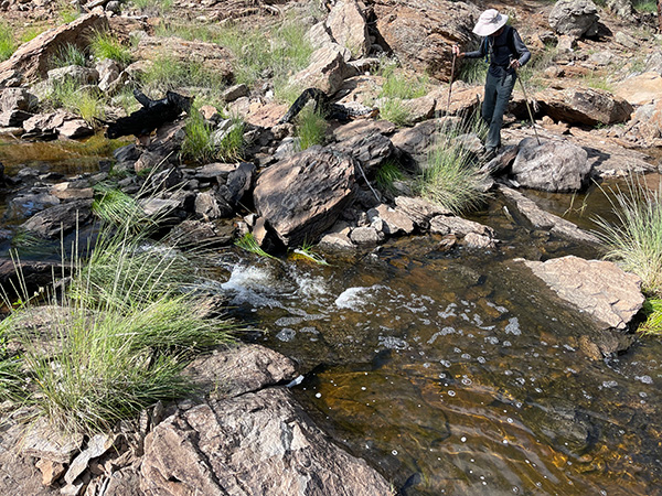
Seven trailblazers gathered at Pomeroy Trailhead for the Sycamore Rim Hike on a sunny Saturday morning. We met at Pilot travel center at 9:30 AM, due to traffic, some of us arrived late, so when we drove through the well-graded forest road to the trailhead, it was 10:40 AM. To our surprise there was a restroom at the trailhead. We started the hike at 10:47 AM after the introductions which was a late start for a long hike. The sun was up over our heads. Luckily the weather at Williams was cool with high of 74°F, so it was not too bad for the late start. The trail started at a flat open area in the woods. Soon we saw the Sycamore Rim and heard the water running over the creek. This year Arizona had plenty of rain, so the water in the creek flowed very well. We did not see any waterfalls here. just some small cascades of water flowing over the rocks and large boulders, which was pleasant. We then proceeded west toward Sycamore Fall Trail. This part of the trail was challenging, since the water had covered the trail. We had to cross the creek four times before reaching the waterfall area. |
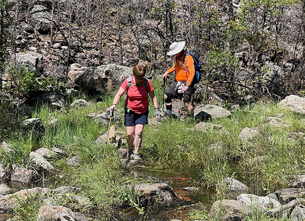 We had to cross the creek four times. [photo by Li] |
|
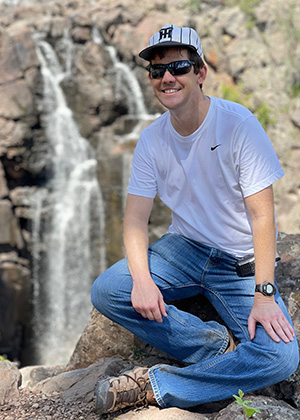
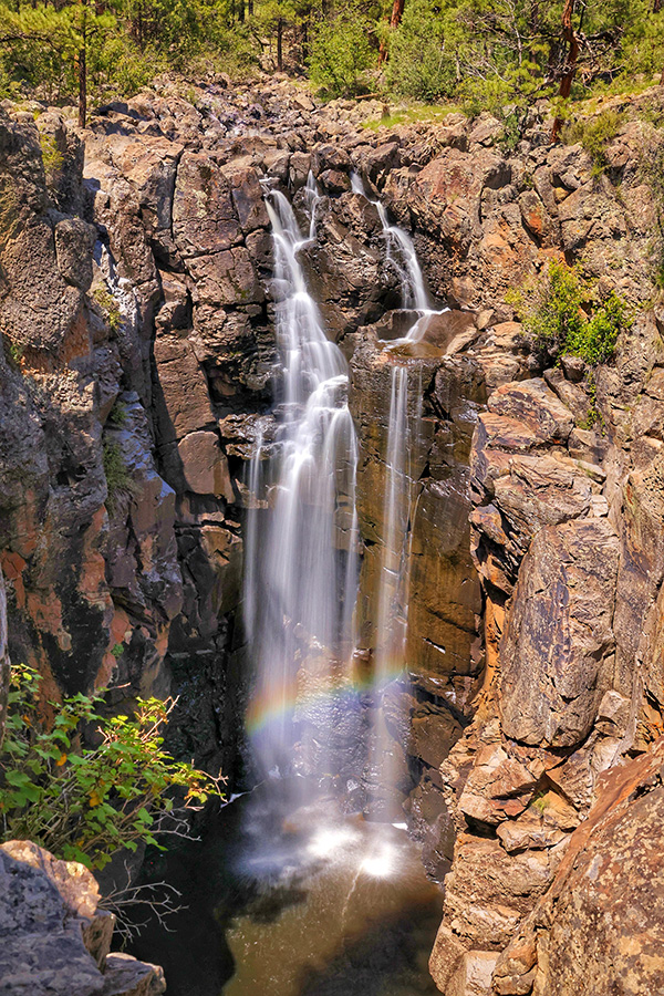
This year Sycamore Falls was beautiful! The waterfall flowed from about 100 feet above, at the lower bottom the rainbow reflection made the whole scene surreal. There are a few people gathered in that area taking pictures and enjoying Mother Nature’s creation. We also saw a few rock climbers carrying their ropes and equipment to this area. This area is commonly used by rock climbers to practice their skills. |
 Lin [photo by Li] |
 Li [photo by Lin] |
 Carol [photo by Li] |
 Daniel [photo by Li] |
|
After a short break, the long hiking group crossed the rocks again on top of the waterfall to continue our journey toward vista point, soon we disappeared in the woods. Lin’s short hiking group stayed behind enjoying more of the scenic waterfall. Vista point was 1.5 miles from the waterfall area. It provided a majestic view of the sycamore canyon. Wild flowers blooming along the path provided pleasant sights. We took a lot of pictures. then moved on to our next point to Dow Spring. |
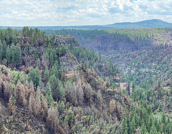 Sycamore Canyon. [photo by Li] |
 Watch your step, Terry. [photo by Lin] |
 Lin takes pictures. [photo by Li] |
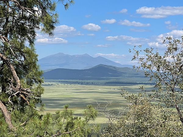 Bill Williams Mountain. [photo by Li] |
|
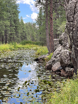
This part of the trail is relatively flat. It featured many small and large ponds along the rim with beautiful yellow water lilies. We stopped for our lunch break at one of the large pond areas. resting on the rocks while enjoying the sight of many beautiful water lilies and wildflowers. It reminded me of Monet’s water lilies oil painting. We relaxed in the solitude of the lush green forest with the blue sky and white clouds above our heads, yellowish scented wildflowers surround us. In the distance the enchanted frogs singing happily on the lilli pads, the fresh air, cozy breeze brushed over our faces. This is a heaven-made place for hikers! |
 The woods are lovely, dark and deep. [Li] |
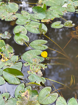 Water lilies. [photo by Li] |
 A pond with water lilies. [photo by Li] |
 Little rapids in the creek. [photo by Li] |
 Waterfall. [photo by Lin] |
|
After Dow Spring point we descend to the lower land with up and down hills and crossed a few water covered trails to reach the old sawmill site. The scattered wood planks and remnants of cabin reminded us the history of the old Williams town and its lumber industry from 1910-1920. |
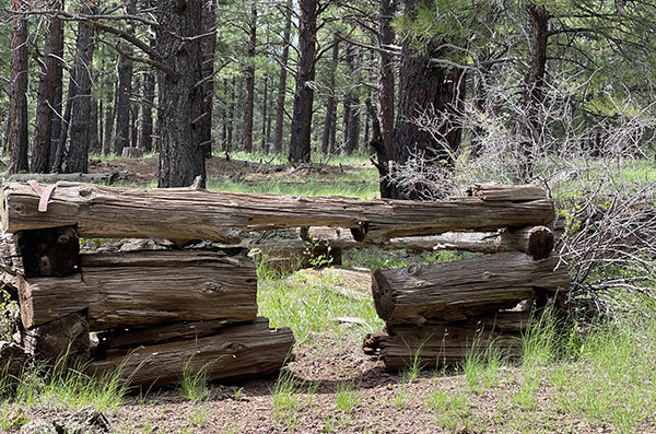 Not much left but some logs. [photo by Li] |
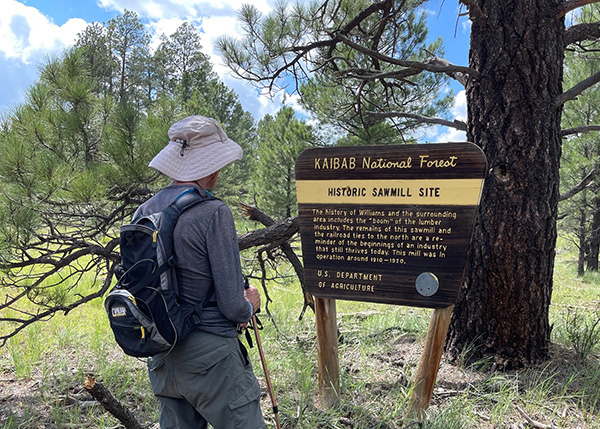 Ken reads the sign for the sawmill. [photo by Li] |
|
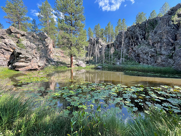
Soon after we passed a large open field, there was a large lake in front of us. I did not remember there was a lake before, it must be from rain water accumulation. We reached KA Hill in no time. After passing Forest Road 59, we started our climbing. Within 1.5 mile distance we had ascended about 500 feet. The weather was a little warm we were climbing. Luckily we had plenty of shade from tall, large ponderosa pines, oaks and Aspens. The view on the top was beautiful. Far away we could see a large grassy meadow with many cows playing on the Garfield plains. There were a few houses that could be spotted as well. Kendrick mountain, Humphrey’s Peak and Bill Williams Mountain were visible far away. |
 Daniel by the creek. [photo by Li] |
 Ken by the trail sign. [photo by Li] |
|
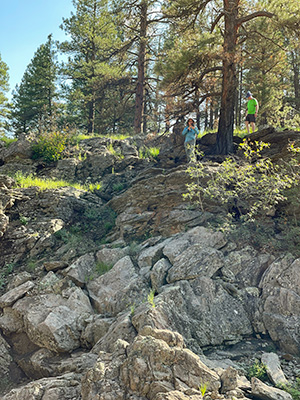
After this part, the trail became hard to follow. Three of us stayed together, walked up and down some large boulders, and soon the trail connected again to Pomeroy Tanks trail. We knew that we were close to the finishing point. At a quarter mile from the trailhead, we got lost. Since there was so much water this year the part of trail was completely covered with water, which was flowing so quick and deep it was impossible to pass. Lin and Terry who were in the short hike group had been waiting for us patiently and radioed us to inquire where we were since this quarter mile took us too long. We could hear them but we could not see them. Finally Lin spotted Ken in the canyon and she called out. We saw Lin stood on the other side of canyon, the only way to cross was through the boulders over the rushing water. I was in the front, Ken was in the middle and Dan was in the back to make sure that we were all safe. Step by step we crossed the dangerous rocks and reached the other side. A few hundred yards away we could see our car. We were overjoyed to finish our long 12.9-mile hike in 5:54 hours with 1,283 feet elevation gain. We conquered another difficult hike! → More pictures, by Li. |
 Top of Page
Arizona Trailblazers Hiking Club, Phoenix, Arizona
Comments? Send them to the AZHC .
updated September 8, 2021