Outdoor Links
Hike Arizona
Trip Planning Guide
Trip Report Index
Calendar of Events
Library
Prescott National Forest
April 2, 2022
by Vicky Johnson
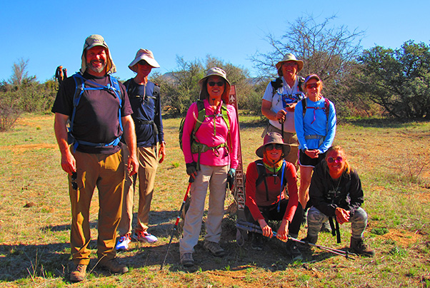 Trailblazers. [photo by Vicky] |
| Robert, Ken, Lin, Jackie, Michael, Lisa, Debbie |
 Trailblazers at Trail 64. [photo by Lin] |
| Robert, Ken, Vicky, Jackie, Michael, Lisa, Debbie |
|
Eight hikers showed up at 9:00 AM at the dirt parking lot to begin the hike across the road at the intersection of South Cherry Creek Road and the General Creek Trail. Two new members, Lisa Levin from Flagstaff and Robert Goodman from Phoenix, joined us on Trail No. 64 in an easterly direction through scrubby range land backed by views of the Bradshaw Mountains. |
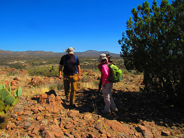
 The trail goes through range land. [photo by Vicky] |
 Bradshaw Mountains in the background. [photo by Vicky] |
|
The sandy path passed through drainages and washes with large cairns marking the way. This trail was once a historic wagon road, in addition to being a pathway for sheep flocking from winter crazing lands around Bloody Basin to summer pastures near Flagstaff and the Mogollon Rim. |
 Foot access only. [photo by Vicky] |
 Cactus makes perfect. [photo by Lin] |
|
As mentioned in a previous description, while sheep still pass through the area, hikers are more likely to encounter domestic cattle, coyotes, and javelina. At the 1.2 mile point, the General Crook Trail intersected the newly constructed section of the Black Canyon Trail and proceeded in a southernly direction. The hike leader cautiously led the group to a fence and cattle guard, because no trail signs had been installed. Construction is still taking place in a southernly direction to hook up with the Russian Well Trailhead. The group proceeded down a wash and began an ascent to the high point of approximately 3,828 feet, where grasslands and juniper forests could be viewed in the distance. A local female rancher rode a friendly brown horse eating grass who enjoyed being photographed and petted. In addition, five hikers from the Trilogy Hiking Club were encountered. The group then approached another fence and cattle guard, where a large water trough was visible, with several grazing black and white curious domesticated cattle with tags in their ears. |
 We met a mounted rancher. [photo by Vicky] |
 Debbie pets the horse. [photo by Lin] |
 On the way back. [photo by Lin] |
 Rocky section of the trail. [photo by Vicky] |
 Lin passes a pond with cattle. [photo by Vicky] |
 We pass a tower on the way back. [photo by Lin] |
|
At the five-mile point, the hikers turned around and enjoyed a short lunch under a shady bark juniper tree. Twelve courteous mountain bikers passed by in the opposite direction. It took two hours to return to the trailhead. The hike ended with a graphic view of a dead cow in a drainage ditch that was obviously resting in peace. The hikers thanked the leader for her efforts and took off in their respective cars.
Total Distance Hiked: 10.02 miles |
 Top of Page
Arizona Trailblazers Hiking Club, Phoenix, Arizona
Comments? Send them to the AZHC .
updated April 7, 2022