Outdoor Links
Hike Arizona
Trip Planning Guide
Trip Report Index
Calendar of Events
Library
|
Cypress-Boulders Loop Payson April 8, 2022 by Wendy Rennert |
|
 Randall, Karen, Rodney, Wendy, Deirdre, Anna. [photo by Wendy] |
|
Six Trailblazers enjoyed a pleasant day hiking the Cypress-Boulders Loop in Payson! 5 of us left the valley at 7 AM, and met 1 other hiker at the trailhead. We started hiking at 8:25 AM. Since there are many social trails that branch off from the main trail, we kept track of our route in real time on All-Trails. For the most part, I believe many of those trails momentarily veer off and then come quickly right back to the main trail, but some of them are an entirely different route, so it is best to stick with the All-Trails route for this loop. The Cypress and Boulders north and south trails part of the PATS system (Payson Area Trails System). PATS is an in-progress, interconnecting trail system using detached pathways, existing sidewalks, and bike lanes in Payson to form an interior trail network. These interior trails will connect to specific Forest Service roads and trails on Payson’s periphery in the Tonto National Forest, providing a more rustic trail-user experience. It is not a great wildflower year, but we were delighted to see 7 different species along the trail! |
 Scrambled Eggs (close-up) [photo by Wendy] |
 Ashen Milkvetch [photo by Wendy] |
 Rockcress [photo by Wendy] |
 Manzanita [photo by Wendy] |
 Godding’s Verbena [photo by Wendy] |
 Western Wallflower [photo by Wendy] |
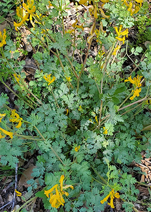 Scrambled eggs [photo by Wendy] |
 Lupine [photo by Wendy] |
|
The trail is pretty easy on the feet, and there is a good mixture of shady and sunny spots, gentle ups and downs, and a few steep and slippery spots. On this April day, there are many water crossings as well. Mind you, there is not really enough water to even call it a stream in some spots, but we desert rats enjoy the sights and occasional sounds of the water nevertheless! |
 A delightful, quick little hop across the shallow waters. [photo by Wendy] |
 A delightful, quick little hop across the shallow waters. [photo by Wendy] |
|
I had scouted out this hike only a week before, so I didn’t have to consult AllTrails as much this time as the first time, but there was still a tricky spot where we got just slightly off the intended route, but as we surmised, it was easy to find the marked trail again. |
 We got a little bit off trail here, but found a PATS trail sign quickly. [photo by Wendy] |
 We got a little bit off trail here, but found a PATS trail sign quickly. [photo by Wendy] |
|
At one point, there was a fun flat rock that looked like a little platform, so we took turns posing atop the rock. |
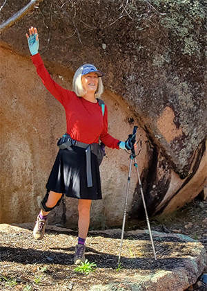 Deirdre strikes a pose. [photo by Wendy] |
 Karen strikes a pose. [photo by Wendy] |
 Rodney strikes a pose. [photo by Wendy] |
 Randall holds up the boulder. [photo by Wendy] |
|
Our favorite part of the hike is what we refer to as “the rock slab.” It is very huge, and we scrambled up to the top of it for our snack break, because it provides excellent views at the top. It is easy to get to the top, since there is plenty of traction, not slippery at all. |
 We didn’t want to leave this peaceful spot! [photo by Wendy] |
 We didn’t want to leave this peaceful spot! [photo by Wendy] |
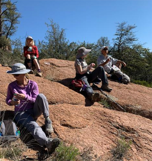 Taking a snack break. [photo by Randall] |
|
One rather interesting pile of boulders had very pretty colors of lichen near the top. |

|

|
| Pretty shapes and colors. [left photo by Wendy, right photo by Deirdre] | |
|
There was a nice variety of scenery along this route—forest, open high desert areas, boulders, views, trickles of water, a wide-open meadow, view of a huge wash, and a narrow cliff-hugging area. |
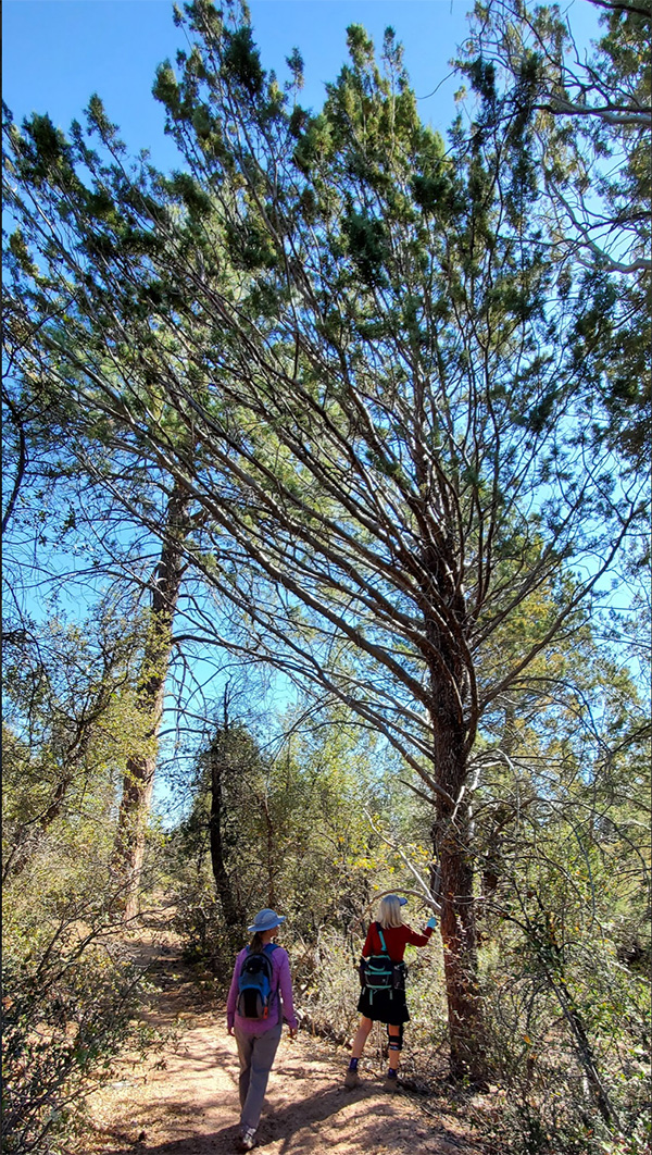 This tree looks very windswept—most branches are leaning left! [photo by Wendy] |
 Fascinating bark! Arizona Cypress. [photo by Deirdre] |
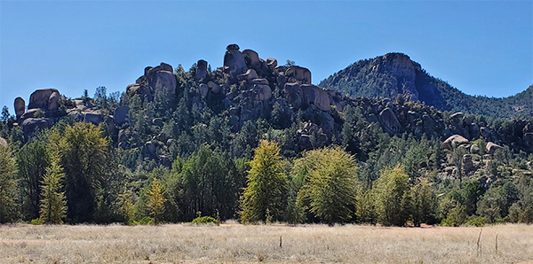 Interesting boulder formations alongside the pretty meadow. [photo by Wendy] |
 What do you see in this formation? Depends on who you ask. [photo by Wendy] |
 Huge boulders in one of the largest washes we’ve ever seen. [photo by Wendy] |
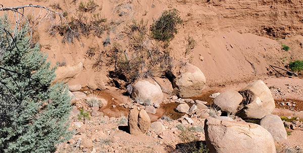 Huge boulders in one of the largest washes we’ve ever seen. [photo by Wendy] |
 The last few water crossings before we reach the trailhead. [photo by Wendy] |
 The last few water crossings before we reach the trailhead. [photo by Wendy] |
 The last few water crossings before we reach the trailhead. [photo by Wendy] |
|
While we were at our snack break on the huge rock slab, we spotted several turkey vultures smoothly gliding overhead. We also saw a number of very thin, fuzzy caterpillars on that rock slab and elsewhere along the trail. |
 Almost didn’t see the cute little caterpillars! Good eye, Randall! [photo by Wendy] |
 Our last view of the forest. [photo by Wendy] |
|
We finished the 5.5 mile hike in just under 3 hours, including our snack break. Afterwards, 4 of us went to nearby Macky’s Grill and ate out on the shaded patio. A great end to a great day! |
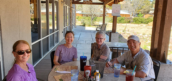 Great patio at Macky’s Grill. [photo by our server] |
 Top of Page
Arizona Trailblazers Hiking Club, Phoenix, Arizona
Comments? Send them to the AZHC .
updated April 13, 2022