Outdoor Links
Hike Arizona
Trip Planning Guide
Trip Report Index
Calendar of Events
Library
|
Russian Well/Black Canyon Trail Prescott National Forest/Mayer, AZ February 5, 2022 by Vicky Johnson |
|
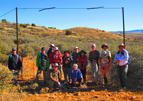
 Trailblazers ready to hike. [photo by Bill] |
| Tom, Li, Michael, Stan, Vicky, Barbara, Kevin, Tamar, Bill, Ken, Terry, Randall, Ron, Anna |
|
Fourteen hikers started at 9:00 AM with a balmy temperature of 34 degree off the dirt lot of the trailhead at the Black Canyon Trail sign. We proceeded along the dirt road that ran parallel to new trails that the USDA had built for both hikers and bikers 9 months ago. |
 Trailblazers. [photo by Vicky] |
|
At the 1.5-mile marker we switched from the road to a section of the newly built trails that was dotted with juniper trees, wide-open range land, some curious brown and black cows, and unique geology that attracted prospectors to mines in the area with mineral-rich volcanic deposits. On the trail we proceeded to Yarber Wash, where a windmill that looked as it has seen better days (the blades were riddled with gun shots). With some trepidation from the hikers one brave hiker, who shall not be named but was frequently photographed, climbed to the top of the windmill. |
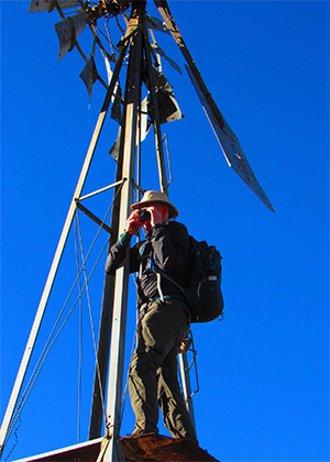 There he goes up the windmill. [photo by Vicky] |
 Hmmm, there’s something interesting here. [Bill] |
 Bill, at the windmill. [photo by Bill] |
|
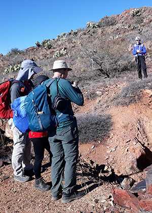
A concrete foundation that had also seen better days could be viewed from the southwest adjacent to the wash. At the 2.9 mile point, the hikers were treated with impressive vistas of the Pine Mountain Wilderness area to the east and the Bradshaw Mountains to the southwest. We began our descent to the Russian Well Outpost, where the group headed left to the Tri-Metals Mine. This mine yielded deposits of silver, gold, copper, and lead, in its heyday. |
 Don’t get caught in the power lines. [photo by Bill] |
 The entrance to the mine. [photo by Bill] |
 The remains of a rock wall. [photo by Bill] |
 A structure at Russian Well. [photo by Bill] |
|
A local rancher who approached the group on his quad stated he raised 250 head of cattle that were monitored with colorful tags that could be seen protruding from their ears. The rancher also stated that the reason the area was called Russian Well is that Russian immigrants had mined the area, that unfortunately was not a large operation during 1910-1920. |
 A rancher explains everything. [photo by Vicky] |
 Cattle with ear tags. [photo by Bill] |
|
From the mine we proceeded downhill to the Russian Well itself, which made for a good place to stop for lunch next to a stone building surrounded by splintered timbers and metal scraps above a small corral at the edge of Brushy Wash. This deeply incised drainage displayed a windmill that pumps groundwater into a collection of brown tanks. |
 Strange markings. [photo by Vicky] |
|
Bill Zimmerman also pulled a sheet of ice from one of the cattle troughs that was an indication of the balmy weather. After stopping for lunch for 45 minutes we proceeded up the trail, continuing to the south side of the Copper Mountain segment. We were rewarded by an informative talk by Randall Greeley (Randall’s father was a well-known geologist who was a professor at ASU and took his son on worldwide expeditions), regarding the geology of a volcano called Joe’s Hill, the gently sloping shield volcano on the east side of I-17 opposite of Sunset point rest area. Randall stated that this volcano is the same type of volcano that makes up Mauna Loa, which comprises most of the big island of Hawaii. Randall stated that Mauna Loa, measuring from its base at the bottom of the ocean, to its summit is over 30,000 feet, which is over 1000 feet higher than Mount Everest, measured from sea level to it summit. Mauna Loa is the tallest mountain on planet earth. |

|
|
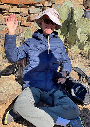
| Old Timers. [photos by Vicky] | |
|
To the north of the trail, we could view the tailings from the Tri-Metal Mine. The turnaround point was ¼ mile from the wash. We took a slightly different route heading back to the car, that involved larger sections of the newly built USDA trail, whose windy meanderings shaved a mile off our total mileage when we made it back to the cars at 2:15 PM. The hike leader had a nice Mexican Dinner at El Canto Dos at 112 E. Carefree Highway. → More pictures, by Vicky. |
 Top of Page
Arizona Trailblazers Hiking Club, Phoenix, Arizona
Comments? Send them to the AZHC .
updated February 8, 2022