Outdoor Links
Hike Arizona
Trip Planning Guide
Trip Report Index
Calendar of Events
Library
Wyoming
August 21, 2022 - September 1, 2022
by Felix, Deirdre, Mike, Kathy, Ramona, and Lin
|
Yellowstone National Park, the world’s first national park. It is one of my favorite parks. There are 2.2 million acres of opportunities to enjoy the wildlife, to observe nature in an intact ecosystem, to explore geothermal hot spring with active geysers, and to view the wonder of the Grand Canyon of the Yellowstone River. Grand Teton National Park? It is one of most popular destinations for mountaineering, hiking, fishing, and photographing and other forms of recreation. Seventeen members of the AZTHC went on a car camping trip, led by Lin, to Grand Teton NP and Yellowstone NP. We camped at Colter Bay and Grant Village. We did 12 hikes, 814 miles; and drove 9812 miles for the trip, from Aug 21, 2022 to Sept 1, 2022. |
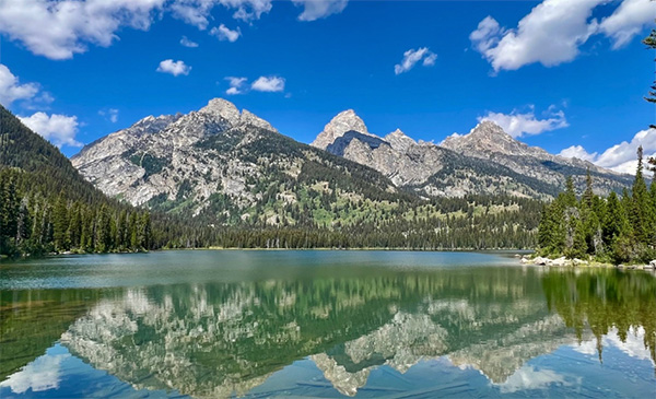
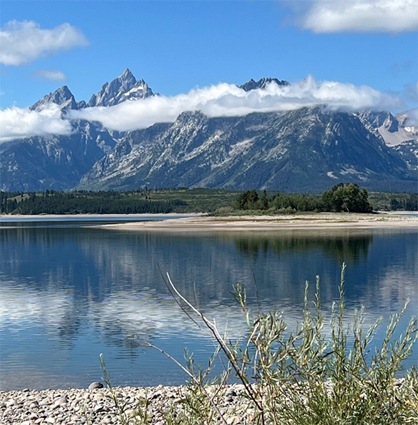
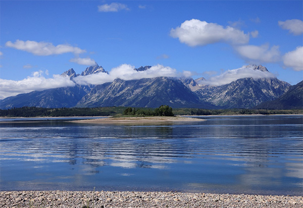
 Reflection of Grand Teton Peaks in Phelps Lake. [photo by Lin] |
 The famous barn at Grand Teton. [photo by Lin] |
 Morning Glory Geyser at Yellowstone. [photo by Lin] |
 Yellowstone Falls. [photo by Lin] |
Day 1 August 21, 2022: Drive from Phoenix to Provo, Utah.
By Lin
|
In the early morning, six of us (Ron, Wendy, Mimi, Lin, Ramona and Felix) met at McDonald’s at I-17 and Carefree HWY. It was my first-time meeting Felix and Ramona. After a quick introduction, we were on our way to our mid-point destination – Provo, UT. Provo is the fourth-largest city in Utah. It is 43 miles (69 km) south of Salt Lake City along the Wasatch Front. Provo is the largest city and county seat of Utah County and is home to Brigham Young University (BYU). Provo lies between the cities of Orem to the north and Springville to the south. With a population of 115,162. Provo is the principal city in the Provo-Orem metropolitan area, which had a population of 526,810. It is Utah’s second-largest metropolitan area after Salt Lake City. Provo is the home to Brigham Young University, a private higher education institution operated by The Church of Jesus Christ of Latter-day Saints (LDS Church). Provo also has the LDS Church’s largest Missionary Training Center (MTC). The city is a focus area for technology development in Utah, with several billion-dollar startups. The city's Peaks Ice Arena was a venue for the Salt Lake City Winter Olympics in 2002. Sundance Resort is 13 miles (21 km) northeast, up Provo Canyon. Our first stop for gas and a quick break was at the McDonald’s at US-89 HWY in Flagstaff; then we stopped at Escobar’s Mexican restaurant in Kanab for lunch. The food was very good. The drive from Flagstaff to Kanab is very scenic. We arrived in Provo at 6:30 PM local time. We stayed at the Sleep Inn. After we checked in, Ramona, Felix, Mimi and Lin went to the Sizzler for a quick dinner. While we were at the restaurant, Michael, Gail, Kim also arrived at the hotel. It was a long day for everyone, we drove more than 11 hours with 600+ miles; we were all very tired. A great first day on the road. Good job to all the drivers. |
 Very country view on the road. [photo by Lin] |
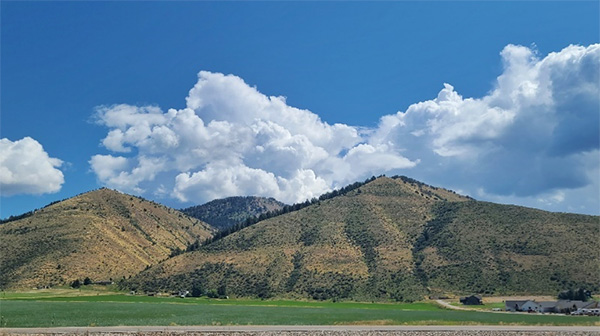
 It is just so beautiful - Puffy clouds and blue sky. [photo by Lin] |
 Beautiful Utah country. [photo by Lin] |
 Welcome us with double rainbows at Provo, UT. [photo by Lin] |
Day 2 August 22, 2022: Drive from Provo UT, to Colter Bay Campground.
By Lin
|
After a great night’s sleep, we woke up fully energized and ready to go. From Provo, UT, to Colter Bay Campground is about 335 miles, more than 6 hours of driving. The road to Colter Bay? We zig-zagged between Utah, Wyoming, Idaho, and Wyoming. |
 It was quiet after left Provo UT, in the morning. [photo by Lin] |
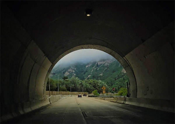 There is light at end of tunnel. [photo by Lin] |
 Another beautiful view along the road. [photo by Lin] |
|
At 1:35 pm local time, I received text message from Ramona:
At 1:35 pm local time, I received text message from Ramona: However, Mimi and I were debating – Should we go to Roadhouse Pub & Eatery for lunch or should we continue driving to the campground? Parking is always a challenge in Jackson Hole at any time. Now with a hitch basket attached in Mimi’s vehicle with our camping equipment, we thought it would be more of a challenge to find parking. In addition, I needed to get to the campground to register our group campsite first before everyone showed up. As much as we would have liked to eat at the Roadhouse Pub and Eatery, Mimi and I decided we would skip lunch and continue to drive to Colter Bay Campground. Check-in at Colter Bay was much easier than I expected, there was no line and the ranger was very helpful. However, there are few sentences that she said which worried me – There is bear activity near the campground, most of the bears are across HWY 191 (John D. Rockefeller Parkway), northeast of the campground; however they usually go through your group campsite to Jackson Lake. So please be extra careful and inform your campers to store the food in the provided food Shed. “Really?” (I wish you can see my face at that moment).. Our Group site was located in Loop L at site C. It can accommodate a maximum of 9 vehicles with five tent pads on the site (each tent pad can have multiple tents). Ralph and Diva toured the campsite earlier (they arrived a day early), they really liked our site, therefore to be closer to everyone, they moved from their individual site to join us at the group campsite. Welcome. In addition, Quy and Deirdre were also at Colter Bay Campground, they stayed at sites of C59 and C60. The last one to arrive was Bud from CO. We reserved a perfect spot for his truck. So glad everyone safely arrived at the campground. Another great day on the road. |
 Map of Colter Bay Campground. [photo by Lin] |
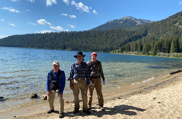
Day 3 August 23, 2022: Taggart Lake and Bradley Lake Loop.
By Deirdre
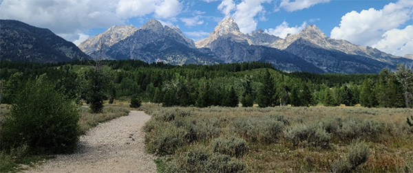
 A great view of Grand Teton Peaks from the trailhead. [photo by Ron] |
|
For our first day of hiking, fearless leader Lin wisely chose a hike that allows us to acclimate for more strenuous hikes later in the week. |
 Group picture. [photo by Lin] |
|
Deirdre, Mike, Kim, Gail, Quy, Michael, Nancy, Ramona, Ron, Kathy, Ralph, Felix, Mimi, Diva, Bud and Wendy. |
|
The Taggart Lake and Bradley Lake Loop, which connects two glacially formed lakes at the base of the Teton Range, nicely fits the bill. |
 AllTrails map of the hiking trail and lakes. |
|
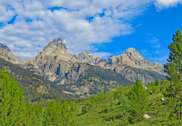
The lakes, ranging in elevation from 6,625 to 7,190, are named after two men who were important to the 1872 geological survey of the Tetons. On the drive to the trailhead, just over two miles from the Moose Entrance station into the park, there are stunning views of Grand Teton, the highest mountain in the range at 13,770 feet. |
 Photo enroute to the trailhead showing Nez Perce (11,893 ft), Middle Teton (12,805 ft), Grand Teton (13, 776 ft) and Mt. Owe (12,913 ft), all visible from the loop trail. [photo by Deirdre] |
|
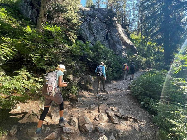
During the hike, we cross over footbridges, admire cascading waterfalls, and traverse mixed forest of spruce, fir, aspen and lodgepole pine. |
 Waterfalls. [photo by Deirdre] |
 Here come AZTHC hikers. [photo by Ron] |
 Bud, Felix and Mike are crossing the footbridge. [photo by Ron] |
 Water rushing at the creek. [photo by Ron] |
 Michael is leading this section of the hike. [photo by Ron] |
 Waiting at the Junction. [photo by Ron] |
 Mimi and Mike are having a great conversation. [photo by Ron] |
 Kim is leading this section of the trail. [photo by Ron] |
|
Eventually, we reach stunning Taggart Lake. |
 Stunning view of the Taggart Lake. [photo by Deirdre] |
 Footbridge in the distance. [photo by Deirdre] |
 Taggart Lake. [photo by Lin] |
|
After soaking in the views of Taggart, we continue hiking through the huckleberry w moraine between the two lakes. Since I left my bear spray at camp, I’m grateful to have lots of talkative company! |
 Red huckleberries. [photo by Deirdre] |
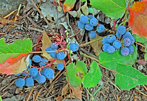 Creeping Oregon grapes. [photo by Ron] |
|
When we reach Bradley Lake, the smallest of the lakes at the base of the Teton Range, the views of the peaks reflected in the lake are incredible. |
 Crossing the footbridge. [photo by Lin] |
 View of Bradley Lake. [photo by Deirdre] |
 Time for a break. [photo by Ron] |
 Time to return to the trailhead. [photo by Ron] |
 Gail is energized after the break. [photo by Lin] |
 Almost back to the trailhead. [photo by Ron] |
|
Although our large groups stretch over considerable distance and segments into smaller groups of varying miles traversed, we all agree at the evening potluck that it was a wonderful first hike. |
 Wildflowers on the trail. [photo by Lin] |
 More wildflowers on the trail. [photo by Lin] |
 Back to the trailhead and a look back the Grant Teton peaks. [photo by Lin] |
Day 3 August 23, 2022: Potluck Dinner. By Lin
|
After a great hike, we returned to the campsite to prepare the AZTHC potluck. Kim, Gail, Mimi, Wendy, Kathy, Ramona… all the ladies were busy helping set up the tables, arranging the dishes, warming up the food. As usual, the food was very yummy, and I think we all ate too much. Good job, ladies, and thanks to everyone who brought delicious food, dessert and drink. |
 Kathy is ready to eat. [photo by Lin] |
 Bud is looking, Gail is tasting, Mimi is picking, and Ralph is thinking. [photo by Lin] |
 Mimi, Bud, Mike and Ralph are busy at potluck table. [photo by Lin] |
 Here is just the corner of food. [photo by Lin] |
Day 4 August 24, 2022: Jenny Lake Loop, by Kathy
|
August 24, Wednesday Jenny Lake Loop, Inspiration Point, Hidden Falls, Cascade Canyon Fork. Total miles app. 11, elevation gain app. 1000 ft.
Jenny Lake is one of the true gems of the Grand Teton National Park with perfect reflection of the jagged peaks above, the breathtaking mountain lake is tucked into the fold of the “glacially carved moraine at the foot of the Tetons”. Jenny Lake was named after the Shoshone woman, Jenny Leigh who was the wife of the fur trapper, “Beaver Dick” Leigh.
In order to avoid some of the crowds on this popular trail, Lin had chosen the clockwise route starting at the Jenny Lake Visitor Center. We passed the Jenny Lake boat dock and started on the trail. After climbing a stone staircase up the trail with views of the lake to our east and the Tetons on the west, we crossed Cascade Creek over a wooded bridge. The sounds of the creek flowing were awesome.
Initially, there weren’t a lot of other hikers until we came to the turnout for the Hidden Falls portion of the hike, we hiked the one-mile trail to the 100-foot cascading waterfall, Hidden Falls and had a spectacular view of the falls which cascade into the aptly named Cascade Canyon. It got a bit crowded with lots of hikers and we chose to limit our time there and proceeded on the trail up 200 feet in elevation to Inspiration Point. The view was a breathtaking view above Jenny Lake and out into the Jackson Hole Valley, as well as a view of the Cascade Canyon, Grand Teton, Mound Owen and Teewinot Mountain. We stopped for many photos, snacks and time to enjoy the view. We continued on the trail through the glacier-carved canyon with numerous huckleberry, thimbleberry and wild raspberry patches which caused us to make lots of noise, bear spray ready and kept us on the lookout for bears.
As we continued up the canyon, the trees thinned and small meadows appeared with stunning views of the canyon’s high peaks. We then continued on the trail through an area of an apparent rock slide with a large boulder field along the southern slope of Storm Point. A couple of hikers pointed out another waterfall cascading down the gorge between the mountains at Valhalla Canyon. We continued on the trail and crossed the bridge over the rushing waters of Cascade Creek. Deidre took a little break going down into the creek where she was totally refreshed and cooled after soaking her feet in the beautiful creek. We continued on to Forks of the Cascade Canyon which is a forested junction between the North and South fork which was our turnaround spot.
Mona, Diva and Ralph decided to go further on their own to hike to Solitude Lake. We bid them farewell and understood they were going to take a later boat ride back to the visitor center.
The hike back for the rest of us afforded us spectacular views from a different angle back to Inspiration Point, Hidden Fall and a trail back to the boat launch area. There were quite a few other hikers in line for our boat shuttle and we ended up waiting 30 mintes for the quick 10-minute ride across the Lake to our starting point. It was a fantastic day and an unforgettable hike.
Somehow, I forgot to filled up my water for today’s hike. One of reason I think was – I was up at 4:30 AM and met with Quy to do sunrise photography. Soon after I realized I do not have enough water, I asked follow hikers if anyone carried extra water or water filter. Bud gave me a bottle of Gatorade, Gail gave me a bottle of water, Michael shared some his water too. Thanks, everyone! After hiked about 5 miles from the Jenny Lake visitor center, I decided it is time for me to returned back to trailhead. It was a warm day and with limited water, it was unsafe to continue to hike any farther; and riding boat back to east side of Jenny Lake maybe is a great idea with today’s situation. As soon as I arrived the west side of Jenny Lake boat dock, there was cooler with cold water, I refilled my water, and rehydrated myself with two bottles of cold water, it felt great. The line was not very long, after I waited about 15 minutes, I was on the boat back to east side of Jenny Lake. Jenny Lake is a beautify Lake – Cool and blue water was so invited after this warm day; I decided I would take my shoes off and waited at beach for rest of my hikers back. What a great decision I made I think it really make me appreciate more about this cool water in the lake. Sit under the shade, waiting at beach, watch the waves in and out by-passing boats, it was one of most relaxing and enjoyable moment even. A great day at Jenny Lake.
|


Day 4 August 24, 2022: Solitude Trails (Fork of Cascade Canyon)
by Ramona
Day 5, August 25, 2022: Hermitage Point, by Felix
On Thursday, August 25th, the Arizona Trailblazers set off on a hike to Hermitage Point from the Colter Bay Village parking lot in Grand Teton National Park. Before beginning the hike, we admired a stunning view of Mount Moran and the adjacent Grand Teton peaks reflected in the waters of Jackson Lake.
 A stunning view of Mount Moran and adjacent of Grand Teton Peaks. [photo by Felix] |
 Group picture: Ramona, Ron, Kathy, Felix, Mike,Quy, Nancy, Bud and Lin. [photo by Quy] |
Jackson Lake is named after a trapper, David E. Jackson, who allegedly wintered along its shores in 1829. Unfortunately, as a result of the historic drought affecting the entire Western United States, the water in Jackson Lake has receded severely, thus exposing previously submerged land. Colter Bay is named after the legendary mountain man, John Colter, a member of the Lewis and Clark expedition and allegedly the first American of European heritage to visit the Grand Tetons.
 Group picture: Nancy, Ron, Kathy, Mike, Bud, Lin and Felix. [photo by Lin] |
The hike itself traversed through a forest interspersed with sage meadows and small bodies of water including Swan Lake and Heron Pond. Early on, we encountered an elk browsing on the forest floor as sunlight filtered through the trees from the early morning sun. Intermittently, we captured views of the Grand Tetons shrouded by a white cloud layer nestled over its gray peaks. The trail split in the beginning but both groups of hikers were reunited shortly thereafter. Every turn on the trail through the forest appeared to offer a glimpse of wildlife. However, the constant chatter of fellow hikers gave more than sufficient notice to alert any bird or mammal of the approach of homo sapiens. Hiking out front, the author did briefly encounter a very colorful bird perhaps a Western Tanager common to the forests of Grand Teton flitting from tree to tree frustrating any attempt at a picture. At another point on the trail, we observed two waterfowl with long whitish heads and necks, brown bodies and long legs perhaps egrets.
At Heron Pond, we silently observed its lily-covered waters, hoping for a glimpse of a moose. However, it was not to be. Although moose prefer marshy areas and willow meadows, they are most active at dawn and dusk. For reference’s sake, the best sites for moose sightings in the Grand Tetons are identified as Willow Flats, Christian Pond and around Oxbow Bend. Perhaps coincidentally, grizzlies are also often sited at Willow Flats and Oxbow Bend.
 Elk in the forest. [photo by Ron] |
 Egrets or Sandhill crane. [photo by Ron] |
 Fresh morning in the forest. [photo by Lin] |
 Keep moving, Lin. [photo by Ron] |
 With 4 hours of morning rain, this mushroom is BIG. [photo by Lin] |
 Heron Pond. [photo by Ron] |
 Beaver dam at Heron Pond. [photo by Ron] |
 Meadow. [photo by Lin] |
 More Mushrooms. [photo by Lin] |
 Near the Hermitage Point. [photo by Felix] |
We reached Hermitage Point in time to enjoy a restful lunch close by Jackson Lake. Although aware of the diminished capacity of the lake, it was still somewhat surprising to see the actual shrinkage as we traversed over many rocks and descended to the waters. Some of us, curious of the water temperature, reached down to sample and all of us took in the impressive views. The views of the Grand Tetons from Hermitage Point are considered by some as among the very best in Grand Teton National Park. The clarity of the lake water was striking. On the lake, a small island appeared initially misconstrued as Elk Island. Elk Island in Jackson Lake is much larger and up until recently offered some dining opportunities as part of a lake cruise. However, the lake cruises were not available for the 2022 summer season but were expected to resume in 2023.
 Beautiful view. [photo by Ron] |
 Small island in Jackson Lake. [photo by Ron] |
 Should we jump in or should we not? [photo by Ron] |
 By now you know who did get wet in the lake. [photo by Ron] |
Leaving Hermitage Point, after encountering some fellow hikers from Wyoming, we proceeded to return to the trailhead. The return trip again provided captivating views of open meadows, water and forest and the magnificent Grand Teton peaks. Early on during the return to the trailhead, we observed in the distance, the Jackson Lake Dam. Although Jackson Lake was glacially carved, it was expanded by the Jackson Lake Dam initially constructed in 1906, subsequently rebuilt and enlarged several times most recently in 1989. It was hard not to be reminded of how far the lake waters had receded. As we hiked the trail, we were hopeful of more wildlife sightings. But the time of day, in the early afternoon conspired against us. We returned to the parking lot more than satisfied at experiencing a beautiful and engaging hike in Grand Teton National Park. The Hermitage Point Trail is referenced at 9.5 miles with a moderate elevation gain of 930 feet.
 Final look the Jackson Lake before we return to the trailhead. [photo by Lin] |
 Where is the bear? Here are some berries on the trail. [photo by Lin] |
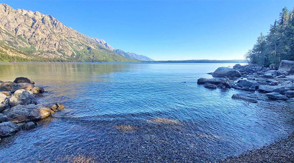
Day 6, August 26, 2022: Phelps Lake, by Kathy
An absolutely beautiful hike circumventing Grand Teton National Park was the Phelps Lake Trail. There were 7 of us – Quy, Pattie, Lin, Kathy, Ron, Felix, and Mike, who chose this hike and were rewarded with spectacular views of the lake and its beaches.
Crystal clear water reflected the mountains surrounding the lake and around every corner, we were awed with even more spectacular views of the lake. The trail was relatively flat with 725-foot elevation gain and was shaded by the forest surrounding us. Constantly on the lookout for bears, we did see a few deer and a few horseback riders on beautiful horses. A few of us took a small detour to Huckleberry Point, which was a small area close to the water with many shrubs with a variety of huckleberries. We tasted sweet ones and bitter ones. We all survived! At the end of our hike, we toured the Lawrence Rockefeller Preserve, which is an absolutely spectacular building. We toured the building and learned the history of the Preserve. It was once the family retreat of Lawrence Rockefeller, son of John Rockefeller who had donated 33,000 acres to the NPS, and like his father, he continued the legacy of conservation by donating the private ranch land. There were old family photos of the family and beautiful artwork inside as well. All in all, the hike was an absolutely unforgettable experience!
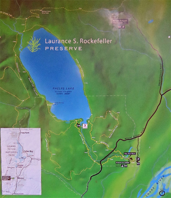 Trail map of Phelps Lake. [photo by Ron] |
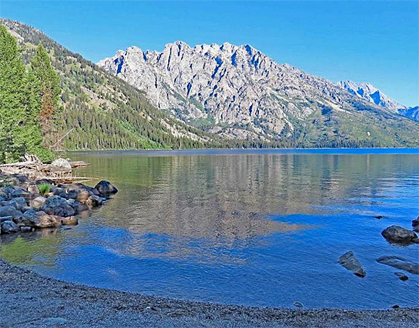
 Phelps Lake. [photo by Kathy] |
 Anyone interested to hike to the Ski Tower? [photo by Ron] |
 Happy hikers. [photo by Ron] |
 Keep matching, here comes Felix. [photo by Ron] |
 Three Amigos. [photo by Kathy] |
 Four Energized Young Ladies. [photo by Kathy] |
 Wildflowers. [photo by Lin] |
 Isn’t it cute? [photo by Ron] |
Day 7, August 27, 2022: Avalanche Peak, by Mike
Avalanche Peak—the name itself is ominous. Absaroka Mountains, famed for missing people.
Well here we are on day 7, August 27, 2022 of our Arizona Trailblazers trek through the Grand Tetons and Yellowstone National Parks, hopefully the 7s and 2s will provide luck for us on our climb.
Only 4.6-mile round trip, 2100 foot climb, and we start at over 8500 foot elevation, but as Michael Humphrey told us it is straight up and straight down.
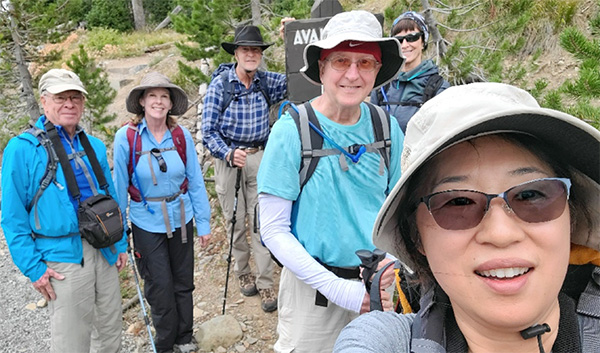 Group Picture - Ron, Kathy Felix, Mike, Ramona, Lin. [photo by Lin] |
 Avalanche Peak Trailhead. [photo by Lin] |
 Lin is marching on and trying to catch up with everyone. [photo by Kathy] |
Large western clouds are blowing by in the mid-afternoon sky as cross the highway and start up the trail through the forest, and it is, straight up.
Our bodies seek oxygen out of the thin high altitude air as we climb.
After what seems like a half hour we finally get to some switchbacks making the climb slightly easier. We’ve passed many hikers coming down telling us it is beautiful on top but a little windy, so be careful.
We reach a level spot near the end of the tree line. Next is climbing in the open buffeted by wind, we see hill tops but not the top, walking through rock slides of stones.
It is up and up and up we go, looking like little bugs on hillsides compared to the mountains climbing into the heavens.
Gusts come in so strong that I am glad I have trekking poles to stay upright, when talking our words blow off into the wind.
We struggle to get up to the rock shelter just below the summit by 200 feet. To get to the summit you need to practically crawl along the rocks on the trail to avoid being blown away. The shelter is a wonderful escape from the pounding wind.
The views are expansive and beautiful, but the black clouds overhead are not welcome and we pray they blow on by us, and not become a thunderstorm.
Alas, it is time to head down hill and off the mountain top. We struggle in the wind but get back down into the forest and now what we thought was a difficult climb seems so much easier, time passes quickly and we are back to the trail head and deer eating grass on the hillside near the road, felt on their growing antlers.
We are exhilarated after we climbed Avalanche Peak!
 Happy hikers at Peak: Ramona, Felix Mike and Kathy. [photo by Kathy] |
 Wind cannot stop Ron and Kathy’s laugh. [photo by Kathy] |
 Stand on the ground before fighting with the strong wind. [photo by Kathy] |
Day 8, August 28, 2022: Old Faithful, Upper Geyser Basin, by Mike
Wow day 8—time flies by when you are having fun. The Old Faithful Inn is quite the architectural achievement.
We had an early morning tour of the Inn to begin our day.
As you walk in the red front doors you are awestruck by the 76 feet tall atrium, looking like a lodge pole pine forest, helped by the square and diamond shaped windows filtering light off the poles and beams like light would in the neighboring forests. Balconies and stairways wind through the lodge pole pine columns and gnarled knee branch supports. Quite a remarkable view we had!
The local stones make a fireplace reaching up through the atrium. We learn how popcorn was popped in this fireplace in early 1900s. Unfortunately, we received no samples today.
Winding up the stairway we get to level 2 with view of the great hall/lobby and the dining room where we would have a wonderful buffet dinner tonight.
We get to go into a vacant original room from the opening in 1904. From a time in the past of “robber barons” running mines, oil companies and railroads, running the USA.
We see up to the “tree house” on top level where bands played for guests and outside balconies that had great views of Old Faithful geyser.
 Welcome to Old Faithful Inn. [photo by Lin] |
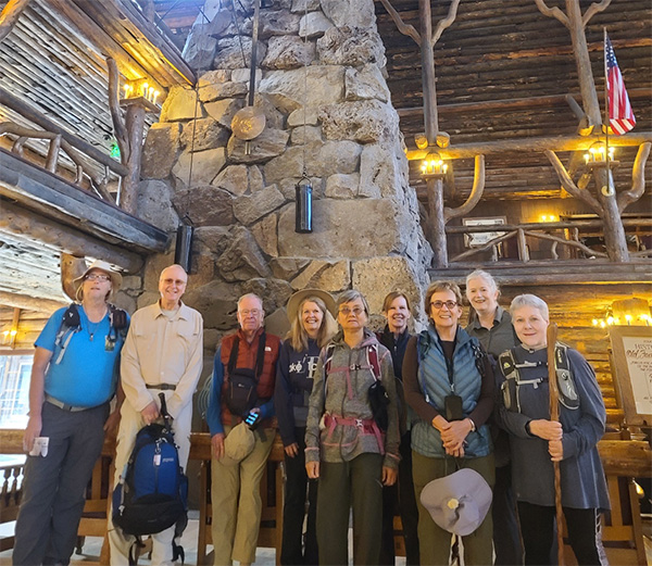 Group picture at the Fireplace: Michael, Mike, Ron, Kim, Mimi, Kathy, Gail, Wendy and Pattie. [photo by Lin] |
 Did you see the Treehouse? [photo by Lin] |
 A hallway at Old Faithful Inn. [photo by Lin] |
 At level 2 of the Inn, looking at the Great Hall. [photo by Lin] |
 Group picture at Fireplace with wall clock: Kathy, Mike, Deirdre, Felix, Lin and Ramona. [photo by Lin] |
Next, we went for our walk on the boardwalk pathways to Upper, middle and lower geyser basins. We saw a number of great geyser shows on our walks including Grand and Beehive, some getting drenched with sulfur smelling water. Plus, morning glory pool and its vibrant colors.
 Group picture as geysers quiet down: Ron, Michael, Ramona, Mimi, Deirdre, Gail, Pattie, Kathy, Felix, Lin, Kim, Wendy and Mike. [photo by Lin] |
 It is a very colorful view. [photo by Lin] |
 Move on to next Geyser. [photo by Lin] |
 A colorful view. [photo by Lin] |
 Beautiful geyser. [photo by Lin] |
 I do not think this bison can read - DO NOT ENTER! [photo by Lin] |
Then back to Old Faithful to watch at 2:30. Crowds much smaller than in past years, lucky for us.
Tour and movie at the visitor center.
 Good bye, until 97 minutes later. [photo by Lin] |
Then Buffet dinner at the Old Faithful Inn dining room.
Wonderful food – main course of prime rib, baked salmon, and huckleberry chicken. 2 soups, vegan vegetable was nice and spicy, green bean almandine and glazed carrots, salad bar. Nice hot rolls with butter or olive oil. Apple and berry crisp with ice cream for dessert. No one left hungry.
 Two very happy tables (Near table from L to R): Felix, Mimi, Gail, Mike, Deirdre, Ron, Kim and Ramona, far table (L to R): Pattie, Michael, Kathy and Lin. [photo by Lin] |
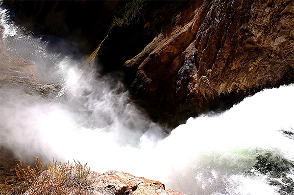
Day 9, August 29, 2022: Yellowstone Falls, Crystal Falls and Inspiration Point, by Felix
On Monday, August 29th, the Arizona Trailblazers hiked the North Rim overlooking the Grand Canyon of the Yellowstone. Along the road and prior to the hike, we spotted a small herd of buffalo just before 9 AM. Of all the larger mammals existent in Yellowstone, the buffalo is clearly the most omnipresent.
 Small herd of Bison. [photo by Lin] |
From the parking lot, we headed north on the trail that runs along the North Rim. Our first stop was a view of Crystal Falls. Crystal Falls plunges 129 feet to Cascade Creek, a tributary of the Yellowstone River. Although less famous than the Upper and Lower Falls, it possessed a graceful appearance while plunging to the canyon below. We then hiked farther along the North Rim trail to the junction where we began a descent to the Brink of the Lower Falls. The hike descends 3/8 mile and 600 feet. There were numerous switchbacks down to an observation platform that provided a view directly above the top of the Lower Falls. As it is typically the first stop along the North Rim trail, we encountered many hikers on the way down to this viewpoint. For perspective, the Lower Falls plunges 308 feet which is approximately twice that of Niagara Falls. However, it must be noted that although the Niagara Falls plunge “only” 176 feet in some sections, the volume of water flowing from Niagara Falls is among the largest of all waterfalls in the world. From the platform, there are spectacular views of the orange, yellow and pink canyon walls.
 Mist, noise of Crystal Falls. [photo by Lin] |
 A view of Crystal Falls on North Rim Trail. [photo by Lin] |
 A group of happy ladies: Kim, Kathy, Gail, Mimi, Wendy and Lin. [photo by Mike] |
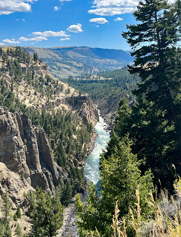
Hiking through a forest along the North Rim, we proceeded to Lookout Point, where we were treated to a complete view top to bottom of the Lower Falls. For some of the hikers, it presented a good opportunity for a picture of themselves with the Lower Falls providing a picturesque backdrop. There was some disappointment as another trail, Red Rock Point was closed. The Red Rock Point Trail extends down toward the river another 500 feet in 0.3 miles and provides one of the finest views of the Lower Falls. The next viewpoint on the North Rim was Grand View. This view was more of the river as it snaked through the Grand Canyon of the Yellowstone. The canyon itself varies from 800 to 1,200 feet in depth and anywhere from 1,500 to 4,000 feet across while extending for 24 miles.
 What an awesome view. [photo by Lin] |
 Group picture: Mimi, Wendy, Kathy, Mike, Gail, Ron, Kim. [photo by Lin] |
Our final destination in hiking north from the parking lot along the North Rim was Inspiration Point. The views here were panoramic of the canyon length including West, Mid and Lower Overlook. At this point, we had a short lunch before proceeding back to the parking lot. Along the way back, several hikers headed off in the wrong direction before turning back and resuming the proper trail. The entire hike up and back along the North Rim was about 6.4 miles and around a 675 foot elevation gain.
After returning to the parking lot, we regrouped and hiked a very short distance south to the Upper Falls viewpoint. On a platform perched almost directly above the falls, we witnessed the river plunging violently for 109 feet. One individual stood with a camera and a microphone boom arm hoping to capture the thunderous roar. From this viewpoint, we could also see upriver as the water flowing downstream approached the first climatic drop on its way down canyon.
After some time, we hiked backed to our cars and drove along the South Rim to Artist Point. The views and photographs from Artist Point are among the most prominent in Yellowstone. As such, the area was very crowded with everyone taking in the view of the of the Grand Canyon of the Yellowstone as it descends from the Lower Falls. The Arizona Trailblazer hikers also obliged with pictures of themselves fronting this spectacular backdrop. In the 19th century, the famous painter, Thomas Moran when first viewing the Grand Canyon of the Yellowstone described it as "Beyond the Reach of Human Art". His painting attempted to capture the grandeur of this particular viewpoint.
 Time to take a break at Inspiration point. [photo by Lin] |
 Artist Point. [photo by Felix] |
 Group picture: Mimi, Gail, Ramona, Ron, Wendy, Kathy, Deirdre, Felix, Kim, Mike, Lin. [photo by Lin] |
One last stop before heading back to our campground was Mud Volcano, which included the malodorous Dragon’s Mouth Spring. Here there exists a rumbling sound from steam and other gases with waves crashing against the walls of the cavern. Back in 1870, explorers witnessed Mud Volcano erupting and thrusting mud at treetop levels. Two years later, it transformed to its present form. The rotten egg smell is a result of hydrogen sulfide gas rising from the magma chamber below. A number of individuals present did hold their nose against one of the more overpowering smells in Yellowstone National Park. Altogether, an excellent day of hiking accompanied by spectacular views and a unique geologic feature.
 Dragon’s breath. [photo by Felix] |
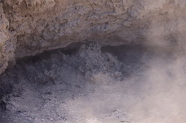 Mud volcano. [photo by Lin] |
 We still hear the Dragon calling. [photo by Lin] |
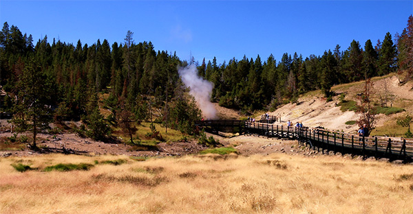
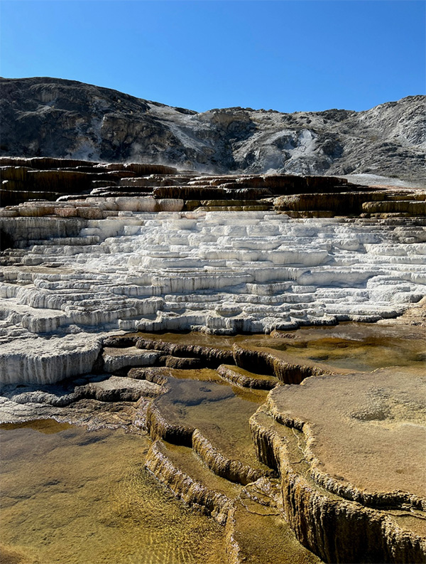
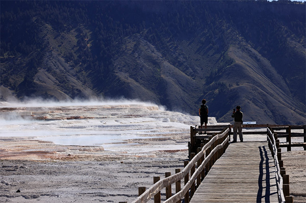
Day 10, August 30, 2022: Mammoth Hot Spring, by Felix
On Tuesday, August 30th, the Arizona Trailblazers hiked the boardwalk surrounding the Mammoth Hot Springs area in Yellowstone National Park. This was our last day before leaving for Provo the following morning. The hike was preceded by a long drive from our Grant Village campground.
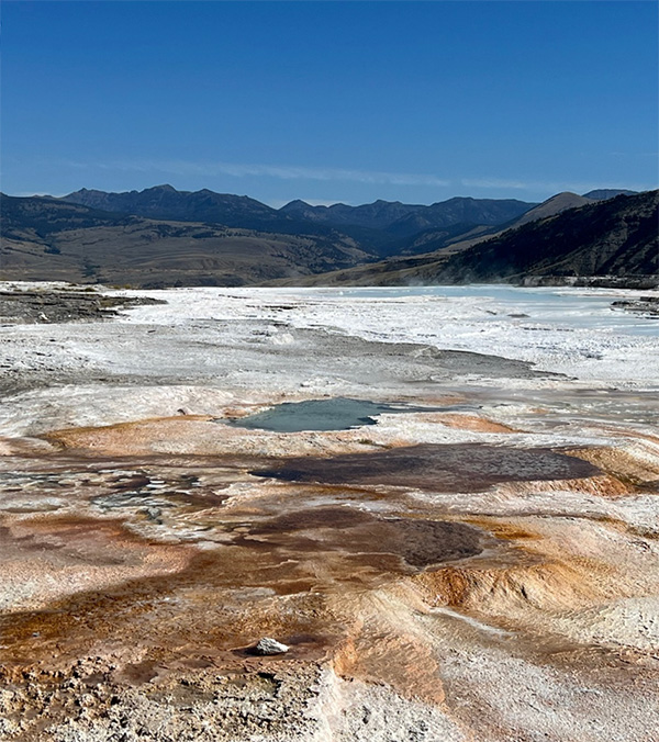
The Mammoth Hot Springs are considered a must-see site within the park because of the unique geological features. As rain and snow slowly flows into the earth each year, the water is heated by a magma chamber that was created by a volcanic explosion that occurred hundreds of thousands of years ago. The heated water travels through fissures dissolving the limestone rock as it travels to above ground. Although the flow of water was disappointing to some hikers accustomed to more vigorous and vibrant action on previous visits, the magnitude of the flow is really dependent on the extent of blockages and subsequent clearance within the underground plumbing system. Unlike geysers, the waters at Mammoth Hot Springs do not thrust into the air. Rather, the heated water dissolves the limestone depositing calcium carbonate on the surface then flowing from basin to basin and slowly creating the colorful terraces that abound throughout the boardwalk hike. The terraces are referred to as travertine formations and are often likened to an inside-out cave. The primary colors of the terraces are orange, brown and white. A posted sign along the way referring to the spring’'s palette of color attributed it to a world of thermophiles, a bacteria that thrives in relatively high temperatures.
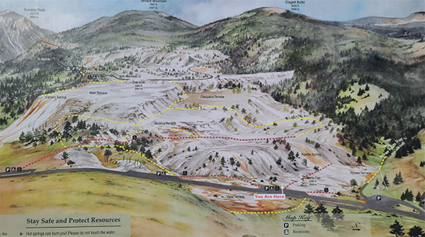 Map of Mammoth Hot Spring. [photo by Lin] |
 Liberty Bell. [photo by Felix] |
 Hot Spring. [photo by Lin] |
Along the boardwalk that traversed the hot springs are many formations with unique names. Among those we visited, the first was Liberty Cap, a 37 foot tall rock formation named in 1937 by the Hayden Survey because of its resemblance to peaked knit caps. We also observed many other travertine formations including Palette Spring, Cleopatra Terrace, New Blue Spring, Cupid Spring, Grassy Spring, Canary Spring and among the most striking was Mound Spring. Although some of the terraces appeared to be moribund, looks can be deceiving. They are not drying up. It should be noted that certain terraces may not flow for several decades at a time with nature providing in its own time and way.
The hike on the boardwalk around Mammoth Hot Springs covers around 1.75 miles and approximately 300 feet of elevation gain. Out and back may double that distance.
 A beautiful view of hot spring. [photo by Lin] |
 A view from top to see the hot spring. [photo by Lin] |
 Bacteria thrive in hot temperature water. [photo by Lin] |
 Colorful hot spring. [photo by Felix] |
 Dark brown, white and brown steps. [photo by Felix] |
 Ramona and Felix are enjoying this moment. [photo by Lin] |
After completing our hike around Mammoth Hot Springs, there was more time for the hikers to visit the Mammoth Springs visitor center. Known as the Albright Visitor Center, nearby houses were the home of the United States Cavalry stationed at Fort Yellowstone. The primary purpose of the fort and soldiers was to protect the park from poachers and souvenir hunters that had begun to degrade our nation’s first national park. For lunch, some of the hikers purchased sandwiches and drinks from the nearby stores.
 A view of Fort Yellowstone. [photo by Lin] |
 Oh, wonder what the person had to drink? [photo by Lin] |
Deirdre had reported a large bison herd at Blacktail Pond and we anxiously proceeded to that location. We were not disappointed. The herd was indeed a large one. Shortly thereafter, while driving on the road to Calcite Springs, we encountered a number of bison along the road some of which proceeded to cross to the other side. This caused a stoppage in traffic with some visitors to the park getting dangerously close to the bison in attempting a photo memory.
 Bisons at Blacktail Loop. [photo by Lin] |
 What a view - herd of bisons at Blacktail. [photo by Lin] |
 Too close to the Bisons. No, she is not member of AZTHC. [photo by Lin] |
 Be patient. I am slow and big. [photo by Felix] |
 A great reflection at Blacktail Pond. [photo by Lin] |
Calcite Springs turned into an unexpected surprise. A magnificent view of the Yellowstone River flowing through a canyon. Rising from the canyon floor were dark vertical cliffs. According to a posted sign, the cliffs resulted from volcanic action 50 million years ago. Around 1.3 to 1.5 million years ago, another volcanic action created a lava flood following the ancient river bed. Rapid cooling of the lava resulted in tall straight columns resembling columnar basalt. After a glacial melt, the Yellowstone River began to carve the Grand Canyon of the Yellowstone. On a nearby mountain, some of us viewed a bald eagle soaring high above the river below.
 Tower Falls. [photo by Felix] |
 Calcite Spring. [photo by Felix] |
Our last stop was Hayden Valley, where bison had roamed for thousands of years before they were almost hunted to extinction. We saw a solitary buffalo, but a distinguished symbol of a successful American conservation story.
Day 11 & 12 - August 31, and September 1, 2022: Grand Village to Provo UT, and Phoenix, AZ, by Lin
|
Today is our last day at Yellowstone NP. Time flies when you having so much fun with a group of energized and fun people. I always have a mixed emotions. Sad to see the awesome trip is almost over, yet, looking forward to going back home to be with family, to sleep in my own bed, and to eat yummy home-cooked food. We were so lucky for the past 10 days! Very comfortable temperatures during the daytime when we were hiking. It rained a few times, but most of that was at night while we were sleeping in our tents. Our campgrounds in Colter Bay and Grant Village were very nice and quiet, surrounded by tall pine trees and much wildlife. We saw elk and deer and squirrels. I am sure there were many more of them around the campground, hiding in the distance, behind and above the trees, watching our every move, listening to our talks, smelling everything that we cooked and ate, and laughing at every joke we shared. To organize a multi-park, many states away camping and hiking trip requires lots of planning and coordination and help from all of the participants. I am so grateful for everyone’s help with this amazing trip. Here are my personal thanks to each every one: • Thanks to everyone for bringing your favorite food, dessert and drink to share. • Thanks to all the potluck helpers (Mimi, Wendy, Gail, Kim, Kathy, Ramona, Diva, Deirdre, Quy). The food was so much better because you made it that way. • Thanks to Bud for your storytelling - sharing your passion and knowledge. • Thanks to Michael and Bud for helping me to lead some hikes. • Thanks to Deirdre for informing us as to the location of the Bison. We had great time. • Thanks to all the safe drivers for bringing everyone safely to the campsite and the trailheads and home on this long trip. I am so grateful. • Thanks for your patience, your understanding, and your flexibility due to last-minute changes of some of our hiking plans. • Thanks to all for your inputs and suggestions in deciding which trails we were going to hike. • It was nice to see you, Quy. We miss you as a hike leader, we wish you the best. • It was nice to meet some new friends and new members. Welcome to AZTHC, Mike, Kathy, Pattie, I am looking forward to seeing you on the trails soon. • Thanks to Ron, Quy, Diva, Mike, Felix, Deirdre for your awesome pictures. • Personal thanks to Mimi for having me in your carpool, allowing me to use your power charger, and some of your camping gear. A long day of driving goes by so much faster because of our conversations. Thank you. • And lastly, a big thanks to Felix, Deirdre, Mike, Kathy, and Ramona for helping to write this enormous 12-day trip report. I truly appreciate each and every one of you from bottom of heart. Thank you. |
 Our campsite at Grant Village. [photo by Lin] |
 Our vehicles are ready to go at any moment. [photo by Lin] |
 Morning Sun shining on our campsite. [photo by Lin] |
 Kim is making hot water for breakfast. [photo by Lin] |
 Still quiet on this early morning. [photo by Lin] |
 Top of Page
Arizona Trailblazers Hiking Club, Phoenix, Arizona
Comments? Send them to the AZHC .
updated September 22, 2022