Outdoor Links
Hike Arizona
Trip Planning Guide
Trip Report Index
Calendar of Events
Library
|
Canyon Lake Kayaking Superstitions October 24, 2023 by Chuck Parsons |
 Eight Arizona Trailblazing kayakers line up for the group picture. {photo by Scott} |
| Ron, Jackie, Chuck, Barbara, Norma, Anna, Burt, and Eva. |
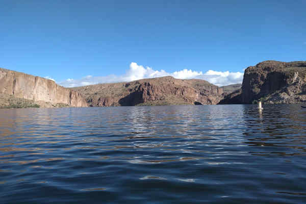
The time is 9:25 a.m. on a cool and beautiful Tuesday morning in late October. Skies are a brilliant sapphire blue over Canyon Lake, with a few thick cumulus clouds beginning to line up on the far horizon. The lake is calm, with only minor ripples on its surface, as we climb aboard our kayaks as gracefully as possible, without falling in the lake, and push off from the shore of the Acacia Picnic Area on the lake’s far south end, between First Water Cove and Labarge Cove. Little do we realize how fast things would change just a few short hours later, on our return trip.
 This Blue Heron is waiting for a fat fish to swim by. {photo by Cyd} |
 We can only guess what this crafty raven is waiting for. {photo by Cyd} |
Our first task of the morning is to paddle across the main body of the lake--from south to north--before entering the narrow and most scenic part of this lake, which is part of the original Salt River Channel before four reinforced concrete dams were built along the river to throttle back its wild side and provide a much-needed and reliable water source for a growing Phoenix and Salt River Valley. President Theodore Roosevelt came to Arizona in 1912, traveling by way of the Apache Trail, to reach the dam site and dedicate the first and largest of these four dams, this one named in his honor. The Apache Trail itself was built several years earlier, specifically for the purpose of transporting thousands of tons of construction materials to the dam site.
 Overall view of Canyon Lake from the road. {photo by Cyd} |
 Eva always has a big smile for the camera. {photo by Cyd} |
The paddle across the lake is relatively uneventful, as we start entering the narrow and scenic channel and continue paddling our way north. We start scanning the high canyon walls, cliffs, and ridgelines for any signs of bighorn sheep, which we’ve seen several times on past trips to both Canyon and Saguaro lakes, but see no signs of them so far this morning. But these animals are such masters of camouflage, you can often be looking straight at them and not see anything, until they start moving.
 The surface of Canyon Lake is relatively calm this morning. {photo by Barbara} |
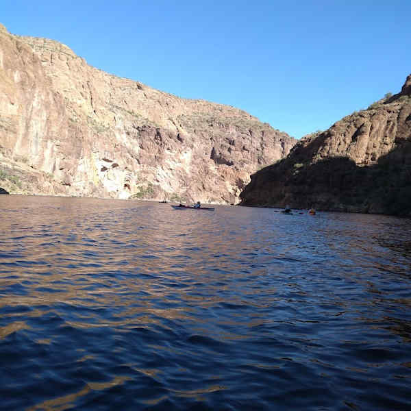 Several kayakers paddle through the deep morning shadows cast across the lake. {photo by Barbara} |
By 11:00 a.m., we finally arrive at the Point Campground area, where we plan on stopping for a rest and lunch break. But some of us first decide to check out the petrified log site that Scott learned about from one of the Dolly Steamboat captains on an earlier Canyon Lake cruise. This area is directly across the water from the campground area. Most people are not even aware of these petrified logs and would likely never find them without knowing exactly where to look. And even then, it can still be challenging to pick them out because the only visible part is on a high rock face and blends in perfectly with the surrounding rock, as seen in these pictures.
 Barbara, Norma, and Chuck check out the petrified logs imbedded in this rock face. {photo by Scott} |
These trees likely fell millions of years ago during the Cretaceous Period, at a time when present-day Arizona and much of the Southwest was covered in lush semi-tropical forests. Following that period, much of the area was covered in seawater, as several seas advanced and retreated over eons of time, each leaving behind deep deposits of sand, silt, and gravel. At some point these trees became petrified and today only the very ends of these petrified logs, flush with the rock surface, can be seen in this rock face overlooking Canyon Lake.
 The most prominent petrified log in this picture is centered vertically on the right side. {photo by Barbara} |
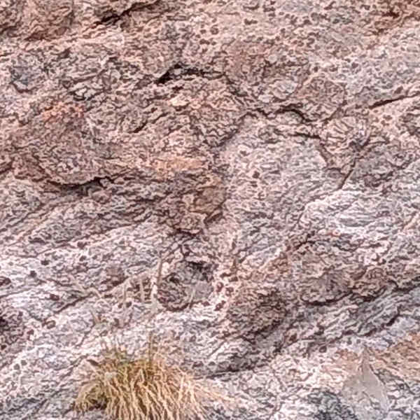 At least six petrified logs can be seen in this picture. {photo by Barbara} |
 While even more can be found in this picture. {photo by Barbara} |
After a relaxing lunch and rest break at the Point Campground, we start the long trip back to the Acacia launch site. The lake surface is still relatively calm until we hit the last quarter-mile stretch of the channel before entering the main body of the lake. Despite the latest weather forecasts from early this morning, calling for only light winds of 5 to 8 mph throughout the day on the lake, increasingly stronger gusts of wind start slamming us as we begin paddling across the main lake body.
 Kayakers line up for a quick group shot in front of the Point Campground. {photo by Barbara} |
The lake surface becomes increasingly rougher and choppier as we continue to paddle
directly into the face of howling winds and stay on course. Strong winds of 30 mph
and higher pummel us and create a cold wet spray that spatters us as we struggle
onward toward the Acacia Picnic Area, which was our launching point earlier this morning.
We’re forced to paddle harder and harder just to keep on track and avoid being blown
backwards. And adding to the challenge, large power boats, some pulling water skiers,
are racing around the lake and creating even larger waves that we have to watch for to
avoid being swamped. Just minutes earlier a rogue 4-foot wave, seemingly coming out of
nowhere, came straight toward me as I was paddling close to the rocky shoreline and
came uncomfortably close to driving me straight into the rocks.
By 1:15 in the afternoon most of us make it back to shore and begin stowing our kayaks
and gear away. After everyone else finally returns, we discuss lunch plans and six of
us decide to make the short drive to Tortilla Flats, while the rest of the group heads
for home. Unfortunately, Tortilla Flats is packed, with a 45-minute wait time, so we
head over to the Canyon Lake Marina Restaurant instead. Arriving there, we find a big
sign on the main door, stating “Closed Indefinitely. Sorry For the Inconvenience.” No
idea what that’s all about. At that point we all turn around and head for home. For the
most part, though, it’s been yet another great day for kayaking one of Arizona’s most
scenic lakes. We’ll be back next spring to do it all over again.
 Top of Page
Arizona Trailblazers Hiking Club, Phoenix, Arizona updated November 29, 2023
Comments? Send them to the AZHC .