Outdoor Links
Hike Arizona
Trip Planning Guide
Trip Report Index
Calendar of Events
Library
|
Canyon Lake Kayaking Superstitions February 19, 2024 by Chuck Parsons |
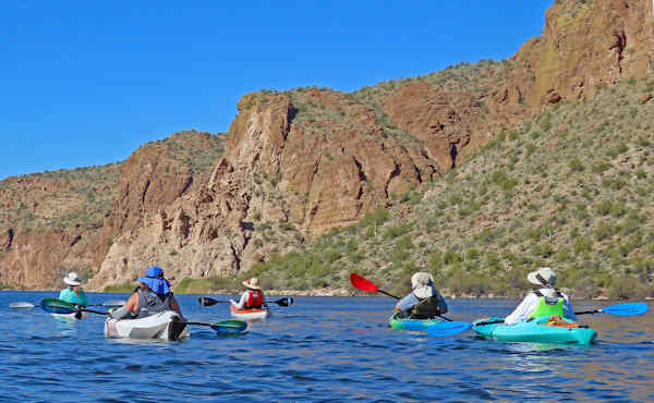
 Trailblazers are ready to start kayaking. [photo by Ron] |
| Ron, Anna, Chuck, Eva, Norma, Lee, Barbara, Cindy, and Helen. |
The time is 9:30 on a beautiful February morning, under bright clear blue skies with a temperature of 60 degrees, as nine Trailblazing kayakers push off from the Acacia Picnic Site beach on the south end of Canyon Lake. On almost all our previous Canyon Lake kayaking trips over the past three years we’ve kayaked north across the main body of the lake before entering the Salt River Channel and continued paddling northeast to the Point Campground. Today, we’re taking a different approach for both a change of pace and a change of scenery.
 Lee, Chuck, and Barbara prepare to launch. [photo by Ron] |
 Cindy, Helen, and Anna discuss Anna’s new Oru foldable kayak. Cindy and Helen are kayaking with us for their first time today. [photo by Ron] |
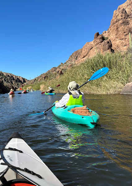
 Anna, Eva, Norma, Chuck, and Barbara making their way toward Tortilla Cove. [photo by Ron] |
This time we’re paddling into three long and scenic coves, more like side canyons on the lake, all at the south end of the lake, exploring and taking pictures at a leisurely pace along the way. We’ll paddle first to Tortilla Cove at the far southeast end of the lake near Tortilla Campground, then Labarge Cove in the middle, and finally check out First Water Cove at the far southwest end of the lake. About 7.5 miles of kayaking altogether. So, let’s move out Trailblazers and start paddling.
 Cindy and Helen in a tandem inflatable, Eva in her Oru kayak, and Ron in his tandem inflatable. [photo by Norma] |
 Barbara sticks close to the shoreline. [photo by Norma] |
 While Norma is sticking close to the tall reeds. [photo by Eva] |
Although the latest weather forecast for the Canyon Lake area calls for winds ranging from 3 to 8 mph throughout the day, occasionally gusting to 10 mph, we encounter steady winds of 10+ mph as we begin paddling east across the south end of the lake toward Tortilla Cove. A mile into the paddle and the wind is still relentless, becoming more intense if anything. And, as luck would have it, we’re paddling straight into the wind the entire time. So much for accurate weather forecasting. Finally, after about 45 minutes of steady paddling, we enter the mouth of Tortilla Cove.
 Cindy and Helen in Cindy’s Advanced Elements tandem inflatable. [photo by Ron] |
 Anna in her new Oru foldable kayak. [photo by Ron] |
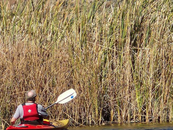 Lee is checking out these massive 12-foot-tall reeds. [photo by Norma] |
And, just as I was hoping, we finally get some relief from the wind. Both the wind and the water surface become much calmer as we paddle deeper into this 0.8-mile-long cove. The further we go, the calmer it gets. And the surrounding scenery continues to improve as well, with colorful high canyon walls on both sides providing shade relief from the sun. After about a half-mile the water becomes shallower, and we must watch for large rocks and boulders lurking just beneath the surface. In most places we simply skirt around them and find deeper water to the right or left.
 This Double-Crested Cormorant is taking a break on a lake buoy. [photo by Ron] |
 While this happy little guy is munching on his breakfast. [photo by Eva] |
 A game of chicken with the power boaters? Not really—they’re farther away than they look. [photo by Ron] |
Even further in and we need to be extra careful about not running aground as the water depth becomes shallower and shallower. Near the end of the cove, we begin to hear water running and finally see a stream and a small waterfall flowing into the cove. This is always a special treat to see when kayaking on desert lakes. We take pictures and relax here in the shade for a while, enjoying a water and snack break before rotating our kayaks 180 degrees and starting the trip back out to the main lake.
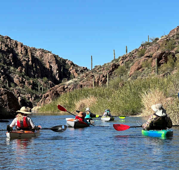 Starting to enter Tortilla Cove. [photo by Eva] |
 Going deeper into the cove. [photo by Eva] |
 As it gets narrower and narrower. [photo by Eva] |
Sometime earlier we noticed that Ron’s 15-foot tandem inflatable kayak was sagging in the middle, and his seat back was badly in need of adjusting since he was leaning back at an uncomfortable 45-degree angle or more. Finally back out onto the main lake, we head for the nearby Laguna picnic and camping area on the southeast lakeshore and beach our kayaks here for a rest and lunch break, as well as a chance for Ron to check out his kayak and readjust his seat back. After lunch, Ron discovers a small leak on the bottom of his kayak. Cindy comes to the rescue with her roll of duct tape and carefully tapes over the leak. What did we ever do before duct tape came along? Then Cindy and Ron readjust his seat back to the correct position, using still more duct tape, Ron pumps his kayak back to normal air pressure, and we’re off once again.
 Anna, Cindy, and Helen check out Ron’s badly sagging inflatable kayak. [photo by Norma] |
 Is Chuck taking a siesta break? Wake up Chuck! [photo by Norma] |
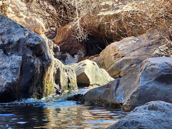 Small waterfall at the end of Tortilla Cove. [photo by Norma] |
Our next destination is Labarge Cove, about a half-mile west of our current position. The winds have finally calmed down and are now to our backs as we paddle toward Labarge Cove. Paddling is much easier now, and within about a half-hour or so we start maneuvering around the large Canyon Lake Marina and enter the cove from the west side. Another 15 minutes and we’re moving beneath the Highway 88 bridge, as we make our way deeper into Labarge Cove. At 0.7 miles in length, Labarge is not quite as long as Tortilla, but certainly just as scenic.
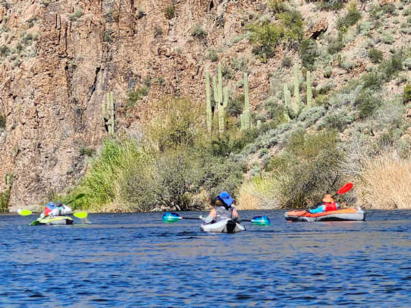
 This Giant Saguaro is trying to top its neighbor to the left. [photo by Eva] |
 Kids on spring break having fun with the old rope swing. [photo by Eva] |
Soon, we’re paddling in the welcoming shade of the cove provided by its high canyon walls. We’ve been kayaking under full sun since we started earlier this morning, and the day is warming up rapidly. As we get deeper into this cove, it also becomes increasingly shallower, and once again we must carefully watch for rocks and boulders just beneath the surface, as well as the water depth to keep from running aground. Fortunately, the water is quite clear in these coves for great visibility beneath the surface. And just as with Tortilla Cove, as we approach the end of the cove we can hear water running and see a stream and small waterfall at the very end. We carefully navigate to that point for more picture ops, take another short shade and water break, and begin the return trip out to the main lake.
 The hills are alive with the sound of music. Nope—make that “The hills are awash in green grass growing. [photo by Ron] |
 If you’re camping on top of this massive and sloping formation, make sure you carefully stake down both your tent and your sleeping bag. [photo by Ron] |
The original plan was to hit First Water Cove, about a quarter-mile past Acacia, last and paddle to its end point and check out its own waterfall. But before we even reach our launch point at the Acacia Picnic Site, after six miles of kayaking everyone decides they’ve had enough exercise and sightseeing for one day. So, we pull into the Acacia launch area at 2:15 p.m. and call it a day. After loading kayaks and packing away all gear, some of us hang around and chat for a while longer before we all start the long drive back home. It’s been yet another near-perfect day for kayaking the spectacular desert lakes of southern Arizona. The big question now is how much longer this cooler spring weather will last before we’re eventually forced to start moving to the north and higher elevations to stay cool and comfortable enough while kayaking.
 Trailblazers are heading back to home base. [photo by Ron] |
 Top of Page
Arizona Trailblazers Hiking Club, Phoenix, Arizona updated March 8, 2024
Comments? Send them to the AZHC .