Outdoor Links
Hike Arizona
Trip Planning Guide
Trip Report Index
Calendar of Events
Library
|
Lake Pleasant Kayaking Lake Pleasant October 27, 2025 by Chuck Parsons |
||||||||||||||||
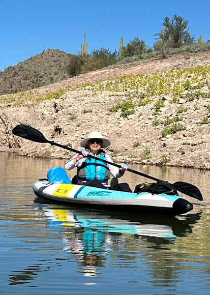
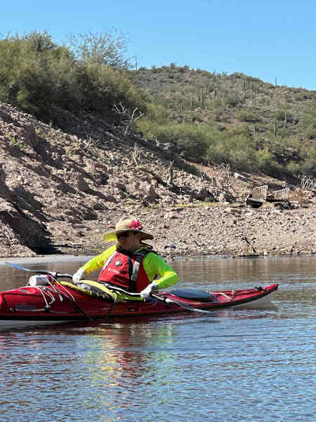
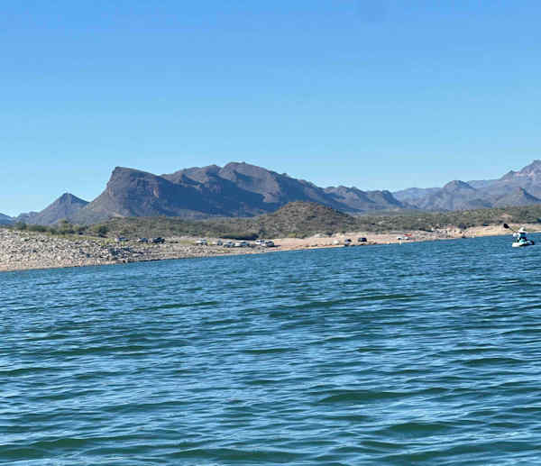
Eva and I arrive at Lake Pleasant Castle Creek Boat Ramp at about the same time—9:00 a.m. on a beautiful Monday morning in late October. Today weather forecast calls for 68 degrees at 9:00 a.m., increasing to 82 degrees by 2:00 p.m. But with a dead calm and under full sun, it already feels like 82 degrees or more. Despite the 73 degrees shown on my vehicle’s thermometer. Fall is definitely not quite in the air yet for the Arizona desert. Hopefully soon, or at least maybe by late November. After a while, Norma and Vicky arrive, and we have our full crew of four kayakers today. Everyone is busy preparing their kayaks and gear for launch, and by 9:30 we’re finally ready to push off into the clear waters of Lake Pleasant. Crystal clear blue skies and not a wisp of a cloud in sight this morning.
After turning off onto Castle Creek Drive from Castle Hot Springs Road, at roughly a half-mile the blue waters of Lake Pleasant begin to come into view. From this vantage point the lake looks almost full. Can it be? Did all that rain from earlier this month cause the Agua Fria River to swell enough to empty millions of gallons of water into the lake and begin re-filling it once again? Unfortunately not, as we soon discover. From the launch ramp it’s quite apparent the lake is still down 40 feet or more, although the end of the wide six lane concrete ramp is still underwater. Probably, only after extending it once or twice as the lake level dropped. And once we start paddling, we come across several small islands of solid rock that were completely submerged on our last trip here in March.
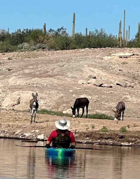
We continue paddling southeast and then west into Firemans Cove. On all our previous kayaking trips here, including last March, we were always able to paddle to the end of the cove and around the north end of Helm’s Island into Cottonwood Cove. But not today. The lake level has now dropped so low there’s a land bridge blocking our passage into Cottonwood. So, we’re forced to backtrack and paddle around Helm Island and enter Cottonwood Cove from the south end. But near the end of the cove, we are rewarded with the sight of at least eight burros, including a couple of youngsters, slowly traversing the hillside as they forage for vegetation. And with all the recent rainfall across the desert, there’s no shortage of vegetation to keep all the wildlife around the lake happy for the next month or two.
Lake Pleasant is almost always windy, or at least breezy enough to keep the sail boaters happy. But today seems to be the exception, with nearly dead calm wind conditions. What seafarers back in the days of sailing vessels used to call the dreaded doldrums, when their ships were literally dead in the water with insufficient winds to fill their sails and keep them moving. Officially called the Intertropical Convergence Zone today, the doldrums are actually a belt of low atmospheric pressure around the equator, characterized by light winds and sometimes even powerful thunderstorms on rare occasions. Sailing ships would sometimes become stranded here for weeks at a time, which could obviously become life-threatening when critical supplies like food and drinking water begin to dwindle.
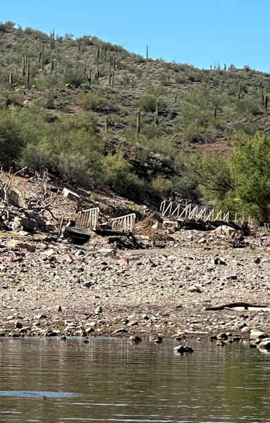
After exploring Cottonwood Cove as far as we can paddle before the water becomes too shallow, we head back out into the main lake and continue paddling south to Pipeline Cove, the last cove before the marina. And it’s here where we get a really good look at just how much the lake level has dropped in the last seven months. In one of these pictures the two main sections of the old floating footbridge, destroyed by a flash flood many years ago, are now sitting high and dry, at least 6 to 8 feet above the waterline. Last March these two sections were submerged enough that we could actually paddle our kayaks right between the railings of the longest bridge section. Today, it would be a chore to even beach our kayaks and scramble over all the rocks and debris to reach the longer footbridge section.
We see the usual birdlife on the lake today, including ducks, grebes, coots, Blue Herons, Great Egrets, and at least one juvenile Osprey flying overhead. As we leave Pipeline Cove behind and continue paddling south toward the Scorpion Bay Marina & Restaurant, from time to time we catch a light breeze that cools us off nicely as the sun climbs higher in the sky and becomes more intense. We finally reach the marina dock just past noon and pull our kayaks up onto the convenient dockside kayak cradle one by one until we’re all out of the water. After neatly stacking all four kayaks off to the side on the dock, we walk over to the restaurant for a long, relaxing lunch on the spacious outside patio overlooking the lake. After lunch we start the long paddle back to Castle Creek Boat Ramp. It has been a picture-perfect day on the lake today, with ideal weather conditions and just about the calmest day I have ever experienced on Lake Pleasant. Great for kayakers, but not so great for sail boaters experiencing the dreaded doldrums.
|
||||||||||||||||
 Top of Page Top of Page
|
Arizona Trailblazers Hiking Club, Phoenix, Arizona updated November 27, 2025 Comments? Send them to the AZHC . |