Outdoor Links
Hike Arizona
Trip Planning Guide
Trip Report Index
Calendar of Events
Library
|
Watson Lake Kayak Prescott May 18, 2026 by Chuck Parsons |
||||||||||||||||
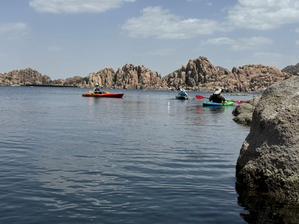
For part of the drive north on I-17 and the entire drive on Highway 69 into the Prescott Valley area the skies are surprisingly hazy this morning and even more so once we’re kayaking on the lake. Normally bright deep blue skies, with white clouds in stark contrast with the blue are now a hazy pale blue, with the fluffy white clouds washed out and offering little contrast against these skies. Although we’re not sure of the cause, we suspect forest fires and smoke as the primary culprit—either fires here in Arizona or perhaps even some of the larger forest fires currently raging in our larger neighbor to the west, southern California. In recent years, the wildfire season, especially in California, is no longer seasonal, but instead year around.
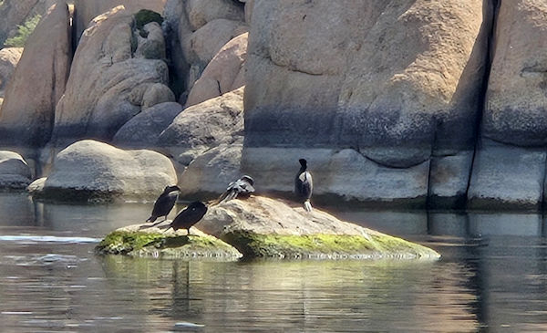
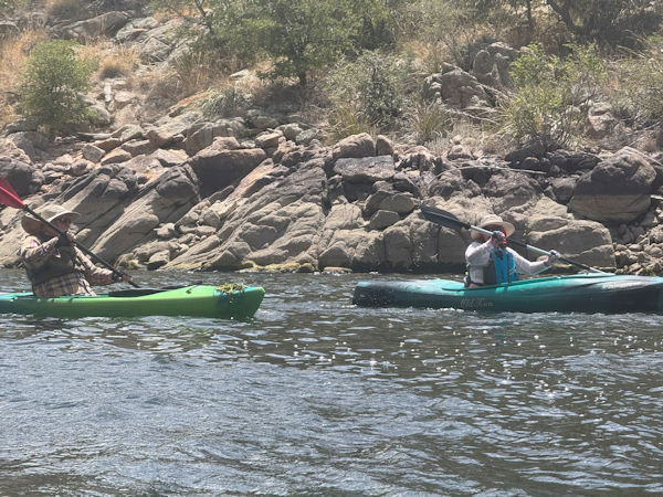
Four Arizona Trailblazers are on the water by 9:15 and paddling northeast towards the scenic Granite Dells area of the lake at the far north end, where we will spend the majority of our time on the lake today. Geologists date these large granite boulders in the Dells area at 1.4 billion years old. We continue leisurely paddling up the west side of the lake and reach the Granite Dells area in about 20 minutes. The Granite Dells consists of huge granite boulders, some the size of a large truck or even as big as a house. After the dam was built and the lake filled with water, many of these large boulders became partially or even fully submerged. The end result is a vast collection of massive granite boulders, promontories, hoodoos, and small islands on the lake.
This is truly a kayaker paradise, with a labyrinth of passageways to explore, weaving among the many boulders and promontories. And today we plan on spending more time than usual exploring the many small coves, passageways, and hidden areas of the lake we sometimes miss altogether. In addition, the north end of the Watson Lake Loop Trail threads its way among many of these granite boulders that still sit high and dry above the waterline. By foot or by kayak, this area of the lake is definitely the most scenic and picturesque part of Watson Lake. We slowly paddle our way through this granite wonderland of jumbled rocks and winding passageways for over two hours, soaking in the breathtaking scenery and taking numerous pictures along the way.
I was asked today about the history of this area and its two lakes, so this bears repeating from one of my previous trip reports. Watson Lake and neighboring Willow Lake, located on the west side of Highway 89, were both created in 1915 when the Chino Valley Irrigation District built Granite Creek Dam (now called Watson Lake Dam) on Granite Creek and Willow Creek Dam on Willow Creek. In April of that year the creation of these two lakes would justify one of the biggest celebrations in Prescott history, with speakers, free barbecue, local bands, and even a special event train to transport people to the lake. The City of Prescott eventually purchased both reservoirs and surrounding land in 1997 to preserve as recreational land and later created Watson Lake Park.
The Santa Fe, Prescott, and Phoenix Railway ran through the Prescott area for over ninety years and was referred to locally as the "Peavine" due to its winding, serpentine route and many trestles along its path. The eventual decline of the railroad industry led to thousands of miles of abandoned rail lines across the country, including the old Peavine line in Prescott, abandoned in 1984.Tracing its beginnings to the 1960s in the Midwest, the rails-to-trails movement started transforming these abandoned railroad corridors into multiuse paths for walking and bicycling. In 1994 the City of Prescott acquired the abandoned Peavine rail line and begin its rail-to-trail conversion, creating the 6.7-mile-long Prescott Peavine National Recreation Trail, one of 2,390 rails-to-trails in the United States. When a planned connector trail is completed, linking the 5.3 miles of the Peavine Trail in nearby Chino Valley, the Peavine Trail will grow to 18.5 miles in length. In 1986, the Rails-to-Trails Conservancy was founded, and to date over 22,000 miles of rails-to-trails have been completed nationwide. In 2019, the Rails-to-Trails Conservancy launched the Great American Rail-Trail, a multi-use route spanning over 3,000 miles across eleven states, from Washington State in the Pacific Northwest to Maryland on the east coast.
With that, we conclude City of Prescott/Watson Lake History 101. Although the day starts out with only light breezes and calm lake waters, by 11:30 wind speeds have increasing significantly, with gusts peaking around 15 to 20 mph and making it harder and harder to paddle. And if we stop paddling, the winds simply begin pushing us backwards. I had hoped we could paddle among the thick grove of partially submerged cottonwood and willow trees at the far south end of the lake to seek shelter from the winds, but the area is still closed to all activities due to nesting bald eagles. So, by 12:15 we decide to head back to the South Ramp area and call it a day. After loading up our kayaks and packing all gear away, the four of us caravan together to Rosa Pizzeria in Prescott Valley for lunch.
|
||||||||||||||||
 Top of Page Top of Page
|
Arizona Trailblazers Hiking Club, Phoenix, Arizona updated Augest 9, 2026 Comments? Send them to the AZHC . |