Outdoor Links
Hike Arizona
Trip Planning Guide
Trip Report Index
Calendar of Events
Library
|
O’Grady Canyon Day Hike Superstition Mountains February 5, 2011 by Chuck Parsons |
|
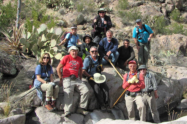
 Arizona Trailblazers gather at the First Water Trailhead. [photo by Chuck] |
||||
|
|
We start hiking southeast on the Dutchman’s Trail #104 through lush and rolling Sonoran Desert terrain for almost 1.5 miles, crossing over six dry washes and creek beds, before finally reaching this prominent landmark of monolithic rock formations perched high on a hill on the right side of the trail. This seventh creek bed crossing marks our departure from the Dutchman’s Trail, as we slowly begin moving upstream along boulder-choked First Water Creek. This will be just the beginning of several hours of challenging bushwhacking and boulder hopping on today’s hiking venture, perhaps even more than some of us may have bargained for. |
|
 Boulder Row from the Dutchman’s Trail. [photo by Chuck] |
|
 Hikers carefully pick their way up First Water Creek. [photo by Chuck] |
|
|
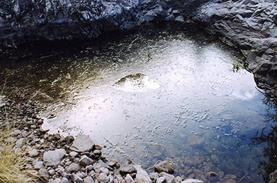
Although the temperature has gradually warmed up to almost 50 degrees (about as warm as it would get today) by the time we start seeing these ice-covered pools farther up First Water Creek, a combination of unusually cool days and sub-freezing nights in the Superstitions has prevented the ice from melting for days. We estimate the ice to be between 1 and 2 inches thick in some of the deeper pools, since we can’t punch through it with a hiking pole or even smash through it with a large rock. In many years of hiking the Superstitions none of us can recall ever seeing so much heavy ice on a sunny day. But as the weather slowly warms back to normal, all of the ice will eventually vanish and become only a distant memory – but a fond memory indeed on a sizzling 110 degree day come this July. In the meantime, is anyone up for skating or ice fishing? |
|
 Ice. [photo by Quy] |
 Did anyone bring their ice skates today? [photo by Chuck] |
 Butt-Sliding 101. [photo by Chuck]  The going just keeps on getting tougher. [photo by Chuck] At one point farther down the canyon we find ourselves cliffed out and facing a sheer rock wall about 30 feet high that would require serious technical climbing to navigate. Lacking the necessary equipment or skills, we elect to work our way around the wall. Bill leads a small group up a steep hill, while the rest of us search for a route on lower ground. We trade off and repeat this process along the way as we try to find the safest and shortest path of least resistance through this increasingly challenging and narrowing canyon. But, as seen in the following picture, we still sometimes find ourselves in a questionable situation as some of us wind up on top of a high and dry waterfall and wonder how the heck we’ll ever get down from here. |
 OK, how do we get down from this dry waterfall? [photo by Bill] |
 Eleven terrific Trailblazers traverse the tough terrain of First Water Creek. [photo by Bill] |
 Taking a break from trailblazing. [photo by Chuck] What a perfect day for hiking in the Superstitions! Now, if we can just find our way out of here after lunch... |
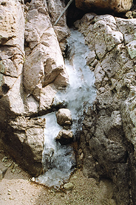
 Ice waterfall. [photo by Michael Humphrey] |
 Ice! Dead ahead! [photo by Chuck] |
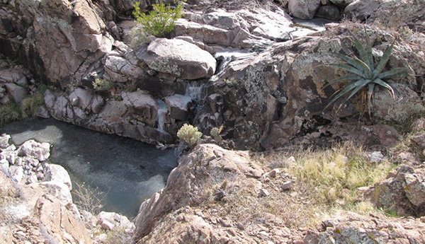
Gathering up our gear and striking out from our lunch stop, we continue in the direction of O’Grady Canyon. Now where in the heck is that canyon, anyway? It’s got to be around here somewhere. After all, maps don’t lie. Even though it’s well past noon and a little above 50 degrees, we’re amazed to see still more ice pools and these two intriguing frozen waterfalls. We can see some melt water trickling down behind the ice, but these long, sub-freezing nights and unusually cool days just won’t allow the ice to completely melt away during the day. This is a very rare sight in the Lower Sonoran Desert of southern Arizona and a real treat for us desert dwellers, who are more accustomed to seeing bone-dry creek beds, totally dry river beds, and even drier waterfalls. And we certainly can’t forget the dried fish we’ve seen on occasion in the dry river beds. I’ve always wondered how those suckers navigate, but that’s another story for another time. |
 Top of Page
Arizona Trailblazers Hiking Club, Phoenix, Arizona
Comments? Send them to the AZHC .
updated January 17, 2020