Outdoor Links
Hike Arizona
Trip Planning Guide
Trip Report Index
Calendar of Events
Library
|
Union Hills Loop Day Hike & Hike Leader Training Phoenix Sonoran Preserve January 22, 2011 by Wendy Rennert |
|
 The saguaro behind us is sporting a massive nest.
|
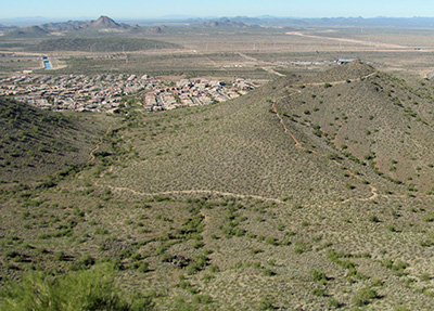
Cool breezes and sunny skies: picture perfect hiking weather! 16 Trailblazers set off on a trail new to the club, and fairly new to Phoenix. The Union Hills Loop trail is part of the Phoenix Sonoran Preserve, and is currently the only official trail in the Preserve. The trail offers a nice variety of uphill and downhill sections. The uphill portions of the trail are mostly gentle to moderate. The two side spurs to the peaks are quite a bit steeper, but the 360° views from the top are well worth the effort. Right after the first uphill segment around the loop junction, we spot several hot air balloons to the north, adding color to the desert landscape. |
 Whew! Glad our hike was on Saturday, not Wednesday. |
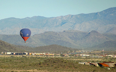 Balloonists take advantage of the perfect weather, mild breeze, and spectacular scenery north of the Phoenix Sonoran Preserve. |
|
We then head downhill for a little while and turn eastward along the base between two mountains. Everyone stops for a few minutes to check out an unusual sight – a rusted out old jeep that apparently took a header into the wash. |
|
 Whoops, wrong turn. But didn’t you say the party was this way? |
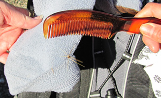 This was all that was left of the cholla ball after about 2-3 quick flicks with the comb. |
|
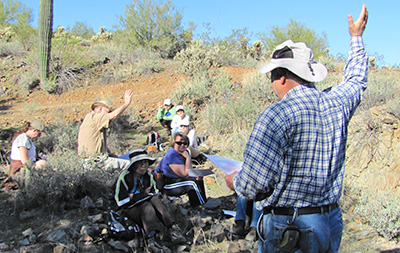
As we emerge from that valley, people are starting to think about shedding a layer of clothing, so we try to wait until we go past a few stands of teddy bear cholla to do so. 1 or 2 pesky cholla balls still manage to jump onto a dangling sweatshirt, so hike leader training starts a little earlier than anticipated with a little show and tell. “This is why we carry combs in our first aid kit,” hike leader Wendy says (not for a quick primping along the trail, but to flick off nasty cholla balls). |
|

|

|
| Left: Wendy displays the find. Right: Geocacher Monica is excited to sign the log. | |
|
A few moments after the show and tell, we arrive at the first peak spur trail. Most of the group goes at least part way up the peak; several people do go all the way to the top. A geocache and fine views are the reward – we signed the geocache log and take in the views for a bit (including a nearby gravel pit), and Wendy points out the Deem Hills area on the other side of I-17. The Deem Hills Recreation area has 6 trails covering about 8.5 miles, offering more hiking possibilities for a different day. |
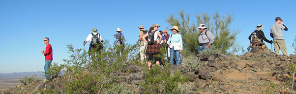 Are they all just too busy checking out the view in all directions, or camera shy? |
|
||||||||||||||||


 Top of Page
Arizona Trailblazers Hiking Club, Phoenix, Arizona
Comments? Send them to the AZHC .
updated February 10, 2020