Outdoor Links
Hike Arizona
Trip Planning Guide
Trip Report Index
Calendar of Events
Library
|
Christiansen Trail Day Hike Phoenix North Mountain Preserve September 22, 2012 by Jim Buyens |
|
|
The first weekend in Fall seemed like a great time to schedule a hike in the Phoenix Mountains. Temperatures should be dropping by then, right? And after all, we were Phoenicians, well accustomed to a little warm weather now and then. Right? No more driving two hundred miles north (and a mile higher elevation) just to get a break from the heat. Right? |
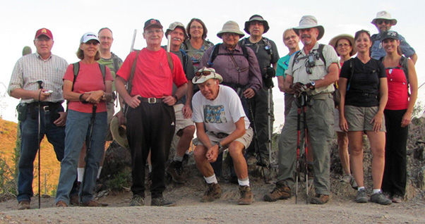 Trailblazers start on the Christiansen Trail. [photo by Bill] |
|
The weather, of course, has a way of not cooperating. Despite much cooler temperatures the previous weekend, and much cooler temperatures forecast later in the week, the temperature on our day was destined to reach 105 degrees. |
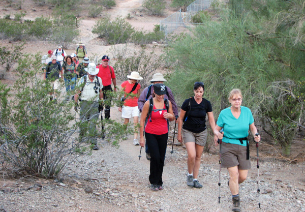 Here we are, still in a fairly close group. [photo by Jim} |
|
This was my first hike as a leader and I almost cancelled it. On the other hand, as the final week progressed, people kept signing up. Encouraged by their enthusiasm, I went ahead as planned. The trip itself was a ten-mile out-and-back from the North Mountain Trailhead to the Dreamy Draw trailhead, both in Phoenix. Some hikers, however, chose only the five mile “out” portion. They left their cars at Dreamy Draw before carpooling to the starting point. The hike started at 6:30 AM with fifteen hikers and a temperature of about 78 degrees. |
 The scenery was a mix of natural and urban settings. Notice the long shadows from the early morning sun. [photo by Jim] |
|
Our route was a segment of the Charles M. Christiansen Memorial Trail. This trail was dedicated in 1986 to Charles Milo Christiansen, a past director of Phoenix Parks and Recreation who led efforts to preserve the Phoenix Mountains. |
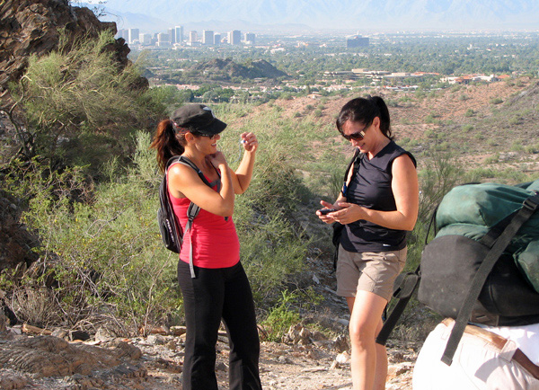
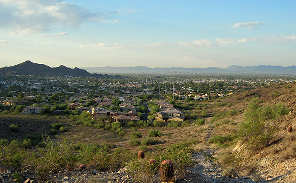 Phoenix basks in the early morning light. [by Ted] |
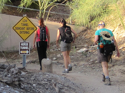 Trailblazers enter the tunnel under Cave Creek Road. [by Ted] |
The Phoenix Mountains are a range that extends across the north side of Phoenix. With the exception of one peak – Mummy Mountain – they’re all inside thePhoenix Mountain Preserve, a series of mountainous city parks totaling 36 square miles. Our route involved passing through three tunnels: one each under 7th Street, Cave Creek Road, and Arizona 51. |
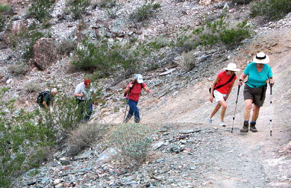 The trail had its steep sections but most weren’t long. [photo by Jim] |
|
Temperatures rose as the hike progressed but remained moderate on the trip out. Walking in the shade of the mountains certainly helped. |
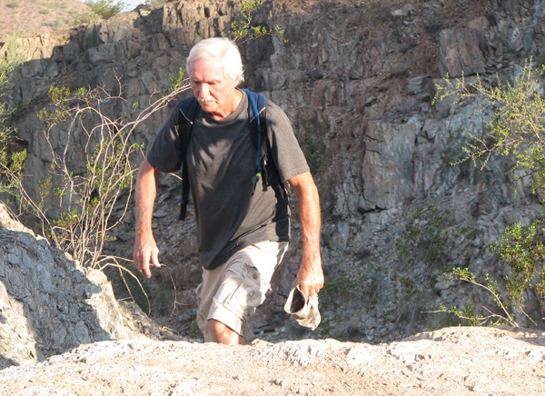 Doug reaches the top of a steep climb. [photo by Jim] |
|
The scenery was typical of central Arizona -- bushes, cactuses, and rocks. The urban landscape was mostly in the distance. Some stretches, however, had no development in sight, and in one case the trail passed within 25 feet of someone’s expensive home! |
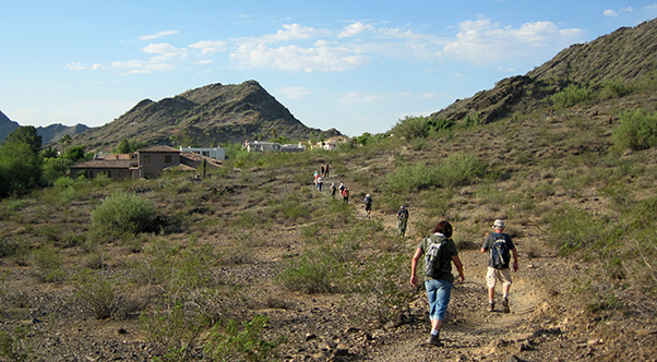
 Heading into a wash [photo by Jim] |
|
Some hikers were faster than others, of course, and the group occasionally spaced out. Or maybe strung out. Hmmm. Anyway, nobody minded when we stopped for a minute and regrouped. |
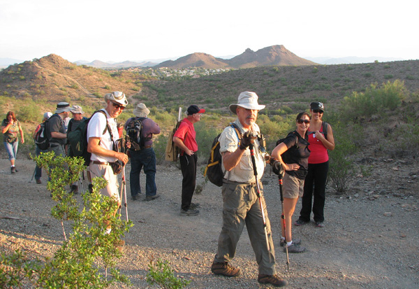
 Climbing the penultimate pass. [by Ted] |
 Light and dark multilayered rocks frame the view. [by Bill] |
The Dreamy Draw is a pass between between the Stoney/Echo mountain ridge and Piestewa Peak. Its name refers from the neurological effects on miners who at one time worked a cinnabar (mercury sulfide) mine in that area. But for us it was just a turn-around point. The mine and the mercury vapors are distant memories. |
 A welcome pause a mile from the turnaround point. [photo by Jim] |
|
When we got to Dreamy Draw four of the original hikers headed home. The rest of us took advantage of the washrooms, water, and shaded table for about half an hour, and then we headed out for the trip back. Two more changed their mind shortly later and went back. That left nine of us tackling the full course. |
 Almost at Dreamy Draw and still all together. [photo by Jim] |
|
There was some question whether we should set a fast pace and finish before it got any hotter, or save our energy and keep cool. The fast pace generally won out but not so much that anyone became exhausted. No one took time for pictures during the return trip; I guess the back side of all the same rocks wasn’t that interesting. |
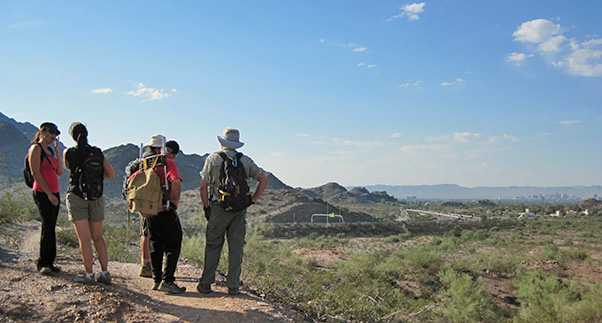 Grand overview of Phoenix and SR-51. [by Ted] |
|
All nine round-trippers made it back to the starting point by 11:30 AM, five hours after we left, and not bad for a 10-mile group hike. The temperature by then was about 95°, but no bumps, no bruises, no heat exhaustion. Even so, I’ll be more careful about scheduling city hikes in September next year. |
 Bill heads off-trail to find a better climbing angle. [photo by Jim] |
| Here are the statistics from my GPS: |
|
Total distance: 10.6 miles Moving time: 3:42 hours Stopped time: 0:10 hours Moving average: 2.8 mph Overall average: 2.2 mph Starting elevation: 1426 feet Maximum elevation: 1622 feet Total Ascent: 1282 feet. |
 Top of Page
Arizona Trailblazers Hiking Club, Phoenix, Arizona
Comments? Send them to the AZHC .
updated December 18, 2017