Outdoor Links
Hike Arizona
Trip Planning Guide
Trip Report Index
Calendar of Events
Library
|
Garden Valley Arch Day Hike Superstition Mountains March 17, 2012 by Ted Tenny |
|
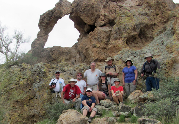 Don, Bill, Randy, Jenni, Michael, Nicole, Dave, Anikó, Monika, Ted [Bill Zimmermann photo] |
 Trailblazers on the ascendancy: hill 2587, that is. |
Ten terrific Trailblazers started their hike from the First Water Horse Staging Area on a breezy and partly cloudy morning. The hike ends at Horse Staging, so it made sense to start there. We hiked the northward extension of the Dutchman’s Trail through First Water Trailhead and on down to the junction with the Second Water Trail. It took us across the creek, by the site of First Water Ranch, and on up to Garden Valley. |
 Trooping the Second Water Trail. [Bill Zimmermann photo] |
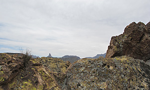
 The trail we hiked up on, below Peak 5024. Hill 2587 is nearby and provides a commanding view. Our route began with an end run around the canyon that paralleled the Second Water Trail on the way up, then westward and northward to the top. Breezy! We got some panoramic pictures from the top before beginning our precarious descent back to Garden Valley. Ted pointed out the butte we were making our way to, then everyone found their own route down from hill 2587. The northwest corner of Garden Valley is high desert framed with golden buttes covered with bright green lichens. After discussing the Legend of the Lichens we arrived at a saddle where the Military Trail begins and the Garden Valley Arch towers high above us. |
 Hackberry Mesa, Four Peaks, and the Arizona Trailblazers. |
|
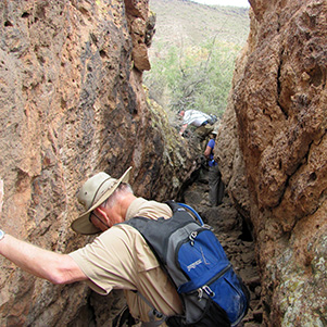
Bill took some of the hikers on a detour to a nearby cave – probably mine diggings. Don and Ted looked for a reasonable way to the arch. |
|
|
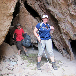
| Are you quite sure this is a "C" hike? [Bill Zimmermann photos] | |
|
A trail of sorts led up to some caves at the base of the butte. They may be an archaeological site, but not today’s destination. East of the caves there were footprints. So wouldn’t you expect this to be the way around the butte and on up to the arch on the other side? |
 Nicole is the first to reach the arch. 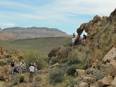 Picture time! There wasn’t an obvious trail from the saddle to the other side of the rock formation that contained the arch. Ted had followed a makeshift trail up to the caves at the base of the rock formation. These caves have been visited before, as evidenced by stacks of firewood and empty, abandoned water bottles. But beyond the caves it was a steep boulder scramble — couldn’t possibly be the right way. Meanwhile other Trailblazers were finding a moderate way around the butte on the east side. We all converged on the slope leading up behind the arch. There were suggestions of a trail as we climbed higher, bringing the arch into view. Then we were there! Hikers climbed up to the arch, starting with Nicole, as Ted walked around looking for the Arizona Highways view. Hmmmm. Weaver’s Needle is in the background in the magazine, but you can’t see Weaver’s Needle from the rocks right behind the arch. However, you are looking at the arch at an angle. Jenni confirmed the observation. Now Ted, what if it’s the same angle but on the other side? Yes! The location had to be on the other side, but it quickly became evident that Paul Gill’s Arizona Highways picture was taken with a wide-angle lens. Ted hikes with only a compact camera. “Does anyone have a wide-angle lens?” he asked. Dave to the rescue! |
| Compare with Arizona Highways, March 2012, page 54: | |
 by Dave French, March 17, 2012 |
|
|

|
| by Ted Tenny, March 17, 2012 | |
 Farewell, Garden Valley Arch. |
We saw plenty of hikers on the Second Water Trail and Hackberry Spring Trail, but none on the Military Trail. The Military Trail is easy to see at the top, but awfully steep. We eased our way northward then westward on the trail. After taking us to a gentle slope, the trail starts to become faint. Then it fizzles out on the north side of a hill. Everyone expected the trail to continue on down to the streambed, but ten hikers couldn’t tell where it goes! |
|
Alas, we must bushwhack our way down to the streambed. After crossing the dry stream a game trail takes us to the horse trail, conveniently marked with horses and riders this time. It’s an easy walk on the horse trail back to the Horse Staging Area. This hike is described in Footloose from Phoenix, by Ted Tenny, pages 140-148. See also: Hill 2587 Exploratory Hike. |
 Top of Page
Comments? Send them to the AZHC .
updated September 10, 2017