Outdoor Links
Hike Arizona
Trip Planning Guide
Trip Report Index
Calendar of Events
Library
|
Indian Spring Day Hike Mazatzal Mountains March 24, 2012 by Bill Zimmermann |
|
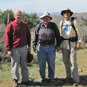
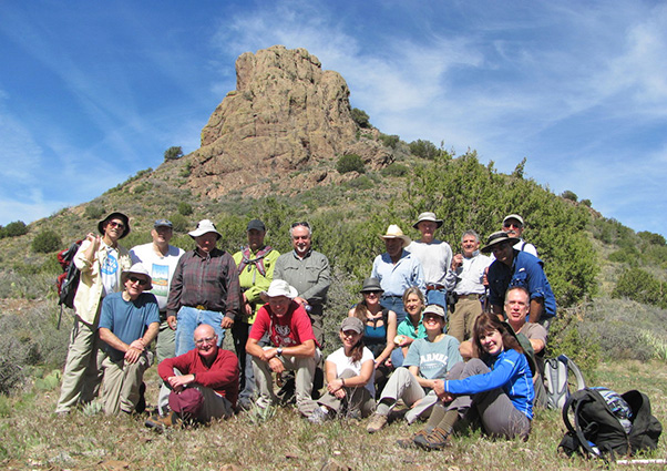 Everybody made it to the saddle between Indian Spring Peak and Diamond Mountain. [Bill] |
|
The hike was a joint event combining the Arizona Trailblazers and Arizona Outdoor Travel Club. After some brief introductions, twenty people left Wendy’s in seven vehicles headed up SR87. We were booted up and by 8:05 AM under sunny skies we were in the oxygen-exchanging mode as we headed up a fairly steep road that soon became grass covered. Bill pointed out a trail post marker on a path that branched off to the south. We continued to the right (west). Many enjoyed conversation and views of the valley below at the re-grouping rest stops along the way. One of the stops was “Shovel Spring.” It had a cement trough on the downhill side of the path. The steel handle shovel and buckets were on the uphill side. |
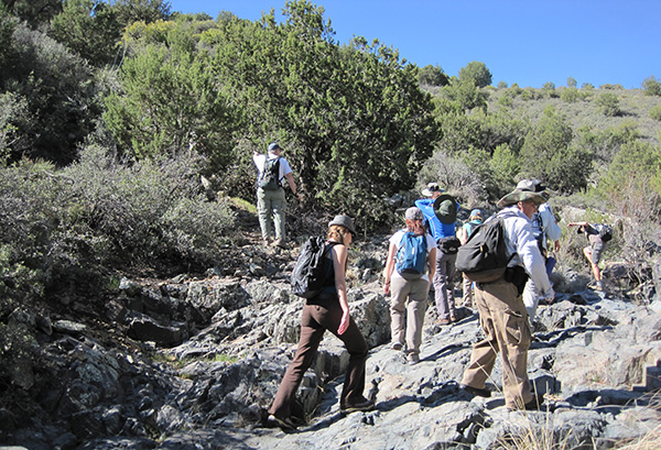
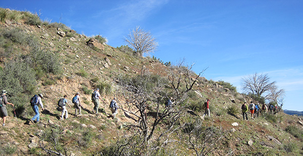 Trooping the trail to Indian Spring Saddle. [Ted] |
|
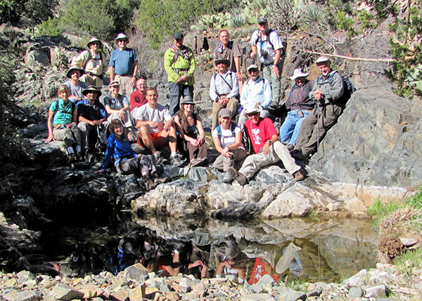
The trail crossed seven “V washes” (down, hairpin turn right, then up). About midway to the peak we stopped at a rock pool for a group photo. From that point the trail narrowed and lead hikers did some light shrub trimming. |
 Hikers pause for reflection on their way up. [Bill] |
|
After reaching the “FLAT” we headed south to the salt blocks for lunch and another group photo. |
|
|
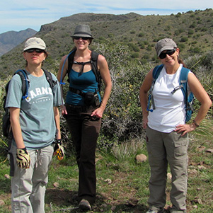
| Anikó, Nicole, Melanie, Ed, Ted, Ned [photos by Bill] | |
|
Twelve hikers started their bushwhack adventure by heading up to peak 4921. We were treated to great views of Bartlett Lake to the west and Diamond Mountain to the east. South facing down slopes were fairly clear and easy to sidestep the spiny vegetation. Following the ridgeline provided views of FR1333 to the south ... a connecting future bushwhack adventure? |
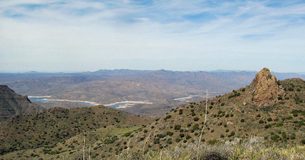 The view from Peak 4921. [Bill] |
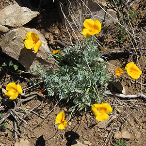 Gold! The California poppies are out. [Ted] |
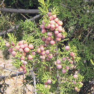 Juniper berries ripen in the Mazatzals. [Ted] |
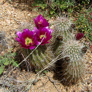 Hedgehog adds its bright color to the trail. [Bill] |
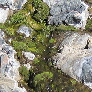 Moss prefers the gently flowing water. [Ted] |
|
Rudy would on occasion venture off and the later rejoin the group. However, after spotting him on a rock outcrop between “FX” and “HT” he did not return. Without radio contact we decided to continue on the pre-route plan toward Indian Spring. Eleven regrouped and took a break as Nicole reapplied sun block before starting our ascent to “R5” The climb was steep and clear with loose gravel. Exploration of the canyon that contained the spring was optional. Some hikers spotted pools to the south. George and Bill headed toward the large sycamore thinking that may be the source but got cliffed out. Others stayed high to the east. We continued around the west side of the peak. Anikó found an animal trail that we followed until it faded. When we reached the flat on the north side of the peak we regrouped and did some water swapping from those with extra to those with none. |
 The view from “K1”.  Rudy disappears. 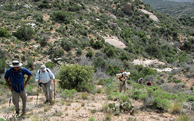 The view from “R5”. |
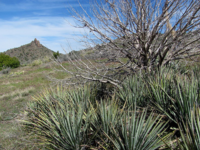
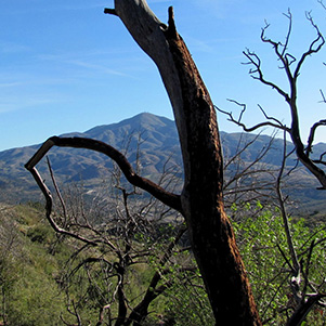 Trees offer a sharp contrast to Mt. Ord. [Bill] |
 A natural cairn marks our return route. [Ted] |
 Emory’s Globemallow [Ajay] |
 Rock Echeveria [Ajay] |
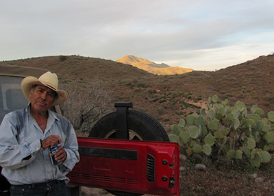 Rudy found. |
No Rudy. Arturo made contact with Rudy via his cell phone. “Two miles out.” We arrived at the cars. No Rudy. Second contact “three quarter mile out” After a half hour and no Rudy, Bill released the others to return to the valley. Third contact “just over the hill” A half hour later, fourth contact “I see the road. Meet you quarter mile south.” |
|
Final contact 6:21 PM. Still daylight. See location “RR” (1.3 miles south) on GPS map. Rudy says “I’M GOING TO GET ME A GP AND S AND TAKE A RADIO.” |
|
Supplemental Report by Ted Tenny |
|
Bill Zimmermann’s Indian Spring hike took us up to a high saddle in the western Mazatzals on a rocky trail that was steep in places. It was a joint outing with AOTC, so the people who rode with me were two I hadn’t met before. When we got up to the saddle by Indian Spring Peak, Bill split the group and took the bushwhackers on a wild off-trail excursion while the rest of us walked back on the trail. Josephine, John and I returned to my car in the early afternoon. |
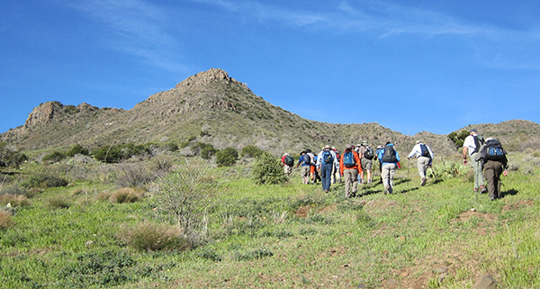 Head for the hills! [photo by Ted] |
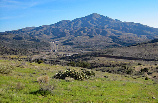 The Beeline Highway and Mt. Ord. [photo by Ted] |
 It’s this way. [photo by Ted] |
 A mountain stream cheers us. [photo by Ted] |
 Are we almost there? [photo by Ted] |
 Miniature Woollystar [photo by Ted] |
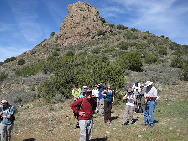
 A stately rock column points to Mt. Ord. [photo by Ted] |
 Top of Page
Arizona Trailblazers Hiking Club, Phoenix, Arizona
Comments? Send them to the AZHC .
updated June 4, 2020