Outdoor Links
Hike Arizona
Trip Planning Guide
Trip Report Index
Calendar of Events
Library
|
Orohai Loop Day Hike Goldfield Mountains December 8, 2012 by Ted Tenny |
|
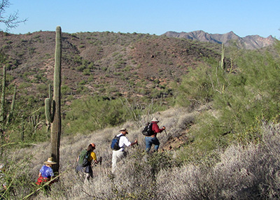
 Don, Wendy, Debbie, Mark, Eileen, Dave, Bill, Cyd, Ted, Scott, Ajay, Nancy, Chuck [photo by Bill] |
|
Hike leader training began at Hackamore Trailhead as Ted handed out copies of the GPS map he made pre-hiking this route. “No one is born with the ability to read topographic maps,” he explained, “but it’s worth learning. So I highly encourage everyone to learn it.” In the first part of the hike he stopped several times to show us where we were on the map. |
 Contouring around hill 2402 [photo by Bill] North of hill 2402 is a maze of trails, all of them unmarked. Ted has attempted to hike them all and record them on his GPS. He probably got most of them, and points out trails and junctions as we walk by. |
 Hike Leader Training, 2012. [photo by Ajay] |
|
The Green Thumb Trail crosses a road then immediately crosses it again. We walk the road on down to our training site. Wendy, Ted, Bill, and Chuck give brief Hike Leader Training presentations. |
|
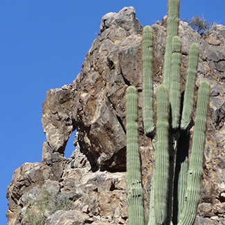
After all questions are answered, we proceed with the hike. The next part of the hike is on Packsaddle Road (which Hackamore Road becomes north of the trailhead gate). Walking up and over the pass, we proceed to the junction of Forest Road 1356. A gentle climb westward takes us by a window rock and then alongside Hat Top Hill. Hat Top Hill is a formation of Tertiary volcanic tuff, from the big eruption 18½ million years ago which formed the Superstition and Goldfield Mountains. We see it from the south and then from the west as FR 1356 takes us toward Rock House Pass. |
 Window rock beside FR 1356. [photo by Dave] |
 Hat Top Hill caps a formation of Tertiary volcanic tuff. |
 Four Peaks and Hat Top Hill, looking east from FR 1356. |
|
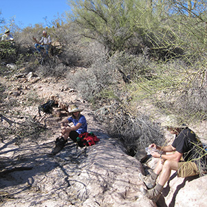
Not much left of the Rock House, though it’s been marked on topographic maps for many years. Just down the road we find a delightful picnic spot where FR 1356 crosses Bulldog Canyon. |

|
|
| Picnic in Bulldog Canyon below the Rock House. | |
|
The north end of the Orohai Trail is on down the road. We turn right and take the trail southeast to Triple Trail Junction, where the Orohai Trail meets the Blue Ridge Trail. |
 Peak 3269. |
|
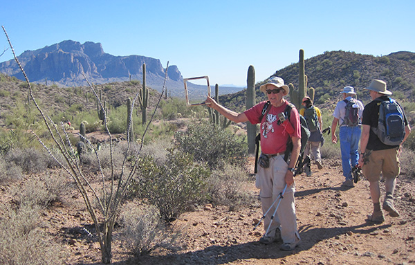
From here on it’s the Orohai Trail all the way. The trail takes us northeast around a hill then southeast with fine views of the Superstition Mountains. |
 Bill finds The Ultimate AM Radio Antenna. |
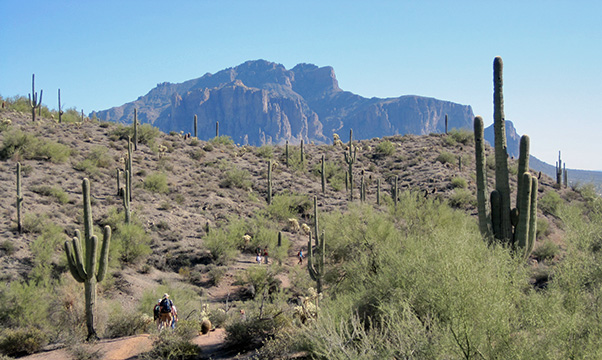 Trailblazers hiking the Orohai Trail toward the Superstition Mountains. |
 Home stretch — Trailblazers on the march. [photo by Bill] |
|
We soon find ourselves down in a sandy wash, then out of the wash and back on the trail as the home stretch takes us back to Hackamore Trailhead. |
 Top of Page
Arizona Trailblazers Hiking Club, Phoenix, Arizona
Comments? Send them to the AZHC .
updated December 21, 2019